Category:Königlich-Sächsische Triangulirung Station 49 Salzenforst
Jump to navigation
Jump to search
| (Wikidata) |
| Object location | | View all coordinates using: OpenStreetMap |
|---|
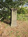
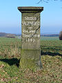
Triangulation Column, 2nd Order Station, the Royal Saxon Triangulation in Saxony 1862-1890  | |||||
| Upload media | |||||
| Instance of |
| ||||
|---|---|---|---|---|---|
| Part of | |||||
| Location | Salzenforst/Słona Boršć, Bautzen, Bautzen District, Saxony, Germany | ||||
| Street address |
| ||||
| Located on street |
| ||||
| Heritage designation | |||||
| Inception |
| ||||
 | |||||
Media in category "Königlich-Sächsische Triangulirung Station 49 Salzenforst"
The following 5 files are in this category, out of 5 total.
-
 Station 49 Salzenforst.jpg 1,500 × 2,100; 1,016 KB
-
 TP Salzenforst.jpg 2,112 × 2,816; 1.72 MB
-
 Triangulationsstein Salzenforst 1.JPG 4,000 × 3,000; 4.58 MB
-
 Triangulationsstein Salzenforst 2.JPG 3,000 × 4,000; 7.24 MB
-
 Triangulationsstein Salzenforst 3.JPG 4,000 × 3,000; 6.84 MB


