Category:Kúpalisko Eva, Piešťany
Jump to navigation
Jump to search
| Object location | | View all coordinates using: OpenStreetMap |
|---|
| This category shows the protected monument with the number 204-11264/1 (other) in the Slovak Republic. |
| This category shows the protected monument with the number 204-11264/2 (other) in the Slovak Republic. |
| This category shows the protected monument with the number 204-11264/3 (other) in the Slovak Republic. |
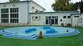
Slovenčina: Kúpalisko Eva v Piešťanoch.
|
According to section 37 and 41 of the Slovak copyright law, Slovakia has freedom of panorama. Works permanently located at public places may be freely reproduced and such reproductions may be freely published and sold without the consent of the original author.
See COM:CRT/Slovakia#Freedom of panorama for more information.
|
 | |||||
| Upload media | |||||
| Instance of | |||||
|---|---|---|---|---|---|
| Location | Piešťany, Piešťany District, Trnava Region, Slovakia | ||||
| Street address |
| ||||
| Located on street |
| ||||
| Has part(s) | |||||
| official website | |||||
 | |||||
Media in category "Kúpalisko Eva, Piešťany"
The following 6 files are in this category, out of 6 total.
-
 Budovy, Kúpeľný ostrov. Piešťany 22 Slovakia 10.jpg 3,648 × 2,736; 3.72 MB
-
 Budovy, Kúpeľný ostrov. Piešťany 22 Slovakia 8.jpg 3,648 × 2,736; 3.96 MB
-
 EVA termálfürdő. Fortepan 28653.jpg 5,400 × 3,923; 9.19 MB
-
 Piešťany Kúpalisko Eva - bazén.jpg 4,000 × 2,248; 3.98 MB
-
 Piešťany Kúpalisko Eva - detský (relaxačný) bazén.jpg 4,000 × 2,248; 3.66 MB
-
 Piešťany Kúpalisko Eva.jpg 4,000 × 2,248; 3.19 MB


_baz%C3%A9n.jpg)