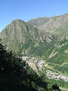
Category:L'Hospitalet-près-l'Andorre
Jump to navigation
Jump to search
commune in Ariège, France | |||||
| Upload media | |||||
| Instance of | |||||
|---|---|---|---|---|---|
| Named after | |||||
| Location |
| ||||
| Street address |
| ||||
| Population |
| ||||
| Area |
| ||||
| Elevation above sea level |
| ||||
| official website | |||||
 | |||||
Subcategories
This category has the following 26 subcategories, out of 26 total.
B
- Barrage du Baldarquès (11 F)
C
- Cap de Clote Flouride (4 F)
- Cap de la Palomera (5 F)
- Cilindre d'Escobes (3 F)
G
M
P
- Pic de l'Albe (19 F)
- Pic de Noé (7 F)
- Pic de Nérassol (11 F)
- Pic de Regalecio (7 F)
- Pic des Maures (4 F)
- Porteilla du Sisca (6 F)
R
- Roc de Carroux (2 F)
- Roc Melé (3 F)
- Ruisseau de Val d'arques (5 F)
T
Media in category "L'Hospitalet-près-l'Andorre"
The following 36 files are in this category, out of 36 total.
-
Accès inférieur du tunnel hélicoïdal de Saillens (avril 2023).jpg 3,000 × 4,000; 11.03 MB
-
Arrivée dans les Pyrénées Orientales - panoramio.jpg 2,048 × 936; 273 KB
-
Barrage de Sisca (Ariège).jpg 1,360 × 1,020; 1.23 MB
-
Cabane de Jasse de Brougnic 01.jpg 4,192 × 3,144; 3.41 MB
-
Cabane de Jasse de Brougnic.jpg 4,192 × 3,144; 2.65 MB
-
Cascade de Bésines (Ct280324).jpg 2,602 × 3,903; 4.58 MB
-
Centrale hydroélectrique de l'Hospitalet.jpg 4,624 × 3,472; 7.69 MB
-
Conduite forcée L'Hospitalet-près-l'Andorre.jpg 2,304 × 3,456; 1.88 MB
-
Forêt domaniale de L'Hospitalet.jpg 3,456 × 2,304; 2.04 MB
-
GR T68 @ L'Hospitalet-près-l'Andorre.jpg 4,192 × 3,144; 5.22 MB
-
Gros pic de Cazalassis @ Val d'Arques.jpg 4,192 × 3,144; 3.59 MB
-
Hospitalet depuis Cap de la Cometa del Forn.jpg 4,624 × 3,472; 4.66 MB
-
L hospitalet pres l andorre ariege.JPG 1,536 × 2,048; 1.99 MB
-
L'Hospitalet-près-l'Andorre - 20180324 (1).jpg 5,472 × 3,648; 5.48 MB
-
L'Hospitalet-près-l'Andorre - panoramio.jpg 2,310 × 1,300; 2.32 MB
-
L'Hospitalet-près-l'Andorre - Place Sainte-Suzanne - 20180324 (1).jpg 5,472 × 3,648; 5.92 MB
-
L'Hospitalet-près-l'Andorre - Source du Pédourrès - 2017-06-22 (1).jpg 2,736 × 3,648; 3.82 MB
-
L'Hospitalet-près-l'Andorre @ GR T68 01.jpg 4,192 × 3,144; 2.55 MB
-
L'Hospitalet-près-l'Andorre @ GR T68 02.jpg 4,192 × 3,144; 3.37 MB
-
L'Hospitalet-près-l'Andorre @ GR T68 03.jpg 4,192 × 3,144; 3.36 MB
-
L'Hospitalet-près-l'Andorre, l'Ariège, Régiolis et conduite forcée.jpg 3,738 × 2,634; 4.06 MB
-
Les deux accès du tunnel hélicoïdal de Saillens (Ariège).jpg 2,782 × 1,825; 4.49 MB
-
Massif du Pic d'Escobes.jpg 3,456 × 2,304; 2.02 MB
-
Paravalanches, L'Hospitalet-près-l'Andorre.jpg 3,456 × 2,304; 2.04 MB
-
Pic d'Auriol @ GR T68.jpg 4,192 × 3,144; 1.85 MB
-
Pic de Querforc - P1090138.jpg 4,320 × 3,240; 5.1 MB
-
Pic de Querforc - P1090139.jpg 4,320 × 3,240; 5.08 MB
-
Pic de Tossal Mercader @ GR T68.jpg 4,192 × 3,144; 1.51 MB
-
Pont sur l'Ariège et entrée inférieure du tunnel hélicoïdal de Saillens (Ariège).jpg 1,967 × 2,864; 4.75 MB
-
Population - Municipality code 09139.svg 475 × 355; 13 KB
-
Tose de Pédourrés @ Étang de Pédourrés.jpg 4,192 × 3,144; 2.84 MB
-
Tunnel puym1.JPG 1,600 × 1,200; 478 KB
-
Val d'Arques @ Cabane de Jasse de Brougnic.jpg 4,192 × 3,144; 2.93 MB
-
Val d'Arques.jpg 4,192 × 3,144; 3.3 MB
-
Vallée Siscar.jpg 4,624 × 3,472; 5.75 MB


