Category:La Pommeraye (Maine-et-Loire)
Jump to navigation
Jump to search
former commune in Maine-et-Loire, France   | |||||
| Upload media | |||||
| Instance of |
| ||||
|---|---|---|---|---|---|
| Location |
| ||||
| Dissolved, abolished or demolished date |
| ||||
| Population |
| ||||
| Area |
| ||||
| Replaced by | |||||
| official website | |||||
 | |||||
Subcategories
This category has only the following subcategory.
Media in category "La Pommeraye (Maine-et-Loire)"
The following 5 files are in this category, out of 5 total.
-
 Blason ville fr La Pommeraye (Maine-et-Loire).svg 512 × 563; 13 KB
-
 La Pommeraye (Maine-et-Loire)02.JPG 1,920 × 1,080; 484 KB
-
 Map commune FR insee code 49244.png 756 × 605; 64 KB
-
 Population - Municipality code 49244.svg 475 × 355; 13 KB
-
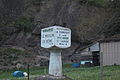 W0329-Pommeraye BorneMichelin MoulinDeBene 60290.JPG 4,752 × 3,168; 4.06 MB
.svg)
02.JPG)
