Category:Land reclamation
Vai alla navigazione
Vai alla ricerca
processo di creazione artificiale di terra dove c'era il mare  | |||||
| Carica un file multimediale | |||||
| Istanza di | |||||
|---|---|---|---|---|---|
| Sottoclasse di |
| ||||
| Distinto da | |||||
| |||||
Sottocategorie
Questa categoria contiene le 9 sottocategorie indicate di seguito, su un totale di 9.
File nella categoria "Land reclamation"
Questa categoria contiene 48 file, indicati di seguito, su un totale di 48.
-
 2020-06-21 - Landgewinnung im Rickelsbüller Koog.jpg 4 640 × 6 960; 7,86 MB
-
 2020-06-21 - Landgewinnung vorm Deich.jpg 6 960 × 4 640; 8,28 MB
-
 2020-06-21 - Priel.jpg 6 960 × 4 640; 10,66 MB
-

-
 ASSASSIANANDO A NATUREZA.jpg 640 × 480; 59 KB
-
 Bedford Basin Waterfront.jpg 2 556 × 1 273; 513 KB
-

-
-
 Bundesarchiv Bild 183-M0519-0007, Pahna, Rekultivierung.jpg 598 × 800; 114 KB
-
 CollectorDrain.jpg 2 592 × 1 944; 1,41 MB
-
 Engineering for land drainage; a manual for the reclamation of lands injured by water (IA cu31924004003103).pdf 643 × 1 035, 398 pagine; 7,85 MB
-
 Da Phuoc Overview DN.JPG 1 943 × 1 007; 725 KB
-
 Dollart-Geschichte.png 1 668 × 1 562; 376 KB
-
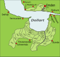 Dollart-Geschichte.svg 3 200 × 3 000; 53 KB
-
 Drainage Les merveilles de la sciences 1869.jpg 506 × 378; 242 KB
-
 DrainageControl2.jpg 863 × 645; 72 KB
-
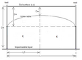
 DrainSection2.png 1 073 × 588; 30 KB
-
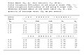 DrainTable.jpg 662 × 434; 49 KB
-
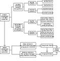
 DrDiagram.JPG 741 × 624; 63 KB
-
 DrSyst.JPG 410 × 414; 33 KB
-
 ExchangeESP.JPG 609 × 320; 18 KB
-
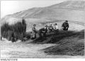
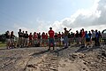 Giving instructions to the group - Land reclamation in Plaquemines Parish, Louisiana.jpg 3 872 × 2 592; 2,35 MB
-
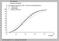 GOHANAFREQ.jpg 623 × 441; 29 KB
-
 Hockenheimring Ostkurve 2008.JPG 3 264 × 2 448; 2,15 MB
-
 Land Reclamation Cabello Coal Mine.png 1 750 × 400; 1,27 MB
-
 MAK 1.jpg 2 480 × 3 507; 1,58 MB
-
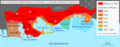
 Map of the Atlantrop Projekt nl.PNG 2 100 × 2 542; 4,06 MB
-
 Meedhoo land reclamation area.jpg 640 × 480; 147 KB
-
 Mississippi River Sediment Delivery System – Bayou Dupont.jpg 3 872 × 2 592; 2,32 MB
-
 Monaco depuis since 1861.png 744 × 293; 75 KB
-
 Mpbas.gif 640 × 480; 8 KB
-
 Pilote polder andijk.PNG 1 040 × 360; 18 KB
-
 Planting native grasses on a recently completed marsh restoration project.jpg 3 872 × 2 592; 2,33 MB
-
 PSM V63 D098 Planting on deforested land.png 1 557 × 1 019; 295 KB
-
 PSM V63 D098 Planting on reclaimed meadow land.png 1 590 × 1 012; 339 KB
-
 RAKeepOff.JPG 640 × 480; 45 KB
-
 Rough former industrial land - geograph.org.uk - 1492389.jpg 640 × 480; 129 KB
-
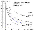
 Saltleaching.jpg 422 × 318; 21 KB
-
 SALTMOD4.JPG 577 × 513; 37 KB
-
 SeawaterInlet.jpg 553 × 275; 51 KB
-
 Stella riverside crescent.JPG 5 056 × 1 040; 315 KB
-
 Students carrying native grasses to plant.jpg 3 872 × 2 592; 2,23 MB
-
 Students from Belle Chasse Middle School.jpg 3 872 × 2 592; 2,24 MB
-
 Tetrapods-ColomboHarbour-Dec2010.jpg 3 648 × 2 736; 3,14 MB
-
 Well arrangement.png 331 × 334; 4 KB
-
 Well arrangement.svg 512 × 512; 2 KB
-
 WellDrain.png 528 × 388; 27 KB
-


