Category:Landesgrenzstein 661
Jump to navigation
Jump to search
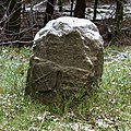
This is the category of the Bavarian Baudenkmal (cultural heritage monument) with the ID D-4-76-166-10 (Wikidata)
|
| Object location | | View all coordinates using: OpenStreetMap |
|---|
Media in category "Landesgrenzstein 661"
The following 2 files are in this category, out of 2 total.
-
 Reichenbach - Landesgrenzstein 661 - BY-Seite.jpg 3,072 × 3,072; 5.41 MB
-
 Reichenbach - Landesgrenzstein 661 - TH-Seite.jpg 3,072 × 3,072; 5.43 MB

