Category:Landkreis Ostvorpommern
Vai alla navigazione
Vai alla ricerca
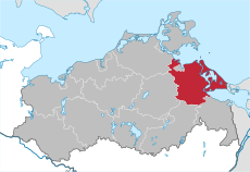
Deutsch: Der Landkreis Ostvorpommern war ein Landkreis des Bundeslandes Mecklenburg-Vorpommern in Deutschland.
former rural district of Germany | |||||
| Carica un file multimediale | |||||
| Istanza di |
| ||||
|---|---|---|---|---|---|
| Luogo | Meclemburgo-Pomerania Anteriore, Germania | ||||
| Capitale | |||||
| Data di fondazione o creazione |
| ||||
| Data di scioglimento o demolizione |
| ||||
| Superficie |
| ||||
| Sostituito da | |||||
 | |||||
Sottocategorie
Questa categoria contiene le 2 sottocategorie indicate di seguito, su un totale di 2.
File nella categoria "Landkreis Ostvorpommern"
Questa categoria contiene 9 file, indicati di seguito, su un totale di 9.
-
Flagge des Landkreises Ostvorpommern.svg 1 560 × 1 050; 199 KB
-
Bevoelkerungsdichte OVP.png 299 × 299; 7 KB
-
Bevölkerungsgewinn- bzw. verlust 2002 bis 2007 in OVP.png 2 481 × 2 245; 384 KB
-
Lage des Landkreises Ostvorpommern in Deutschland.png 176 × 234; 5 KB
-
Locator map OVP in Germany.svg 1 075 × 1 273; 517 KB
-
Locator map OVP in Mecklenburg-Vorpommern.svg 1 129 × 775; 260 KB
-
Mecklenburg wp ovp.png 280 × 199; 11 KB
-
Mecklenburg-Vorpommern OVP.svg 1 129 × 775; 472 KB
-
OVP in Mecklenburg-Vorpommern.svg 859 × 607; 84 KB


