Category:Langley, Cheshire
Jump to navigation
Jump to search
English: Langley is a village in the county of Cheshire, England, on the River Bollin, near Macclesfield and the Macclesfield Forest.
village in Cheshire, United Kingdom  | |||||
| Upload media | |||||
| Instance of | |||||
|---|---|---|---|---|---|
| Location | Sutton, Cheshire East, Cheshire, North West England, England | ||||
 | |||||
Media in category "Langley, Cheshire"
The following 42 files are in this category, out of 42 total.
-
 Clarke Lane & Bottoms Reservoir, Langley - geograph.org.uk - 5219333.jpg 5,184 × 2,920; 5.65 MB
-
 Clarke Lane, Langley - geograph.org.uk - 2728360.jpg 1,704 × 2,272; 1.1 MB
-
 Coal Pit Lane above Langley - geograph.org.uk - 5757976.jpg 1,280 × 960; 498 KB
-
 Coalpit Lane, Langley - geograph.org.uk - 5758569.jpg 1,280 × 960; 346 KB
-
 Cottages on Langley Road, Langley - geograph.org.uk - 5758306.jpg 1,280 × 932; 322 KB
-
 Cottages on Langley Road, Langley - geograph.org.uk - 5758554.jpg 1,280 × 945; 302 KB
-
 Cottages on Main Road, Langley - geograph.org.uk - 5758285.jpg 1,280 × 960; 400 KB
-
 East end of Bottoms Reservoir, Langley - geograph.org.uk - 5298134.jpg 1,024 × 682; 147 KB
-
 Former mill pond, Langley - geograph.org.uk - 5758571.jpg 1,280 × 960; 363 KB
-
 Former silk weaving mill, Langley - geograph.org.uk - 5758314.jpg 1,280 × 884; 339 KB
-
 Langley Methodist Church - geograph.org.uk - 5758310.jpg 1,280 × 909; 322 KB
-
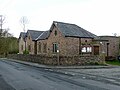
 Langley Public Institute, 1883 - geograph.org.uk - 5758560.jpg 1,280 × 960; 523 KB
-

-
 Langley village - geograph.org.uk - 2728350.jpg 1,704 × 2,272; 963 KB
-
 Langley Village Hall - geograph.org.uk - 5758566.jpg 1,280 × 960; 304 KB
-
 Leather's Smithy - geograph.org.uk - 2027367.jpg 640 × 426; 71 KB
-
 Leather's smithy - geograph.org.uk - 2248570.jpg 480 × 640; 61 KB
-
 Leather's Smithy - geograph.org.uk - 5757997.jpg 1,280 × 907; 244 KB
-
 Leather's Smithy Public House - geograph.org.uk - 4846118.jpg 1,350 × 764; 134 KB
-
 Leathers Smithy Macclesfield Forest.jpg 640 × 426; 89 KB
-
 Main Road through Langley near Macclesfield - geograph.org.uk - 5217463.jpg 5,184 × 2,920; 1.79 MB
-
 Redhouses, Langley - geograph.org.uk - 5757989.jpg 1,280 × 960; 277 KB
-
 Rossendale - geograph.org.uk - 210963.jpg 640 × 480; 145 KB
-
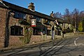
 St Dunstan's Inn, Langley - geograph.org.uk - 5758299.jpg 1,280 × 960; 330 KB
-
 The old school Langley - geograph.org.uk - 5758280.jpg 960 × 1,280; 332 KB
-
 Croker Farm - geograph.org.uk - 228850.jpg 640 × 480; 131 KB
-
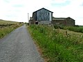
 Derelict Quarry Buildings - geograph.org.uk - 230497.jpg 640 × 480; 124 KB
-
 Five Ashes and Crooked Yard Farms - geograph.org.uk - 60844.jpg 640 × 480; 125 KB
-
 Footpath to Shutlingsloe - geograph.org.uk - 131813.jpg 640 × 480; 101 KB
-
 Hollinset Farm - geograph.org.uk - 210964.jpg 640 × 480; 76 KB
-
 Lee Hills Quarry - geograph.org.uk - 228851.jpg 640 × 480; 97 KB
-
 Main Road, Langley - geograph.org.uk - 499811.jpg 640 × 480; 124 KB
-
 Nab End Farm - geograph.org.uk - 210966.jpg 640 × 480; 85 KB
-
 Pasture - geograph.org.uk - 55418.jpg 640 × 480; 63 KB
-
 Pasture - geograph.org.uk - 55421.jpg 640 × 480; 77 KB
-
 Pond on moors near Oakenclough - geograph.org.uk - 59782.jpg 640 × 480; 91 KB
-
 Quarry - geograph.org.uk - 55410.jpg 640 × 480; 73 KB
-
 Road - geograph.org.uk - 55397.jpg 640 × 480; 108 KB
-
 Rough Hey Quarry - geograph.org.uk - 228848.jpg 640 × 480; 144 KB
-
 Sutton from the moor - geograph.org.uk - 59788.jpg 640 × 480; 89 KB
-
 Trees and Pasture - geograph.org.uk - 55404.jpg 640 × 480; 88 KB
-


