Category:Lanner, Cornwall
Jump to navigation
Jump to search
village and civil parish in Cornwall, England, UK  | |||||
| Upload media | |||||
| Instance of |
| ||||
|---|---|---|---|---|---|
| Location | Cornwall, South West England, England | ||||
 | |||||
English: Lanner is a village and civil parish in Cornwall, England, United Kingdom. For statistical purposes, the village is part of the St Day, Carharrack and Lanner ward, which had a collective population of 5,438 in 2001. Lanner is the largest village of the three, with 2,493 inhabitants.
Subcategories
This category has the following 2 subcategories, out of 2 total.
C
T
- Tresavean Mine (1 F)
Media in category "Lanner, Cornwall"
The following 62 files are in this category, out of 62 total.
-
 A393 at the top of Lanner Hill - geograph.org.uk - 5462879.jpg 640 × 480; 44 KB
-
 A393, Lanner - geograph.org.uk - 5462891.jpg 640 × 480; 51 KB
-
-
 Bungalow on the A393, Lanner - geograph.org.uk - 5462886.jpg 640 × 480; 87 KB
-
 Bus shelter, Sandy Lane, Redruth - geograph.org.uk - 4883970.jpg 1,600 × 1,202; 235 KB
-
 Bus stop and shelter on Lanner Hill - geograph.org.uk - 5463002.jpg 640 × 480; 43 KB
-

-
 Bus stop on Lanner Hill, Lanner - geograph.org.uk - 5462882.jpg 640 × 488; 68 KB
-
 Christ Church - geograph.org.uk - 4695540.jpg 896 × 673; 183 KB
-
 Christ Church - geograph.org.uk - 4695547.jpg 960 × 720; 147 KB
-
 Cornwall , Country Lane - geograph.org.uk - 4597150.jpg 4,003 × 2,659; 4.91 MB
-
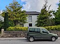
 Detached house, Lanner Hill, Lanner, Cornwall - May 2024.jpg 4,608 × 2,609; 1.17 MB
-
 Epworth - detached house on Lanner Hill, Lanner, Cornwall - May 2024.jpg 3,909 × 2,722; 1.81 MB
-
 Fish and chip shop, Lanner, Cornwall - May 2024 (1).jpg 2,723 × 3,516; 1.63 MB
-
 Fish and chip shop, Lanner, Cornwall - May 2024 (2).jpg 3,743 × 2,836; 2.03 MB
-
 Grays Terrace, Lanner, Cornwall - May 2024.jpg 4,032 × 2,419; 2.15 MB
-
 Henscol, Lanner, Cornwall - May 2024.jpg 3,969 × 2,382; 1.72 MB
-
 House on Lanner Hill, Lanner - geograph.org.uk - 5462881.jpg 640 × 480; 70 KB
-
 Lanner , Bell Lane - geograph.org.uk - 4597143.jpg 3,851 × 2,558; 4.69 MB
-
 Lanner , Bus Stop - geograph.org.uk - 4597140.jpg 4,011 × 2,664; 6.58 MB
-
 Lanner , Lanmoor Estate - geograph.org.uk - 4597136.jpg 4,288 × 2,848; 5.88 MB
-
 Lanner , Lannarth Glas - geograph.org.uk - 4597147.jpg 4,016 × 2,667; 5.31 MB
-
 Lanner , Lanner Hill A393 - geograph.org.uk - 4597139.jpg 4,288 × 2,848; 7.22 MB
-
 Lanner , Rough Street - geograph.org.uk - 4597145.jpg 3,973 × 2,638; 7.22 MB
-
 Lanner , Spar Petrol Station - geograph.org.uk - 4597130.jpg 4,288 × 2,848; 4.95 MB
-
 Lanner , The A393 - geograph.org.uk - 4597132.jpg 4,172 × 2,771; 7.32 MB
-
 Lanner Hill, Lanner, Cornwall - May 2024 (1).jpg 3,817 × 2,535; 1.85 MB
-
 Lanner Hill, Lanner, Cornwall - May 2024 (2).jpg 3,024 × 2,835; 1.42 MB
-
 Lanner Hill, Lanner, Cornwall - May 2024 (3).jpg 4,310 × 2,559; 1.42 MB
-
 Lanner Hill, Lanner, Cornwall - May 2024 (4).jpg 4,032 × 2,722; 2.02 MB
-
 Lanner Hill, Lanner, Cornwall - May 2024 (5).jpg 4,032 × 2,439; 1.83 MB
-
 Lanner Hill, Lanner, Cornwall - May 2024 (6).jpg 3,743 × 2,268; 1.35 MB
-
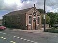
 Lanner Village Hall - geograph.org.uk - 532031.jpg 640 × 427; 100 KB
-
 LannerAndCarnMarthCornwallUK.jpg 640 × 310; 80 KB
-
 LannerBandRoom.jpg 1,600 × 1,200; 320 KB
-
 LannerMoor.jpg 1,200 × 1,600; 365 KB
-
 Londis convenience store, Lanner, Cornwall - May 2024 (1).jpg 3,468 × 2,495; 1.4 MB
-
 Londis convenience store, Lanner, Cornwall - May 2024 (2).jpg 4,476 × 3,234; 1.99 MB
-
 Londis convenience store, Lanner, Cornwall - May 2024 (3).jpg 4,495 × 3,122; 1.7 MB
-
 Meneghy - detached house on Lanner Hill, Lanner, Cornwall - May 2024.jpg 4,423 × 3,006; 1.86 MB
-
 Near Redruth - geograph.org.uk - 4179171.jpg 4,000 × 2,664; 3.88 MB
-
 Oak Villa, Lanner, Cornwall - May 2024.jpg 3,856 × 2,835; 2.51 MB
-
 On the way to Redruth - geograph.org.uk - 4179159.jpg 4,000 × 2,664; 6.54 MB
-
 Porch, Woodlands Terrace, Lanner, Cornwall - May 2024.jpg 2,207 × 2,949; 1.19 MB
-
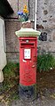 Post box with spring flowers post box topper, Lanner, Cornwall - May 2024.jpg 2,269 × 4,364; 1.93 MB
-
 Redruth , 110 Lanner Hill - geograph.org.uk - 4597155.jpg 4,288 × 2,848; 7.37 MB
-
 Redruth , Road - geograph.org.uk - 4597152.jpg 3,959 × 2,629; 5.07 MB
-
 Redruth , South Downs B3300 - geograph.org.uk - 4597157.jpg 4,127 × 2,741; 4.99 MB
-
 Redruth Wesleyan chapel - geograph.org.uk - 4719338.jpg 576 × 589; 105 KB
-
 Service station on the A393, Lanner - geograph.org.uk - 5462889.jpg 640 × 403; 53 KB
-
 Spring flowers post box topper, Lanner, Cornwall - May 2024.jpg 2,773 × 3,806; 2.82 MB
-
 Terraced houses, Lanner Hill, Lanner, Cornwall - May 2024.jpg 4,608 × 2,544; 2.15 MB
-
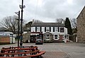 The Lanner Inn - geograph.org.uk - 2868945.jpg 640 × 436; 73 KB
-
 The Lanner Inn - geograph.org.uk - 5462927.jpg 640 × 480; 74 KB
-
 The Square, Lanner, Cornwall - May 2024.jpg 4,423 × 2,836; 1.8 MB
-
 View of Lanner, near Redruth , Cornwall - geograph.org.uk - 2607275.jpg 800 × 600; 154 KB
-
 Villiage Hall, Lanner, Cornwall - May 2024 (1).jpg 3,024 × 3,516; 2.19 MB
-
 Villiage Hall, Lanner, Cornwall - May 2024 (2).jpg 2,890 × 2,382; 1.48 MB
-

-

-
 Houses near Copper Hill Farm - geograph.org.uk - 532180.jpg 640 × 426; 84 KB
-
 Lanner Church Hall and Terrace Houses - geograph.org.uk - 145185.jpg 640 × 455; 81 KB


.jpg)
.jpg)


.jpg)
.jpg)
.jpg)
.jpg)
.jpg)
.jpg)


.jpg)
.jpg)
.jpg)


.jpg)
.jpg)


