Category:Lavanda (Crimea)
Jump to navigation
Jump to search
| Object location | | View all coordinates using: OpenStreetMap |
|---|
human settlement in Alushta city council, Autonomous Republic of Crimea  | |||||
| Upload media | |||||
| Instance of |
| ||||
|---|---|---|---|---|---|
| Location | Alushta city council, Autonomous Republic of Crimea, Ukraine | ||||
| Population |
| ||||
| Area |
| ||||
| Elevation above sea level |
| ||||
| official website | |||||
 | |||||
English: en:Lavanda, Crimea
Русский: ru:Лаванда (Крым)
Українська: uk:Лаванда (Алуштинська міська рада)
Media in category "Lavanda (Crimea)"
The following 6 files are in this category, out of 6 total.
-
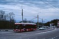 Crimean trolleybus 2604 2021-05 mountain line Lavanda stop.jpg 3,130 × 2,075; 5.29 MB
-
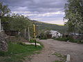
 Lavanda Crim 1.JPG 2,816 × 2,112; 1.07 MB
-
 Lavanda Crim 2.JPG 2,816 × 2,112; 1.11 MB
-
 Lavanda Crim 3.JPG 2,816 × 2,112; 1.13 MB
-
 Lavanda Crim 4.JPG 2,816 × 2,112; 1.24 MB
-
 Нп Лаванда.JPG 3,984 × 2,656; 2.01 MB


