Category:Laytown
Перейти к навигации
Перейти к поиску
Български: 290px|мини|Статуята "Вояджър" в Лейтаун
English: Laytown, historically known as Nynch or Ninch , is a village on the R150 regional road on the Irish Sea coast of County Meath, Ireland. Together with the neighbouring villages of Mornington and Bettystown it comprises the census town of Laytown-Bettystown-Mornington.
Gaeilge: Sráidbhaile atá suite i g Contae na Mí, Poblacht na hÉireann é An Inse, nó Laytown as Béarla.
Svenska: Laytown är ett litet samhälle i grevskapet Meath i Republiken Irland. En tredje skola ska byggas i Laytown med byggstart i slutet av 2006 eller början av 2007. Skolan kommer vara en gaelscoil, vilket betyder att undervisningen kommer ske på iriska.
village in Leinster, Ireland  | |||||
| Медиафайл | |||||
| Это частный случай понятия | |||||
|---|---|---|---|---|---|
| Местонахождение | Мит, Ленстер, Ирландия | ||||
| Высота над уровнем моря |
| ||||
 | |||||
Подкатегории
В этой категории отображается 2 подкатегории из имеющихся 2.
L
- Laytown railway station (6 Ф)
- Laytown Viaduct (14 Ф)
Файлы в категории «Laytown»
Показаны 27 файлов из 27, находящихся в данной категории.
-
 A View of the Inn, Laytown, County Meath P5693.jpg 2480 × 1918; 5,16 МБ
-
 Ballygarth church, west gable - geograph.org.uk - 544349.jpg 442 × 640; 132 КБ
-
 Beech trees at Corballis - geograph.org.uk - 680031.jpg 480 × 640; 159 КБ
-
 Evening on the beach at low tide - geograph.org.uk - 723891.jpg 640 × 480; 46 КБ
-
 Last race at Laytown, Co. Meath - geograph.org.uk - 959203.jpg 640 × 489; 72 КБ
-
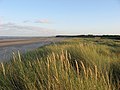
 Laytown beach - geograph.org.uk - 2645649.jpg 2048 × 1536; 445 КБ
-
 Laytown meath beach.jpg 4592 × 3056; 3,44 МБ
-
 Laytown railway viaduct - geograph.org.uk - 2851515.jpg 640 × 333; 88 КБ
-
-
 Medieval parish church, Ballygarth - geograph.org.uk - 544327.jpg 640 × 421; 122 КБ
-
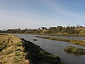
 Mouth of the River Nanny - geograph.org.uk - 694766.jpg 640 × 480; 42 КБ
-

-
 River Nanny and The Mote, Laytown - geograph.org.uk - 679960.jpg 640 × 480; 58 КБ
-
 Ruined tower, Corballis, Co. Meath - geograph.org.uk - 634790.jpg 640 × 480; 66 КБ
-
 South end of Laytown - geograph.org.uk - 4671106.jpg 800 × 600; 77 КБ
-

-
 Laytown-Voyager.jpg 426 × 640; 47 КБ
-
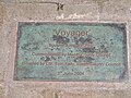 VoyagerLaytownPlaque.jpg 4320 × 3240; 5,55 МБ
-
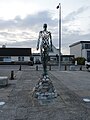 VoyagerLaytownScupture.JPG 3240 × 4320; 5,22 МБ
-

-
 Chapel of St. Peter, Irishtown - geograph.org.uk - 730419.jpg 640 × 480; 56 КБ
-
 Gilna's Lounge - geograph.org.uk - 653185.jpg 640 × 480; 51 КБ
-
 Laytown Strand Races - geograph.org.uk - 547827.jpg 640 × 373; 50 КБ
-
 Mouth of the River Nanny - geograph.org.uk - 491299.jpg 640 × 480; 90 КБ
-
 Playing field at Mosney - geograph.org.uk - 224460.jpg 640 × 480; 72 КБ
-
 The Back Strand, near Mosney - geograph.org.uk - 694736.jpg 640 × 480; 70 КБ
-
 The Targets, Gormanston, Co. Meath - geograph.org.uk - 549479.jpg 640 × 480; 67 КБ


