<nowiki>Le Hamel; Le Hamel; Le Hamel; Le Hamel; Le Hamel; L'Hamel; Le Hamel; 勒阿梅梅; Le Hamel; Le Hamel; Le Hamel; 勒阿梅梅; 勒阿梅勒; Le Hamel; Le Hamel; Le Hamel; Le Hamel; Le Hamel; Le Hamel; Le Hamel; Le Hamel; Le Hamel; Le Hamel; Le Hamel; Le Hamel; Le Hamel; Le Hamel; Le Hamel; Le Hamel; Le Hamel; Le Hamel; Le Hamel; Le Hamel; Le Hamel; 勒阿梅梅; Le Hamel; Hamel; Le Hamel; Le Hamel; Le Hamel; Le Hamel; Le Hamel; Le Hamel; Le Hamel; Le Hamel; Le Hamel; Le Hamel; Le Hamel; Le Hamel; Le Hamel; Ле-Амель (Уаза); Le Hamel; Амел; 勒阿梅勒; Le Hamel, Oise; Le Hamel; Le Hamel; Le Hamel; Le Hamel; Le Hamel; Le Hamel; Ле-Амель; Ле-Амель (Уаза); Le Hamel; Le Hamel; Le Hamel; Le Hamel; Le Hamel; Le Hamel; Le Hamel; Amel; Le Hamel; Le Hamel; Le Hamel; Le Hamel; Le Hamel; Le Hamel; Le Hamel; Le Hamel; Le Hamel; Le Hamel; Le Hamel; Le Hamel; Le Hamel; Le Hamel; Le Hamel; Le Hamel; Le Hamel; Le Hamel; Le Hamel; Le Hamel; Le Hamel; Le Hamel; Le Hamel; Le Hamel; Le Hamel; Le Hamel; Le Hamel; Le Hamel; Le Hamel; Le Hamel; Le Hamel; Амел; comune francese nel dipartimento dell'Oise; település Franciaországban; sveitarfélag í Frakklandi; municipi francès; 法国瓦兹省市镇; comuña del departamentu d'Oise, Francia; коммуна во Франции; بلدية في واز، فرنسا; französische Gemeinde; comuna francesa; komunë në departamentin Oise, Francë; commune française du département de l'Oise; 法国瓦兹省市镇; Komuneke Fransayê; Fransa'nın Oise ilinde komün; 法國瓦茲省市鎮; kumun Bro-C'hall; comuna francesa; fransk kommun i departementet Oise; gemeente in Oise, Frankrijk; kommune i Oise i Frankrike; komune di Peurancih; 法國瓦茲省市鎮; 法国瓦兹省市镇; una comuna francesa; obec v departemente Oise vo Francúzsku; commune in Oise, France; komunumo en la departemento Oise de Francio; obec v departementu Oise ve Francii; муніципалітет у департаменті Уаза, Франція; Le Hamel (Oise; Hamel; Le Hamel (Oise)</nowiki>


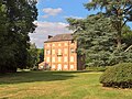 Le Hamel (Oise) - Hameau de Rieux - Le Château WP 20180723 17 54 41 Rich.jpg 3,264 × 2,448; 3.77 MB
 Le Hamel (Oise) - Hameau de Rieux - Le Château WP 20180723 17 54 48 Rich.jpg 3,264 × 2,448; 2.72 MB
 Le Hamel (Oise) - Monument aux morts - WP 20180723 17 28 24 Rich.jpg 2,448 × 3,264; 4.17 MB
 Le Hamel (Oise) - Monument aux morts -IMG 20190715 171216 02.jpg 3,496 × 4,656; 2.93 MB
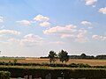 Le Hamel (Oise) - Paysage à la moisson WP 20180723 17 35 37 Rich.jpg 3,264 × 2,448; 1.88 MB
 Population - Municipality code 60297.svg 475 × 355; 13 KB
_-_Hameau_de_Rieux_-_Le_Ch%C3%A2teau_WP_20180723_17_54_41_Rich.jpg)
_-_Hameau_de_Rieux_-_Le_Ch%C3%A2teau_WP_20180723_17_54_48_Rich.jpg)
_-_Monument_aux_morts_-_WP_20180723_17_28_24_Rich.jpg)
_-_Monument_aux_morts_-IMG_20190715_171216_02.jpg)
_-_Paysage_%C3%A0_la_moisson_WP_20180723_17_35_37_Rich.jpg)
