Category:Le Taillan-Médoc
Sari la navigare
Sari la căutare
| Poziția obiectului | | View all coordinates using: OpenStreetMap |
|---|
Deutsch: Le Taillan-Médoc ist eine französische Gemeinde im Département Gironde in der Region Aquitanien.
English: Le Taillan-Médoc is a commune in the Gironde department in Aquitaine in south-western France.
Español: Le Taillan-Médoc es una población y comuna francesa, situada en la región de Aquitania, departamento de Gironda.
Français : Le Taillan-Médoc est une commune française, située dans le département de la Gironde et la région Aquitaine.
Italiano: Le Taillan-Médoc è un comune francese situato nel dipartimento della Gironda nella regione dell'Aquitania.
commune in Gironde, France  .svg)  | |||||
| Încarcă multimedia | |||||
| Este un/o | |||||
|---|---|---|---|---|---|
| Locul actual |
| ||||
| Localizat la adresa stradală |
| ||||
| Populație |
| ||||
| Suprafață |
| ||||
| Altitudine deasupra nivelului mării |
| ||||
| site oficial | |||||
 | |||||
Subcategorii
Această categorie conține următoarele 7 subcategorii, dintr-un total de 7.
C
- Château de la Dame Blanche (17 F)
M
- Maps of Le Taillan-Médoc (7 F)
P
- Postcards of Le Taillan-Médoc (10 F)
T
- Trail du Taillan (2 F)
Fișiere media din categoria „Le Taillan-Médoc”
Următoarele 37 fișiere se află în această categorie, dintr-un total de 37.
-
 D 1215 contournement du Taillan.jpg 4.875x3.250; 4,95 MB
-
 Enfouissement de lignes.jpg 4.500x3.000; 8,38 MB
-
 Jallepont.jpg 5.649x3.696; 7,23 MB
-
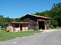 Lapey hangar bois.jpg 2.216x1.632; 677 KB
-
 Le Palio.jpg 640x480; 88 KB
-
 Blason ville fr Taillant Médoc (Gironde).svg 600x660; 117 KB
-
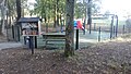 Le Taillan-Médoc - avenue Bossuet - aire de jeux.jpg 3.264x1.840; 3,03 MB
-
 Le Taillan-Médoc - Avenue des Rouges Gorges - boîte à livres.jpg 3.264x1.840; 2,62 MB
-
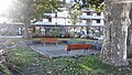
 Le Taillan-Médoc - parc du presbytère - 01.jpg 3.264x1.840; 2,35 MB
-
 Le Taillan-Médoc - parc du presbytère - 02.jpg 3.264x1.840; 2,7 MB
-
 Le Taillan-Médoc - place du général de Gaulle - boîte à livres 01.jpg 3.264x1.840; 2,69 MB
-
 Le Taillan-Médoc - place du général de Gaulle - boîte à livres 02.jpg 3.264x1.840; 2,75 MB
-
 Lf officielle.jpg 2.362x3.234; 906 KB
-
 LTM - Jumelles.jpg 5.596x3.731; 8,8 MB
-
 LTM-Bâtiment centre.jpg 5.760x3.840; 5,23 MB
-
 LTM-Cagaraou chemin.jpg 5.452x3.635; 9,95 MB
-
 LTM-Cagaraou.jpg 5.760x3.840; 11,35 MB
-
 LTM-Clinique Véto.jpg 5.760x3.840; 4,01 MB
-
 LTM-Commerces centre.jpg 5.760x3.840; 4,74 MB
-
 LTM-Croix.jpg 5.760x3.840; 4,87 MB
-
 LTM-Entreprise.jpg 4.992x3.328; 3,21 MB
-
 LTM-grange.jpg 5.760x3.840; 6,39 MB
-
 LTM-Maison bitour.jpg 5.248x3.084; 4,91 MB
-
 LTM-Maison Boëtie.jpg 5.760x3.840; 5,13 MB
-
 LTM-Maison Pargau.jpg 5.445x3.630; 4,86 MB
-
 LTM-Maison symétrique.jpg 5.760x3.840; 6,13 MB
-
 LTM-Maison, Lapey.jpg 4.196x3.124; 4,56 MB
-
 LTM-Maisons centre.jpg 5.356x3.571; 4,94 MB
-
 LTM-médiathèque.jpg 5.030x3.353; 7,03 MB
-
 LTM-Oustaou.jpg 5.478x3.653; 5,3 MB
-
 LTM-Parc Presbytère.jpg 5.760x3.840; 6,97 MB
-
 LTM-place.jpg 5.454x3.636; 4,22 MB
-
 LTM-École.jpg 5.794x3.868; 10,49 MB
-
 LTM-établissements.jpg 5.760x3.840; 4,23 MB
-
 Population - Municipality code 33519.svg 475x355; 13 KB
-
 Puits de Curé (nord).jpg 5.760x3.840; 5,83 MB
-
 Puits de Curé (sud).jpg 5.760x3.840; 7,06 MB


.jpg)
.jpg)