Category:Lea Marston
Jump to navigation
Jump to search
village in the United Kingdom  | |||||
| Upload media | |||||
| Instance of | |||||
|---|---|---|---|---|---|
| Location | North Warwickshire, Warwickshire, West Midlands, England | ||||
| Population |
| ||||
| Area |
| ||||
 | |||||
English: Lea Marston is a village in the North Warwickshire district of the county of Warwickshire, England.
Subcategories
This category has the following 2 subcategories, out of 2 total.
H
Media in category "Lea Marston"
The following 66 files are in this category, out of 66 total.
-

-
 A place to deposit old portakabins - geograph.org.uk - 6169630.jpg 6,000 × 4,000; 4.7 MB
-
-
 Birmingham ^ Fazeley Canal near Marston - geograph.org.uk - 4677734.jpg 800 × 674; 217 KB
-

-

-
 Bridleway to Marston in Warwickshire - geograph.org.uk - 6396613.jpg 1,440 × 960; 1.67 MB
-

-
 Car boot sale - geograph.org.uk - 6168240.jpg 6,000 × 4,000; 6.88 MB
-

-
 Cottages in Lea Marston - geograph.org.uk - 6168255.jpg 6,000 × 4,000; 5.23 MB
-
 Cross on Church Lane - geograph.org.uk - 6169356.jpg 5,157 × 3,438; 6.93 MB
-

-
 Doomed field near Lea Marston - geograph.org.uk - 6168313.jpg 6,000 × 4,000; 3.99 MB
-
 Edison Road on the Coleshill Industrial Park - geograph.org.uk - 5674238.jpg 1,469 × 1,102; 753 KB
-

-

-
 Farmland near Lea Marston - geograph.org.uk - 6168249.jpg 6,000 × 4,000; 4.86 MB
-
-

-
 Field for a car boot sale - geograph.org.uk - 6169617.jpg 6,000 × 4,000; 3.3 MB
-
 Field of oil seed rape - geograph.org.uk - 6169345.jpg 6,000 × 4,000; 4.26 MB
-
 Footpath near Lea Marston - geograph.org.uk - 6168298.jpg 6,000 × 4,000; 5.54 MB
-
 Footpath off Hams Lane - geograph.org.uk - 6168324.jpg 6,000 × 4,000; 4.24 MB
-
 Hams Hall "B" control room - geograph.org.uk - 4119079.jpg 640 × 426; 80 KB
-
 Head gardener's cottage, Hams Hall - geograph.org.uk - 1176495.jpg 640 × 480; 70 KB
-
 Hollies Farm at Marston - geograph.org.uk - 2892162.jpg 640 × 425; 84 KB
-
 Hollies Farm at Marston - geograph.org.uk - 4842885.jpg 800 × 609; 162 KB
-
 Lake near Lea Marston - geograph.org.uk - 6169652.jpg 5,695 × 3,796; 4.01 MB
-
 Lea Bridge - geograph.org.uk - 3407423.jpg 640 × 435; 62 KB
-

-
 Lea Marston - geograph.org.uk - 6788968.jpg 1,200 × 802; 1.1 MB
-
 Lea Marston church cross - geograph.org.uk - 5673568.jpg 1,543 × 2,399; 1.35 MB
-
 Lea Marston Hotel - geograph.org.uk - 6168230.jpg 6,000 × 4,000; 3.81 MB
-
 Lea Marston Weirs - geograph.org.uk - 5497950.jpg 4,608 × 2,592; 2.23 MB
-
 Lea Marston, St John the Baptist - geograph.org.uk - 6369423.jpg 4,000 × 3,000; 4.86 MB
-
 Lea Rail Bridge at Lea Marston - geograph.org.uk - 2892091.jpg 640 × 425; 92 KB
-
 Level Crossing to nowhere - geograph.org.uk - 210855.jpg 640 × 480; 46 KB
-

-

-
-
 M42 Motorway alongside the canal - geograph.org.uk - 2332779.jpg 640 × 480; 46 KB
-
 M42 Motorway near Marston Farm Hotel - geograph.org.uk - 2332792.jpg 640 × 480; 45 KB
-

-
 Model Cottages on Bodymoor Heath Road - geograph.org.uk - 4842876.jpg 800 × 562; 138 KB
-
-
 No parking on Canton Lane - geograph.org.uk - 5674323.jpg 1,432 × 1,074; 530 KB
-
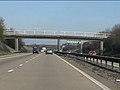
 North Warwickshire , M42 Motorway - geograph.org.uk - 5951565.jpg 6,000 × 4,000; 6.17 MB
-
 Not much of a path by the field edge - geograph.org.uk - 6168339.jpg 6,000 × 4,000; 4.99 MB
-
 Paddocks and pylons - geograph.org.uk - 6168305.jpg 6,000 × 4,000; 7 MB
-
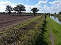
 Path by the River Tame - geograph.org.uk - 6170193.jpg 6,000 × 4,000; 5.58 MB
-
 Path near Lea Marston Lakes - geograph.org.uk - 6169645.jpg 6,000 × 4,000; 5.43 MB
-
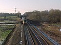
 Railway near Lea Marston - geograph.org.uk - 6169350.jpg 6,000 × 4,000; 5.34 MB
-
 River Tame - Looking NW from Hams Hall - geograph.org.uk - 49108.jpg 640 × 480; 85 KB
-
 River Tame at Lea Marston - geograph.org.uk - 49122.jpg 640 × 480; 133 KB
-

-
 River Tame, Lea Marston - geograph.org.uk - 3407424.jpg 640 × 450; 66 KB
-
 Road Closed - geograph.org.uk - 1137141.jpg 640 × 480; 95 KB
-
 Seeney Lane bridge over M42 - geograph.org.uk - 3195211.jpg 1,024 × 768; 511 KB
-

-
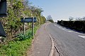
 The A4097 towards Kingsbury - geograph.org.uk - 4842891.jpg 800 × 554; 127 KB
-
 The River Tame near Marston - geograph.org.uk - 6169665.jpg 6,000 × 4,000; 5.53 MB
-
 Whitacre Waterworks.JPG 5,152 × 3,864; 5.34 MB
-
 Blackgreaves Farm - geograph.org.uk - 285557.jpg 640 × 480; 107 KB
-

-
 Whiteacre water works - geograph.org.uk - 49132.jpg 640 × 480; 116 KB


