Category:Lechtaler Alpen
Zur Navigation springen
Zur Suche springen

Gebirgsgruppe der Alpen   | |||||
| Medium hochladen | |||||
| Ist ein(e) | |||||
|---|---|---|---|---|---|
| Material | |||||
| Ort |
| ||||
| Gebirgszug | |||||
| Höchster Punkt | |||||
| Höhe über dem Meeresspiegel |
| ||||
 | |||||
Unterkategorien
Es werden 27 von insgesamt 27 Unterkategorien in dieser Kategorie angezeigt:
In Klammern die Anzahl der enthaltenen Kategorien (K), Seiten (S), Dateien (D)
A
- Alpine coaster Imst (26 D)
B
- Balschtespitze (1 D)
- Blankahorn (Lechtaler Alpen) (7 D)
D
F
G
- Grubigjoch (12 D)
H
- Hahntennjoch (58 D)
- Hintere Platteinspitze (10 D)
L
M
- Maldonkopf (6 D)
P
- Patrolscharte (2 D)
R
- Rauer Kopf (Lechtal Alps) (5 D)
- Rotlechstausee (5 D)
S
- Seewiseen (8 D)
- Silberspitze (15 D)
- Stanskogel (2 D)
- Steinjöchle (13 D)
Z
- Zwölferkopf (Lechtal Alps) (4 D)
Medien in der Kategorie „Lechtaler Alpen“
Folgende 200 Dateien sind in dieser Kategorie, von 206 insgesamt.
(vorherige Seite) (nächste Seite)-
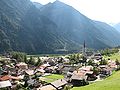
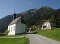
 - Kapelle und Elmen im Lechtal.jpg 3.264 × 2.448; 1,19 MB
-
 - Kirche in Martinau, Lechtal.jpg 2.334 × 2.423; 492 KB
-
 - Lechtal westlich von Rieden.jpg 3.264 × 2.448; 1,03 MB
-
 - Vorderhornbach.jpg 3.218 × 2.225; 1,22 MB
-
 - Wildfluß Lech mit Ausdehnung bei Forchach.jpg 3.163 × 2.443; 1,25 MB
-
 -Wildfluß Lech mit Kiesbank bei Forchach.jpg 3.264 × 2.448; 1,26 MB
-
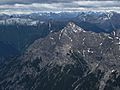
 012 Lechtaler Alpen in Austria - Hintere and Vordere Platteinspitze.jpg 2.400 × 1.600; 1,45 MB
-
 20110826.Lechtal.-01.jpg 6.842 × 5.132; 4,34 MB
-
 20110826.Lechtal.-02.jpg 6.842 × 5.132; 4,28 MB
-
 20110826.Lechtal.-03.jpg 6.681 × 5.011; 5,19 MB
-
 20110826.Lechtal.-04.jpg 6.773 × 5.080; 4,66 MB
-
 20140907 104604 Boden, Gde. Pfafflar.jpg 2.988 × 5.312; 6,63 MB
-
 20140907 104610 Boden, Gde. Pfafflar.jpg 5.312 × 2.988; 6,34 MB
-
 2018.06.22.-12-Beim Badesee am Lechweg-Weissenbach am Lech--Bergblick.jpg 5.200 × 2.925; 14,27 MB
-
 2018.06.22.-13-Beim Badesee am Lechweg-Weissenbach am Lech--Bergblick.jpg 5.200 × 2.925; 11,55 MB
-
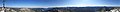
 300° Diedamskopf Panorama.jpg 9.559 × 1.362; 1,89 MB
-
 360° Hochkünzelspitze 2397m.jpg 8.950 × 1.728; 3,69 MB
-
 360° Kanisfluh.jpg 8.767 × 1.712; 4,76 MB
-
 662 Pians Ausschnitt.jpg 2.340 × 1.170; 885 KB
-
 662 Pians.jpg 3.008 × 2.000; 3,04 MB
-
 A Tarrenz StarkenbergB.jpg 1.240 × 930; 358 KB
-
 Alpen Daniel.jpg 3.264 × 2.448; 3,97 MB
-
 Alpen Lechtal.jpg 2.560 × 1.920; 1,57 MB
-
 Alpen von der Zugspitze...).jpg 3.874 × 2.578; 3,03 MB
-
 Alperschontal.png 706 × 1.026; 706 KB
-
 Alpjoch Panorama.jpg 4.385 × 1.500; 2,87 MB
-
 Alte Klein Gfall Alm.jpg 5.568 × 3.132; 3,74 MB
-
 AT 64835 Stanz mit Pfarrkirche hll. Peter und Paul-7223.jpg 5.472 × 3.648; 10,05 MB
-
 Auf der Mutte.JPG 3.264 × 2.448; 4,3 MB
-
 Ausblick Albona 2400 m Richtung Zürs und Lech - panoramio.jpg 4.608 × 2.828; 4,78 MB
-
 Ausblick von der Scharte über Bichlbach - panoramio.jpg 2.000 × 1.339; 466 KB
-
 Austria 1.jpg 3.296 × 2.450; 3,37 MB
-
 Austrian alps from airplane - panoramio.jpg 5.184 × 3.456; 6,65 MB
-
 Bach im Winter.jpg 2.560 × 1.920; 1,7 MB
-
 Bahnhof Imst-Pitztal.png 3.888 × 2.592; 11,88 MB
-
 Blankaspitze im Stanzertal.jpg 5.568 × 3.132; 13,48 MB
-
 Blick aus dem Aufstieg zur Kohlbergspitze heraus - panoramio.jpg 2.000 × 1.339; 406 KB
-
 Blick vom Galtjoch HQ.jpg 1.280 × 960; 281 KB
-
 Blick vom Schlieregrind auf Mitteregg.jpg 1.199 × 899; 174 KB
-
 Blick von der hinteren Dremelscharte.jpg 983 × 964; 171 KB
-
 Blick zur Trittscharte.jpg 2.560 × 1.920; 886 KB
-
 Boden - Kirche v N 01.JPG 3.008 × 2.000; 3 MB
-
 Bschlabs-NW.jpg 6.000 × 3.376; 8,09 MB
-
 Compton, 1901, Hanauer Hütte und Umgebung.jpg 992 × 712; 171 KB
-
De-Lechtaler Alpen.ogg 2,5 s; 24 KB
-
De-Lechtaler Alpen2.ogg 2,5 s; 23 KB
-
 Dremelspitze04.jpg 2.160 × 1.698; 717 KB
-
 EalpWidum1571.jpg 800 × 504; 221 KB
-
 Ehrwald, Austria.JPG 3.648 × 2.736; 2,49 MB
-
 Ellbognerspitze from Rappenseekopf.JPG 3.264 × 2.448; 2,87 MB
-
 ETH-BIB-Mittagspitze, Lechtaler Alpen-LBS H1-020310.tif 6.317 × 5.008; 90,59 MB
-
 Fallenbacherjoch.png 4.174 × 2.993; 21,7 MB
-
 Fiss - Vom Fisser Joch 2436 Hm auf Parseierspitze 3036 Hm, Wolken.jpg 4.000 × 3.000; 1 MB
-
 Fiss - Vom Fisser Joch auf Gatschkopf 2943 Hm. Lechtaler Alpen.jpg 3.000 × 4.000; 814 KB
-
 Flirsch Gemeindehaus1.jpg 2.848 × 4.288; 6,85 MB
-
 Friedhof Falterschein, Zams 01.JPG 5.184 × 3.456; 9,87 MB
-
 Galtjoch - panoramio.jpg 2.000 × 1.339; 362 KB
-
 Galtjoch Südseite.jpg 1.927 × 1.445; 673 KB
-
 Galtjoch.jpg 1.280 × 851; 413 KB
-
 Galzig.jpg 3.072 × 2.304; 2,81 MB
-
 Gehrenspitze Gipfelkreuz West.JPG 3.264 × 2.448; 3,16 MB
-
 Gipfelaufbau des Spiehlerturms.jpg 1.156 × 1.400; 269 KB
-
 Gramais - Ort mit Seitekopf.JPG 3.582 × 2.662; 1,97 MB
-
 Gramais 08.2013 05.JPG 3.504 × 2.336; 4,48 MB
-
 Griesskopf Sommer 2014.jpg 3.240 × 2.430; 2,5 MB
-
 Grins to Augsburger Hütte, ladder.jpg 1.606 × 2.141; 1,52 MB
-
 Grist.JPG 3.008 × 2.000; 3,25 MB
-
 Grubig-Ost-Pano.jpg 8.192 × 1.856; 4,23 MB
-
 Grubigstein.jpg 744 × 220; 53 KB
-
 Gufelsee.JPG 1.600 × 1.200; 1,71 MB
-
 Görisried sö - Bleispitze, Gartnerwand 100115.jpg 4.000 × 2.248; 1,25 MB
-
 HeiterwandNord.jpg 1.667 × 800; 779 KB
-
-
 Hintere and Vordere Platteinspitze.jpg 4.032 × 3.024; 3,66 MB
-
 Holzgau - Kirche und Kapelle mit Ruitelspitze 2580 m.ü.NN..JPG 2.736 × 3.648; 1,34 MB
-
 Holzgau - Ort von Westen mit Lechtal.JPG 3.557 × 1.953; 1,35 MB
-
 Holzgau - Ort von Westen, Lechtaler Alpen.JPG 3.584 × 2.016; 1,26 MB
-
 Holzgau - Ruitelspitze über dem Lechtal, Heustadel.JPG 3.584 × 2.016; 1,18 MB
-
 Holzgau.JPG 3.264 × 2.448; 4,56 MB
-
 Häselgehrberg from Northnortheast.JPG 3.680 × 2.070; 2,12 MB
-
 Imst - Infotafel bei der Untermarkter Alm.jpg 3.491 × 5.236; 4,61 MB
-
 Imst - Kapuzinerkloster und Kirche hl Josef - Ansicht von Osten - II.jpg 5.459 × 3.639; 8,94 MB
-
 Imst - panoramio.jpg 2.048 × 1.536; 1,05 MB
-
 Imst - Untermarkter Alm - 1.jpg 5.703 × 3.802; 6,73 MB
-
 Imst - Untermarkter Alm - 2.jpg 6.000 × 4.000; 7,28 MB
-
 Imst - Untermarkter Alm - Infotafel Muttekopfhütte.jpg 3.786 × 5.679; 6,79 MB
-
 Inntal Zams Lechtaler Alpen Verwallgruppe.JPG 5.184 × 3.456; 8,55 MB
-
 ISS030-E-17137 - View of Austria.jpg 4.288 × 2.848; 2,07 MB
-
 ISS030-E-17138 - View of Germany.jpg 4.288 × 2.848; 2,02 MB
-
 ISS058-E-13129 - View of Earth.jpg 3.712 × 5.568; 3,24 MB
-
 Joechelspitze Northeastface Summit.JPG 3.264 × 2.448; 2,42 MB
-
 Joechelspitze Summit.JPG 3.264 × 2.448; 2,62 MB
-
 Kaisertal (Lechtaler Alpen).png 2.816 × 2.112; 8,18 MB
-
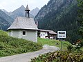 Kapelle-Madau DSCF1219.JPG 2.592 × 1.944; 2,45 MB
-
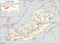 Karte Lechtaler Alpen.png 3.407 × 2.481; 2,59 MB
-
 Kaunerberg01.jpg 1.600 × 1.200; 398 KB
-
 KelmenKapelle2013.jpg 1.500 × 1.103; 687 KB
-
 KelmenKapelle2015.jpg 1.500 × 1.000; 950 KB
-
 Kiesbank im Wildfluß Lech bei Forchach.jpg 3.264 × 2.448; 1,28 MB
-
 Kirche Gramais.JPG 2.816 × 2.112; 1,15 MB
-
 Kirche und Widum in Vorderhornbach.jpg 3.264 × 2.448; 1,12 MB
-
 Klimmspitze from Northwest.JPG 4.000 × 3.000; 3,23 MB
-
 Knittelkarspitze Gipfelaufbau.jpg 1.891 × 1.450; 932 KB
-
 Knittelkarspitze Pano.jpg 10.127 × 1.013; 2,36 MB
-
 Kogel mit Kogelsee.jpg 2.816 × 2.112; 1,95 MB
-
 Kogelsee cropped.JPG 2.737 × 1.540; 2,43 MB
-
 Kogelsee.JPG 3.264 × 2.448; 2,3 MB
-
 Kogelseespitze-Panorama.jpg 7.343 × 627; 825 KB
-
 Kogelseespitze.jpg 1.600 × 1.200; 1,65 MB
-
 Kohlbergspitze - panoramio.jpg 2.000 × 1.339; 609 KB
-
 Krahbergwinter1.jpg 3.008 × 2.000; 4,15 MB
-
 Kreuzkarspitze from North.JPG 4.000 × 3.000; 3,16 MB
-
 Kreuzspitzekamm02.JPG 2.501 × 1.407; 1,9 MB
-
 Kreuzspitzekamm03.JPG 1.984 × 1.116; 1,24 MB
-
 Kreuzspitzkamm.JPG 2.246 × 1.263; 1,93 MB
-
 Krinnenspitze from Einstein.JPG 3.264 × 2.448; 4,51 MB
-
 Lachenkopf-SW.jpg 6.000 × 3.376; 10,32 MB
-
 Lake Blindsee (222019082).jpg 2.304 × 3.072; 3,06 MB
-
 Lechtal.Febr.März.2006 120.jpg 1.024 × 768; 709 KB
-
 Lechtaler Alpen, Pians 01.JPG 5.184 × 3.456; 4,05 MB
-
 Lechtaler Alpen, Pians 02.JPG 5.184 × 3.456; 4,05 MB
-
 Lechtaler Alpen.jpg 2.048 × 1.536; 1,11 MB
-
 Leiterspitzen und Alblitjoch.png 2.816 × 2.112; 8,79 MB
-
 Litnisschrofen Westridge02.JPG 3.264 × 2.448; 3,31 MB
-
 Loreakopf Panorama.jpg 7.255 × 674; 920 KB
-
 M-FALZ Falcon 7X Innsbruck 11-12-15 (2) (23699487002).jpg 3.096 × 1.884; 994 KB
-
 Madloch Zürs 01.JPG 4.288 × 2.848; 4,1 MB
-
 Madloch Zürs Panorama.jpg 8.757 × 3.385; 22,84 MB
-
 Malatschkopf.jpg 3.240 × 2.430; 1,92 MB
-
 Maldongrat.JPG 2.816 × 2.112; 1,05 MB
-
 Maldonkopf Imster-Klettersteig.JPG 2.136 × 2.848; 1,36 MB
-
 Maldonkopf.jpg 1.920 × 1.202; 1,99 MB
-
 Memminger Huette.JPG 4.000 × 3.000; 5,07 MB
-
 Memminger Hütte.JPG 2.816 × 2.112; 2,34 MB
-
 MemmingerHuette.jpg 800 × 533; 223 KB
-
 Mindelheimer Huette from Kemptner Kopf.JPG 3.264 × 2.448; 4,21 MB
-
 Mittlerer Seewisee.jpg 4.000 × 3.000; 5,54 MB
-
 Mittlerer Seewisee.JPG 4.000 × 3.000; 4,67 MB
-
 Moon hits mountain - panoramio.jpg 2.000 × 1.339; 426 KB
-
 Murmeltiere - panoramio.jpg 4.608 × 3.456; 6,31 MB
-
 Muttekopf Wildmahdspitze.JPG 3.264 × 2.448; 3,59 MB
-
 Namloser Kirche.jpg 2.304 × 3.072; 3,21 MB
-
 Nassereith, Pfarrkirche hl. Drei König Dm779 2012-08-15 10.13.jpg 4.290 × 3.124; 7,11 MB
-
 ObererSeewisee.jpg 1.530 × 1.040; 744 KB
-
 Oelbergkapelle1431.jpg 719 × 516; 137 KB
-
 Panorama Namloser Wetterspitze.jpg 7.801 × 1.200; 5,06 MB
-
 Panorama Wetterspitze.png 9.392 × 1.330; 16,13 MB
-
 Panoramaweg blick bach.JPG 3.968 × 2.976; 2,21 MB
-
 PanoVerwall Patteriol.jpg 9.350 × 1.167; 898 KB
-
 Parsaierspitze 25 8 2021.jpg 4.953 × 3.302; 11,66 MB
-
 Parseierspitz-Patrolscharte.JPG 2.048 × 1.536; 685 KB
-
 Parzinnsee mit Parzinnspitze.png 2.816 × 2.112; 9,43 MB
-
 Parzinnspitze mit Gufelsee.png 2.816 × 2.112; 9,01 MB
-
 Parzinntuerme.jpg 890 × 1.360; 303 KB
-
 Peischelgruppe.JPG 3.264 × 2.448; 2,88 MB
-
 Pfafflar4950.jpg 2.400 × 1.600; 2,12 MB
-
 Pfafflar4971 Pan.jpg 3.367 × 764; 1,28 MB
-
 Pfafflar5146.jpg 2.400 × 1.600; 1,97 MB
-
 Pflach - Säuling - Säulinghaus, Reutte, Pflach.jpg 2.048 × 1.536; 1,39 MB
-
 Plants in Gramaiser Tal 01.JPG 2.336 × 3.504; 4,7 MB
-
 Pseudoleskea incurvata (c, 103959-471538) 4757.JPG 2.816 × 1.880; 1,17 MB
-
 Pseudoleskea incurvata (c, 103959-471538) 4761.JPG 2.816 × 1.880; 1,63 MB
-
 Pseudoleskea incurvata (c, 103959-471538) 4762.JPG 2.816 × 1.880; 1,86 MB
-
 Reutte - Tiroler Lechtal, gesehen von der Lechbrücke Platten.JPG 3.522 × 1.925; 1,25 MB
-
 Reutte - Wildfluss Lech.JPG 3.584 × 2.016; 1,39 MB
-
 Robert-Bosch-Weg 2012.jpg 2.048 × 1.536; 650 KB
-
 Robert-Bosch-Weg-Panorama.jpg 12.756 × 2.489; 18,18 MB
-
 Roggspitze 2012.jpg 2.560 × 1.920; 1,04 MB
-
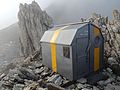 Roland Ritter Biwak.JPG 4.608 × 3.456; 5,39 MB
-
 Roter Stein Gipfel.jpg 2.008 × 1.501; 2,27 MB
-
 Rotkopf und Imster Muttekopf.jpg 4.608 × 3.456; 11,43 MB
-
 Rotkopf, Imster Muttekopf vom Melzergrat.jpg 4.608 × 3.456; 11,93 MB
-
 Samspitze.jpg 3.221 × 2.270; 4,44 MB
-
 Schwellenspitze.JPG 3.051 × 2.288; 2,01 MB
-
 Seekogel.JPG 4.000 × 3.000; 2,55 MB
-
 Silberspitze.jpg 2.592 × 1.944; 5,07 MB
-
 Stapfetobel.jpg 1.360 × 890; 280 KB
-
 Steinkarspitze, Lechtal Alps.jpg 5.184 × 3.456; 5,98 MB
-
 Steinseehuette.jpg 2.325 × 1.625; 586 KB
-
 Steinseehuette1.jpg 1.840 × 1.232; 522 KB
-
 Steinseehuette2.jpg 1.032 × 1.352; 273 KB
-
 Steinseehütte, Steinkarspitze.JPG 3.264 × 2.448; 3,38 MB
-
 Tagweidkopf.jpg 1.092 × 864; 570 KB
-
 Trittscharte Warnhinweis.JPG 1.713 × 1.413; 1,27 MB
-
 Unterer Seewisee.JPG 4.000 × 3.000; 4,58 MB
-
 Untermarkter Alm Lechtaler Alpen.JPG 2.576 × 1.952; 1,26 MB
-
 Valfagehrjoch.jpg 2.560 × 1.920; 325 KB
-
 Venet - panoramio (23).jpg 4.272 × 2.848; 9,2 MB
-
 Venet - panoramio (38).jpg 4.272 × 2.848; 9,47 MB
-
 Venet - panoramio (39).jpg 4.272 × 2.848; 9,64 MB
-
 Venet - panoramio (43).jpg 4.272 × 2.848; 9,14 MB
-
 Venet - panoramio (49).jpg 4.272 × 2.848; 10,3 MB
-
 Venet - panoramio (50).jpg 4.272 × 2.848; 9,09 MB
-
 Venet - panoramio (74).jpg 4.272 × 2.848; 9,83 MB
-
 Venet - panoramio (77).jpg 4.272 × 2.848; 9,28 MB
-
 Venetimpressionen.jpg 2.736 × 1.824; 2,3 MB
-
 Vorderer Gufelkopf.png 2.816 × 2.112; 8,94 MB
-
 Warnschild auf der Loreascharte.jpg 2.000 × 1.500; 844 KB
-
 Weißenbach - Weißenbach im Lechtal Kirche und Lokal.jpg 3.264 × 1.964; 887 KB
-
 Wilder Kasten Peischelspitze Ellbognerspitze.JPG 3.264 × 2.448; 3,75 MB


.jpg)


.png)


.jpg)


_(23699487002).jpg)


_4757.JPG)
_4761.JPG)
_4762.JPG)


.jpg)
.jpg)
.jpg)
.jpg)
.jpg)
.jpg)
.jpg)
.jpg)


