Category:Ledsham, Cheshire
Aller à la navigation
Aller à la recherche
village britannique  | |||||
| Téléverser des médias | |||||
| Nature de l’élément | |||||
|---|---|---|---|---|---|
| Lieu | Cheshire West and Chester, Cheshire, Angleterre du Nord-Ouest, Angleterre | ||||
| Réputé identique à | Ledsham (page en doublon, paroisse civile) | ||||
 | |||||
Sous-catégories
Cette catégorie comprend seulement la sous-catégorie ci-dessous.
I
- Inglewood, Cheshire (2 F)
Média dans la catégorie « Ledsham, Cheshire »
Cette catégorie comprend 54 fichiers, dont les 54 ci-dessous.
-
 At The Junction - geograph.org.uk - 2175237.jpg 4 000 × 3 000 ; 5,95 Mio
-
 Badgers Rake Lane - geograph.org.uk - 2618097.jpg 640 × 481 ; 108 kio
-
 Blocked entrance, former British Nuclear Fuels site - geograph.org.uk - 4321493.jpg 1 024 × 768 ; 198 kio
-
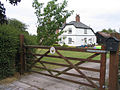
 Bungalow and bench, Ledsham - DSC06423.JPG 3 648 × 2 736 ; 3,59 Mio
-
 Canada Geese and goslings - geograph.org.uk - 4013391.jpg 640 × 480 ; 134 kio
-
 Capenhurst Electrical Substation - geograph.org.uk - 4056489.jpg 4 000 × 2 248 ; 1,98 Mio
-
 Capenhurst Uranium Enrichment Plant - geograph.org.uk - 4056507.jpg 4 000 × 2 248 ; 1,76 Mio
-
 Caution^ Lake Ahead - geograph.org.uk - 4013379.jpg 640 × 480 ; 185 kio
-
 Copper Beech Farm near Ledsham - geograph.org.uk - 215101.jpg 640 × 480 ; 99 kio
-
 Cut Mark, Gatepost, Ledsham Lane - geograph.org.uk - 2294372.jpg 3 648 × 2 736 ; 3,98 Mio
-
 Farm access bridge over the railway near Ledsham - geograph.org.uk - 3442476.jpg 1 024 × 768 ; 258 kio
-
 Fishing lake, Inglewood Manor - geograph.org.uk - 4013384.jpg 640 × 480 ; 184 kio
-
 Fishing lake, Inglewwod Manor - geograph.org.uk - 4013386.jpg 640 × 480 ; 164 kio
-
 Fulwood Lodge, Badgersrake Lane - geograph.org.uk - 180460.jpg 640 × 480 ; 61 kio
-
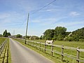
 Grassland off Ledsham Lane - geograph.org.uk - 6347987.jpg 640 × 480 ; 60 kio
-
 House at the eastern end of Ledsham - geograph.org.uk - 4321487.jpg 1 024 × 768 ; 203 kio
-
 Houses, Ledsham - DSC06426.JPG 3 648 × 2 736 ; 3,57 Mio
-
 Lean Too - geograph.org.uk - 2175238.jpg 4 000 × 3 000 ; 5,23 Mio
-
 Ledsham - Bank Cottage - geograph.org.uk - 253879.jpg 640 × 480 ; 333 kio
-
 Ledsham - nuclear nurseries - geograph.org.uk - 253877.jpg 640 × 480 ; 275 kio
-
 Ledsham sign - DSC06427.JPG 3 648 × 2 736 ; 3,62 Mio
-
 Ledsham Village - DSC06424.JPG 3 648 × 2 736 ; 3,63 Mio
-
 Little Sutton - Badgersrake Lane - geograph.org.uk - 253888.jpg 640 × 480 ; 429 kio
-
 Methodist Chapel - geograph.org.uk - 116885.jpg 640 × 480 ; 163 kio
-
 National Cycle Route 56 near Bank Farm - geograph.org.uk - 6347988.jpg 800 × 600 ; 137 kio
-
 Newly planted crop off Welsh Road (A550) - geograph.org.uk - 6185838.jpg 800 × 600 ; 132 kio
-
 Penistone Drive public footpath, Wirral - DSC03403.JPG 3 648 × 2 736 ; 3,65 Mio
-
 Penistone Drive public footpath, Wirral - DSC03408.JPG 3 648 × 2 736 ; 3,61 Mio
-
 Penistone Drive public footpath, Wirral - DSC03409.JPG 3 648 × 2 736 ; 3,68 Mio
-
 Penistone Drive public footpath, Wirral - DSC03410.JPG 3 648 × 2 736 ; 3,64 Mio
-
 Penistone Drive public footpath, Wirral - DSC03412.JPG 3 648 × 2 736 ; 3,58 Mio
-
 Penistone Drive public footpath, Wirral - DSC03413.JPG 3 648 × 2 736 ; 3,56 Mio
-
 Penistone Drive public footpath, Wirral - DSC03414.JPG 3 648 × 2 736 ; 3,61 Mio
-
 Pond at Inglewood House - geograph.org.uk - 180468.jpg 640 × 480 ; 60 kio
-
 Pond, Inglewood Manor - geograph.org.uk - 4013397.jpg 640 × 480 ; 190 kio
-
 Postbox, Ledsham - DSC06430.JPG 2 736 × 3 648 ; 3,57 Mio
-
 Premier Plants of Ledsham - geograph.org.uk - 4055476.jpg 4 000 × 2 248 ; 2,06 Mio
-
 Premier Plants of Ledsham - geograph.org.uk - 4056467.jpg 4 000 × 2 248 ; 2,4 Mio
-
 Pylon at Capenhurst - geograph.org.uk - 4056511.jpg 4 000 × 2 248 ; 1,74 Mio
-
 Pylons, Ledsham, Wirral 1.JPG 3 648 × 2 736 ; 3,62 Mio
-
 Pylons, Ledsham, Wirral 2.JPG 3 648 × 2 736 ; 3,61 Mio
-
 Pylons, Ledsham, Wirral 3.JPG 3 648 × 2 736 ; 3,6 Mio
-
 Railway line between Capenhurst and Hooton Stations - geograph.org.uk - 3442489.jpg 1 024 × 768 ; 304 kio
-
 The Foxes, Farm and Riding School - geograph.org.uk - 180474.jpg 640 × 480 ; 61 kio
-
 The grounds of Inglewood Manor Hotel - geograph.org.uk - 2552141.jpg 640 × 480 ; 113 kio
-
 The Oaks Cottages, Badgersrake Lane - geograph.org.uk - 180454.jpg 640 × 480 ; 61 kio
-
 Two Mills junction of A550 and A540 - geograph.org.uk - 2343209.jpg 640 × 480 ; 42 kio
-
 Village of Ledsham - geograph.org.uk - 215112.jpg 640 × 480 ; 97 kio
-
 Welsh Road (A550) - geograph.org.uk - 6185844.jpg 800 × 600 ; 89 kio
-
 Welsh Road - geograph.org.uk - 2343199.jpg 640 × 480 ; 43 kio
-
 Welsh Road-Ledsham Lane junction - geograph.org.uk - 2343186.jpg 640 × 480 ; 36 kio
-
 Wirral Line, Ledsham 1.JPG 3 648 × 2 736 ; 3,54 Mio
-
 Wirral Line, Ledsham 2.JPG 3 648 × 2 736 ; 3,57 Mio
-
 Wirral Line, Ledsham 3.JPG 3 648 × 2 736 ; 3,6 Mio


_-_geograph.org.uk_-_6185838.jpg)


_-_geograph.org.uk_-_6185844.jpg)


