Category:Legeweg 23, Dokkum
Jump to navigation
Jump to search
| Object location | | View all coordinates using: OpenStreetMap |
|---|
 | |||||
| Upload media | |||||
| Instance of |
| ||||
|---|---|---|---|---|---|
| Location | Dokkum, Noardeast-Fryslân, Friesland, Netherlands | ||||
| Street address |
| ||||
| Located on street | |||||
| Heritage designation |
| ||||
 | |||||
|
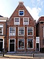
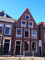
This is a category about rijksmonument number 13150
|
| Address |
|
Media in category "Legeweg 23, Dokkum"
The following 5 files are in this category, out of 5 total.
-
 Lege weg 23 Dokkum.jpg 1,368 × 1,824; 581 KB
-
 Legeweg 23, Dokkum.JPG 3,456 × 4,608; 3.48 MB
-
 Pand met puntgevel.Legeweg 23 Dokkum..JPG 3,456 × 4,608; 2.46 MB
-
 Voordeur Legeweg 23 Dokkum.JPG 3,456 × 4,608; 2.76 MB
-
 Voorgevel - Dokkum - 20403964 - RCE.jpg 972 × 1,200; 257 KB


