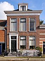
Category:Legeweg 32, Dokkum
Jump to navigation
Jump to search
| Object location | | View all coordinates using: OpenStreetMap |
|---|
 | |||||
| Upload media | |||||
| Instance of | |||||
|---|---|---|---|---|---|
| Location | Dokkum, Noardeast-Fryslân, Friesland, Netherlands | ||||
| Street address |
| ||||
| Located on street | |||||
| Heritage designation |
| ||||
 | |||||
|
This is a category about rijksmonument number 13154
|
| Address |
|
Media in category "Legeweg 32, Dokkum"
The following 4 files are in this category, out of 4 total.
-
 Aanzicht - Dokkum - 20059041 - RCE.jpg 1,188 × 1,200; 294 KB
-
 Gevel - Dokkum - 20059049 - RCE.jpg 805 × 1,200; 190 KB
-
 Lege weg 32 Dokkum.jpg 1,368 × 1,824; 653 KB
-
 Legeweg 32, Dokkum.JPG 3,456 × 4,608; 3.27 MB


