Category:Lepe, Hampshire
Jump to navigation
Jump to search
human settlement in United Kingdom  | |||||
| Upload media | |||||
| Instance of | |||||
|---|---|---|---|---|---|
| Location | Exbury and Lepe, New Forest, Hampshire, South East England, England | ||||
 | |||||
English: Lepe is a small settlement on the Solent in Hampshire, England. It lies in the civil parish of Exbury and Lepe. It was once a fishing village, and is now the site of the Lepe Country Park, which runs from Stanswood Bay to the mouth of the Beaulieu River.
Subcategories
This category has the following 3 subcategories, out of 3 total.
Media in category "Lepe, Hampshire"
The following 150 files are in this category, out of 150 total.
-
 20050515 129 solent.jpg 700 × 525; 471 KB
-
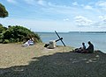 Anchor within Lepe Country Park - geograph.org.uk - 1946006.jpg 640 × 469; 71 KB
-
 At the start of Stanswood Road near Lepe - geograph.org.uk - 3459591.jpg 640 × 480; 285 KB
-
 Beach at Lepe - geograph.org.uk - 1350926.jpg 640 × 497; 133 KB
-
 Beach at Lepe, Hampshire, England.jpg 2,238 × 1,656; 1.4 MB
-
 Beach café at Lepe, Hampshire, England.jpg 2,272 × 1,704; 1.59 MB
-
 Beneath the Dark Water bridge, Lepe - geograph.org.uk - 284349.jpg 640 × 480; 95 KB
-
 Black headed Gull - geograph.org.uk - 1350909.jpg 640 × 485; 123 KB
-
 Car park at Lepe Beach - geograph.org.uk - 1977825.jpg 640 × 480; 79 KB
-
 Closed footpath at Lepe Country Park - geograph.org.uk - 517366.jpg 427 × 640; 158 KB
-
 Coastal scene, Lepe - geograph.org.uk - 2244607.jpg 640 × 480; 76 KB
-
 Corn crop west of Lepe Farm, Lepe - geograph.org.uk - 33293.jpg 640 × 480; 153 KB
-
 D-Day Memorial, Lepe - geograph.org.uk - 450156.jpg 640 × 480; 121 KB
-
 D-Day Memorial, Lepe Country Park - geograph.org.uk - 1977834.jpg 640 × 480; 116 KB
-
 Dark Water, Lepe - geograph.org.uk - 2213620.jpg 640 × 480; 71 KB
-

-

-
 Electricity substation at Lepe - geograph.org.uk - 515993.jpg 427 × 640; 138 KB
-
 Entering the Beaulieu River - geograph.org.uk - 18022.jpg 640 × 480; 133 KB
-
 Entrance to Lepe Country Park - geograph.org.uk - 1977951.jpg 640 × 480; 119 KB
-
 Finger post at Lepe - geograph.org.uk - 1882620.jpg 640 × 465; 132 KB
-
 Finger post at Lepe Country Park - geograph.org.uk - 1882611.jpg 640 × 480; 73 KB
-
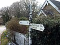
 Fingerpost near Lepe - geograph.org.uk - 1882603.jpg 640 × 465; 139 KB
-
 Foreshore at Lepe - geograph.org.uk - 3739755.jpg 800 × 450; 222 KB
-

-
 Foreshore, Beaulieu River - geograph.org.uk - 2213691.jpg 640 × 480; 75 KB
-
 Foreshore, Lepe - geograph.org.uk - 2213595.jpg 640 × 480; 85 KB
-

-
 Gipsy Lane electricity substation, Lepe - geograph.org.uk - 517404.jpg 640 × 427; 199 KB
-
 Groyne and WWII Relic at Stansore Point - geograph.org.uk - 404862.jpg 480 × 640; 168 KB
-
 Groynes at Lepe - geograph.org.uk - 1350924.jpg 640 × 495; 153 KB
-

-
 Groynes, Lepe - geograph.org.uk - 2213559.jpg 640 × 480; 74 KB
-
 Guarding the Fortress of Britain at a Coastal Battery H23086.jpg 795 × 800; 79 KB
-
 Guarding the Fortress of Britain at a Coastal Battery H23092.jpg 799 × 800; 87 KB
-
 Guarding the Fortress of Britain at a Coastal Battery H23096.jpg 799 × 800; 80 KB
-
 High Water Line at Lepe - geograph.org.uk - 450171.jpg 640 × 480; 152 KB
-

-
 In Lepe Country Park - geograph.org.uk - 3459602.jpg 640 × 480; 183 KB
-
 Lepe (16490180263).jpg 3,000 × 4,000; 3.3 MB
-
 Lepe - geograph.org.uk - 450178.jpg 480 × 640; 127 KB
-
 Lepe - geograph.org.uk - 479338.jpg 640 × 409; 66 KB
-
 Lepe - panoramio.jpg 2,869 × 2,152; 1.99 MB
-
 Lepe Beach - geograph.org.uk - 1589241.jpg 640 × 417; 70 KB
-
 Lepe Beach - geograph.org.uk - 1874642.jpg 640 × 454; 52 KB
-
 Lepe Beach - geograph.org.uk - 859425.jpg 640 × 424; 102 KB
-
 Lepe Beach - geograph.org.uk - 859469.jpg 640 × 424; 101 KB
-
 Lepe beach bollards.jpg 4,597 × 2,929; 3.07 MB
-
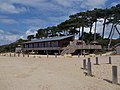
 Lepe Beach Café and Shop - geograph.org.uk - 3459617.jpg 640 × 480; 239 KB
-
 Lepe Beach East - geograph.org.uk - 1589244.jpg 640 × 419; 96 KB
-

-
 Lepe Beach to Cowes - geograph.org.uk - 648383.jpg 640 × 464; 68 KB
-
 Lepe beach WWII ruins.jpg 2,153 × 1,485; 1.56 MB
-
 Lepe car park - geograph.org.uk - 284344.jpg 640 × 480; 59 KB
-
 Lepe Country Park - geograph.org.uk - 1560145.jpg 640 × 419; 91 KB
-
 Lepe Country Park - geograph.org.uk - 2607438.jpg 1,600 × 1,200; 583 KB
-
 Lepe Country Park - geograph.org.uk - 33304.jpg 640 × 480; 124 KB
-
 Lepe Country Park - geograph.org.uk - 3459607.jpg 640 × 480; 158 KB
-
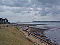
 Lepe Country Park from The Solent - geograph.org.uk - 2279904.jpg 640 × 427; 52 KB
-
 Lepe Foreshore - geograph.org.uk - 859435.jpg 640 × 424; 102 KB
-
 Lepe House - geograph.org.uk - 1096853.jpg 640 × 427; 163 KB
-
 Lepe House foreshore - geograph.org.uk - 1134727.jpg 427 × 640; 132 KB
-
 Lepe Light (3207287976).jpg 1,877 × 2,816; 1.13 MB
-
 Lepe Loop circular trail - geograph.org.uk - 3695330.jpg 4,320 × 2,432; 2.2 MB
-
 Lepe overlooking East Lepe - geograph.org.uk - 404886.jpg 640 × 479; 114 KB
-
 Lepe Road to Lepe Point - geograph.org.uk - 3463161.jpg 1,500 × 927; 119 KB
-
 Lepe shoreline - geograph.org.uk - 1096845.jpg 640 × 427; 177 KB
-
 Lepe Spit at Stansore Point - geograph.org.uk - 404873.jpg 640 × 479; 94 KB
-
 Lepe wartime installations - geograph.org.uk - 1591807.jpg 640 × 406; 116 KB
-
 Lepe, a westward foreshore view - geograph.org.uk - 2121217.jpg 640 × 480; 62 KB
-
 Lepe, an eastward foreshore view - geograph.org.uk - 2121205.jpg 480 × 640; 109 KB
-
 Lepe, postbox № SO45 201 - geograph.org.uk - 3720283.jpg 480 × 640; 126 KB
-
 Lepe, short low groynes - geograph.org.uk - 2121222.jpg 640 × 480; 92 KB
-
 Lepe, signpost - geograph.org.uk - 2121185.jpg 480 × 640; 118 KB
-
 Lepe, view across the Solent - geograph.org.uk - 2121190.jpg 480 × 640; 68 KB
-
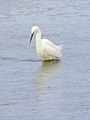 Little Egret, Lepe - geograph.org.uk - 2213636.jpg 480 × 640; 73 KB
-
 Looking towards Lepe from the west - panoramio.jpg 4,174 × 3,050; 5.17 MB
-
 Looking towards Stansore Point - geograph.org.uk - 1977851.jpg 640 × 480; 90 KB
-
 Meeting of tracks, Lepe Country Park - geograph.org.uk - 1977843.jpg 640 × 480; 71 KB
-
 Mudflats near Lepe - geograph.org.uk - 1350927.jpg 640 × 480; 87 KB
-
 Mudflats near Lepe Quay - geograph.org.uk - 3463150.jpg 1,500 × 1,000; 356 KB
-
 Nature park at Lepe.jpg 4,791 × 3,194; 13.19 MB
-
 Navigation Beacon - geograph.org.uk - 4319430.jpg 1,024 × 769; 362 KB
-
 New Forest ponies at lepe.JPG 3,064 × 2,312; 2.3 MB
-

-
 On the beach at Stone Point, Lepe - geograph.org.uk - 3727880.jpg 640 × 427; 80 KB
-
 Pine trees at Lepe Country Park - geograph.org.uk - 3459610.jpg 640 × 480; 197 KB
-
 Pines at Lepe - geograph.org.uk - 873858.jpg 640 × 400; 54 KB
-
 Pines, Lepe Country Park - geograph.org.uk - 859423.jpg 640 × 449; 113 KB
-
 Pink sunset - geograph.org.uk - 285817.jpg 640 × 426; 42 KB
-

-
 Road sign near Lepe - geograph.org.uk - 3459592.jpg 640 × 480; 263 KB
-
 Sandstone cliff, Lepe - geograph.org.uk - 1146133.jpg 640 × 480; 108 KB
-

-
 Sea defences west of the Watch House, Lepe - geograph.org.uk - 33297.jpg 640 × 480; 135 KB
-
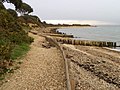
 Shore path at Lepe - geograph.org.uk - 3727894.jpg 640 × 427; 100 KB
-
 Solent north shore at Lepe - geograph.org.uk - 3739766.jpg 800 × 450; 186 KB
-
 Solent shoreline south of Lepe House - geograph.org.uk - 3134902.jpg 3,648 × 2,291; 1.87 MB
-
 Spit at Lepe country park - geograph.org.uk - 944445.jpg 640 × 480; 63 KB
-
 Stansore Point - geograph.org.uk - 1350916.jpg 640 × 480; 94 KB
-
 Stansore Point - geograph.org.uk - 647491.jpg 640 × 480; 90 KB
-
 Stansore Point, Lepe Country Park - geograph.org.uk - 517304.jpg 640 × 427; 107 KB
-
 Stanswood Road, Lepe - geograph.org.uk - 1977881.jpg 640 × 480; 78 KB
-
 Submarine power cable marker, Lepe - geograph.org.uk - 284348.jpg 640 × 480; 55 KB
-
 Sunset at Lepe - Low Tide - panoramio.jpg 2,304 × 3,072; 1.04 MB
-

-
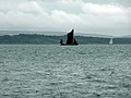 Thames Sailing Barge - geograph.org.uk - 4603394.jpg 640 × 480; 231 KB
-
 The beach at Lepe - geograph.org.uk - 2257837.jpg 1,500 × 969; 271 KB
-
 The Coast East of Stone Point - geograph.org.uk - 450146.jpg 640 × 480; 107 KB
-
 The foreshore at Lepe - geograph.org.uk - 3698495.jpg 640 × 480; 199 KB
-
 The Solent from Lepe - geograph.org.uk - 3739759.jpg 800 × 450; 192 KB
-
 Turnstone (Arenaria interpres), Lepe - geograph.org.uk - 2213546.jpg 640 × 480; 113 KB
-
 View from Beach below Lepe House looking towards Jetty - geograph.org.uk - 3016060.jpg 4,320 × 2,432; 3.01 MB
-

-
 View over the sand spit - geograph.org.uk - 3464932.jpg 1,500 × 1,000; 260 KB
-
 Wet coast road, Lepe - geograph.org.uk - 284467.jpg 640 × 480; 64 KB
-
 Wooden steps at Lepe Country Park - geograph.org.uk - 1010871.jpg 332 × 500; 44 KB
-
 WW2 relics near Lepe - geograph.org.uk - 1405113.jpg 640 × 480; 52 KB
-
 WW2 remains - geograph.org.uk - 944475.jpg 640 × 480; 89 KB
-
 WWII piles at Lepe - D-Day relics - panoramio.jpg 1,200 × 1,600; 269 KB
-
 Arriving at Lepe Foreshore near Inchmery - geograph.org.uk - 332128.jpg 640 × 480; 105 KB
-

-

-
 Coastal defences and beach at Lepe - geograph.org.uk - 24973.jpg 640 × 480; 370 KB
-

-

-

-
 Dark Water, Lepe Country Park - geograph.org.uk - 284367.jpg 640 × 480; 52 KB
-
 Groyne at Inchmery foreshore - geograph.org.uk - 431507.jpg 480 × 640; 93 KB
-

-
 Lepe Beach - geograph.org.uk - 229023.jpg 640 × 480; 74 KB
-
 Lepe Beach - geograph.org.uk - 332130.jpg 640 × 480; 101 KB
-
 Lepe Beach - geograph.org.uk - 332140.jpg 640 × 478; 103 KB
-
 Lepe Beach - geograph.org.uk - 332142.jpg 640 × 474; 107 KB
-
 Lepe beach during rough seas - geograph.org.uk - 284361.jpg 640 × 480; 61 KB
-
 Lepe marsh, Lepe beach - geograph.org.uk - 285822.jpg 640 × 426; 74 KB
-
 Lepe marsh, Lepe beach - geograph.org.uk - 285825.jpg 640 × 426; 72 KB
-
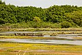
 Lepe Marshes - geograph.org.uk - 332146.jpg 640 × 480; 76 KB
-
 Lepe shoreline at dusk - geograph.org.uk - 146963.jpg 640 × 480; 118 KB
-
 Reedbed and trees, Lepe marsh - geograph.org.uk - 285821.jpg 640 × 431; 124 KB
-

-
 Ripe wheatfield between Exbury and Lepe - geograph.org.uk - 33291.jpg 640 × 480; 189 KB
-
 Ripe wheatfield south of Lepe Farm, Lepe - geograph.org.uk - 33299.jpg 640 × 480; 141 KB
-
 Seaviews - geograph.org.uk - 18025.jpg 640 × 480; 154 KB
-

-
 Stansore Point, Lepe Country Park - geograph.org.uk - 33307.jpg 640 × 480; 173 KB
-
 Stanswood - geograph.org.uk - 661709.jpg 640 × 480; 151 KB
-
 The Darkwater, Lepe beach - geograph.org.uk - 285824.jpg 640 × 426; 65 KB
-
 Trees at Lepe Country Park - geograph.org.uk - 284372.jpg 640 × 480; 56 KB
-
 Windsurfing off Lepe beach - geograph.org.uk - 284342.jpg 640 × 480; 53 KB


.jpg)


.jpg)


,_Lepe_-_geograph.org.uk_-_2213546.jpg)


