Category:Lesbury
Aller à la navigation
Aller à la recherche
village britannique _37.jpg) | |||||
| Téléverser des médias | |||||
| Nature de l’élément | |||||
|---|---|---|---|---|---|
| Lieu | Northumberland, Angleterre du Nord-Est, Angleterre | ||||
 | |||||
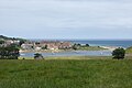
English: Lesbury is a small rural village in Northumberland in the north of England. It is built on the main coastal road southeast of Alnwick, on the north bank of the river Aln. Alnmouth railway station is about half a mile away.
Italiano: Lesbury è una piccola cittadina rurale del Northumberland, nel nord dell'Inghilterra. Si trova lungo la strada che costeggia a 3,5 miglia, circa 5,6 km, a sud-est di Alnwick, a nord del fiume Aln. La cittadina è situata a un miglio dalla stazione ferroviaria di Alnmouth.
Sous-catégories
Cette catégorie comprend 9 sous-catégories, dont les 9 ci-dessous.
A
- Aln Viaduct, Lesbury (13 F)
C
- Coach Inn, Lesbury (5 F)
H
- Hipsburn (7 F)
L
- Lesbury New Bridge (12 F)
- Lesbury Old Bridge (7 F)
- Lesbury railway station (4 F)
O
- Old Vicarage, Lesbury (5 F)
S
- St Mary's Church, Lesbury (21 F)
W
- Woodbine Cottage, Lesbury (2 F)
Média dans la catégorie « Lesbury »
Cette catégorie comprend 684 fichiers, dont les 200 ci-dessous.
(page précédente) (page suivante)-
 A bend in National Cycle Route 1 - geograph.org.uk - 4474474.jpg 640 × 480 ; 72 kio
-
 A field of barley - geograph.org.uk - 2573345.jpg 640 × 480 ; 302 kio
-
 A green lane near Ledbury - geograph.org.uk - 4542572.jpg 800 × 533 ; 122 kio
-
 A most unusual tree (1) - geograph.org.uk - 2474853.jpg 3 216 × 4 288 ; 2,43 Mio
-
 A most unusual tree (2) - geograph.org.uk - 2474855.jpg 3 216 × 4 288 ; 2,01 Mio
-
 A most unusual tree (3) - geograph.org.uk - 2474856.jpg 3 216 × 4 288 ; 1,62 Mio
-
 A most unusual tree (4) - geograph.org.uk - 2474857.jpg 4 288 × 3 216 ; 1,05 Mio
-
 A profusion of signs at start of Foxton Drive - geograph.org.uk - 2995415.jpg 1 600 × 969 ; 185 kio
-
 A seat by the river - geograph.org.uk - 6288823.jpg 1 600 × 1 060 ; 727 kio
-
 A strip wood - geograph.org.uk - 3238266.jpg 640 × 360 ; 236 kio
-
 A well hidden signpost - geograph.org.uk - 6058567.jpg 1 200 × 1 459 ; 464 kio
-
 A well-earned rest - geograph.org.uk - 1859760.jpg 640 × 480 ; 106 kio
-
 A1068 - geograph.org.uk - 4257948.jpg 640 × 428 ; 73 kio
-
 A1068 - geograph.org.uk - 4542586.jpg 800 × 533 ; 110 kio
-
 A1068 at Hipsburn village boundary - geograph.org.uk - 5836039.jpg 1 024 × 734 ; 101 kio
-
 A1068 bridge at Lesbury - geograph.org.uk - 5836063.jpg 1 024 × 732 ; 92 kio
-
 A1068 bridge over the River Aln - geograph.org.uk - 4041586.jpg 2 592 × 1 936 ; 908 kio
-
 A1068 descending to Hawkhill Bridge - geograph.org.uk - 5836083.jpg 1 024 × 752 ; 90 kio
-
 A1068 eastbound - geograph.org.uk - 3899477.jpg 640 × 480 ; 53 kio
-
 A1068 heading east - geograph.org.uk - 3408839.jpg 640 × 480 ; 45 kio
-
 A1068 heading east - geograph.org.uk - 3408850.jpg 640 × 480 ; 51 kio
-
 A1068 near Hawkhill - geograph.org.uk - 4283917.jpg 640 × 428 ; 70 kio
-
 A1068 near Wooden Farm - geograph.org.uk - 1201524.jpg 640 × 480 ; 82 kio
-
 A1068 nears Hawkhill - geograph.org.uk - 5836071.jpg 1 024 × 748 ; 101 kio
-
 A1068 southbound - geograph.org.uk - 3903836.jpg 640 × 480 ; 43 kio
-
 A1068 southbound - geograph.org.uk - 3903845.jpg 640 × 480 ; 46 kio
-
 A1068 towards Warkworth - geograph.org.uk - 3031241.jpg 640 × 480 ; 70 kio
-
 Above the Aln - geograph.org.uk - 6308258.jpg 1 024 × 683 ; 505 kio
-
 Above the River Aln - geograph.org.uk - 6395442.jpg 5 120 × 2 448 ; 4,06 Mio
-
 Access road to Alnmouth railway station - geograph.org.uk - 5836445.jpg 1 024 × 768 ; 254 kio
-
 Access track to Bilton Barns - geograph.org.uk - 6016926.jpg 2 000 × 1 333 ; 386 kio
-
 Across to Alnmouth - geograph.org.uk - 5065122.jpg 640 × 427 ; 99 kio
-
 Aln estuary - geograph.org.uk - 1518677.jpg 640 × 427 ; 197 kio
-
 Aln Estuary - geograph.org.uk - 1860626.jpg 640 × 480 ; 64 kio
-
 Aln estuary - geograph.org.uk - 5065125.jpg 640 × 427 ; 125 kio
-
 Aln Marshes - geograph.org.uk - 1859795.jpg 640 × 480 ; 86 kio
-
 Alnmouth - 1981 - geograph.org.uk - 2244796.jpg 2 272 × 1 521 ; 619 kio
-
 Alnmouth - 1986 - geograph.org.uk - 2258555.jpg 2 272 × 1 515 ; 233 kio
-
 Alnmouth - geograph.org.uk - 5082686.jpg 640 × 480 ; 190 kio
-
 Alnmouth - geograph.org.uk - 5831092.jpg 5 472 × 3 648 ; 5,09 Mio
-
 Alnmouth and the Aln estuary - geograph.org.uk - 6324420.jpg 3 264 × 2 448 ; 2,32 Mio
-
 Alnmouth Bridge - geograph.org.uk - 5507334.jpg 1 024 × 768 ; 195 kio
-
 Alnmouth Bridge - geograph.org.uk - 5589423.jpg 640 × 480 ; 29 kio
-
 Alnmouth for Alnwick - geograph.org.uk - 3005807.jpg 1 200 × 900 ; 164 kio
-
 Alnmouth from a train - geograph.org.uk - 5418384.jpg 640 × 291 ; 77 kio
-
 Alnmouth from a train - geograph.org.uk - 5418863.jpg 640 × 336 ; 102 kio
-
 Alnmouth from a train - geograph.org.uk - 5418874.jpg 640 × 350 ; 101 kio
-
 Alnmouth from a train - geograph.org.uk - 5435031.jpg 640 × 341 ; 95 kio
-
 Alnmouth from a train - geograph.org.uk - 5435034.jpg 640 × 366 ; 115 kio
-
 Alnmouth from a train - geograph.org.uk - 5435037.jpg 640 × 350 ; 139 kio
-
 Alnmouth from the west - geograph.org.uk - 4845795.jpg 1 024 × 678 ; 112 kio
-
 Alnmouth Golf Club - geograph.org.uk - 4457295.jpg 640 × 480 ; 73 kio
-
 Alnmouth Golf Club - geograph.org.uk - 4844006.jpg 1 024 × 761 ; 210 kio
-
 Alnmouth in evening sunshine - geograph.org.uk - 5082682.jpg 640 × 480 ; 198 kio
-
 Alnmouth on a sunny morning - geograph.org.uk - 3530380.jpg 3 900 × 2 110 ; 2,74 Mio
-
 Alnmouth platform 2 - geograph.org.uk - 6234959.jpg 768 × 1 024 ; 496 kio
-
 Alnmouth railway station - geograph.org.uk - 5836468.jpg 1 024 × 768 ; 146 kio
-
 Alnmouth railway station - geograph.org.uk - 5883636.jpg 5 357 × 3 013 ; 2,99 Mio
-
 Alnmouth railway station - geograph.org.uk - 5883637.jpg 5 376 × 3 024 ; 4,75 Mio
-
 Alnmouth Signal Box - geograph.org.uk - 4441132.jpg 640 × 480 ; 93 kio
-
 Alnmouth Signal Box - geograph.org.uk - 5082689.jpg 640 × 480 ; 196 kio
-
 Alnmouth signal box - geograph.org.uk - 5435290.jpg 640 × 480 ; 192 kio
-
 Alnmouth signal box - geograph.org.uk - 5435291.jpg 640 × 560 ; 183 kio
-
 Alnmouth signal box - geograph.org.uk - 5883639.jpg 5 331 × 2 999 ; 4,39 Mio
-
 Alnmouth station - geograph.org.uk - 6234967.jpg 1 024 × 768 ; 509 kio
-
 Alnmouth village - geograph.org.uk - 5964255.jpg 1 600 × 1 067 ; 357 kio
-

-
 An old road alignment - geograph.org.uk - 2572106.jpg 640 × 359 ; 246 kio
-
 Arable field at Bilton Barns - geograph.org.uk - 4119595.jpg 2 048 × 1 536 ; 727 kio
-
 Arable field at Bilton Barns - geograph.org.uk - 6016912.jpg 2 000 × 1 333 ; 300 kio
-
 Arable field at Bilton Hill - geograph.org.uk - 4119586.jpg 2 048 × 1 536 ; 905 kio
-
 Arable field between the river and the railway - geograph.org.uk - 4115859.jpg 2 048 × 1 536 ; 779 kio
-
 Arable field east of Bilton Mill - geograph.org.uk - 4115813.jpg 2 048 × 1 536 ; 776 kio
-
 Arable field near Alnmouth - geograph.org.uk - 4660491.jpg 2 048 × 1 536 ; 975 kio
-
 Arable field on the edge of Hipsburn - geograph.org.uk - 4115871.jpg 2 048 × 1 536 ; 676 kio
-
 Arable field west of Bilton - geograph.org.uk - 4119602.jpg 2 048 × 1 152 ; 546 kio
-
 Arable field west of Hipsburn - geograph.org.uk - 4119584.jpg 2 048 × 1 536 ; 860 kio
-
 Arable land beside the River Aln - geograph.org.uk - 4156970.jpg 2 048 × 1 536 ; 816 kio
-
 Arable land in front of Bilton Wood - geograph.org.uk - 4115828.jpg 2 048 × 1 536 ; 877 kio
-
 B1339 heading west through Lesbury - geograph.org.uk - 3031234.jpg 640 × 480 ; 60 kio
-
 B1339 Longhoughton Road at RAF Boulmer entrance - geograph.org.uk - 5836308.jpg 1 024 × 703 ; 120 kio
-
 B1339 towards Lesbury - geograph.org.uk - 3031225.jpg 640 × 480 ; 71 kio
-
 B1339 towards Lesbury - geograph.org.uk - 3031231.jpg 640 × 480 ; 46 kio
-
 Barns at Bilton Barns - geograph.org.uk - 6016915.jpg 2 000 × 1 333 ; 324 kio
-
 Beach and Sea at Foxton - geograph.org.uk - 5148274.jpg 1 066 × 800 ; 169 kio
-
 Beach at Foxton Hall - geograph.org.uk - 5507338.jpg 1 024 × 749 ; 100 kio
-
 Beach at the mouth of Whaw Burn - geograph.org.uk - 1898382.jpg 640 × 480 ; 56 kio
-
 Beach below Foxton Hall - geograph.org.uk - 1898352.jpg 640 × 480 ; 75 kio
-
 Beach hut near Alnmouth - geograph.org.uk - 6347520.jpg 1 024 × 768 ; 521 kio
-
 Beach hut near Alnmouth - geograph.org.uk - 6347521.jpg 1 024 × 768 ; 559 kio
-
 Beach near Foxton - geograph.org.uk - 4244394.jpg 640 × 480 ; 28 kio
-
 Benches and information board - geograph.org.uk - 1859784.jpg 640 × 480 ; 91 kio
-
 Beside the railway near Lesbury - geograph.org.uk - 1366478.jpg 640 × 426 ; 92 kio
-
 Bilton Farm - geograph.org.uk - 3408896.jpg 640 × 480 ; 75 kio
-
 Bilton Farm - geograph.org.uk - 6234919.jpg 1 024 × 683 ; 591 kio
-
 Bilton House, Bilton - geograph.org.uk - 6016930.jpg 2 000 × 1 333 ; 529 kio
-
 Bilton Mill - geograph.org.uk - 3501544.jpg 3 872 × 2 592 ; 3,98 Mio
-
 Bilton Mill - geograph.org.uk - 3847679.jpg 1 600 × 1 200 ; 381 kio
-
 Bilton Mill - geograph.org.uk - 6251844.jpg 1 600 × 1 265 ; 315 kio
-
 Bilton Wood - geograph.org.uk - 3501527.jpg 3 872 × 2 592 ; 3,65 Mio
-
 Boats in Alnmouth - geograph.org.uk - 17577.jpg 640 × 480 ; 64 kio
-
 Branch on the bridleway - geograph.org.uk - 2474845.jpg 4 288 × 3 216 ; 1,54 Mio
-
 Bridge across the Aln at Lesbury - geograph.org.uk - 6057281.jpg 3 410 × 2 558 ; 2,52 Mio
-
 Bridge across the railway, Hipsburn - geograph.org.uk - 5836430.jpg 1 024 × 768 ; 127 kio
-
 Bridge over River Aln on A1068 at Lesbury - geograph.org.uk - 6057284.jpg 3 504 × 2 123 ; 2,36 Mio
-
 Bridge over the former railway - geograph.org.uk - 4283885.jpg 640 × 428 ; 105 kio
-
 Bridge over the Hip Burn - geograph.org.uk - 2955283.jpg 640 × 360 ; 186 kio
-
 Bridge over the railway at Hipsburn - geograph.org.uk - 5504018.jpg 1 024 × 768 ; 775 kio
-
 Bridge over the trackbed - geograph.org.uk - 3608422.jpg 640 × 428 ; 162 kio
-
 Bridleway crossing an arable field - geograph.org.uk - 6016909.jpg 2 000 × 1 333 ; 375 kio
-
 Bridleway joins track - geograph.org.uk - 2474859.jpg 4 288 × 3 216 ; 1,34 Mio
-
 Bridleway to Lesbury - geograph.org.uk - 4156984.jpg 2 048 × 1 536 ; 1,16 Mio
-
 Bungalow, Bilton - geograph.org.uk - 3031262.jpg 640 × 480 ; 48 kio
-
 Bus stop and shelter on Curly Lane, Hipsburn - geograph.org.uk - 5022464.jpg 640 × 480 ; 69 kio
-
 Bus stop and shelter on Curly Lane, Hipsburn - geograph.org.uk - 5022473.jpg 640 × 480 ; 82 kio
-
 Bus stops at Alnmouth Station - geograph.org.uk - 4119563.jpg 2 048 × 1 536 ; 765 kio
-
 Byway to Denwick (1) - geograph.org.uk - 2475203.jpg 4 288 × 3 216 ; 1,45 Mio
-
 Byway to Denwick (2) - geograph.org.uk - 2475207.jpg 4 288 × 3 216 ; 1,15 Mio
-
 Byway to Denwick (3) - geograph.org.uk - 2475216.jpg 4 288 × 3 216 ; 2,42 Mio
-
 Byway to Denwick (4) - geograph.org.uk - 2476089.jpg 4 288 × 3 216 ; 3,33 Mio
-
 Byway to the river - geograph.org.uk - 2475182.jpg 4 288 × 3 216 ; 1,52 Mio
-
 Byway towards Greenrigg - geograph.org.uk - 1520198.jpg 640 × 426 ; 203 kio
-
 Calf in a grass field at Bilton Banks - geograph.org.uk - 4126259.jpg 2 048 × 1 536 ; 1,08 Mio
-
 Car on the A1068 - geograph.org.uk - 2315402.jpg 640 × 430 ; 32 kio
-
 Car park at Alnmouth station - geograph.org.uk - 6234970.jpg 1 024 × 768 ; 732 kio
-
 Cattle near the estuary - geograph.org.uk - 4255633.jpg 640 × 428 ; 78 kio
-
 Cattle pen - geograph.org.uk - 2955279.jpg 640 × 360 ; 210 kio
-
 Cereals growing at last^ - geograph.org.uk - 3467878.jpg 1 600 × 1 200 ; 241 kio
-
 Class 66 passing through Alnmouth Station - geograph.org.uk - 5704909.jpg 1 800 × 1 013 ; 1,16 Mio
-
 Cliff path to Alnmouth - geograph.org.uk - 4845338.jpg 1 024 × 678 ; 187 kio
-
 Coal at Alnmouth station - geograph.org.uk - 3608465.jpg 640 × 428 ; 111 kio
-
 Coke, coal and logs - cash and carry - geograph.org.uk - 3024339.jpg 1 600 × 1 139 ; 277 kio
-
 Colourful houses in Alnmouth village - geograph.org.uk - 1860663.jpg 640 × 480 ; 69 kio
-
 Combine trailer - geograph.org.uk - 2573340.jpg 640 × 480 ; 326 kio
-
 Communications mast at RAF Boulmer - geograph.org.uk - 3050693.jpg 1 600 × 1 595 ; 229 kio
-
 Communications mast, RAF Boulmer - geograph.org.uk - 3031229.jpg 480 × 640 ; 48 kio
-
 Communications masts - geograph.org.uk - 3051387.jpg 640 × 480 ; 66 kio
-
 Confluence of Cawledge Burn with River Aln - geograph.org.uk - 4335815.jpg 1 600 × 1 180 ; 339 kio
-
 Confluence on the Aln - geograph.org.uk - 4283895.jpg 640 × 428 ; 94 kio
-
 Coppice near Bilton - geograph.org.uk - 3408887.jpg 640 × 480 ; 105 kio
-
 Corn fields by the River Aln - geograph.org.uk - 5523353.jpg 1 024 × 762 ; 244 kio
-
 Corner on the road - geograph.org.uk - 4559231.jpg 640 × 428 ; 110 kio
-
 Cottages, Bilton - geograph.org.uk - 3408884.jpg 1 200 × 900 ; 306 kio
-
 Country crossroads - geograph.org.uk - 2475187.jpg 4 288 × 3 216 ; 1,24 Mio
-
 Country road west of Bilton - geograph.org.uk - 4119588.jpg 2 048 × 1 536 ; 931 kio
-
 Country road west of Bilton - geograph.org.uk - 4126237.jpg 2 048 × 1 536 ; 794 kio
-
 Countryside north of Lesbury - geograph.org.uk - 2312283.jpg 640 × 430 ; 22 kio
-
 Course of the old railway - geograph.org.uk - 3608425.jpg 640 × 428 ; 145 kio
-
 Cows at Bilton Bank - geograph.org.uk - 4559218.jpg 640 × 428 ; 102 kio
-
 Crop field north east of Lesbury - geograph.org.uk - 4457305.jpg 640 × 480 ; 81 kio
-
 Cross Country crossing at Wooden Gate - geograph.org.uk - 4932949.jpg 3 072 × 1 728 ; 1,45 Mio
-
 Crossing the A1068 - geograph.org.uk - 4283913.jpg 640 × 428 ; 80 kio
-
 Crossing the Aln - geograph.org.uk - 4283891.jpg 640 × 428 ; 132 kio
-
 Cultivated arable field near Lesbury - geograph.org.uk - 4156986.jpg 2 048 × 1 536 ; 884 kio
-
 Curious calf - geograph.org.uk - 1520215.jpg 640 × 426 ; 181 kio
-
 Curly Lane - geograph.org.uk - 3903839.jpg 640 × 480 ; 71 kio
-
 Curly Lane, Hipsburn - geograph.org.uk - 3408877.jpg 640 × 480 ; 76 kio
-
 Curly Lane, Hipsburn - geograph.org.uk - 4115913.jpg 2 048 × 1 536 ; 614 kio
-
 Curly Lane, Hipsburn - geograph.org.uk - 5836018.jpg 1 024 × 768 ; 135 kio
-
 Cycle path along the A1068 - geograph.org.uk - 3596066.jpg 640 × 428 ; 93 kio
-
 Cycle path beside the A1068 - geograph.org.uk - 4660528.jpg 2 048 × 1 536 ; 1,07 Mio
-
 Cycle path beside the road - geograph.org.uk - 5064453.jpg 640 × 427 ; 106 kio
-
 Cycle path south of Hipsburn - geograph.org.uk - 4660518.jpg 2 048 × 1 536 ; 1,12 Mio
-
 Cycle route - geograph.org.uk - 367135.jpg 640 × 480 ; 96 kio
-
 Cycle track beside the A1068 - geograph.org.uk - 4257952.jpg 640 × 428 ; 87 kio
-
 Cycle-foot path, A1086 - geograph.org.uk - 2955617.jpg 640 × 360 ; 205 kio
-
 Cyclepath by the A1068 - geograph.org.uk - 4845812.jpg 1 024 × 678 ; 224 kio
-
 Cycletrack and coast path - geograph.org.uk - 4845775.jpg 1 024 × 678 ; 175 kio
-
 Denwick Burn - geograph.org.uk - 2476092.jpg 4 288 × 3 216 ; 5,66 Mio
-
 Dinghy park at Foxton Hall - geograph.org.uk - 1898348.jpg 640 × 480 ; 116 kio
-
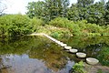
 Dipper on the Stepping Stones - geograph.org.uk - 6005333.jpg 1 600 × 919 ; 230 kio
-
 Disused level crossing near Lesbury - geograph.org.uk - 1366475.jpg 640 × 435 ; 111 kio
-
 Disused quarry - geograph.org.uk - 4345252.jpg 1 600 × 1 070 ; 425 kio
-
 Ditch near Nabs Plantation - geograph.org.uk - 1520239.jpg 640 × 427 ; 193 kio
-
 Dog walking on the beach - geograph.org.uk - 1898313.jpg 640 × 480 ; 55 kio
-
 Down from Eden Hill - geograph.org.uk - 4283887.jpg 640 × 428 ; 93 kio
-
 Downstream from the stepping stones - geograph.org.uk - 4283894.jpg 640 × 428 ; 127 kio
-
 Drain near Hawkhill - geograph.org.uk - 3408859.jpg 640 × 480 ; 97 kio
-
 Duchess Bridge crossing the estuary of the River Aln - geograph.org.uk - 3293922.jpg 1 600 × 1 200 ; 273 kio
-
 Duchess Bridge, Alnmouth - geograph.org.uk - 1423724.jpg 640 × 480 ; 71 kio
-
 Duchess Bridge, Alnmouth - geograph.org.uk - 3631483.jpg 3 437 × 2 578 ; 1,81 Mio
-
 Duchess Bridge, Alnmouth - geograph.org.uk - 4845381.jpg 1 024 × 678 ; 174 kio
-
 Duchess Bridge, Alnmouth - geograph.org.uk - 5340562.jpg 4 320 × 2 880 ; 5,28 Mio
-
 Duck pond beside the River Aln - geograph.org.uk - 6058589.jpg 1 600 × 1 067 ; 432 kio
-
 East Coast Main Line (1) - geograph.org.uk - 2474870.jpg 4 288 × 3 216 ; 1,9 Mio
-
 East Coast Main Line (2) - geograph.org.uk - 2474873.jpg 4 288 × 3 216 ; 1,72 Mio
-
 East Coast Main Line south of Alnmouth station - geograph.org.uk - 5836434.jpg 1 024 × 768 ; 115 kio
-
 East Coast mainline looking south at Bilton - geograph.org.uk - 5883638.jpg 5 239 × 2 947 ; 3,89 Mio
-
 Eden Bridge - geograph.org.uk - 6234982.jpg 1 024 × 683 ; 637 kio
-
 Eider on Marden Rocks - geograph.org.uk - 3052656.jpg 1 600 × 1 159 ; 175 kio
-
 Electricity poles across the River Aln - geograph.org.uk - 3847686.jpg 1 600 × 1 902 ; 547 kio
-
 Electricity poles stride across the fields - geograph.org.uk - 3024358.jpg 750 × 1 000 ; 93 kio
-
 Electricity sub-station, Alnmouth - geograph.org.uk - 1423737.jpg 640 × 480 ; 111 kio
-
 End of bridleway - geograph.org.uk - 2475058.jpg 4 288 × 3 216 ; 934 kio
-
 Entrance to Bilton Barns - geograph.org.uk - 1518768.jpg 640 × 427 ; 188 kio
-
 Entrance to Hipsburn - geograph.org.uk - 3903841.jpg 640 × 443 ; 91 kio
-

-
 Entrance to Lesbury - geograph.org.uk - 3899481.jpg 640 × 480 ; 116 kio
-
 Fallow arable land - geograph.org.uk - 4114244.jpg 2 048 × 1 536 ; 998 kio
-
 Farm buildings at Bilton Mill - geograph.org.uk - 4115804.jpg 2 048 × 1 536 ; 780 kio


_-_geograph.org.uk_-_2474853.jpg)
_-_geograph.org.uk_-_2474855.jpg)
_-_geograph.org.uk_-_2474856.jpg)
_-_geograph.org.uk_-_2474857.jpg)


_-_geograph.org.uk_-_2475203.jpg)
_-_geograph.org.uk_-_2475207.jpg)
_-_geograph.org.uk_-_2475216.jpg)
_-_geograph.org.uk_-_2476089.jpg)


_-_geograph.org.uk_-_2474870.jpg)
_-_geograph.org.uk_-_2474873.jpg)


