Category:Lighthouses in England
Zur Navigation springen
Zur Suche springen
Länder des Vereinigten Königreichs: England · Nordirland · Schottland · Wales – Abhängigkeiten der britischen Krone: Bailiwick of Guernsey · Isle of Man · Jersey
Britische Überseeterritorien: Anguilla · Bermuda · Cayman Islands · Falklandinseln · Gibraltar · Turks- und Caicosinseln
Britische Überseeterritorien: Anguilla · Bermuda · Cayman Islands · Falklandinseln · Gibraltar · Turks- und Caicosinseln
Wikimedia-Kategorie | |||||
| Medium hochladen | |||||
| Ist ein(e) | |||||
|---|---|---|---|---|---|
| Kategorie kombiniert die Themen | |||||
 | |||||
Unterkategorien
Es werden 4 von insgesamt 4 Unterkategorien in dieser Kategorie angezeigt:
In Klammern die Anzahl der enthaltenen Kategorien (K), Seiten (S), Dateien (D)
H
L
Medien in der Kategorie „Lighthouses in England“
Folgende 97 Dateien sind in dieser Kategorie, von 97 insgesamt.
-
 -2018-12-24 Lighthouse access road, Royal Cromer Golf Club, Overstrand Road, Cromer.JPG 3.864 × 5.152; 5,33 MB
-
 A Coastal View With a Lighthouse RMG BHC3877.jpg 1.280 × 891; 308 KB
-
 A Couple Walking to the Paull Small Lighthouses - geograph.org.uk - 2916872.jpg 4.592 × 3.448; 3,5 MB
-
 A footpath from the top of Lighthouse Hill. - panoramio.jpg 4.000 × 3.000; 4,88 MB
-

-

-
 A water outfall near the little white lighthouse at Paull - geograph.org.uk - 2990901.jpg 4.521 × 3.252; 4,39 MB
-
 Access road to Foreland Lighthouse - geograph.org.uk - 1460029.jpg 640 × 480; 82 KB
-
 B1259 towards Flamborough Lighthouse - geograph.org.uk - 2678133.jpg 800 × 600; 96 KB
-

-
 Beach closeups St Mary's Lighthouse (12598797153).jpg 4.928 × 3.264; 3,51 MB
-

-
-
 A description and list of the lighthouses of the world, 1863 (microform) (IA cihm 44540).pdf 1.162 × 1.425, 42 Seiten; 3,04 MB
-
 A description and list of the lighthouses of the world, 1861 (microform) (IA cihm 47776).pdf 1.170 × 1.429, 170 Seiten; 10,77 MB
-

-
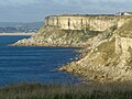
 Cliff near Pendeen Lighthouse - geograph.org.uk - 2247489.jpg 1.840 × 1.232; 546 KB
-
 Coast Path heading away from the lighthouse - May 2015 - panoramio.jpg 4.000 × 3.000; 2,79 MB
-

-
-
 Coastal Path near Pendeen Lighthouse - geograph.org.uk - 2247504.jpg 1.840 × 1.232; 475 KB
-
 Crags and a winding road to the lighthouse - May 2015 - panoramio.jpg 4.000 × 2.000; 692 KB
-
 Crags hiding the lighthouse - May 2015 - panoramio.jpg 4.000 × 3.000; 1,7 MB
-
 Engineering; a lighthouse, with a pump clearing a wreck. Col Wellcome V0024486ETR.jpg 2.094 × 1.326; 1,47 MB
-
 Field stile ^ Godrevy Lighthouse. - panoramio.jpg 3.648 × 2.056; 5,13 MB
-
 Finger post to the Lighthouse - geograph.org.uk - 2382761.jpg 640 × 480; 76 KB
-
 Gabion and lighthouse - geograph.org.uk - 2878520.jpg 4.000 × 3.000; 2,38 MB
-
 Garden Walls And Explosives Store To South Of Lighthouse And Building.jpg 2.335 × 1.557; 405 KB
-

-
 Harkess Rocks, west of the lighthouse - geograph.org.uk - 1915453.jpg 1.024 × 768; 214 KB
-
 J M W Turner - Shields Lighthouse - B1977.14.8351 - Yale Center for British Art.jpg 1.920 × 1.380; 320 KB
-
 J M W Turner - Shields Lighthouse - B1977.14.8352 - Yale Center for British Art.jpg 1.920 × 1.359; 335 KB
-
-

-
 Landing Bay and the lighthouse - geograph.org.uk - 3113844.jpg 4.752 × 3.168; 3,1 MB
-
 Lighthouse ahead^ - geograph.org.uk - 57513.jpg 640 × 480; 116 KB
-
 Lighthouse and Lifeboat station at Shoreham harbour - geograph.org.uk - 3016314.jpg 3.264 × 2.448; 3,54 MB
-
 Lighthouse on Spurn Head - geograph.org.uk - 2034210.jpg 640 × 480; 107 KB
-
 Lighthouse Point, The Highway - geograph.org.uk - 3027005.jpg 640 × 480; 63 KB
-
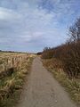
 Lighthouse Road - geograph.org.uk - 3159634.jpg 640 × 480; 38 KB
-
 Lighthouse Walk - geograph.org.uk - 1949073.jpg 426 × 640; 124 KB
-
 Lighthouse, Whitby - geograph.org.uk - 2824440.jpg 640 × 426; 51 KB
-
 Lighthouse, Whitby - geograph.org.uk - 2824468.jpg 640 × 426; 84 KB
-

-
 Looking back to the Lighthouse - geograph.org.uk - 3092586.jpg 2.592 × 1.936; 2,68 MB
-
 Looking towards the lighthouse - geograph.org.uk - 3092690.jpg 2.592 × 1.936; 2,05 MB
-
 Looking up to the lighthouse - geograph.org.uk - 3093837.jpg 2.592 × 1.936; 2,13 MB
-

-

-
 Morthoe to Lee Bay Lighthouse - panoramio.jpg 3.600 × 2.702; 7,15 MB
-

-
 Near the lighthouse - May 2015 - panoramio.jpg 4.000 × 3.000; 2,31 MB
-
 Old Boundary Marker near The Lizard Lighthouse (geograph 6035740).jpg 480 × 640; 345 KB
-
 Old Lighthouse - geograph.org.uk - 3255778.jpg 800 × 600; 71 KB
-
 Old lighthouse and cottage on Farne Islands.jpg 2.048 × 1.536; 478 KB
-

-

-

-
 Portreath Beach from Lighthouse Hill - geograph.org.uk - 809117.jpg 640 × 480; 79 KB
-
 Road to Foreland Lighthouse - geograph.org.uk - 1460039.jpg 480 × 640; 67 KB
-
 Rocky coast west of Bamburgh Lighthouse - geograph.org.uk - 1915516.jpg 1.024 × 768; 201 KB
-
 Sand dunes and Spurn High Lighthouse - geograph.org.uk - 3203205.jpg 1.024 × 768; 145 KB
-
 Saxon Shore Way on Lighthouse Down - geograph.org.uk - 2319464.jpg 3.072 × 2.304; 1,75 MB
-
 Sea defences near Leasowe lighthouse-by-Roger-Davies.jpg 640 × 426; 48 KB
-

-

-
 John Thomas Serres - Running inshore towards the lighthouse.jpg 2.418 × 1.955; 715 KB
-
 Shipping off the coast near a lighthouse RMG BHC1106.tiff 3.800 × 2.581; 28,06 MB
-
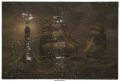 Ships at night near a lighthouse RMG BHC3827.tiff 4.800 × 3.272; 44,93 MB
-
 Slight bend Lighthouse Road (B1259) - geograph.org.uk - 3159391.jpg 640 × 480; 58 KB
-
 Stanhope Forbes - The Lighthouse 1892.jpg 953 × 1.280; 795 KB
-
 Tean, deceptive lighthouse view - geograph.org.uk - 567356.jpg 640 × 429; 57 KB
-
 The cat, the lizard and the lighthouse - geograph.org.uk - 3219764.jpg 2.860 × 1.970; 1,39 MB
-

-
 The lighthouse at the end of the street. - panoramio.jpg 2.248 × 4.000; 3,79 MB
-
 The lighthouse from St. Warna's Cove - geograph.org.uk - 3092701.jpg 2.592 × 1.936; 3,05 MB
-
 The Path to Start Point Lighthouse - geograph.org.uk - 1814303.jpg 2.112 × 2.816; 2,2 MB
-
 The River Dart lighthouse - geograph.org.uk - 1505763.jpg 480 × 640; 96 KB
-
 Thrift near the lighthouse - geograph.org.uk - 1257211.jpg 640 × 427; 66 KB
-
 To the Lighthouse (3476502751).jpg 2.409 × 1.598; 3,05 MB
-
 Track from the lighthouse - geograph.org.uk - 2781888.jpg 640 × 427; 206 KB
-
 Track to the lighthouse - geograph.org.uk - 2781865.jpg 640 × 427; 216 KB
-
-

-

-
 View north to St Bees Lighthouse - geograph.org.uk - 1345215.jpg 640 × 430; 67 KB
-

-

-

-

-
 Walk to St Mary's Lighthouse - panoramio.jpg 1.536 × 2.048; 396 KB
-

-
 Wall by Anvil Point Lighthouse - geograph.org.uk - 1095883.jpg 640 × 480; 82 KB
-
 Waves, groynes and lighthouse view - geograph.org.uk - 626375.jpg 640 × 480; 64 KB
-
 West coast of portland from old higher lighthouse.jpg 2.700 × 2.025; 1,2 MB
-
-
 Whitby lighthouses - geograph.org.uk - 1963170.jpg 640 × 480; 277 KB


.jpg)


_-_The_Barque_%27Grampus%27_Passing_a_Lighthouse_-_BHC3378_-_Royal_Museums_Greenwich.jpg)


.jpg)


_-_geograph.org.uk_-_3159391.jpg)


.jpg)


