Category:Lighthouses in Michigan
Aller à la navigation
Aller à la recherche
États des États-Unis : Alabama · Alaska · Arizona · Californie · Caroline du Nord · Caroline du Sud · Colorado · Connecticut · Delaware · Floride · Géorgie · Hawaï · Illinois · Indiana · Louisiane · Maine · Maryland · Massachusetts · Michigan · Minnesota · Mississippi · Missouri · New Hampshire · New Jersey · New York · Ohio · Oklahoma · Oregon · Pennsylvanie · Rhode Island · Texas · Utah · Vermont · Virginie · Washington · Wisconsin
îles Vierges des États-Unis · Porto Rico
îles Vierges des États-Unis · Porto Rico
page de catégorie d'un projet Wikimedia | |||||
| Téléverser des médias | |||||
| Nature de l’élément | |||||
|---|---|---|---|---|---|
| Sujets associés à la catégorie | |||||
| Michigan | |||||
État des États-Unis  someja satełitar in majo     | |||||
| Prononciation (fichier son) | |||||
| Nature de l’élément | |||||
| Partie de | |||||
| Nommé(e) en référence à | |||||
| Lieu | É.-U. | ||||
| Baigné par | |||||
| Capitale | |||||
| Assemblée délibérante | |||||
| Exécutif | |||||
| Corps judiciaire suprême |
| ||||
| Hymne |
| ||||
| Chef ou cheffe de l'exécutif |
| ||||
| Comprend |
| ||||
| Date de fondation ou de création |
| ||||
| Ligne de côte |
| ||||
| Point culminant | |||||
| Population |
| ||||
| Superficie |
| ||||
| Altitude |
| ||||
| À ne pas confondre avec | |||||
| Record de température maximale |
| ||||
| Température minimale record |
| ||||
| site officiel | |||||
 | |||||
Sous-catégories
Cette catégorie comprend 16 sous-catégories, dont les 16 ci-dessous.
A
- Au Sable Light Station (73 F)
C
- Cheboygan Crib Light (6 F)
G
- Gravelly Shoal Light (1 F)
H
- Huron Island Lighthouse (6 F)
I
L
- Little Traverse Light (1 F)
M
- Manning Memorial Light (3 F)
N
- New Buffalo Lighthouse (3 F)
P
S
- Squaw Island Light (2 F)
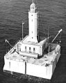
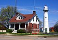
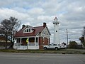
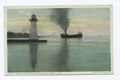
Média dans la catégorie « Lighthouses in Michigan »
Cette catégorie comprend 99 fichiers, dont les 99 ci-dessous.
-
 100725 0757B (4885349107).jpg 3 872 × 2 592 ; 775 kio
-
 140316 9320A (13224433813).jpg 3 872 × 2 592 ; 1,63 Mio
-
 19970720 08 Grand Island near Munising, MI (5882478740).jpg 1 099 × 1 800 ; 290 kio
-
 2004 Grand Haven, Michigan 7 (21514991).jpg 2 272 × 1 704 ; 1,21 Mio
-
 Au Sable Light Station (a5e2aac3-c784-4586-8131-d4010569a26f).JPG 5 472 × 3 648 ; 14,25 Mio
-
 Au Sable Sunrise (f051fd8d-98f4-49a5-b3c1-f66e928b2330).jpg 4 032 × 3 024 ; 1,48 Mio
-
 Belle Isle Light.jpg 503 × 377 ; 50 kio
-
 Belle Isle Lighthouse (1881).jpg 480 × 360 ; 66 kio
-
 CharityIsland.jpg 288 × 241 ; 8 kio
-
 Cheboygan River Range Front Light 1906.jpg 317 × 239 ; 26 kio
-
 Deb, Sand Point Lighthouse (4964697016).jpg 2 890 × 2 213 ; 2,22 Mio
-
 DSC 5525 (1290393834).jpg 3 872 × 2 592 ; 3,54 Mio
-
 Fog forming over Lake Superior (c98e6045-431b-4836-a23b-0fc5b0369185).JPG 3 340 × 2 502 ; 2,2 Mio
-
 Fourteen Foot Shoal Light Station.jpg 3 264 × 1 836 ; 4,08 Mio
-
 GrassyIslandLighthouse.png 635 × 384 ; 450 kio
-
 Graysreef.jpg 323 × 371 ; 34 kio
-
 Grosse Ile North Channel Range Light.jpg 5 067 × 3 801 ; 3,14 Mio
-
 Grosse Isle Lighthouse (8741881760).jpg 1 024 × 768 ; 249 kio
-
 Lake and Light House, Palmer Park (NBY 7827).jpg 827 × 522 ; 106 kio
-
 Lake Michigan (219640293).jpeg 2 048 × 1 371 ; 570 kio
-
 Lake Michigan Lighthouse, St. Joseph (2640197785).jpg 3 872 × 2 592 ; 2,17 Mio
-
 Lansingshoal.jpg 337 × 391 ; 34 kio
-
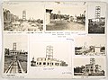
 Lantern + Elevs. Of 9 Foreign Lh's - NARA - 100297780.jpg 10 092 × 7 167 ; 4,45 Mio
-
 Let your light shine! (4005177264).jpg 1 859 × 2 435 ; 2,24 Mio
-
-
 Lighthouse and onlooker (5307274958).jpg 4 752 × 3 168 ; 1,15 Mio
-
 Lighthouse on the St. Clair River (4845453936).jpg 4 218 × 2 748 ; 14,39 Mio
-
 Lighthouse Plan for Belle Isle, Michigan - NARA - 1667772.jpg 1 200 × 861 ; 116 kio
-

-
 MamajudaIsland.png 400 × 249 ; 196 kio
-
 Manitouisland.jpg 491 × 363 ; 42 kio
-
 Mariners Memorial Light (River Rouge, MI).jpg 4 273 × 3 205 ; 3,32 Mio
-
 MI - Beaver Island Harbor - DPLA - a2676ae2a798e1be2a02c8518abc69f3.jpg 8 694 × 6 293 ; 23,52 Mio
-
 MI - Detroit River - DPLA - 394edd028b8d5327d2a6f48b192034b1.jpg 9 052 × 6 618 ; 25,91 Mio
-
 MI - Detroit River - DPLA - 49464d08e1a0408222f0e9ba29aff4d7.jpg 8 999 × 6 618 ; 26,13 Mio
-
 MI - Ecorse Channel - DPLA - 006b1c4dcbeabb7438ff9851294afd42.jpg 6 080 × 5 198 ; 14,12 Mio
-
 MI - Fort Gratiot - DPLA - 3d4d7c3d42f7897ce7f466f7ff84feae.jpg 8 896 × 6 648 ; 25,71 Mio
-
 MI - Fourteen Foot Shoal - DPLA - a19cf91403c967bfe07ed4dae3e7fd36.jpg 8 828 × 6 468 ; 27,48 Mio
-
 MI - Grassy Island - DPLA - e71181ff57a8e83a91ebabdcae53fafb.jpg 7 618 × 6 393 ; 29,31 Mio
-
 MI - Huron Island - DPLA - 9416468a142d523ea5472f7ae0b31334.jpg 8 582 × 5 795 ; 21,19 Mio
-
 MI - Keweenaw - DPLA - 241d3d076c00d467b2a8508c740fc84b.jpg 8 961 × 6 548 ; 23,65 Mio
-
 MI - Livingstone Channel - DPLA - 9486cfcbfb85398127e92d12f13781f7.jpg 8 828 × 6 558 ; 24,78 Mio
-
 MI - Manistee - DPLA - b57e736a49e6bef2767ee84aa5ebf43e.jpg 8 880 × 6 644 ; 23,36 Mio
-
 MI - Martin Reef - DPLA - 191657f20cff1c3d6cf19eadeb1854c0.jpg 8 880 × 6 491 ; 24,43 Mio
-
 MI - Mendota - DPLA - cee5e17ef90a95a3529cb0ef227fd46f.jpg 8 828 × 6 558 ; 25,95 Mio
-
 MI - Middle Hay Lake - DPLA - 1e0d873ab5f0b11af2c4acf615a37437.jpg 8 881 × 6 536 ; 26,49 Mio
-
 MI - Middle Neebish Cut - DPLA - 736369e565c2cb4787f9330c945a2714.jpg 8 828 × 6 468 ; 25,27 Mio
-
 MI - Pilot Island Range - DPLA - 4d4a36b3812bcabb9c86e9dac6813c5d.jpg 8 880 × 6 566 ; 27,62 Mio
-
 MI - Poe Reef - DPLA - eece2dd9c709136ac0ab253bd3f9429e.jpg 8 880 × 6 402 ; 23,92 Mio
-
 MI - Presque Isle - DPLA - 5ebe4548c37f83206e39d00d1d9af993.jpg 8 880 × 6 574 ; 25,65 Mio
-
 MI - Saginaw River - DPLA - 0702b7edd234da41b4ad707df25711cc.jpg 8 772 × 6 543 ; 24,62 Mio
-
 MI - Sand Hills - DPLA - 000e7555e7da5b30d04d628e82f19250.jpg 8 880 × 6 551 ; 27,92 Mio
-
 MI - Sand Hills - DPLA - a8aeb9b37c153dd1fd34a63f2a7046f6.jpg 8 880 × 6 590 ; 27,16 Mio
-
 MI - South Fox Island - DPLA - f1587b17cde7efcb781a4d790cf3f9fb.jpg 8 880 × 6 356 ; 25,89 Mio
-
 MI - Spectacle Reef - DPLA - edc712dce7195f7057cdd9d22348ace3.jpg 8 880 × 6 418 ; 25,17 Mio
-
 MI - St. Joseph - DPLA - 2a26df12c95377ec1aaa73d66f1a7ef0.jpg 7 237 × 6 012 ; 20,78 Mio
-
 MI - St. Marys River Depot - DPLA - b4dc112eeb5614d06d34e64fc33b0d7c.jpg 8 880 × 6 512 ; 25,4 Mio
-
 MI - Tail Point - DPLA - 5070c22e3c2782568395fc412452434e.jpg 8 803 × 6 340 ; 24,67 Mio
-
 MI - Thunder Bay Island - DPLA - 67c82259ca6b020f074b8d0dfd73f764.jpg 8 880 × 6 590 ; 22,92 Mio
-
 MI - West Neebish Channel - DPLA - b2620a4b5fec2d3276cd60b6de0b3bb9.jpg 8 880 × 6 582 ; 25,81 Mio
-
 Michigan Lighthouses... (6200962354).jpg 4 170 × 2 780 ; 9,89 Mio
-
 Minneapolisshoal.jpg 359 × 452 ; 43 kio
-

-

-
 Munising Range Light - National Park Service (9cf1cad4-6ef6-4617-b9c7-3aecedab8cad).jpg 1 390 × 962 ; 1,07 Mio
-
-
 Munising Rear Range Light (7280b321-63b3-43c7-b89a-8ba8b115883a).JPG 4 000 × 3 000 ; 4,02 Mio
-
 Munising Rear Range Light in winter (60986e2a-fea6-4e3b-a723-d986d07ca0b7).jpg 2 592 × 1 944 ; 1,53 Mio
-

-
 Lighthouse Point, Marquette, Mich (NYPL b12647398-62471).tiff 2 424 × 1 510 ; 10,48 Mio
-
 Light House Point, Marquette, Mich (NYPL b12647398-68054).tiff 2 408 × 1 599 ; 11,02 Mio
-
 Sunset at Upper Light, Sault Ste. Marie, Mich (NYPL b12647398-69704).tiff 2 432 × 1 630 ; 11,35 Mio
-
 Steamers off Belle Isle Light, Detroit, Mich (NYPL b12647398-75605).tiff 2 368 × 1 590 ; 10,78 Mio
-
 Windmill Pointe, Lake Ste. Claire, Michigan (NYPL b12647398-75606).tiff 2 376 × 1 581 ; 10,75 Mio
-
 Lake and Lighthouse, Palmer Park, Detroit, Mich (NYPL b12647398-74030).tiff 2 392 × 1 579 ; 10,81 Mio
-
 Poe Reef Light Station.jpg 2 926 × 1 646 ; 3,4 Mio
-
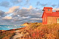
 Point-betsie-hdr.jpg 4 620 × 2 985 ; 8,52 Mio
-
 Portage Entry Quarrry.jpg 466 × 269 ; 23 kio
-
 PovertyislandWith.jpg 490 × 320 ; 30 kio
-
 Presque Lighthouse (3268273826).jpg 2 462 × 3 197 ; 3,11 Mio
-
 Road to the Au Sable Lighthouse (b68ca67a-08c2-4a91-b823-d5ecea95c8ef).JPG 3 024 × 4 032 ; 5,14 Mio
-
 Rough Water at Au Sable (a7676332-8a17-4212-bdf8-a53497c7a934).jpg 1 926 × 1 384 ; 2,46 Mio
-
 Sand Point Lighthouse (4964115275).jpg 2 276 × 3 019 ; 2,05 Mio
-
 Saugatuck, Michigan or Singapore, Michigan Light House.jpg 1 458 × 875 ; 665 kio
-
 Schooner Coaster II Passes the Presque Isle Harbor Breakwater Lighthouse.jpg 2 048 × 1 125 ; 388 kio
-
 Shallow water of the Au Sable Reef (9ca54da1-61bd-4dca-97e8-7db084c1999a).JPG 4 032 × 3 024 ; 2,81 Mio
-
 Snow in early November at Au Sable (9b5a5742-3773-4488-9e4c-f34e294e88bd).JPG 4 608 × 3 456 ; 4,12 Mio
-
 Spring time view from the top of the Au Sable Lighthouse (9ba85999-0c15-411d-aa2e-a5757f769960).JPG 4 032 × 3 024 ; 4,27 Mio
-

-
 Sunset Elberta MI. - panoramio.jpg 1 280 × 960 ; 60 kio
-
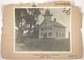
 The Point, showing the lighthouse (NBY 1318).jpg 824 × 524 ; 82 kio
-
 View from the top (5557c548-2e66-4edb-8ec7-3e9d4ed5fce2).jpg 5 248 × 2 952 ; 4,17 Mio
-
 View from the top of the Au Sable Lighthouse (9f3c2b77-40c4-4dd6-8848-ce86edf21686).jpg 3 264 × 2 448 ; 2,35 Mio
-
 Visiting Au Sable Light Station (b3b4bbd2-c1f7-4648-ae06-26a8143f39ab).JPG 4 608 × 3 456 ; 3,76 Mio
-
 White Lake Channel (213316453).jpg 2 580 × 1 932 ; 915 kio
-
 William G. Milliken State Park and Harbor.jpg 5 312 × 2 988 ; 5,57 Mio
-
 Windmill Point Lighthouse on the Detroit River.jpg 3 648 × 2 736 ; 2,06 Mio
-
 WindmillPointLight.jpg 488 × 600 ; 177 kio
-
 Light House Point, Bay of Marquette, by Carbutt, John, 1832-1905.jpg 2 737 × 1 407 ; 1,51 Mio
.jpg)
.jpg)
.jpg)
.jpg)
.JPG)
.jpg)

.jpg)


.jpg)
.jpg)
.JPG)


.jpg)
.jpg)
.jpeg)
.jpg)


.jpg)
.jpg)
.jpg)
.jpg)

.JPG)


.jpg)


.jpg)


_-_DPLA_-_2432a5c156bba96308310115b021743f.jpg)
.jpg)
.JPG)
.JPG)
.jpg)
.JPG)


.jpg)
.JPG)
.jpg)
.jpg)


.JPG)
.JPG)
.JPG)
_-_DPLA_-_aaf42b746a101321c2edf40854b29673.jpg)

.jpg)
.jpg)
.jpg)
.JPG)
.jpg)


