Category:Little Bollington
Jump to navigation
Jump to search
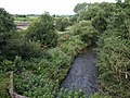
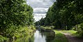
English: Little Bollington is a village and former civil parish in the unitary authority area of Cheshire East and the ceremonial county of Cheshire, England. The Bridgewater Canal runs through the western side of the parish from south-west to north, and Dunham Park lies to the north east of the parish, across the county border in Greater Manchester.
village and former civil parish in Cheshire East, Cheshire, England, UK  | |||||
| Upload media | |||||
| Instance of |
| ||||
|---|---|---|---|---|---|
| Location |
| ||||
 | |||||
Subcategories
This category has the following 3 subcategories, out of 3 total.
S
Y
- Ye Olde No 3 (3 F)
Media in category "Little Bollington"
The following 82 files are in this category, out of 82 total.
-
 Approaching the aqueduct - geograph.org.uk - 4613959.jpg 1,200 × 900; 362 KB
-
 Approaching the Bowdon Roundabout - geograph.org.uk - 3688636.jpg 3,872 × 2,592; 3.28 MB
-

-
 Arthill Farm - geograph.org.uk - 4611784.jpg 1,200 × 900; 189 KB
-
 Arthill Farm - geograph.org.uk - 4611788.jpg 1,200 × 900; 203 KB
-
 Bollington Hall Farm House.jpg 640 × 454; 89 KB
-
 Bollington Hall Farm.jpg 4,000 × 3,000; 6.04 MB
-
 Bollington Mill, Dunham Massey.jpg 640 × 480; 83 KB
-

-
 Bridgewater Canal aqueduct - geograph.org.uk - 3174838.jpg 1,600 × 1,064; 623 KB
-
 Bridgewater Canal Aqueduct near Dunham Massey Hall.jpg 4,000 × 3,000; 5.35 MB
-

-
 Bridgewater Canal scene - geograph.org.uk - 3118984.jpg 4,320 × 3,240; 4.79 MB
-
 Bridgewater Canal, Little Bollington - geograph.org.uk - 2855770.jpg 640 × 480; 336 KB
-
 Bridgewater Canal, Little Bollington - geograph.org.uk - 3117358.jpg 1,920 × 1,080; 598 KB
-
 Bridgewater Canal, Little Bollington - geograph.org.uk - 3117361.jpg 1,920 × 1,080; 556 KB
-
 Bridgewater Canal, near Little Bollington - geograph.org.uk - 2057758.jpg 1,280 × 856; 260 KB
-
 Bridgewater Canal-Dunham Massey - geograph.org.uk - 3117353.jpg 1,920 × 1,080; 888 KB
-
 Buildings at Little Bollington Farm - geograph.org.uk - 5081187.jpg 1,500 × 1,125; 1.7 MB
-
 Cheshire East , Bowdon Roundabout - geograph.org.uk - 4203161.jpg 4,529 × 3,398; 5.15 MB
-
 Cheshire East , Bowdon Roundabout - geograph.org.uk - 4203162.jpg 4,481 × 3,361; 7.53 MB
-
 Coe Lane - geograph.org.uk - 4828243.jpg 4,592 × 2,534; 7.63 MB
-
 Farmland Off Spring Lane - geograph.org.uk - 1337663.jpg 640 × 480; 171 KB
-
 Field by Lymm Road - geograph.org.uk - 5853120.jpg 1,024 × 683; 360 KB
-
 Field by the Bridgewater Canal - geograph.org.uk - 2032904.jpg 640 × 458; 97 KB
-
 Fields Near Little Bollington - geograph.org.uk - 1337644.jpg 640 × 480; 184 KB
-
 Footbridge over Agden Brook - geograph.org.uk - 4611797.jpg 1,200 × 900; 356 KB
-
 Footpath to Spodegreen Farm from the A56 - geograph.org.uk - 4598659.jpg 1,200 × 900; 315 KB
-

-
 Glebe House - geograph.org.uk - 5082653.jpg 1,499 × 859; 1.11 MB
-
 Grassland near Spodegreen Farm - geograph.org.uk - 1129808.jpg 640 × 480; 180 KB
-
 Grazing and pylon - geograph.org.uk - 5183428.jpg 640 × 480; 51 KB
-
 Grazing near Arthill Farm - geograph.org.uk - 5183443.jpg 640 × 480; 71 KB
-

-
 Hillcroft, Little Bollington - geograph.org.uk - 6233299.jpg 1,600 × 1,200; 359 KB
-
 Home Bar & Restaurant - geograph.org.uk - 4262038.jpg 2,975 × 1,962; 1.85 MB
-
 Home Bar & Restaurant, Little Bollington - geograph.org.uk - 5183437.jpg 640 × 480; 105 KB
-
 Home Bar-Stamford Arms - geograph.org.uk - 4598686.jpg 1,200 × 900; 182 KB
-
 Home, Little Bollington - geograph.org.uk - 2855736.jpg 640 × 480; 456 KB
-
 House at Little Bollington - geograph.org.uk - 2032772.jpg 640 × 480; 77 KB
-

-
 Little Bollington - geograph.org.uk - 2628370.jpg 1,280 × 960; 963 KB
-
 Little Bollington - geograph.org.uk - 5853127.jpg 1,024 × 683; 362 KB
-
 Little Bollington - Workmen painting pylon - geograph.org.uk - 3742874.jpg 768 × 1,024; 220 KB
-
 Little Bollington Weir - geograph.org.uk - 2628355.jpg 1,280 × 960; 840 KB
-
 Lymm Road (A56) - geograph.org.uk - 5183432.jpg 640 × 480; 127 KB
-
 Lymm Road (A56), Little Bollington - geograph.org.uk - 5183442.jpg 640 × 480; 80 KB
-
 Mill House, Little Bollington - geograph.org.uk - 2628360.jpg 1,280 × 960; 820 KB
-
 Mooring notice on the Bridgewater Canal - geograph.org.uk - 5723481.jpg 640 × 480; 130 KB
-
 Narrow Boat crossing the Bollin Aqueduct. - geograph.org.uk - 503663.jpg 640 × 479; 123 KB
-
 New Bridge - geograph.org.uk - 4262094.jpg 3,888 × 2,592; 1.66 MB
-
 New Cottages - geograph.org.uk - 4262087.jpg 3,565 × 1,796; 1.79 MB
-
 Overgrown stile near Little Bollington - geograph.org.uk - 4611778.jpg 1,600 × 1,200; 793 KB
-

-
 Overhead Power Lines, nr. Little Bollington - geograph.org.uk - 3117364.jpg 3,968 × 2,232; 5.52 MB
-
 Oxbow lake on River Bollin - geograph.org.uk - 4598628.jpg 1,600 × 1,200; 477 KB
-
 Park Lane looking north - geograph.org.uk - 3883508.jpg 640 × 480; 70 KB
-
 Passing under the Bridgewater Canal west of Bollington Mill - geograph.org.uk - 6233296.jpg 1,600 × 1,200; 1,005 KB
-
 Power line near the Bridgewater Canal - geograph.org.uk - 3174852.jpg 1,600 × 1,064; 258 KB
-
 Pylons near New Farm - geograph.org.uk - 147605.jpg 640 × 426; 90 KB
-
 Reddy Lane - geograph.org.uk - 5183446.jpg 640 × 480; 110 KB
-
 Reddy Lane Meets Lymm Road (A56) - geograph.org.uk - 1337641.jpg 640 × 480; 160 KB
-
 River Bollin - geograph.org.uk - 2032648.jpg 640 × 480; 125 KB
-
 River Bollin - geograph.org.uk - 3117347.jpg 1,920 × 1,080; 1.04 MB
-
 River Bollin above Bollington Mill - geograph.org.uk - 4598620.jpg 1,600 × 1,200; 667 KB
-
 River Bollin and Dunham Massey deer park wall - geograph.org.uk - 4598635.jpg 1,200 × 900; 194 KB
-
 River Bollin at Little Bollington - geograph.org.uk - 6219865.jpg 3,648 × 2,736; 4.5 MB
-
 River Bollin from A56 bridge - geograph.org.uk - 4598656.jpg 1,200 × 900; 262 KB
-
 River Bollin near Dunham Woodhouse - geograph.org.uk - 2231639.jpg 640 × 480; 113 KB
-
 Rolling Cheshire Countryside - geograph.org.uk - 1337652.jpg 640 × 480; 205 KB
-
-
 Southwards along Bridgewater Canal - geograph.org.uk - 5084718.jpg 1,500 × 762; 1.21 MB
-
 Spodegreen Lane-A56 junction - geograph.org.uk - 3883503.jpg 640 × 480; 84 KB
-
 Stile, Little Bollington - geograph.org.uk - 2032779.jpg 480 × 640; 137 KB
-
 The Bridgewater Canal - geograph.org.uk - 4160935.jpg 4,308 × 2,503; 7.65 MB
-
 The Bridgewater Canal - geograph.org.uk - 4160978.jpg 4,592 × 3,056; 6.93 MB
-

-
 The White Cottage, Little Bollington.jpg 4,000 × 3,000; 3.13 MB
-
 Track to The Paddocks - geograph.org.uk - 5183430.jpg 640 × 480; 101 KB
-
 Weir on the River Bollin - geograph.org.uk - 4390047.jpg 800 × 533; 141 KB
-
 Weir on the River Bollin - geograph.org.uk - 4417978.jpg 4,000 × 2,248; 6.02 MB
-
 Winding hole on the Bridgewater Canal - geograph.org.uk - 4390052.jpg 800 × 533; 100 KB


_-_geograph.org.uk_-_5183432.jpg)
,_Little_Bollington_-_geograph.org.uk_-_5183442.jpg)


_-_geograph.org.uk_-_1337641.jpg)


