Category:Little Houghton, South Yorkshire
Jump to navigation
Jump to search
English: Little Houghton is a hamlet and civil parish in the Metropolitan Borough of Barnsley, South Yorkshire, England. At the 2001 census it had a population of 618.
Nederlands: Little Houghton is een nederzetting (hamlet) en civil parish in het bestuurlijke gebied Barnsley, in het Engelse graafschap South Yorkshire. De civil parish telt
hamlet and civil parish in South Yorkshire, UK  | |||||
| Upload media | |||||
| Instance of | |||||
|---|---|---|---|---|---|
| Location | Barnsley, South Yorkshire, Yorkshire and the Humber, England | ||||
 | |||||
Media in category "Little Houghton, South Yorkshire"
The following 80 files are in this category, out of 80 total.
-
 A new lake - geograph.org.uk - 3027719.jpg 1,024 × 768; 101 KB
-
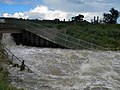
 A raging River Dearne - geograph.org.uk - 3027715.jpg 1,024 × 768; 173 KB
-
 ASOS warehouse from Darfield - geograph.org.uk - 2541808.jpg 1,024 × 768; 239 KB
-
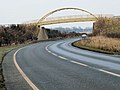 Bridge over A6195 - geograph.org.uk - 117745.jpg 640 × 480; 78 KB
-
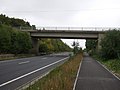 Bridge over the A6195 - geograph.org.uk - 3670991.jpg 640 × 480; 58 KB
-
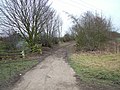
 Bridleway alongside Little Park wood - geograph.org.uk - 4082199.jpg 1,024 × 768; 232 KB
-
 Bridleway to Little Houghton. - geograph.org.uk - 493118.jpg 640 × 480; 165 KB
-
 Chapel Lane, Great Houghton - geograph.org.uk - 5086906.jpg 1,600 × 1,200; 506 KB
-

-

-
 Cycle track beside the A6195 - geograph.org.uk - 3670485.jpg 640 × 480; 74 KB
-
 Dearne Valley Colliery (1901) - geograph.org.uk - 4486383.jpg 5,184 × 3,888; 4.56 MB
-
 Dearne Valley colliery 1979 - geograph.org.uk - 1582225.jpg 640 × 328; 39 KB
-
 Dearne Valley Parkway - geograph.org.uk - 197519.jpg 640 × 480; 71 KB
-
 Dearne Valley Sunrise - geograph.org.uk - 786102.jpg 640 × 398; 72 KB
-
 Deceptive Path - geograph.org.uk - 4486375.jpg 3,888 × 5,184; 4.81 MB
-
 Digger on site. - geograph.org.uk - 493275.jpg 640 × 480; 106 KB
-
 Dynamic consolidation - geograph.org.uk - 493277.jpg 480 × 640; 80 KB
-
 Early morning in the Dearne Valley - geograph.org.uk - 4956247.jpg 1,024 × 768; 96 KB
-

-
 EDF Park Springs wind turbine 2 erection - geograph.org.uk - 4651873.jpg 768 × 1,024; 142 KB
-
 End of the road at Little Houghton - geograph.org.uk - 5086907.jpg 1,600 × 1,200; 651 KB
-
 Farm Track in Sandhill - geograph.org.uk - 117761.jpg 640 × 480; 108 KB
-
 Farmland off the A6195 - geograph.org.uk - 3670480.jpg 640 × 480; 44 KB
-
 Foot bridge over the A6195 - geograph.org.uk - 3670483.jpg 640 × 480; 50 KB
-
 Foot bridge over the A6195 - geograph.org.uk - 3670488.jpg 640 × 480; 61 KB
-

-
 Gone fishing - geograph.org.uk - 1143878.jpg 480 × 640; 85 KB
-
 Houghton Main Colliery - geograph.org.uk - 2252112.jpg 640 × 424; 52 KB
-

-
 Houghton Main Colliery sign - geograph.org.uk - 2260358.jpg 3,472 × 2,270; 799 KB
-
-

-

-

-

-

-

-
-
 It's finally stopped raining - geograph.org.uk - 3026218.jpg 1,024 × 768; 159 KB
-
 Little Houghton and Adjoining Farmland - geograph.org.uk - 5270249.jpg 4,608 × 3,456; 3.59 MB
-
 Little Houghton from bypass. - geograph.org.uk - 493273.jpg 640 × 480; 128 KB
-
 Memorial pit headgear wheel. - geograph.org.uk - 493082.jpg 640 × 505; 200 KB
-
 Middlecliffe Lane - geograph.org.uk - 3671018.jpg 640 × 480; 42 KB
-
 Morning mist forms over The River Dearne - geograph.org.uk - 2583664.jpg 1,024 × 466; 57 KB
-
 Newsagents, Middlecliffe - geograph.org.uk - 3671011.jpg 640 × 480; 57 KB
-
 No entry for off roaders - geograph.org.uk - 3026225.jpg 1,024 × 768; 172 KB
-
 Old market cross - geograph.org.uk - 298218.jpg 640 × 480; 108 KB
-
 Old pit wheel - geograph.org.uk - 298219.jpg 640 × 480; 114 KB
-
-
 Parish Boundary Stone on Chapel Lane - geograph.org.uk - 5270253.jpg 2,996 × 2,260; 1.52 MB
-
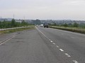
 Park Spring Road (A6195) - geograph.org.uk - 3670489.jpg 640 × 480; 53 KB
-
 Park Spring Road (A6195) - geograph.org.uk - 3670984.jpg 640 × 480; 59 KB
-
 Park Spring Road (A6195) - geograph.org.uk - 3670997.jpg 640 × 480; 64 KB
-
 Park Spring Road (A6195) - geograph.org.uk - 3671004.jpg 640 × 480; 67 KB
-
 Park Springs wind farm turbine 2 - geograph.org.uk - 5099545.jpg 768 × 1,024; 142 KB
-
 RIVER DEARNE - panoramio.jpg 2,048 × 1,536; 734 KB
-
 River Dearne Darfield - geograph.org.uk - 3305818.jpg 768 × 1,024; 217 KB
-
 River Dearne weir near Darfield - geograph.org.uk - 3027725.jpg 1,024 × 768; 177 KB
-
 The Butter Cross, Little Houghton - geograph.org.uk - 4486371.jpg 4,953 × 3,634; 4.14 MB
-
 The eastern end of Edderthorpe Flash RSPB site - geograph.org.uk - 2947818.jpg 1,024 × 674; 151 KB
-
 The River Dearne - geograph.org.uk - 3027716.jpg 1,024 × 768; 98 KB
-
 The River Dearne - geograph.org.uk - 5398127.jpg 1,024 × 654; 150 KB
-
 The River Dearne after the weir - geograph.org.uk - 2487229.jpg 1,024 × 768; 203 KB
-
-
 This was once a colliery spoil heap for Houghton Main - geograph.org.uk - 5099544.jpg 3,264 × 2,448; 854 KB
-
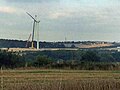
 Track and Wind Turbines near New Park Spring - geograph.org.uk - 5270272.jpg 4,608 × 3,456; 3.75 MB
-
 Trees alongside the A6195 - geograph.org.uk - 1382797.jpg 640 × 480; 95 KB
-
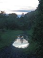 Twilight reflections - geograph.org.uk - 3026229.jpg 768 × 1,024; 153 KB
-
 Walking the dog - geograph.org.uk - 3302755.jpg 1,024 × 597; 204 KB
-
 Weir on The River Dearne - geograph.org.uk - 4486386.jpg 3,888 × 5,184; 4.21 MB
-
 Welcome to Little Houghton. - geograph.org.uk - 493054.jpg 640 × 480; 120 KB
-

-

-
 Dearne Valley Colliery marker stone - geograph.org.uk - 480743.jpg 640 × 480; 137 KB
-

-
 End of the Road^ - geograph.org.uk - 493065.jpg 640 × 480; 127 KB
-
 Houghton Main Colliery plaque - geograph.org.uk - 480748.jpg 640 × 480; 110 KB
-
 Sandhill Golf Club House - geograph.org.uk - 117756.jpg 640 × 480; 60 KB
-
 Sandhill golf course. - geograph.org.uk - 493131.jpg 640 × 480; 111 KB


_-_geograph.org.uk_-_3670491.jpg)

_-_geograph.org.uk_-_4486383.jpg)


_-_geograph.org.uk_-_3670489.jpg)
_-_geograph.org.uk_-_3670984.jpg)
_-_geograph.org.uk_-_3670997.jpg)
_-_geograph.org.uk_-_3671004.jpg)


