Category:Little Whernside
Jump to navigation
Jump to search
English: Little Whernside is a 604m summit in North Yorkshire, England, on the boundary of Coverdale and Nidderdale. The civil parishes of Carlton Highdale and Stonebeck Up meet on the summit.
mountain in the United Kingdom  | |||||
| Upload media | |||||
| Instance of | |||||
|---|---|---|---|---|---|
| Location |
| ||||
| Elevation above sea level |
| ||||
| Parent peak | |||||
 | |||||
Media in category "Little Whernside"
The following 23 files are in this category, out of 23 total.
-
 Angram Reservoir - geograph.org.uk - 1303102.jpg 640 × 394; 212 KB
-
 Boundary wall on Little Whernside - geograph.org.uk - 233317.jpg 640 × 480; 97 KB
-
 Bridleway across Arkleside Moor - geograph.org.uk - 344350.jpg 640 × 480; 103 KB
-
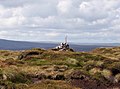 Cairn atop Little Whernside - geograph.org.uk - 404961.jpg 640 × 477; 66 KB
-
 Cairn near the top of Little Whernside - geograph.org.uk - 1863221.jpg 2,592 × 1,944; 1.12 MB
-
 Choppy waters, Scar House Reservoir - geograph.org.uk - 1127967.jpg 640 × 480; 64 KB
-
 Dead Mans Hill - geograph.org.uk - 1398736.jpg 640 × 480; 141 KB
-
 Dry Stone wall - geograph.org.uk - 495237.jpg 640 × 480; 99 KB
-
 Fence west of Little Whernside - geograph.org.uk - 1863234.jpg 2,592 × 1,944; 1.12 MB
-
 Frozen puddle - geograph.org.uk - 400467.jpg 500 × 375; 241 KB
-

-
 Little Whernside in winter.jpg 4,000 × 3,000; 2.62 MB
-
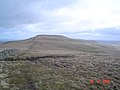
 Little Whernside summit - geograph.org.uk - 53143.jpg 640 × 480; 54 KB
-
 Long Hill Sike Head. - geograph.org.uk - 53147.jpg 640 × 480; 68 KB
-

-
 Scar House Dam - geograph.org.uk - 736012.jpg 640 × 480; 70 KB
-
 Scar House Dam, Nidderdale - geograph.org.uk - 121004.jpg 596 × 394; 97 KB
-
 Scarhouse reservoir - geograph.org.uk - 1596334.jpg 640 × 475; 29 KB
-
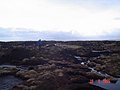
 The summit of Little Whernside - geograph.org.uk - 404966.jpg 640 × 480; 97 KB
-
 Top of Middle Gill. - geograph.org.uk - 276223.jpg 640 × 480; 115 KB
-
 Track down to Scar House - geograph.org.uk - 845602.jpg 640 × 405; 88 KB
-
 Track near Little Whernside - geograph.org.uk - 1863160.jpg 2,592 × 1,944; 1.17 MB
-


