Category:Llanelli Rural
Aller à la navigation
Aller à la recherche
community near Llanelli, Wales | |||||
| Téléverser des médias | |||||
| Nature de l’élément | |||||
|---|---|---|---|---|---|
| Lieu | Carmarthenshire, pays de Galles | ||||
| Assemblée délibérante |
| ||||
| Population |
| ||||
| Superficie |
| ||||
 | |||||
Sous-catégories
Cette catégorie comprend 11 sous-catégories, dont les 11 ci-dessous.
B
C
- Cynheidre (7 F)
D
- Dafen, Carmarthenshire (6 F)
F
- Five Roads (8 F)
P
- Pont Henri, Carmarthenshire (17 F)
- Pwll (21 F)
S
- Sandy, Carmarthenshire (3 F)
- Stradey Castle (1 F)
Y
- Yspitty (4 F)
Média dans la catégorie « Llanelli Rural »
Cette catégorie comprend 780 fichiers, dont les 200 ci-dessous.
(page précédente) (page suivante)-
 "Y Felin" at Felinfoel - geograph.org.uk - 2709200.jpg 1 280 × 960 ; 185 kio
-

-
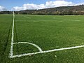 A corner view - geograph.org.uk - 6298187.jpg 2 048 × 1 536 ; 1,27 Mio
-
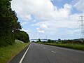
 A4138 and roadside signs north of Penceiliogi roundabout - geograph.org.uk - 5826519.jpg 1 600 × 1 197 ; 763 kio
-

-

-
 A484 and Tasty House - geograph.org.uk - 3543961.jpg 1 280 × 870 ; 965 kio
-
 A484 passes under modern pedestrian bridge - geograph.org.uk - 3265907.jpg 640 × 480 ; 49 kio
-
 A484 Pwll Road looking west - geograph.org.uk - 3266869.jpg 640 × 480 ; 47 kio
-
 A484 west of Moreb Farm - geograph.org.uk - 3266872.jpg 640 × 480 ; 103 kio
-
 A484, pedestrian bridge and pylons - geograph.org.uk - 5826641.jpg 1 600 × 1 200 ; 745 kio
-
 Aber Llwchwr - Loughor Estuary - geograph.org.uk - 5668647.jpg 640 × 480 ; 84 kio
-

-
 Across The Fields To Stradey Woods - geograph.org.uk - 4942000.jpg 1 600 × 861 ; 176 kio
-
 Afon Dafen Bridge - geograph.org.uk - 4037785.jpg 640 × 480 ; 117 kio
-
 Afon Dafen, Llanelli - geograph.org.uk - 4864552.jpg 800 × 600 ; 185 kio
-
 Afon Lliedi River - geograph.org.uk - 4285305.jpg 640 × 480 ; 127 kio
-
 All You Need is Shelter, Bynea - geograph.org.uk - 4880167.jpg 800 × 547 ; 106 kio
-
 Amelia Earhart memorial, Pwll - geograph.org.uk - 3540051.jpg 1 280 × 960 ; 1,47 Mio
-

-
 An entrance to Cycle trail - geograph.org.uk - 1348489.jpg 640 × 480 ; 165 kio
-
 An old road that's no longer maintained - geograph.org.uk - 1334210.jpg 640 × 480 ; 67 kio
-

-
 Arched brick structure - geograph.org.uk - 6503812.jpg 2 048 × 1 536 ; 2,2 Mio
-
 Argos Extra, Llanelli - geograph.org.uk - 4867253.jpg 800 × 597 ; 99 kio
-
 Artwork on the walls of Llwynhendy Library - geograph.org.uk - 4877383.jpg 800 × 478 ; 122 kio
-
 Av-Nu Carpet ^ Flooring shop in Llwynhendy - geograph.org.uk - 4905353.jpg 800 × 661 ; 119 kio
-
 B4297 ascends towards a railway bridge, Bynea - geograph.org.uk - 4878654.jpg 800 × 526 ; 104 kio
-
 B4297 pelican crossing, Bynea - geograph.org.uk - 4867874.jpg 800 × 660 ; 116 kio
-
 B4297 speed bumps, Llanelli - geograph.org.uk - 4876404.jpg 703 × 571 ; 145 kio
-
 B4304 crossing railway line east of Llanelli - geograph.org.uk - 5826524.jpg 1 600 × 1 200 ; 772 kio
-
 B4308, Cwmbach Road - geograph.org.uk - 3541497.jpg 1 280 × 960 ; 1,32 Mio
-
 Backward look - geograph.org.uk - 2379465.jpg 1 280 × 960 ; 610 kio
-
 Bassett Terrace - geograph.org.uk - 3266864.jpg 640 × 480 ; 69 kio
-

-
 Beach Road, Llanelli - geograph.org.uk - 5718519.jpg 800 × 700 ; 94 kio
-
 Beefeater and Premier Inn at Pemberton - geograph.org.uk - 4954033.jpg 3 264 × 2 448 ; 2,97 Mio
-
 Bend in Heol Gwili, Llwynhendy - geograph.org.uk - 4905133.jpg 800 × 468 ; 85 kio
-
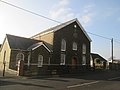
 Berea Independent Chapel, Tanygraig Road, Bynea - geograph.org.uk - 4873337.jpg 800 × 629 ; 110 kio
-
 Berwick Road, Bynea - geograph.org.uk - 4878606.jpg 731 × 604 ; 109 kio
-
 Bethel Presbyterian Church, Llwynhendy - geograph.org.uk - 4876470.jpg 800 × 496 ; 100 kio
-
 Bethlehem Baptist Chapel, Pwll - geograph.org.uk - 3540015.jpg 1 280 × 960 ; 817 kio
-
 Bethlehem Chapel - geograph.org.uk - 4262552.jpg 640 × 480 ; 52 kio
-
 Bethlehem Chapel in Pwll - geograph.org.uk - 4377449.jpg 1 600 × 1 067 ; 333 kio
-

-
 Bird sculpture at Llanelli North Dock - geograph.org.uk - 3186902.jpg 1 984 × 1 488 ; 650 kio
-
 Black 5 at Pwll - geograph.org.uk - 6259757.jpg 5 070 × 2 852 ; 4,2 Mio
-
 Black 5 near Pwll - geograph.org.uk - 6259782.jpg 4 588 × 3 441 ; 6,44 Mio
-
 Black 5 near Pwll - geograph.org.uk - 6259786.jpg 4 437 × 3 327 ; 5,57 Mio
-
-
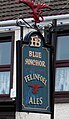
 Blue Anchor pub, Pwll, Carmarthenshire - geograph.org.uk - 5717349.jpg 800 × 693 ; 104 kio
-
 Blue Anchor, 29 Pwll Road, Pwll, Carmarthenshire - geograph.org.uk - 5717266.jpg 798 × 800 ; 131 kio
-
 Blue houses, Tir Yr Hen Ysgol, Bynea - geograph.org.uk - 4878533.jpg 800 × 452 ; 90 kio
-
 Breakwater near North Dock, Llanelli - geograph.org.uk - 6259790.jpg 5 184 × 3 888 ; 4,05 Mio
-
 Bridge over Afon Lliedi between the two reservoirs - geograph.org.uk - 6183380.jpg 2 000 × 1 500 ; 1,32 Mio
-
 Bridge over Loughor - geograph.org.uk - 6331928.jpg 2 048 × 1 536 ; 546 kio
-
 Bridge to the Heron's Wing Hide, Llanelli Wetlands Centre - geograph.org.uk - 5826551.jpg 1 600 × 1 200 ; 768 kio
-
 Broken Milestone - Llandeilo 15 - geograph.org.uk - 6496442.jpg 1 024 × 629 ; 213 kio
-
 Broken tree, Cwm Lleidi Reservoir - geograph.org.uk - 6183376.jpg 2 000 × 1 500 ; 1,33 Mio
-

-
 Brynhelyg Residential Care Home, Bynea - geograph.org.uk - 4867820.jpg 800 × 647 ; 145 kio
-

-
 Building plot for sale in Bynea - geograph.org.uk - 4908870.jpg 800 × 583 ; 168 kio
-

-

-

-
 Bynea boundary sign - geograph.org.uk - 4908465.jpg 800 × 670 ; 161 kio
-
 Bynea Business Park nameboards, Bynea - geograph.org.uk - 4902221.jpg 800 × 510 ; 121 kio
-
 Bynea General Store - geograph.org.uk - 4878555.jpg 800 × 667 ; 125 kio
-
 Bynea House, Bynea - geograph.org.uk - 4901573.jpg 800 × 468 ; 95 kio
-
 Bynea railway station name sign - geograph.org.uk - 4992870.jpg 800 × 781 ; 90 kio
-
 Bynea Rugby Club Internationals plaque - geograph.org.uk - 4992834.jpg 800 × 766 ; 197 kio
-
 Bynea rugby football ground - geograph.org.uk - 4908892.jpg 747 × 800 ; 101 kio
-
 Cae Rygbi Ffwrnais - Furnace Rugby Field - geograph.org.uk - 5664625.jpg 640 × 480 ; 81 kio
-
 Caerbigyn Farm - geograph.org.uk - 1010650.jpg 640 × 480 ; 82 kio
-
 Capel y Bryn - geograph.org.uk - 4037749.jpg 480 × 640 ; 63 kio
-
 Car dealership in Sandy Road - geograph.org.uk - 3543932.jpg 1 275 × 768 ; 679 kio
-
 Car sales business, Bynea - geograph.org.uk - 4878685.jpg 800 × 602 ; 140 kio
-

-
 Cartref Clyd, Pemberton Road, Llanelli - geograph.org.uk - 4876252.jpg 800 × 696 ; 160 kio
-
 CEM Day Ltd, Llanelli - geograph.org.uk - 5719212.jpg 800 × 566 ; 79 kio
-
 Centuries apart in Llwynhendy - geograph.org.uk - 4873237.jpg 800 × 562 ; 112 kio
-

-

-
 Chimney at former Horeb Brickworks - geograph.org.uk - 5559514.jpg 573 × 1 200 ; 242 kio
-
 Chimney of the former Carnarvon Colliery - geograph.org.uk - 5776065.jpg 4 592 × 3 056 ; 6,16 Mio
-
 ChocoDragon, Bynea - geograph.org.uk - 4902246.jpg 800 × 482 ; 91 kio
-
 Cilfrey Isaf farm through farm gate - geograph.org.uk - 1347494.jpg 640 × 480 ; 138 kio
-
 Clochyrie Hill - geograph.org.uk - 4235069.jpg 640 × 480 ; 24 kio
-

-
 Coastal Path marker, near Pwll, Llanelli, - geograph.org.uk - 1724229.jpg 640 × 480 ; 42 kio
-
 Coed-y-bwlch, Bynea - geograph.org.uk - 4878513.jpg 800 × 664 ; 146 kio
-
 Coleg Sir Gâr - Carmarthenshire College - geograph.org.uk - 3543941.jpg 1 275 × 750 ; 843 kio
-
 Coleg Sir Gâr - geograph.org.uk - 6298184.jpg 3 137 × 2 353 ; 1,93 Mio
-

-
 Colliers Arms, Pwll, Carmarthenshire - geograph.org.uk - 5714537.jpg 800 × 528 ; 80 kio
-
 Community Education Centre, Pwll - geograph.org.uk - 3544203.jpg 1 280 × 960 ; 1 Mio
-
 Cottage and house, Pont-iets - geograph.org.uk - 1010648.jpg 640 × 480 ; 49 kio
-
 Country Life - geograph.org.uk - 3085260.jpg 640 × 480 ; 69 kio
-
 Country Road - geograph.org.uk - 1278052.jpg 640 × 534 ; 92 kio
-
 Country road - geograph.org.uk - 6170374.jpg 1 536 × 2 048 ; 1,53 Mio
-
 Cronfa Ddwr Lliedi Isaf - geograph.org.uk - 4285280.jpg 640 × 492 ; 93 kio
-
 Cronfa Ddwr Lliedi Isaf - Lower Lliedi Reservoir - geograph.org.uk - 4285318.jpg 640 × 480 ; 146 kio
-

-
 Currys PC World and Carphone Warehouse, Llanelli - geograph.org.uk - 4867267.jpg 800 × 495 ; 100 kio
-
 Cwm Lliedi reservoir - geograph.org.uk - 3443930.jpg 1 941 × 1 339 ; 1,39 Mio
-
 Cwm Lliedi Reservoir dam - geograph.org.uk - 6183362.jpg 2 000 × 1 500 ; 762 kio
-
 Cwmfelin Road - geograph.org.uk - 6195978.jpg 3 264 × 2 448 ; 2,25 Mio
-
 Cwmfelin Road bus stop and shelter, Bynea - geograph.org.uk - 4992682.jpg 800 × 551 ; 140 kio
-
 Cycle trail down to Llanelli - geograph.org.uk - 1348491.jpg 640 × 480 ; 156 kio
-
 Cycle way under Pembrey Road - geograph.org.uk - 3541625.jpg 1 280 × 960 ; 1,18 Mio
-

-
 Cyffordd o heolydd - Road Junction - geograph.org.uk - 6221165.jpg 1 024 × 768 ; 206 kio
-
 Cyffordd o Lwybrau - Junction of Paths - geograph.org.uk - 5666435.jpg 640 × 480 ; 102 kio
-
 Cynheidre Bridge - geograph.org.uk - 3217860.jpg 2 592 × 1 936 ; 1,1 Mio
-
 Dark blue house in Pwll, Carmarthenshire - geograph.org.uk - 5720283.jpg 800 × 438 ; 66 kio
-
 Deep rocky cutting on Swiss Valley Cycle Route - geograph.org.uk - 3089158.jpg 1 200 × 900 ; 246 kio
-
 Denham Avenue, Sandy - geograph.org.uk - 3541505.jpg 1 280 × 960 ; 1,11 Mio
-
 Derelict building - geograph.org.uk - 1010623.jpg 640 × 480 ; 44 kio
-
 Derelict House, Herberdeg Road - geograph.org.uk - 3004479.jpg 640 × 480 ; 58 kio
-
 Detail of the Death Stone at Pwll - geograph.org.uk - 5560653.jpg 1 024 × 768 ; 201 kio
-
 Direction signs on a Llanelli corner - geograph.org.uk - 4864455.jpg 800 × 639 ; 233 kio
-

-

-

-
 Disused canopy behind a bus shelter, Bynea - geograph.org.uk - 4867817.jpg 800 × 521 ; 114 kio
-
 Disused railway - geograph.org.uk - 6503860.jpg 2 836 × 3 782 ; 5,96 Mio
-
 Disused railway line - geograph.org.uk - 6503797.jpg 2 048 × 1 536 ; 2,06 Mio
-
 Disused Railway... apparently - geograph.org.uk - 2106833.jpg 640 × 480 ; 124 kio
-
 Diversion sign facing the B4297 south of Bynea - geograph.org.uk - 4880039.jpg 800 × 491 ; 126 kio
-
 Diversion^ - geograph.org.uk - 853922.jpg 640 × 480 ; 87 kio
-
 Dolafon, Bynea - geograph.org.uk - 4873315.jpg 800 × 582 ; 152 kio
-
 Down Elgin Road, Pwll, Carmarthenshire - geograph.org.uk - 5714874.jpg 753 × 800 ; 154 kio
-
 Duck pond at Gelli Fawr Farm - geograph.org.uk - 1027979.jpg 640 × 480 ; 364 kio
-
 Early 21st century houses, Bynea - geograph.org.uk - 4902258.jpg 800 × 622 ; 98 kio
-
-
 East side of the B4297 bridge, Bynea - geograph.org.uk - 4992929.jpg 800 × 600 ; 121 kio
-
 Eastern boundary of Burry Port - geograph.org.uk - 3608683.jpg 800 × 550 ; 134 kio
-
 Eastern end of Ffos Las race cource - geograph.org.uk - 1347393.jpg 640 × 480 ; 50 kio
-
 Eastern end of Glyncoed Terrace, Llanelli - geograph.org.uk - 4865659.jpg 800 × 588 ; 114 kio
-

-
 Electricity pylon, Pemberton, Llanelli - geograph.org.uk - 4867385.jpg 666 × 800 ; 128 kio
-

-
 Elgin Road, Pwll - geograph.org.uk - 3544191.jpg 768 × 1 024 ; 193 kio
-
 End of the 30 zone through Pwll, Carmarthenshire - geograph.org.uk - 5714159.jpg 800 × 490 ; 108 kio
-

-
 Entrance gates to Bynea RFC - geograph.org.uk - 4908883.jpg 800 × 445 ; 82 kio
-
 Entrance on the south-west side of the Hoffman brick kiln, Horeb - geograph.org.uk - 6173176.jpg 2 000 × 1 500 ; 1,32 Mio
-
 Entrance to Berea Independent Chapel, Bynea - geograph.org.uk - 4873345.jpg 800 × 690 ; 131 kio
-
 Entrance to Bynea Car Park - geograph.org.uk - 4880049.jpg 800 × 600 ; 176 kio
-

-
 Entrance to Llwynhendy Children's Club - geograph.org.uk - 4905532.jpg 800 × 443 ; 111 kio
-
 Entrance to Pinetops - geograph.org.uk - 6170402.jpg 2 048 × 1 536 ; 1,42 Mio
-
 Entrance to the southern end of the Hoffman brick kiln, Horeb - geograph.org.uk - 6173183.jpg 2 000 × 1 500 ; 1,33 Mio
-
 Entrances to the north-eastern side of the Hoffman brick kiln, Horeb - geograph.org.uk - 6173186.jpg 2 000 × 1 500 ; 1,28 Mio
-
 Eroding shoreline at Morfa Bacas - geograph.org.uk - 3163845.jpg 2 288 × 1 712 ; 1,22 Mio
-
 Exit from Graig Campus, Coleg Sir Gâr, Llanelli - geograph.org.uk - 5718681.jpg 800 × 727 ; 114 kio
-

-
 Factory in Bynea - geograph.org.uk - 4901345.jpg 800 × 506 ; 146 kio
-
 Farm fields south of Five Roads - geograph.org.uk - 1347242.jpg 640 × 480 ; 79 kio
-
 Farm Track - geograph.org.uk - 1278042.jpg 480 × 640 ; 76 kio
-
 Felinfoel plaque - geograph.org.uk - 6170882.jpg 1 536 × 2 048 ; 1,44 Mio
-
 Felinfoel Rugby Club - geograph.org.uk - 1497504.jpg 640 × 480 ; 59 kio
-
 Fenced-off building, Bynea - geograph.org.uk - 4867856.jpg 800 × 527 ; 119 kio
-
 Fenced-off site in Llwynhendy - geograph.org.uk - 4906818.jpg 800 × 452 ; 81 kio
-
 Fferm Clochyrie - geograph.org.uk - 901394.jpg 640 × 480 ; 94 kio
-
 Ffordd Sant Illtyd - St Illtyd's Way - geograph.org.uk - 4520120.jpg 640 × 480 ; 138 kio
-
 Ffynon Helig - geograph.org.uk - 3540090.jpg 1 280 × 960 ; 970 kio
-
 Ffynon Helig, Pwll - geograph.org.uk - 3180152.jpg 2 288 × 1 712 ; 1,34 Mio
-
 Filter Tower on lower Lliedi Reservoir - geograph.org.uk - 3089125.jpg 1 024 × 768 ; 147 kio
-
 Finishing Touches in Bynea - geograph.org.uk - 4902260.jpg 800 × 509 ; 105 kio
-
 Flamingos at the Llanelli Wetland Centre - geograph.org.uk - 3364293.jpg 4 000 × 3 000 ; 3,89 Mio
-
 Foal resting in the midday sun, Millennium Coastal Park - geograph.org.uk - 3166224.jpg 2 288 × 1 712 ; 1,38 Mio
-
 Footbridge in Swiss Valley - geograph.org.uk - 3443962.jpg 1 756 × 1 186 ; 1,76 Mio
-
 Footpath at the National Wetland Centre Wales - Llanelli - geograph.org.uk - 2299387.jpg 2 880 × 1 913 ; 1,09 Mio
-
 Footpath down to Cycle trail - geograph.org.uk - 1348486.jpg 596 × 640 ; 173 kio
-
 Footpath in Swiss Valley - geograph.org.uk - 3443970.jpg 1 865 × 1 271 ; 1,9 Mio
-
 Footpath marker at the National Wetland Centre Wales - Llanelli - geograph.org.uk - 2299399.jpg 2 880 × 1 913 ; 786 kio
-
 Footpath to Pontyberem - geograph.org.uk - 6505035.jpg 2 048 × 1 536 ; 1,78 Mio
-
 Fording the Lliedi - geograph.org.uk - 3217831.jpg 1 936 × 2 592 ; 1,6 Mio
-
 Former BT phonebox, Bynea - geograph.org.uk - 4867676.jpg 800 × 656 ; 133 kio
-

-
 Former rugby club ground - geograph.org.uk - 3541614.jpg 1 280 × 960 ; 1,14 Mio
-
 Former Sandy Gate newsagents - geograph.org.uk - 3541643.jpg 1 280 × 960 ; 1,12 Mio
-
 Former^ business premises, Llwynhendy - geograph.org.uk - 4906266.jpg 800 × 546 ; 110 kio
-
 Four swans, Sandy Water Park, Llanelli - geograph.org.uk - 3750977.jpg 768 × 1 024 ; 176 kio
-
 Fresz Cafe, Pwll, Carmarthenshire - geograph.org.uk - 5714945.jpg 800 × 591 ; 106 kio
-
 From 20 to 30 on Heol Gwalia, Llwynhendy - geograph.org.uk - 4905225.jpg 800 × 546 ; 130 kio
-
 From 20 to 30, Heol Hen, Llwynhendy - geograph.org.uk - 4905469.jpg 800 × 736 ; 108 kio
-
 Furnace Pond, Llanelli - geograph.org.uk - 5559082.jpg 2 261 × 800 ; 406 kio
-
 Furnace Primary School - geograph.org.uk - 3541578.jpg 1 280 × 960 ; 924 kio
-
 Gate and field - geograph.org.uk - 6170092.jpg 2 048 × 1 536 ; 1,04 Mio
-
 Gate in the footpath - geograph.org.uk - 3541486.jpg 1 280 × 1 707 ; 2,38 Mio
-
 Gellifawr Rd, Five Roads - geograph.org.uk - 1010653.jpg 640 × 480 ; 59 kio
-
 General Store, Bynea - geograph.org.uk - 4878572.jpg 800 × 600 ; 115 kio
-
 Ger Ffarm Cwta- Near Cwtta Farm - geograph.org.uk - 4930034.jpg 640 × 480 ; 82 kio
-

-
 Ger Glyngwernern Uchaf - Near Glyngwernen Uchaf - geograph.org.uk - 5676764.jpg 640 × 480 ; 107 kio
-
 Ger y Coed, Pwll, Carmarthenshire - geograph.org.uk - 5713844.jpg 711 × 800 ; 116 kio
-
 Ger-y-coed, Pont-iets - geograph.org.uk - 1010644.jpg 640 × 480 ; 47 kio


