Category:Llanfairpwllgwyngyll
Aller à la navigation
Aller à la recherche
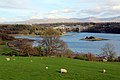
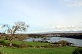
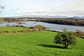
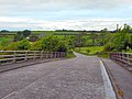
Llanfairpwllgwyngyll, complete name Llanfairpwllgwyngyllgogerychwyrndrobwllllantysiliogogogoch, also known as Llanfairpwll and Llanfair PG, is a village in Wales, United Kingdom. The long form of its name, with 58 characters, it is the longest place name in Europe and one of the longest place names in the world.
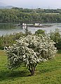
village du pays de Galles _-_geograph.org.uk_-_1058335.jpg) | |||||
| Téléverser des médias | |||||
| Lecture du texte à haute voix | |||||
|---|---|---|---|---|---|
| Prononciation (fichier son) | |||||
| Nature de l’élément | |||||
| Lieu | Llanfair Pwllgwyngyll, Île-d’Anglesey, pays de Galles | ||||
| Population |
| ||||
| Altitude |
| ||||
| site officiel | |||||
 | |||||
Sous-catégories
Cette catégorie comprend 9 sous-catégories, dont les 9 ci-dessous.
Média dans la catégorie « Llanfairpwllgwyngyll »
Cette catégorie comprend 245 fichiers, dont les 200 ci-dessous.
(page précédente) (page suivante)-
 58 letters name (49577960668).jpg 2 976 × 3 484 ; 1,71 Mio
-
 A55 Eastbound - geograph.org.uk - 38849.jpg 640 × 480 ; 61 kio
-
 Afon Menai from Pont Britannia - geograph.org.uk - 1459292.jpg 640 × 480 ; 34 kio
-
 Afon Menai from the A5 - geograph.org.uk - 789960.jpg 640 × 366 ; 44 kio
-
 Afon Menai from Treborth Woods - geograph.org.uk - 387353.jpg 640 × 480 ; 146 kio
-

-
 Anglesey looking towards Menai Suspension Bridge - geograph.org.uk - 2382106.jpg 1 024 × 683 ; 153 kio
-
-
 Baby Barn, Llanfairpwllgwyngyll, Wales, advert bus, 6 April 2005.jpg 1 024 × 768 ; 188 kio
-
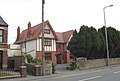
 Benchmark on post in front of the White Lodge, Llanfairpwll - geograph.org.uk - 1997541.jpg 2 547 × 3 913 ; 2,44 Mio
-

-
 Bridge at Brynsiencyn Road - geograph.org.uk - 1718300.jpg 2 816 × 2 112 ; 1,65 Mio
-
 Bridge over the river Braint at Pwll Fanogl - geograph.org.uk - 786181.jpg 640 × 452 ; 124 kio
-
 Britannia Bridge - geograph.org.uk - 1817616.jpg 1 024 × 683 ; 478 kio
-
 Britannia Bridge from St Mary's Church - geograph.org.uk - 2109469.jpg 640 × 480 ; 86 kio
-
 Britannia Bridge memorial - geograph.org.uk - 2109482.jpg 480 × 640 ; 44 kio
-
 Bwthyn Pen Parc.jpg 4 000 × 3 000 ; 4,6 Mio
-
 Coed Mor - geograph.org.uk - 388428.jpg 640 × 480 ; 170 kio
-
 Column keeper's cottage - geograph.org.uk - 2597230.jpg 2 816 × 2 112 ; 2,43 Mio
-
 Cottage on Gored Goch - geograph.org.uk - 79006.jpg 640 × 480 ; 90 kio
-
 Crossing Station Road - geograph.org.uk - 1718282.jpg 2 816 × 2 112 ; 1,61 Mio
-
-
-
De-Llanfairpwllgwyngyllgogerychwyrndrobwllllantysiliogogogoch-article.ogg 2 min 47 s ; 6,37 Mio
-
 Down Menai Straits from St Mary's church - geograph.org.uk - 2109487.jpg 640 × 480 ; 62 kio
-
 Drive to Pwllfanogl (geograph 2508241).jpg 1 024 × 683 ; 226 kio
-
 Eastbound A55 from Ffordd Penmynydd - geograph.org.uk - 2425590.jpg 640 × 480 ; 191 kio
-
 Ebeneser Welsh Independent Chapel (1).jpg 3 872 × 2 592 ; 4,33 Mio
-
 Eel Catching Spear - geograph.org.uk - 114629.jpg 452 × 640 ; 87 kio
-
 Farmland looking towards Menai Suspension Bridge - geograph.org.uk - 2389732.jpg 1 024 × 683 ; 160 kio
-
 Farmland near Menai Strait, Anglesey - geograph.org.uk - 2390057.jpg 1 024 × 683 ; 142 kio
-
 Farmland near Menai Strait, Anglesey - geograph.org.uk - 2390063.jpg 1 024 × 683 ; 145 kio
-
 Farmland, Anglesey - geograph.org.uk - 2382119.jpg 1 024 × 683 ; 118 kio
-
 Farmland, Anglesey - geograph.org.uk - 2382144.jpg 1 024 × 683 ; 154 kio
-
 Ffordd Penmynydd, Llanfair Pwllgwyngyll - geograph.org.uk - 2425587.jpg 640 × 480 ; 194 kio
-
 Ffordd Penmynydd, Llanfair Pwllgwyngyll - geograph.org.uk - 2425600.jpg 640 × 480 ; 187 kio
-
Fr-17112020-Llanfairpwllgwyngyllgogerychwyrndrobwllllantysiliogogogoch.ogg 8 min 1 s ; 6,57 Mio
-
 Gates at White Lodge.jpg 3 456 × 2 304 ; 723 kio
-

-
 Graveyard at St Mary's Church - geograph.org.uk - 2109507.jpg 640 × 480 ; 102 kio
-
 Gully in stream at St Mary's Church - geograph.org.uk - 2109513.jpg 640 × 480 ; 101 kio
-
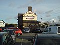
 Gwesty Carreg Mon - geograph.org.uk - 786341.jpg 640 × 480 ; 78 kio
-
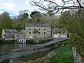
 Hen Felin.jpg 3 456 × 2 304 ; 4,5 Mio
-
 Holyhead Road (A5), Llanfairpwll - geograph.org.uk - 805224.jpg 640 × 480 ; 37 kio
-

-
-

-
 Llanfair P.G. (10456806386).jpg 3 409 × 1 824 ; 3,18 Mio
-
 Llanfair P.G. (10456818755).jpg 2 958 × 2 428 ; 4,38 Mio
-
 Llanfair PG - 1980 - geograph.org.uk - 2455620.jpg 2 272 × 1 515 ; 949 kio
-
 Llanfair PG.png 4 871 × 310 ; 33 kio
-

-
 Llanfair Pwllgwyngyll roofscape (1) - geograph.org.uk - 1058331.jpg 640 × 480 ; 154 kio
-
 Llanfair Pwllgwyngyll roofscape (2) - geograph.org.uk - 1058335.jpg 640 × 480 ; 156 kio
-
 Llanfairpwll Level Crossing (Eastbound).jpg 4 032 × 3 024 ; 8,91 Mio
-
 Llanfairpwll Level Crossing.jpg 4 032 × 3 024 ; 17,72 Mio
-
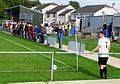 Llanfairpwll v Nefyn Town (10522301243).jpg 2 791 × 1 955 ; 3,62 Mio
-
 Llanfairpwllgwyn station Holyhead Road (A5) - geograph.org.uk - 2684228.jpg 640 × 480 ; 63 kio
-
 Llanfairpwllgwyngyll sticker advertising Tyn Lon Garage.JPG 2 592 × 1 944 ; 1,74 Mio
-
 Llanfairpwllgwyngyllgogerychwyrndrobwllllantysiliogogogoch 2010.jpg 1 745 × 1 071 ; 978 kio
-
 Llanfairpwllgwyngyllgogerychwyrndrobwllllantysiliogogogoch Postmark.jpg 389 × 454 ; 144 kio
-

-
 LlanfairSign.jpg 1 560 × 878 ; 356 kio
-
 Lodge to Plas Llanfair - geograph.org.uk - 786338.jpg 640 × 426 ; 73 kio
-
 Lon Pant, Llanfairpwllgwyngyll. - geograph.org.uk - 114626.jpg 640 × 437 ; 63 kio
-
 Lon Refail at its junction with the A5 - geograph.org.uk - 793430.jpg 640 × 480 ; 76 kio
-
 Lon Refail near Bryn-eira Farm - geograph.org.uk - 1431265.jpg 640 × 444 ; 89 kio
-
 Lon Refail, Llanfairpwllgwyngyll - geograph.org.uk - 1431216.jpg 640 × 480 ; 86 kio
-
 Lon y Wylan, Llanfairpwll - geograph.org.uk - 1431350.jpg 640 × 404 ; 55 kio
-
 Looking towards column from graveyard - geograph.org.uk - 2109511.jpg 480 × 640 ; 81 kio
-
 Mae'r Ty Yma AR WERTH- This House is ON SALE - geograph.org.uk - 1431287.jpg 426 × 640 ; 76 kio
-
 Map of Anglesey OS Map name 019-SW, Ordnance Survey, 1888-1891.jpg 5 376 × 3 576 ; 3,67 Mio
-
 Marine walk, Plasnewydd - (north Wales).jpeg 900 × 653 ; 317 kio
-
 Marquis of Anglesey's column - geograph.org.uk - 2597229.jpg 2 112 × 2 816 ; 1,42 Mio
-
 Menai Strait and Snowdonia from viewpoint near Llanfair Pwllgwyngyll (7610).jpg 4 288 × 2 848 ; 4,94 Mio
-
 Menai Strait and Snowdonia from viewpoint near Llanfair Pwllgwyngyll (7611).jpg 4 288 × 2 848 ; 5,18 Mio
-
 Menai Strait and Snowdonia from viewpoint near Llanfair Pwllgwyngyll (7612).jpg 4 288 × 2 848 ; 5,16 Mio
-
 Menai Strait and Snowdonia from viewpoint near Llanfair Pwllgwyngyll (7615).jpg 4 288 × 2 848 ; 5,37 Mio
-
 Menai Strait and Snowdonia from viewpoint near Llanfair Pwllgwyngyll (7628).jpg 4 288 × 2 848 ; 5,06 Mio
-
 Menai Strait with Suspension Bridge, Anglesey - geograph.org.uk - 2390269.jpg 1 024 × 683 ; 173 kio
-
 Menai Strait with Suspension Bridge, Anglesey - geograph.org.uk - 2390283.jpg 1 024 × 683 ; 146 kio
-
 Menai Suspension Bridge - geograph.org.uk - 640352.jpg 640 × 427 ; 109 kio
-
 Monkey Puzzle tree, Llanfairpwll - geograph.org.uk - 786187.jpg 480 × 640 ; 103 kio
-
 Mouth of Afon Braint - geograph.org.uk - 2508246.jpg 1 024 × 683 ; 195 kio
-
 Nelson looking towards Plas Newydd - geograph.org.uk - 785656.jpg 480 × 640 ; 84 kio
-
 Nelson overlooking Menai Straits - geograph.org.uk - 2109494.jpg 640 × 480 ; 58 kio
-
 Nelson's statue from St Mary's church - geograph.org.uk - 2109484.jpg 640 × 480 ; 59 kio
-

-
 Parade of shops at Llanfair PG - geograph.org.uk - 2485246.jpg 3 296 × 2 472 ; 1,93 Mio
-
 Parana pine at the crossroads - geograph.org.uk - 388635.jpg 640 × 473 ; 150 kio
-
 Pasture above Gaerwen Farm - geograph.org.uk - 969756.jpg 640 × 426 ; 44 kio
-
 Pasture field by the Menai Strait - geograph.org.uk - 2138984.jpg 1 500 × 1 000 ; 184 kio
-
 Pen y Berth road, Llanfairpwll - geograph.org.uk - 1431246.jpg 640 × 480 ; 68 kio
-
 Penrhos Arms opposite the station - geograph.org.uk - 2109522.jpg 640 × 480 ; 72 kio
-
 Photograph of Britain's first Women's Institute, 1915. (22145847964).jpg 4 134 × 2 639 ; 1,4 Mio
-
 Pier at Pwll Fanogl - geograph.org.uk - 117751.jpg 640 × 480 ; 128 kio
-
 Plaque on Britannia Bridge memorial - geograph.org.uk - 2109474.jpg 480 × 640 ; 69 kio
-
 Plas Britannia - geograph.org.uk - 1430123.jpg 640 × 480 ; 130 kio
-
 Plas Britannia - geograph.org.uk - 785650.jpg 640 × 480 ; 77 kio
-
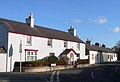
 Plas Garnedd Residential Home, Llanfairpwll - geograph.org.uk - 1431361.jpg 640 × 440 ; 46 kio
-
 Plas Llanfair - geograph.org.uk - 365856.jpg 640 × 480 ; 76 kio
-
 Plas Llanfair - geograph.org.uk - 786173.jpg 480 × 640 ; 103 kio
-
 Plas Mona Care Home, Llanfairpwll - geograph.org.uk - 1431364.jpg 640 × 480 ; 58 kio
-
 Pont Britannia from Pwll-fanogl - geograph.org.uk - 2021693.jpg 4 000 × 3 000 ; 6,7 Mio
-
 Pont Britannia, Anglesey - geograph.org.uk - 2389752.jpg 1 024 × 683 ; 156 kio
-
 Pont Britannia, Anglesey - geograph.org.uk - 2390261.jpg 1 024 × 683 ; 157 kio
-
 Pont Grog y Borth (Menai Suspension Bridge) - geograph.org.uk - 2103738.jpg 640 × 427 ; 239 kio
-
-
 Pringles Weavers shop at Llanfairpwll... - geograph.org.uk - 2109520.jpg 640 × 480 ; 54 kio
-
-
 Pwll Fanogl - geograph.org.uk - 786176.jpg 640 × 480 ; 81 kio
-
 Pwll Fanogl - geograph.org.uk - 786179.jpg 640 × 480 ; 113 kio
-
 Rails towards Holyhead - geograph.org.uk - 2109526.jpg 640 × 480 ; 88 kio
-
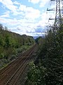 Railway line at Llanfairpwll - geograph.org.uk - 786183.jpg 480 × 640 ; 98 kio
-
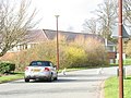
 Recently built houses in Hen Lon Dyfnia - geograph.org.uk - 943701.jpg 640 × 480 ; 53 kio
-
 Sheep grazing beneath power lines - geograph.org.uk - 793458.jpg 640 × 471 ; 49 kio
-

-
 Shop in Wales.20170416 181536.jpg 2 560 × 1 536 ; 1,29 Mio
-
 Slow moving traffic ahead - geograph.org.uk - 367876.jpg 640 × 480 ; 118 kio
-
 Snowdonia from viewpoint near Llanfair Pwllgwyngyll (7627).jpg 4 288 × 2 848 ; 5,23 Mio
-
 St Mary's church Llanfair P.G. - geograph.org.uk - 2109470.jpg 640 × 480 ; 80 kio
-
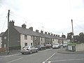 Terraced houses in Ffordd Penmynydd - geograph.org.uk - 943694.jpg 640 × 480 ; 45 kio
-
 The A5 at Llanfairpwll - geograph.org.uk - 943672.jpg 640 × 480 ; 58 kio
-
 The Anglesey Coastal Path east of Pont Britannia - geograph.org.uk - 1430071.jpg 640 × 480 ; 143 kio
-
 The Anglesey foreshore near Pont Britannia - geograph.org.uk - 1430091.jpg 640 × 480 ; 65 kio
-
 The Cae Gethin Estate from Lon Refail - geograph.org.uk - 1431276.jpg 640 × 422 ; 48 kio
-
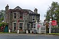
 The Carreg Mon Hotel, Llanfairpwllgwyngyll - geograph.org.uk - 1430121.jpg 640 × 480 ; 105 kio
-
 The entrance into Y Wern housing estate - geograph.org.uk - 1431257.jpg 640 × 480 ; 55 kio
-

-
-
 The junction of Lon Dryll with Lon Refail - geograph.org.uk - 1431255.jpg 640 × 370 ; 57 kio
-

-

-
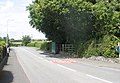
 The junction of the A 4080 and the A5 - geograph.org.uk - 1040869.jpg 640 × 480 ; 55 kio
-
 The junction of Y Wern Road with Lon Refail - geograph.org.uk - 1431263.jpg 640 × 480 ; 74 kio
-
 The Llanfair PG Bowling Green - geograph.org.uk - 943688.jpg 640 × 375 ; 31 kio
-

-
 The Lon Refail-Lon Pant crossroads - geograph.org.uk - 1431222.jpg 640 × 413 ; 57 kio
-

-

-
 The new Caeau Penrallt Estate off Lon Dryll - geograph.org.uk - 1431250.jpg 640 × 480 ; 68 kio
-
 The new Lon Dyfnia - geograph.org.uk - 943714.jpg 640 × 328 ; 45 kio
-

-
 The Penrhos Arms at Llanfair PG - geograph.org.uk - 2485243.jpg 3 296 × 2 472 ; 1,93 Mio
-
 The Plas Penrhyn Boathouse - geograph.org.uk - 524613.jpg 640 × 480 ; 97 kio
-
 The Plas Penrhyn Private Dock and Boathouse - geograph.org.uk - 524625.jpg 640 × 347 ; 77 kio
-
 The station at Llanfairpwll - geograph.org.uk - 2550347.jpg 640 × 480 ; 64 kio
-

-
-

-
 View north-eastwards along Lon Pant - geograph.org.uk - 1431225.jpg 640 × 480 ; 69 kio
-
-
 View of the Menai Straits from Anglesey - geograph.org.uk - 786342.jpg 640 × 480 ; 56 kio
-
 View on the Menai.jpeg 900 × 664 ; 347 kio
-
-
 View towards Britannia Bridge - geograph.org.uk - 2597220.jpg 2 816 × 2 112 ; 1,43 Mio
-
 View WSW along Lon Penmynydd, Llanfairpwll - geograph.org.uk - 1431343.jpg 640 × 480 ; 84 kio
-
 Villas on the western side of Llanfairpwll - geograph.org.uk - 1420106.jpg 640 × 480 ; 47 kio
-
 War Memorial at Llanfair PG - geograph.org.uk - 2485240.jpg 2 472 × 3 296 ; 1,89 Mio
-
 War memorial Llanddwyn Island - panoramio.jpg 3 200 × 2 368 ; 1,97 Mio
-
 Waterfowl in an ornamental pool - geograph.org.uk - 367882.jpg 640 × 437 ; 98 kio
-
 Westbound A55 from Ffordd Penmynydd - geograph.org.uk - 2425594.jpg 640 × 480 ; 162 kio
-
 White Lodge, Llanfair PG.jpg 3 456 × 2 304 ; 798 kio
-
 Y Garnedd estate, Llanfairpwll - geograph.org.uk - 1431353.jpg 640 × 480 ; 53 kio
-

-
 Ynys Gorad Goch-from the bus. - geograph.org.uk - 972963.jpg 640 × 480 ; 78 kio
-
 Ynys Gored Goch - geograph.org.uk - 1885151.jpg 640 × 427 ; 268 kio
-
 Ynys Gored Goch - geograph.org.uk - 2103746.jpg 465 × 640 ; 300 kio
-
 Ynys Gored Goch in the Menai Strait - geograph.org.uk - 2138980.jpg 1 500 × 1 000 ; 228 kio
-
 Ynys Gored Goch, Menai Strait - geograph.org.uk - 2382138.jpg 1 024 × 683 ; 153 kio
-
 A glimpse of the new hall at Y Faenol - geograph.org.uk - 364969.jpg 640 × 480 ; 106 kio
-

-
 A strong tidal race near Pont Britannia - geograph.org.uk - 438911.jpg 640 × 480 ; 158 kio
-
 A tidal creek and wooded island - geograph.org.uk - 438888.jpg 640 × 480 ; 110 kio
-
 An old winch alongside the Coed Mor path - geograph.org.uk - 438879.jpg 640 × 480 ; 128 kio
-
 An ornamental lake - geograph.org.uk - 367878.jpg 640 × 480 ; 91 kio
-

-
 Anglesey Coastal Path - geograph.org.uk - 785664.jpg 480 × 640 ; 106 kio
-
 Anglesey Coastal Path, near Pwll Fanogl - geograph.org.uk - 786174.jpg 480 × 640 ; 82 kio
-
 Anglesey Coastal Walk - geograph.org.uk - 785647.jpg 480 × 640 ; 152 kio
-
 Approaching the Faenol's Jacobean barn - geograph.org.uk - 364458.jpg 640 × 480 ; 103 kio
-

-

-
 British Rail owned bridge access track - geograph.org.uk - 388448.jpg 640 × 480 ; 186 kio
-
 Bungalows in Ffordd Teifion - geograph.org.uk - 1431272.jpg 640 × 464 ; 45 kio
-
 Bungalows in Holyhead Road - geograph.org.uk - 437679.jpg 640 × 447 ; 107 kio
-
 Bungalows on Y Wern estate - geograph.org.uk - 1431260.jpg 640 × 480 ; 62 kio
-
-
 Coed Mor - geograph.org.uk - 438884.jpg 480 × 640 ; 163 kio
-
 Coed y Faenol - Vaynol Woods - geograph.org.uk - 365453.jpg 640 × 480 ; 168 kio
-
 Coed y Faenol Woodland - geograph.org.uk - 550806.jpg 640 × 324 ; 60 kio
-
 Collen Wen Estate, Llanfairpwll - geograph.org.uk - 1431346.jpg 640 × 420 ; 59 kio
-
 Converted farm buildings at Bryn-eira - geograph.org.uk - 1431270.jpg 640 × 413 ; 67 kio
-
 Cottages at Aber Braint, Ynys Mon - geograph.org.uk - 365780.jpg 640 × 480 ; 82 kio
-
 Creek east of Pont Britannia - geograph.org.uk - 1430082.jpg 640 × 480 ; 69 kio
-
 Cribben Rock - geograph.org.uk - 82694.jpg 640 × 480 ; 120 kio
-
 Entrance and car park at Twr Marcwis - geograph.org.uk - 437517.jpg 494 × 640 ; 128 kio
-
 Farm buildings at Y Faenol - geograph.org.uk - 365447.jpg 640 × 317 ; 48 kio
-
 Feeding the swans - geograph.org.uk - 367146.jpg 640 × 480 ; 132 kio
-

.jpg)


.jpg)

.jpg)


,_Llanfairpwll_-_geograph.org.uk_-_805224.jpg)


.jpg)
.jpg)


_-_geograph.org.uk_-_1058331.jpg)
.jpg)

.jpg)
_-_geograph.org.uk_-_2684228.jpg)


.jpeg)

.jpg)
.jpg)
.jpg)
.jpg)
.jpg)


.jpg)


_-_geograph.org.uk_-_2103738.jpg)


.jpg)


_-_geograph.org.uk_-_1431551.jpg)
_-_geograph.org.uk_-_805399.jpg)


