Category:Llanfairpwllgwyngyll
Vai alla navigazione
Vai alla ricerca
Llanfairpwllgwyngyll, nome completo Llanfairpwllgwyngyllgogerychwyrndrobwllllantysiliogogogoch, conosciuto anche come Llanfairpwll e Llanfair PG, è un villaggio del Regno Unito in Galles. Con 58 caratteri è il toponimo più lungo d'Europa e uno dei più lunghi del mondo.
paese del Galles _-_geograph.org.uk_-_1058335.jpg) | |||||
| Carica un file multimediale | |||||
| File audio dell'elemento | |||||
|---|---|---|---|---|---|
| Audio della pronuncia | |||||
| Istanza di | |||||
| Luogo | Llanfair Pwllgwyngyll, Isle of Anglesey, Galles, Regno Unito | ||||
| Popolazione |
| ||||
| Altezza sul mare |
| ||||
| sito web ufficiale | |||||
 | |||||
Sottocategorie
Questa categoria contiene le 9 sottocategorie indicate di seguito, su un totale di 9.
File nella categoria "Llanfairpwllgwyngyll"
Questa categoria contiene 200 file, indicati di seguito, su un totale di 245.
(pagina precedente) (pagina successiva)-
 58 letters name (49577960668).jpg 2 976 × 3 484; 1,71 MB
-
 A55 Eastbound - geograph.org.uk - 38849.jpg 640 × 480; 61 KB
-
 Afon Menai from Pont Britannia - geograph.org.uk - 1459292.jpg 640 × 480; 34 KB
-
 Afon Menai from the A5 - geograph.org.uk - 789960.jpg 640 × 366; 44 KB
-
 Afon Menai from Treborth Woods - geograph.org.uk - 387353.jpg 640 × 480; 146 KB
-

-
 Anglesey looking towards Menai Suspension Bridge - geograph.org.uk - 2382106.jpg 1 024 × 683; 153 KB
-
-
 Baby Barn, Llanfairpwllgwyngyll, Wales, advert bus, 6 April 2005.jpg 1 024 × 768; 188 KB
-
 Benchmark on post in front of the White Lodge, Llanfairpwll - geograph.org.uk - 1997541.jpg 2 547 × 3 913; 2,44 MB
-

-
 Bridge at Brynsiencyn Road - geograph.org.uk - 1718300.jpg 2 816 × 2 112; 1,65 MB
-

-
 Britannia Bridge - geograph.org.uk - 1817616.jpg 1 024 × 683; 478 KB
-

-
 Britannia Bridge memorial - geograph.org.uk - 2109482.jpg 480 × 640; 44 KB
-
 Bwthyn Pen Parc.jpg 4 000 × 3 000; 4,6 MB
-
 Coed Mor - geograph.org.uk - 388428.jpg 640 × 480; 170 KB
-
 Column keeper's cottage - geograph.org.uk - 2597230.jpg 2 816 × 2 112; 2,43 MB
-
 Cottage on Gored Goch - geograph.org.uk - 79006.jpg 640 × 480; 90 KB
-
 Crossing Station Road - geograph.org.uk - 1718282.jpg 2 816 × 2 112; 1,61 MB
-
-
-
De-Llanfairpwllgwyngyllgogerychwyrndrobwllllantysiliogogogoch-article.ogg 2 min 47 s; 6,37 MB
-
-
 Drive to Pwllfanogl (geograph 2508241).jpg 1 024 × 683; 226 KB
-
 Eastbound A55 from Ffordd Penmynydd - geograph.org.uk - 2425590.jpg 640 × 480; 191 KB
-
 Ebeneser Welsh Independent Chapel (1).jpg 3 872 × 2 592; 4,33 MB
-
 Eel Catching Spear - geograph.org.uk - 114629.jpg 452 × 640; 87 KB
-
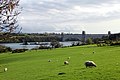
 Farmland looking towards Menai Suspension Bridge - geograph.org.uk - 2389732.jpg 1 024 × 683; 160 KB
-
 Farmland near Menai Strait, Anglesey - geograph.org.uk - 2390057.jpg 1 024 × 683; 142 KB
-
 Farmland near Menai Strait, Anglesey - geograph.org.uk - 2390063.jpg 1 024 × 683; 145 KB
-
 Farmland, Anglesey - geograph.org.uk - 2382119.jpg 1 024 × 683; 118 KB
-
 Farmland, Anglesey - geograph.org.uk - 2382144.jpg 1 024 × 683; 154 KB
-
 Ffordd Penmynydd, Llanfair Pwllgwyngyll - geograph.org.uk - 2425587.jpg 640 × 480; 194 KB
-
 Ffordd Penmynydd, Llanfair Pwllgwyngyll - geograph.org.uk - 2425600.jpg 640 × 480; 187 KB
-
Fr-17112020-Llanfairpwllgwyngyllgogerychwyrndrobwllllantysiliogogogoch.ogg 8 min 1 s; 6,57 MB
-
 Gates at White Lodge.jpg 3 456 × 2 304; 723 KB
-

-
 Graveyard at St Mary's Church - geograph.org.uk - 2109507.jpg 640 × 480; 102 KB
-
 Gully in stream at St Mary's Church - geograph.org.uk - 2109513.jpg 640 × 480; 101 KB
-
 Gwesty Carreg Mon - geograph.org.uk - 786341.jpg 640 × 480; 78 KB
-
 Hen Felin.jpg 3 456 × 2 304; 4,5 MB
-
 Holyhead Road (A5), Llanfairpwll - geograph.org.uk - 805224.jpg 640 × 480; 37 KB
-

-
-

-
 Llanfair P.G. (10456806386).jpg 3 409 × 1 824; 3,18 MB
-
 Llanfair P.G. (10456818755).jpg 2 958 × 2 428; 4,38 MB
-
 Llanfair PG - 1980 - geograph.org.uk - 2455620.jpg 2 272 × 1 515; 949 KB
-
 Llanfair PG.png 4 871 × 310; 33 KB
-

-
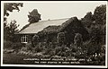
 Llanfair Pwllgwyngyll roofscape (1) - geograph.org.uk - 1058331.jpg 640 × 480; 154 KB
-
 Llanfair Pwllgwyngyll roofscape (2) - geograph.org.uk - 1058335.jpg 640 × 480; 156 KB
-
 Llanfairpwll Level Crossing (Eastbound).jpg 4 032 × 3 024; 8,91 MB
-
 Llanfairpwll Level Crossing.jpg 4 032 × 3 024; 17,72 MB
-
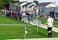 Llanfairpwll v Nefyn Town (10522301243).jpg 2 791 × 1 955; 3,62 MB
-
-
 Llanfairpwllgwyngyll sticker advertising Tyn Lon Garage.JPG 2 592 × 1 944; 1,74 MB
-
 Llanfairpwllgwyngyllgogerychwyrndrobwllllantysiliogogogoch 2010.jpg 1 745 × 1 071; 978 KB
-
 Llanfairpwllgwyngyllgogerychwyrndrobwllllantysiliogogogoch Postmark.jpg 389 × 454; 144 KB
-

-
 LlanfairSign.jpg 1 560 × 878; 356 KB
-
 Lodge to Plas Llanfair - geograph.org.uk - 786338.jpg 640 × 426; 73 KB
-
 Lon Pant, Llanfairpwllgwyngyll. - geograph.org.uk - 114626.jpg 640 × 437; 63 KB
-

-
 Lon Refail near Bryn-eira Farm - geograph.org.uk - 1431265.jpg 640 × 444; 89 KB
-
 Lon Refail, Llanfairpwllgwyngyll - geograph.org.uk - 1431216.jpg 640 × 480; 86 KB
-
 Lon y Wylan, Llanfairpwll - geograph.org.uk - 1431350.jpg 640 × 404; 55 KB
-

-

-
 Map of Anglesey OS Map name 019-SW, Ordnance Survey, 1888-1891.jpg 5 376 × 3 576; 3,67 MB
-
 Marine walk, Plasnewydd - (north Wales).jpeg 900 × 653; 317 KB
-
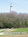
 Marquis of Anglesey's column - geograph.org.uk - 2597229.jpg 2 112 × 2 816; 1,42 MB
-
 Menai Strait and Snowdonia from viewpoint near Llanfair Pwllgwyngyll (7610).jpg 4 288 × 2 848; 4,94 MB
-
 Menai Strait and Snowdonia from viewpoint near Llanfair Pwllgwyngyll (7611).jpg 4 288 × 2 848; 5,18 MB
-
 Menai Strait and Snowdonia from viewpoint near Llanfair Pwllgwyngyll (7612).jpg 4 288 × 2 848; 5,16 MB
-
 Menai Strait and Snowdonia from viewpoint near Llanfair Pwllgwyngyll (7615).jpg 4 288 × 2 848; 5,37 MB
-
 Menai Strait and Snowdonia from viewpoint near Llanfair Pwllgwyngyll (7628).jpg 4 288 × 2 848; 5,06 MB
-
 Menai Strait with Suspension Bridge, Anglesey - geograph.org.uk - 2390269.jpg 1 024 × 683; 173 KB
-
 Menai Strait with Suspension Bridge, Anglesey - geograph.org.uk - 2390283.jpg 1 024 × 683; 146 KB
-
 Menai Suspension Bridge - geograph.org.uk - 640352.jpg 640 × 427; 109 KB
-
 Monkey Puzzle tree, Llanfairpwll - geograph.org.uk - 786187.jpg 480 × 640; 103 KB
-
 Mouth of Afon Braint - geograph.org.uk - 2508246.jpg 1 024 × 683; 195 KB
-
 Nelson looking towards Plas Newydd - geograph.org.uk - 785656.jpg 480 × 640; 84 KB
-
 Nelson overlooking Menai Straits - geograph.org.uk - 2109494.jpg 640 × 480; 58 KB
-

-

-
 Parade of shops at Llanfair PG - geograph.org.uk - 2485246.jpg 3 296 × 2 472; 1,93 MB
-
 Parana pine at the crossroads - geograph.org.uk - 388635.jpg 640 × 473; 150 KB
-
 Pasture above Gaerwen Farm - geograph.org.uk - 969756.jpg 640 × 426; 44 KB
-
 Pasture field by the Menai Strait - geograph.org.uk - 2138984.jpg 1 500 × 1 000; 184 KB
-
 Pen y Berth road, Llanfairpwll - geograph.org.uk - 1431246.jpg 640 × 480; 68 KB
-
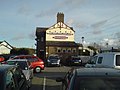
 Penrhos Arms opposite the station - geograph.org.uk - 2109522.jpg 640 × 480; 72 KB
-
 Photograph of Britain's first Women's Institute, 1915. (22145847964).jpg 4 134 × 2 639; 1,4 MB
-
 Pier at Pwll Fanogl - geograph.org.uk - 117751.jpg 640 × 480; 128 KB
-
 Plaque on Britannia Bridge memorial - geograph.org.uk - 2109474.jpg 480 × 640; 69 KB
-
 Plas Britannia - geograph.org.uk - 1430123.jpg 640 × 480; 130 KB
-
 Plas Britannia - geograph.org.uk - 785650.jpg 640 × 480; 77 KB
-

-
 Plas Llanfair - geograph.org.uk - 365856.jpg 640 × 480; 76 KB
-
 Plas Llanfair - geograph.org.uk - 786173.jpg 480 × 640; 103 KB
-
 Plas Mona Care Home, Llanfairpwll - geograph.org.uk - 1431364.jpg 640 × 480; 58 KB
-
 Pont Britannia from Pwll-fanogl - geograph.org.uk - 2021693.jpg 4 000 × 3 000; 6,7 MB
-
 Pont Britannia, Anglesey - geograph.org.uk - 2389752.jpg 1 024 × 683; 156 KB
-
 Pont Britannia, Anglesey - geograph.org.uk - 2390261.jpg 1 024 × 683; 157 KB
-

-
-

-
-
 Pwll Fanogl - geograph.org.uk - 786176.jpg 640 × 480; 81 KB
-
 Pwll Fanogl - geograph.org.uk - 786179.jpg 640 × 480; 113 KB
-
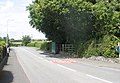
 Rails towards Holyhead - geograph.org.uk - 2109526.jpg 640 × 480; 88 KB
-
 Railway line at Llanfairpwll - geograph.org.uk - 786183.jpg 480 × 640; 98 KB
-

-
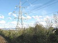
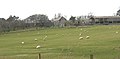
 Sheep grazing beneath power lines - geograph.org.uk - 793458.jpg 640 × 471; 49 KB
-

-
 Shop in Wales.20170416 181536.jpg 2 560 × 1 536; 1,29 MB
-
 Slow moving traffic ahead - geograph.org.uk - 367876.jpg 640 × 480; 118 KB
-
 Snowdonia from viewpoint near Llanfair Pwllgwyngyll (7627).jpg 4 288 × 2 848; 5,23 MB
-
 St Mary's church Llanfair P.G. - geograph.org.uk - 2109470.jpg 640 × 480; 80 KB
-
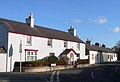
 Terraced houses in Ffordd Penmynydd - geograph.org.uk - 943694.jpg 640 × 480; 45 KB
-
 The A5 at Llanfairpwll - geograph.org.uk - 943672.jpg 640 × 480; 58 KB
-

-

-

-

-
-

-
-

-

-

-

-
-
 The Llanfair PG Bowling Green - geograph.org.uk - 943688.jpg 640 × 375; 31 KB
-

-
 The Lon Refail-Lon Pant crossroads - geograph.org.uk - 1431222.jpg 640 × 413; 57 KB
-

-

-

-
 The new Lon Dyfnia - geograph.org.uk - 943714.jpg 640 × 328; 45 KB
-

-
 The Penrhos Arms at Llanfair PG - geograph.org.uk - 2485243.jpg 3 296 × 2 472; 1,93 MB
-
 The Plas Penrhyn Boathouse - geograph.org.uk - 524613.jpg 640 × 480; 97 KB
-

-
 The station at Llanfairpwll - geograph.org.uk - 2550347.jpg 640 × 480; 64 KB
-

-
-

-
 View north-eastwards along Lon Pant - geograph.org.uk - 1431225.jpg 640 × 480; 69 KB
-
-

-
 View on the Menai.jpeg 900 × 664; 347 KB
-
-
 View towards Britannia Bridge - geograph.org.uk - 2597220.jpg 2 816 × 2 112; 1,43 MB
-

-

-
 War Memorial at Llanfair PG - geograph.org.uk - 2485240.jpg 2 472 × 3 296; 1,89 MB
-
 War memorial Llanddwyn Island - panoramio.jpg 3 200 × 2 368; 1,97 MB
-
 Waterfowl in an ornamental pool - geograph.org.uk - 367882.jpg 640 × 437; 98 KB
-
 Westbound A55 from Ffordd Penmynydd - geograph.org.uk - 2425594.jpg 640 × 480; 162 KB
-
 White Lodge, Llanfair PG.jpg 3 456 × 2 304; 798 KB
-
 Y Garnedd estate, Llanfairpwll - geograph.org.uk - 1431353.jpg 640 × 480; 53 KB
-

-
 Ynys Gorad Goch-from the bus. - geograph.org.uk - 972963.jpg 640 × 480; 78 KB
-
 Ynys Gored Goch - geograph.org.uk - 1885151.jpg 640 × 427; 268 KB
-
 Ynys Gored Goch - geograph.org.uk - 2103746.jpg 465 × 640; 300 KB
-
 Ynys Gored Goch in the Menai Strait - geograph.org.uk - 2138980.jpg 1 500 × 1 000; 228 KB
-
 Ynys Gored Goch, Menai Strait - geograph.org.uk - 2382138.jpg 1 024 × 683; 153 KB
-
 A glimpse of the new hall at Y Faenol - geograph.org.uk - 364969.jpg 640 × 480; 106 KB
-

-
 A strong tidal race near Pont Britannia - geograph.org.uk - 438911.jpg 640 × 480; 158 KB
-
 A tidal creek and wooded island - geograph.org.uk - 438888.jpg 640 × 480; 110 KB
-
 An old winch alongside the Coed Mor path - geograph.org.uk - 438879.jpg 640 × 480; 128 KB
-
 An ornamental lake - geograph.org.uk - 367878.jpg 640 × 480; 91 KB
-

-
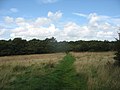
 Anglesey Coastal Path - geograph.org.uk - 785664.jpg 480 × 640; 106 KB
-
-
 Anglesey Coastal Walk - geograph.org.uk - 785647.jpg 480 × 640; 152 KB
-
 Approaching the Faenol's Jacobean barn - geograph.org.uk - 364458.jpg 640 × 480; 103 KB
-

-

-
 British Rail owned bridge access track - geograph.org.uk - 388448.jpg 640 × 480; 186 KB
-
 Bungalows in Ffordd Teifion - geograph.org.uk - 1431272.jpg 640 × 464; 45 KB
-
 Bungalows in Holyhead Road - geograph.org.uk - 437679.jpg 640 × 447; 107 KB
-
 Bungalows on Y Wern estate - geograph.org.uk - 1431260.jpg 640 × 480; 62 KB
-
-
 Coed Mor - geograph.org.uk - 438884.jpg 480 × 640; 163 KB
-
 Coed y Faenol - Vaynol Woods - geograph.org.uk - 365453.jpg 640 × 480; 168 KB
-
 Coed y Faenol Woodland - geograph.org.uk - 550806.jpg 640 × 324; 60 KB
-
 Collen Wen Estate, Llanfairpwll - geograph.org.uk - 1431346.jpg 640 × 420; 59 KB
-

-
 Cottages at Aber Braint, Ynys Mon - geograph.org.uk - 365780.jpg 640 × 480; 82 KB
-
 Creek east of Pont Britannia - geograph.org.uk - 1430082.jpg 640 × 480; 69 KB
-
 Cribben Rock - geograph.org.uk - 82694.jpg 640 × 480; 120 KB
-
 Entrance and car park at Twr Marcwis - geograph.org.uk - 437517.jpg 494 × 640; 128 KB
-
 Farm buildings at Y Faenol - geograph.org.uk - 365447.jpg 640 × 317; 48 KB
-
 Feeding the swans - geograph.org.uk - 367146.jpg 640 × 480; 132 KB
-

.jpg)


.jpg)

.jpg)


,_Llanfairpwll_-_geograph.org.uk_-_805224.jpg)


.jpg)
.jpg)


_-_geograph.org.uk_-_1058331.jpg)
.jpg)

.jpg)
_-_geograph.org.uk_-_2684228.jpg)


.jpeg)

.jpg)
.jpg)
.jpg)
.jpg)
.jpg)


.jpg)


_-_geograph.org.uk_-_2103738.jpg)


.jpg)


_-_geograph.org.uk_-_1431551.jpg)
_-_geograph.org.uk_-_805399.jpg)


