Category:Llanyblodwel
Aller à la navigation
Aller à la recherche
village britannique  | |||||
| Téléverser des médias | |||||
| Nature de l’élément | |||||
|---|---|---|---|---|---|
| Lieu | Shropshire, Midlands de l'Ouest, Angleterre | ||||
 | |||||
Sous-catégories
Cette catégorie comprend 3 sous-catégories, dont les 3 ci-dessous.
L
M
Média dans la catégorie « Llanyblodwel »
Cette catégorie comprend 210 fichiers, dont les 200 ci-dessous.
(page précédente) (page suivante)-
 A diesel unit undergoing restoration - geograph.org.uk - 5807524.jpg 640 × 427 ; 66 kio
-
 A483 at Llynclys - geograph.org.uk - 5503432.jpg 640 × 427 ; 374 kio
-
 A483 at Llynclys Hall Farm - geograph.org.uk - 3291300.jpg 640 × 480 ; 39 kio
-
 A495 east of Porth-y-waen - geograph.org.uk - 3951555.jpg 640 × 481 ; 69 kio
-
 A495 lights for Aber Tanat Farm cattle - geograph.org.uk - 3951565.jpg 640 × 481 ; 57 kio
-
 A495 north towards railway bridge - geograph.org.uk - 2306856.jpg 640 × 480 ; 103 kio
-

-
 A495 southbound at sharp bend - geograph.org.uk - 3951561.jpg 640 × 481 ; 46 kio
-
 A495 west of Llynclys - geograph.org.uk - 3951553.jpg 640 × 481 ; 48 kio
-
 A495 west of Porth-y-waen - geograph.org.uk - 3951559.jpg 640 × 480 ; 78 kio
-
 Across fields to Caravan Site - geograph.org.uk - 1570198.jpg 640 × 480 ; 74 kio
-
 Afon Tanat - geograph.org.uk - 552175.jpg 640 × 427 ; 162 kio
-
 Along Cefn Lane in Porth-y-waen village - geograph.org.uk - 5896258.jpg 1 469 × 1 102 ; 595 kio
-
 Along the A495 north of Llynclys Hill - geograph.org.uk - 5086832.jpg 1 469 × 1 102 ; 843 kio
-
 Approaching the crossroads at Llynclys - geograph.org.uk - 1858439.jpg 1 024 × 768 ; 202 kio
-
 B4396 west of Moreton Crossroads - geograph.org.uk - 3232598.jpg 640 × 378 ; 38 kio
-
 Blodwel Bank - the road to Treflach - geograph.org.uk - 5898494.jpg 1 469 × 1 102 ; 622 kio
-
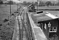 Blodwell Junction Station 1836071 cf4580bb.jpg 640 × 436 ; 156 kio
-
 Bridge over the Afon Tanat - geograph.org.uk - 1983058.jpg 640 × 480 ; 190 kio
-

-
 Cefn Lane - geograph.org.uk - 910298.jpg 640 × 480 ; 86 kio
-
 Cefn Lane crosses Blodwel Bank - geograph.org.uk - 5896260.jpg 1 469 × 1 102 ; 780 kio
-
 Chocolate, chewing gum or a cigar - geograph.org.uk - 5807463.jpg 640 × 427 ; 101 kio
-
 Class 101 diesel multiple units - geograph.org.uk - 5807480.jpg 640 × 427 ; 70 kio
-
 Crickheath Tramways bridge, at Llynclys Station - geograph.org.uk - 1858418.jpg 1 024 × 768 ; 248 kio
-
 Crossing a disused railway line - geograph.org.uk - 3825232.jpg 640 × 480 ; 127 kio
-

-

-
 Disused railway bridge - geograph.org.uk - 559837.jpg 640 × 480 ; 57 kio
-
 Disused railway crossing - geograph.org.uk - 1731965.jpg 640 × 480 ; 89 kio
-

-
 Disused railway, Porth-y-Waen - geograph.org.uk - 6237140.jpg 768 × 1 024 ; 486 kio
-
 Edwardian shelter - geograph.org.uk - 555783.jpg 640 × 480 ; 134 kio
-
 English-Electric 0-6-0DH at Llynclys - geograph.org.uk - 5814880.jpg 640 × 427 ; 98 kio
-
 Entrance to Bryn Farm - geograph.org.uk - 3540351.jpg 640 × 480 ; 84 kio
-
 Entrance to Porth y Waen - geograph.org.uk - 1858841.jpg 1 024 × 768 ; 159 kio
-
 Entrance to quarry, off A495 - geograph.org.uk - 1858833.jpg 1 024 × 768 ; 193 kio
-
 Entrance to the Tanat Valley Railway - geograph.org.uk - 1858867.jpg 1 024 × 768 ; 264 kio
-
 Ford at Sychtyn - geograph.org.uk - 4041522.jpg 3 872 × 2 592 ; 4,72 Mio
-
 Ford on a country lane - geograph.org.uk - 1859033.jpg 1 024 × 768 ; 232 kio
-
 Former School and schoolhouse, Llanyblodwel - geograph.org.uk - 6293297.jpg 640 × 556 ; 113 kio
-
 Former schoolhouse and school, Llanyblodwel - geograph.org.uk - 6293310.jpg 640 × 498 ; 91 kio
-
 Former Toll House near Llanyblodwel.jpg 1 024 × 768 ; 175 kio
-
 Further restoration work at Crickheath Wharf - geograph.org.uk - 525879.jpg 640 × 480 ; 123 kio
-
 Glyn Cottage from Ty-issa road - geograph.org.uk - 2120015.jpg 640 × 480 ; 127 kio
-
-
 Height plate - Oswestry FBM - geograph.org.uk - 5086859.jpg 1 370 × 1 028 ; 715 kio
-
 Hillside and farmhouse - geograph.org.uk - 1858880.jpg 1 024 × 768 ; 238 kio
-
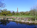 Hoffmann Chimney, Llanymynech.jpg 1 600 × 1 200 ; 1,67 Mio
-
 Horse Shoe Inn, Llanyblodwel.JPG 6 000 × 4 000 ; 9,81 Mio
-
 Horseshoe Inn Llanyblodwell - geograph.org.uk - 1802407.jpg 640 × 480 ; 103 kio
-
 Houses in Llynclys - geograph.org.uk - 1858427.jpg 1 024 × 768 ; 126 kio
-
 Hut in the woods, Llanyblodwel - geograph.org.uk - 6237142.jpg 1 024 × 768 ; 1,03 Mio
-
 Industrial monorail collection - geograph.org.uk - 6227798.jpg 640 × 427 ; 136 kio
-
 Lane passing church from Ivy Cottage - geograph.org.uk - 3014985.jpg 640 × 488 ; 94 kio
-

-
 Level Crossing on Offa's Dyke National Trail - geograph.org.uk - 3825203.jpg 640 × 480 ; 117 kio
-
 Lime kilns Nant Mawr Visitor Centre - geograph.org.uk - 6236513.jpg 427 × 640 ; 110 kio
-
 Llamas in field by Whitehaven - geograph.org.uk - 555758.jpg 640 × 480 ; 98 kio
-
 Llanyblodwel Bridge - geograph.org.uk - 6293316.jpg 640 × 480 ; 107 kio
-
 Llanyblodwel townships.svg 512 × 394 ; 20 kio
-
 Llanyblodwel village sign - geograph.org.uk - 1894964.jpg 640 × 480 ; 79 kio
-
 Llanyblodwel, St. Michael's Church - geograph.org.uk - 5740562.jpg 4 712 × 3 144 ; 2,87 Mio
-
 Llanyblodwel, St. Michael's Church - geograph.org.uk - 5740576.jpg 4 912 × 7 360 ; 6,54 Mio
-
 Llanyblodwel, St. Michael's Church, Altar 1 - geograph.org.uk - 5740617.jpg 7 353 × 4 907 ; 6,93 Mio
-
 Llanyblodwel, St. Michael's Church, Altar 2 - geograph.org.uk - 5740622.jpg 7 050 × 4 705 ; 6,65 Mio
-
 Llanyblodwel, St. Michael's Church, Altar 3 - geograph.org.uk - 5740625.jpg 6 633 × 4 428 ; 7,09 Mio
-
 Llanyblodwel, St. Michael's Church, Altar 4 - geograph.org.uk - 5740629.jpg 7 360 × 4 912 ; 6,53 Mio
-
 Llanyblodwel, St. Michael's Church, Brigeman memorial - geograph.org.uk - 5740867.jpg 6 238 × 4 163 ; 5,25 Mio
-
 Llanyblodwel, St. Michael's Church, Brigeman memorial - geograph.org.uk - 5740871.jpg 4 733 × 7 091 ; 5,98 Mio
-
 Llanyblodwel, St. Michael's Church, Chancel arch detail - geograph.org.uk - 5740872.jpg 7 360 × 4 912 ; 6,99 Mio
-
 Llanyblodwel, St. Michael's Church, From nave to chancel - geograph.org.uk - 5740667.jpg 7 174 × 4 787 ; 5,6 Mio
-

-

-
 Llanyblodwel, St. Michael's Church, Lych gate - geograph.org.uk - 5740584.jpg 7 360 × 4 912 ; 7,63 Mio
-
 Llanyblodwel, St. Michael's Church, Nave arches - geograph.org.uk - 5740607.jpg 7 360 × 4 912 ; 6,6 Mio
-
 Llanyblodwel, St. Michael's Church, Nave column - geograph.org.uk - 5740609.jpg 4 912 × 7 360 ; 6,48 Mio
-
 Llanyblodwel, St. Michael's Church, Nave columns - geograph.org.uk - 5740686.jpg 7 360 × 4 912 ; 6,21 Mio
-
 Llanyblodwel, St. Michael's Church, Roof 1 - geograph.org.uk - 5740634.jpg 6 068 × 4 050 ; 3,85 Mio
-
 Llanyblodwel, St. Michael's Church, Roof 2 - geograph.org.uk - 5740637.jpg 6 216 × 4 148 ; 4,81 Mio
-
 Llanyblodwel, St. Michael's Church, Roof 3 (detail and date) - geograph.org.uk - 5740643.jpg 6 973 × 4 653 ; 5,05 Mio
-
 Llanyblodwel, St. Michael's Church, South window painting detail - geograph.org.uk - 5740873.jpg 4 912 × 7 360 ; 6,25 Mio
-
 Llanyblodwel, St. Michael's Church, Southern aspect - geograph.org.uk - 5740580.jpg 7 360 × 4 912 ; 5,68 Mio
-
 Llanyblodwel, St. Michael's Church, Stained glass window - geograph.org.uk - 5740681.jpg 4 912 × 7 360 ; 6,5 Mio
-
 Llanyblodwel, St. Michael's Church, The font - geograph.org.uk - 5740599.jpg 3 788 × 5 676 ; 4,09 Mio
-
 Llanyblodwel, St. Michael's Church, The nave - geograph.org.uk - 5740591.jpg 7 360 × 4 912 ; 5,86 Mio
-
 Llanyblodwel, St. Michael's Church, The organ - geograph.org.uk - 5740669.jpg 7 360 × 4 912 ; 6,19 Mio
-
 Llanyblodwel, St. Michael's Church, The organ - geograph.org.uk - 5740673.jpg 7 360 × 4 912 ; 6,27 Mio
-
 Llanyblodwel, St. Michael's Church, Wall scripture 1 - geograph.org.uk - 5740649.jpg 7 094 × 4 735 ; 5,39 Mio
-
 Llanyblodwel, St. Michael's Church, Wall scripture 2 - geograph.org.uk - 5740653.jpg 6 193 × 4 133 ; 4,76 Mio
-
 Llanyblodwel, St. Michael's Church, Wall scripture 3 - geograph.org.uk - 5740660.jpg 7 016 × 4 681 ; 6,7 Mio
-
 Llanyblodwel, St. Michael's Church, Wall scripture 4 - geograph.org.uk - 5740863.jpg 7 360 × 4 912 ; 6,94 Mio
-
 Llynclys crossroads and the White Lion - geograph.org.uk - 5535752.jpg 640 × 461 ; 58 kio
-
 Llynclys crossroads and the White Lion inn - geograph.org.uk - 5086861.jpg 1 469 × 1 102 ; 454 kio
-
 Llynclys Crossroads entrance sign - geograph.org.uk - 2404638.jpg 640 × 412 ; 66 kio
-
 Llynclys South railway station, Shropshire - geograph.org.uk - 5428742.jpg 1 600 × 1 200 ; 347 kio
-
 Minor road leaving the B4396 at Llanybodwel - geograph.org.uk - 5234002.jpg 4 000 × 3 000 ; 2,88 Mio
-
 Minor road to Nantmawr and Treflach - geograph.org.uk - 902455.jpg 640 × 480 ; 87 kio
-
 Morton Common Lane railway bridge - geograph.org.uk - 3855532.jpg 1 600 × 1 092 ; 295 kio
-
 Nantmawr Chapel - geograph.org.uk - 6276879.jpg 5 184 × 3 888 ; 5,88 Mio
-
 No further just yet - geograph.org.uk - 1858395.jpg 1 024 × 768 ; 208 kio
-
 Offa's Dyke Footpath on Blodwel Rock - geograph.org.uk - 526835.jpg 640 × 480 ; 158 kio
-

-

-
 Old house and drive - geograph.org.uk - 1858827.jpg 1 024 × 768 ; 225 kio
-
 Old railway bridge at Llanyblodwel - geograph.org.uk - 1983054.jpg 640 × 480 ; 186 kio
-
 Old station sign at Llynclys - geograph.org.uk - 5806593.jpg 640 × 427 ; 77 kio
-
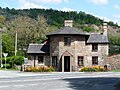
 Old Toll House, Llanyblodwel - geograph.org.uk - 6115356.jpg 700 × 525 ; 327 kio
-
 Old Toll House, Llynclys - geograph.org.uk - 6114650.jpg 800 × 600 ; 351 kio
-
 Old Toll House, Porth-y-Waen - geograph.org.uk - 6115030.jpg 800 × 600 ; 387 kio
-
 Old Toll House, Wern Isaf - geograph.org.uk - 6114680.jpg 800 × 600 ; 370 kio
-
 Old track to Carreghofa Hall - geograph.org.uk - 2306853.jpg 640 × 480 ; 80 kio
-
 Ordnance Survey Cut Mark - geograph.org.uk - 5915678.jpg 1 024 × 669 ; 316 kio
-
 Ordnance Survey Flush Bracket 2648 - geograph.org.uk - 4743019.jpg 4 000 × 3 000 ; 2,51 Mio
-
 Ordnance Survey Flush Bracket G3029 - geograph.org.uk - 5234016.jpg 4 000 × 3 000 ; 2,86 Mio
-
 Ordnance Survey Flush Bracket S0828 - geograph.org.uk - 5233999.jpg 3 545 × 2 659 ; 2,07 Mio
-
 OS benchmark - Porth-y-waen, gatehouse - geograph.org.uk - 5898497.jpg 857 × 1 142 ; 509 kio
-
 OS flush bracket - Llynclys, The White Lion inn - geograph.org.uk - 5086872.jpg 1 008 × 1 342 ; 519 kio
-
 OS Flush Bracket - Porth-y-waen - geograph.org.uk - 5898544.jpg 1 102 × 1 469 ; 816 kio
-
 Oswestry FBM - geograph.org.uk - 5086852.jpg 1 102 × 1 469 ; 983 kio
-
 Pen-Isa r-llan Farm shop - geograph.org.uk - 780522.jpg 640 × 426 ; 60 kio
-
 Pen-Isa r-llan Farm shop entrance - geograph.org.uk - 780525.jpg 640 × 426 ; 60 kio
-
 Porth-Y-Waen - geograph.org.uk - 1802364.jpg 640 × 480 ; 109 kio
-
 Porth-y-waen, Lime Kiln - geograph.org.uk - 5496018.jpg 1 024 × 745 ; 147 kio
-
 Prospect farm Water Treatment works - geograph.org.uk - 1722534.jpg 640 × 480 ; 71 kio
-
 Quarry wagons - geograph.org.uk - 5807861.jpg 640 × 427 ; 101 kio
-
 Refreshment carriage at Llynclys - geograph.org.uk - 5806599.jpg 640 × 427 ; 81 kio
-
 Remains of Crickheath Tramways bridge - geograph.org.uk - 5807575.jpg 427 × 640 ; 117 kio
-
 Restricted byway near Cefn Ucha - geograph.org.uk - 559407.jpg 640 × 480 ; 94 kio
-
 Right bank of the Tanat at Llanyblodwel - geograph.org.uk - 6293327.jpg 640 × 379 ; 79 kio
-
 River Tanat downstream - geograph.org.uk - 1802405.jpg 640 × 480 ; 119 kio
-
 River Tanat upstream from Llanyblodwell bridge - geograph.org.uk - 1802409.jpg 640 × 480 ; 116 kio
-
 Road works near Llanyblodwel - geograph.org.uk - 3562442.jpg 3 872 × 2 592 ; 3,68 Mio
-
 Roadsigns at Llanyblodwel - geograph.org.uk - 559811.jpg 640 × 481 ; 67 kio
-
 Rolling stock at Llynclys - geograph.org.uk - 3666001.jpg 1 500 × 1 000 ; 1,56 Mio
-
 Rolling stock undergoing restoration - geograph.org.uk - 5814794.jpg 640 × 427 ; 99 kio
-
 School house and schoolmaster's house, Llanyblodwell 81.JPG 6 000 × 4 000 ; 10,28 Mio
-
 School house and schoolmaster's house, Llanyblodwell 84.JPG 6 000 × 4 000 ; 9,13 Mio
-
 School house and schoolmaster's house, Llanyblodwell 94.JPG 6 000 × 4 000 ; 9,69 Mio
-
 Section of railway under Llynclys Hill - geograph.org.uk - 1731966.jpg 640 × 480 ; 132 kio
-
 Sign of the season - geograph.org.uk - 555762.jpg 640 × 480 ; 109 kio
-
 St Michael the Archangel manse, Llanyblodwel, Shropshire.jpg 4 896 × 2 752 ; 5,7 Mio
-
 St Michael's Church, Llanyblodwel - geograph.org.uk - 6259152.jpg 5 184 × 3 888 ; 4,1 Mio
-
 Sweeney Fen Ford - geograph.org.uk - 4041465.jpg 3 872 × 2 592 ; 4,8 Mio
-
 Tanat House, Llanyblodwel - geograph.org.uk - 159798.jpg 432 × 324 ; 67 kio
-
 Tanat Valley - geograph.org.uk - 2104069.jpg 1 600 × 1 200 ; 573 kio
-
 Tanat Valley Light Railway - diesel shunter - geograph.org.uk - 6235944.jpg 640 × 427 ; 140 kio
-
 Tanat Valley Light Railway - DMUs - geograph.org.uk - 6235923.jpg 640 × 427 ; 124 kio
-
 Tanat Valley Light Railway - easy rider - geograph.org.uk - 6234632.jpg 640 × 427 ; 138 kio
-
 Tanat Valley Light Railway - geograph.org.uk - 6236505.jpg 640 × 422 ; 144 kio
-
 Tanat Valley Light Railway - miscellany - geograph.org.uk - 6228176.jpg 640 × 427 ; 159 kio
-
 Tanat Valley Light Railway - Monoloco - geograph.org.uk - 6227824.jpg 640 × 417 ; 138 kio
-

-

-
 Tanat Valley Light Railway - overgrown - geograph.org.uk - 6235917.jpg 640 × 427 ; 146 kio
-
 The abutments of the former tramway bridge - geograph.org.uk - 5807648.jpg 640 × 427 ; 113 kio
-
 The Church of St Michael the Archangel at Llanybodwel - geograph.org.uk - 5234008.jpg 4 000 × 3 000 ; 2,04 Mio
-
 The end of the line at Llynclys - geograph.org.uk - 5803699.jpg 640 × 427 ; 92 kio
-
 The end of the line, for now - geograph.org.uk - 1858344.jpg 1 024 × 768 ; 213 kio
-
 The former station at Llynclys (North) - geograph.org.uk - 5807629.jpg 640 × 427 ; 131 kio
-
 The lane down the hill - geograph.org.uk - 1858886.jpg 1 024 × 768 ; 232 kio
-
 The lane up the hill - geograph.org.uk - 1858876.jpg 1 024 × 768 ; 195 kio
-

-
 The old lane to Carreghofa Hall - geograph.org.uk - 1983039.jpg 614 × 819 ; 176 kio
-
 The platform, Llynclys Station - geograph.org.uk - 1858392.jpg 1 024 × 768 ; 135 kio
-
 The rear of the White Lion - geograph.org.uk - 5807634.jpg 640 × 427 ; 76 kio
-

-
 The White Lion inn at Llynclys - geograph.org.uk - 4481702.jpg 1 600 × 1 066 ; 1,12 Mio
-
 The White Lion pub at Llynclys, Shropshire - geograph.org.uk - 4240539.jpg 640 × 360 ; 40 kio
-
 The White Lion, Llynclys - geograph.org.uk - 3562453.jpg 3 872 × 2 592 ; 2,9 Mio
-
 The White Lion, Llynclys - geograph.org.uk - 5503430.jpg 640 × 427 ; 342 kio
-
 Trace of a level crossing - geograph.org.uk - 559460.jpg 640 × 480 ; 98 kio
-
 Tree at the foot of Blodwel Bank - geograph.org.uk - 1858853.jpg 1 024 × 768 ; 160 kio
-
 Ty Isaf from minor road to Nantmawr - geograph.org.uk - 1722514.jpg 640 × 480 ; 66 kio
-
 Ty'n-Y-Coed entrance - geograph.org.uk - 1840772.jpg 640 × 480 ; 93 kio
-
 Village track between Cefn Lane and Porth Y Waen - geograph.org.uk - 5896257.jpg 1 469 × 1 102 ; 750 kio
-
 Warning sign on bridge over Tanat, Llanyblodwell.JPG 6 000 × 4 000 ; 9,31 Mio
-
 White Lion - geograph.org.uk - 5805027.jpg 640 × 427 ; 84 kio
-
 Access lane for Plas Onn - geograph.org.uk - 559400.jpg 640 × 480 ; 80 kio
-

-
 Beef stots grazing at Craig-llwyn - geograph.org.uk - 555780.jpg 640 × 480 ; 83 kio
-
 Classic 1950s Semi-detached house - geograph.org.uk - 568019.jpg 640 × 480 ; 102 kio
-
 Cottage and outbuildings - geograph.org.uk - 559737.jpg 640 × 480 ; 94 kio
-
 Cottage in the valley at Nantmawr - geograph.org.uk - 548852.jpg 640 × 480 ; 138 kio
-
 Crag beside the road - geograph.org.uk - 656748.jpg 640 × 428 ; 86 kio
-
 Dairy Farm at Blodwel Hall - geograph.org.uk - 526844.jpg 640 × 480 ; 113 kio
-
 Dairy heifers grazing at Bank Fm - geograph.org.uk - 548999.jpg 640 × 480 ; 70 kio
-
 Field barn and bales - geograph.org.uk - 559766.jpg 640 × 482 ; 76 kio
-
 Ford by Sweeney Fen - geograph.org.uk - 555765.jpg 640 × 480 ; 91 kio
-
 Gateway to Gwern Ddu - geograph.org.uk - 568121.jpg 640 × 480 ; 107 kio
-
 Glyn - cottage and wooded hillside - geograph.org.uk - 568078.jpg 640 × 480 ; 57 kio
-
 Hill above Nantmawr - geograph.org.uk - 548839.jpg 640 × 480 ; 119 kio
-
 Hillside near Llanyblodwel - geograph.org.uk - 552159.jpg 640 × 427 ; 134 kio
-
 House near Whitehaven - geograph.org.uk - 548866.jpg 640 × 480 ; 139 kio
-
 Kerry Hill sheep at Pentreheylin Hall - geograph.org.uk - 572300.jpg 640 × 480 ; 98 kio
-
 Lane with Mynydd Mawr in the background - geograph.org.uk - 559426.jpg 640 × 480 ; 64 kio
-
 Level crossing near Porth-y-Waen - geograph.org.uk - 390069.jpg 640 × 480 ; 109 kio
-

-
 Moelydd - geograph.org.uk - 343018.jpg 640 × 406 ; 71 kio
-
 New bungalows beside the Montgomery Canal - geograph.org.uk - 651094.jpg 640 × 428 ; 87 kio


_-_geograph.org.uk_-_5740565.jpg)
_-_geograph.org.uk_-_5740570.jpg)


_-_geograph.org.uk_-_5740643.jpg)


_-_geograph.org.uk_-_5807629.jpg)


