Category:Lonan
Vai alla navigazione
Vai alla ricerca
parrocchia dell'Isola di Man _church_-_geograph.org.uk_-_32555.jpg) | |||||
| Carica un file multimediale | |||||
| Istanza di |
| ||||
|---|---|---|---|---|---|
| Luogo | isola di Man, Mare d'Irlanda | ||||
| sito web ufficiale | |||||
 | |||||
File nella categoria "Lonan"
Questa categoria contiene 200 file, indicati di seguito, su un totale di 404.
(pagina precedente) (pagina successiva)-
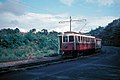
 "Otter" at Lhen Coan depot - geograph.org.uk - 6179501.jpg 5 202 × 3 465; 3,42 MB
-
 'Annie' at Sea Lion Cove - geograph.org.uk - 5934952.jpg 4 608 × 3 456; 6,41 MB
-
 3pm in Baldrine - geograph.org.uk - 5101614.jpg 1 009 × 757; 441 KB
-

-
 A mountain stream, Laxey - geograph.org.uk - 2549490.jpg 1 600 × 1 200; 883 KB
-
 A patch of gorse on the clifftop - geograph.org.uk - 5111587.jpg 1 024 × 615; 115 KB
-
 A Quarter wall, on Clay Head - geograph.org.uk - 1814364.jpg 600 × 800; 236 KB
-
 A Stitch in Time - geograph.org.uk - 3936425.jpg 640 × 424; 66 KB
-
 A very big Manx Sheep - geograph.org.uk - 4678325.jpg 4 608 × 3 072; 1,2 MB
-
 A11 at Balladroma - geograph.org.uk - 3144583.jpg 3 648 × 2 736; 6,28 MB
-
 A11 road junction - geograph.org.uk - 1878804.jpg 800 × 600; 219 KB
-

-
 A18 at Bibaloe Beg - geograph.org.uk - 3144579.jpg 3 648 × 2 736; 6,49 MB
-
 A18 towards Beinn - Phott Road - geograph.org.uk - 5722707.jpg 1 600 × 1 065; 535 KB
-
 A2 crossing near Ballabeg - geograph.org.uk - 4839147.jpg 640 × 480; 53 KB
-
 A2 heading north to Baldrine - geograph.org.uk - 5101577.jpg 1 024 × 768; 144 KB
-
 A2 in Ballabeg - geograph.org.uk - 3148563.jpg 2 592 × 1 936; 1,38 MB
-
 A2 Near Ballabeg - geograph.org.uk - 3408515.jpg 640 × 424; 50 KB
-
 A2 road junction - geograph.org.uk - 3144590.jpg 3 648 × 2 736; 6,42 MB
-
 Above Laxey Bay - geograph.org.uk - 5459424.jpg 800 × 600; 83 KB
-
 Access Road to Balavarane - geograph.org.uk - 5479410.jpg 1 440 × 1 080; 1,54 MB
-
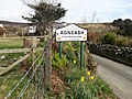
 Agneash - Isle of Man - geograph.org.uk - 48918.jpg 640 × 426; 132 KB
-
 Agneash - panoramio.jpg 4 000 × 3 000; 4,98 MB
-
 Agneash village - geograph.org.uk - 3143707.jpg 2 592 × 1 936; 2,12 MB
-
 Agneash Village - geograph.org.uk - 4845791.jpg 640 × 480; 80 KB
-
 Animal feeders by the Snaefell Mountain Railway - geograph.org.uk - 5102925.jpg 1 024 × 768; 257 KB
-
 Approaching Baldrine - geograph.org.uk - 3144612.jpg 3 648 × 2 736; 6,4 MB
-
 At Windy Corner on the TT course - geograph.org.uk - 4876280.jpg 5 184 × 3 888; 4,77 MB
-
 B20 road - geograph.org.uk - 5781622.jpg 640 × 427; 64 KB
-
 Baldrine Manx Electric Railway halt - geograph.org.uk - 1878988.jpg 800 × 600; 212 KB
-
 Baldrine Methodist Chapel - geograph.org.uk - 2539237.jpg 640 × 426; 82 KB
-
 Baldrine Methodist Church - geograph.org.uk - 3144629.jpg 3 648 × 2 736; 6,59 MB
-
 Baldrine Methodist Church - geograph.org.uk - 4714086.jpg 640 × 480; 90 KB
-
 Baldrine station shelter - geograph.org.uk - 3144634.jpg 3 648 × 2 736; 6,97 MB
-
 Baldrine station shelter - geograph.org.uk - 6180428.jpg 5 202 × 3 465; 3,31 MB
-
 Baldrine, cars 5 ^ 47 - geograph.org.uk - 4619276.jpg 1 024 × 768; 231 KB
-
 Baldrine, cattle grazing - geograph.org.uk - 4619284.jpg 1 024 × 768; 183 KB
-
 Baldromma Farm Yard - geograph.org.uk - 5479388.jpg 1 440 × 1 080; 1,13 MB
-
 Baldromma Road - geograph.org.uk - 5479491.jpg 1 440 × 1 080; 1,02 MB
-

-
 Ballabeg railway crossing - geograph.org.uk - 3148568.jpg 2 592 × 1 936; 1,54 MB
-
 Ballacollister Road - geograph.org.uk - 3541124.jpg 1 600 × 1 063; 363 KB
-
 Ballacowle House Farm - geograph.org.uk - 3143729.jpg 2 592 × 1 936; 2,4 MB
-
 Ballamenagh Road - geograph.org.uk - 5101334.jpg 1 024 × 769; 176 KB
-
 Ballamenagh Road above Groudle Glen - geograph.org.uk - 4879863.jpg 3 785 × 5 045; 4,06 MB
-

-
 Ballaragh, cottage - geograph.org.uk - 4619020.jpg 1 024 × 768; 131 KB
-
 Ballayolgane Farm, Agneash - geograph.org.uk - 5103456.jpg 1 024 × 768; 215 KB
-
 Blackberries in the hedge - geograph.org.uk - 3143696.jpg 2 592 × 1 936; 2,99 MB
-
 Boathouse at Garwick Bay - geograph.org.uk - 3408537.jpg 640 × 424; 75 KB
-
 Boggy Bit at Ballannette - geograph.org.uk - 4429034.jpg 640 × 424; 59 KB
-
 Braggan Point - geograph.org.uk - 1819647.jpg 800 × 600; 142 KB
-
 Brick outhouse - Snaefell Mine manager's house - geograph.org.uk - 4878234.jpg 3 717 × 4 957; 4,94 MB
-
 Bridge on the Mines Road - geograph.org.uk - 4428938.jpg 640 × 424; 96 KB
-
 Bridge over Mines Road - geograph.org.uk - 3143610.jpg 2 592 × 1 936; 2,63 MB
-
 Bridge over the A18 at Bungalow - geograph.org.uk - 6180436.jpg 4 850 × 3 175; 3,1 MB
-
 Bridge over the stream - geograph.org.uk - 3143540.jpg 2 592 × 1 936; 2,69 MB
-
 Brown Bear at Groudle Glen - geograph.org.uk - 5059625.jpg 640 × 427; 120 KB
-
 Bulgham Bay - geograph.org.uk - 5459417.jpg 800 × 600; 103 KB
-
 Bulgham Bay foreshore, at low tide - geograph.org.uk - 5111560.jpg 1 024 × 768; 145 KB
-
 Bungalow Bend - geograph.org.uk - 5460540.jpg 800 × 600; 74 KB
-
 Bungalow, car No. 1 - geograph.org.uk - 4617575.jpg 1 024 × 768; 146 KB
-
 Bungalow, level crossing - geograph.org.uk - 4617535.jpg 1 024 × 768; 199 KB
-
 Bus stop on the A2, south of Baldrine - geograph.org.uk - 5101583.jpg 1 024 × 768; 158 KB
-
 Bus stop on the northern limits of Baldrine - geograph.org.uk - 5101643.jpg 1 024 × 768; 111 KB
-
 Bushes along a clifftop stream - geograph.org.uk - 5111634.jpg 1 024 × 615; 131 KB
-
 By the side of The Snaefell Mountain Railway - geograph.org.uk - 4879902.jpg 4 977 × 3 733; 4,24 MB
-
 Cattle, east of Ballamooar Farm - geograph.org.uk - 5111628.jpg 1 024 × 768; 124 KB
-
 Chapel at Baldrine - geograph.org.uk - 1878973.jpg 800 × 600; 182 KB
-
 Chassis of Brown Bear at Groudle Glen - geograph.org.uk - 5059631.jpg 640 × 427; 115 KB
-
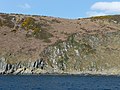
 Clay Head - geograph.org.uk - 1814342.jpg 800 × 600; 152 KB
-
 Clay Head Cliff Top - geograph.org.uk - 5479434.jpg 1 440 × 1 080; 1,16 MB
-
 Cliff edge view - geograph.org.uk - 3144745.jpg 3 648 × 2 736; 6,51 MB
-
 Cliff scenery near Ballavarane - geograph.org.uk - 1819603.jpg 800 × 600; 157 KB
-
 Clifftop at Braggan Point - geograph.org.uk - 4429007.jpg 640 × 424; 68 KB
-
 Clifftop Pasture by the MER - geograph.org.uk - 4905770.jpg 640 × 436; 36 KB
-
 Clifftop Pasture Near Ballabeg - geograph.org.uk - 3408519.jpg 424 × 640; 72 KB
-
 Clifftop pasture, above Bulgham Bay - geograph.org.uk - 5111570.jpg 1 024 × 768; 127 KB
-
 Climbing towards Ballaragh - geograph.org.uk - 1524028.jpg 640 × 513; 71 KB
-
 Coastal scenery near Ballakilley Farm - geograph.org.uk - 1819613.jpg 800 × 600; 177 KB
-
 Coastline and beach at Groudle Glen - geograph.org.uk - 6179529.jpg 5 202 × 3 465; 3,29 MB
-
 Coastline at Sea Lion Cove station - geograph.org.uk - 6179525.jpg 5 202 × 3 465; 3,39 MB
-
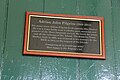 Commemorative plaque, Baldrine tram station - geograph.org.uk - 5078794.jpg 1 280 × 853; 301 KB
-

-
 Crossing at the Bungalow - geograph.org.uk - 6286560.jpg 1 024 × 768; 129 KB
-
 Crossing the A2 - geograph.org.uk - 3133823.jpg 1 936 × 2 592; 1,74 MB
-
 Crossing the A2 on the Manx Electric Railway - geograph.org.uk - 3133831.jpg 1 936 × 2 592; 1,83 MB
-
 Crossing the A2 on the Manx Electric Railway - geograph.org.uk - 3143369.jpg 3 648 × 2 736; 6 MB
-
 Crossing The Ballagawne Rd - geograph.org.uk - 3408529.jpg 640 × 424; 57 KB
-
 Disused building - geograph.org.uk - 3143499.jpg 3 648 × 2 736; 6,44 MB
-
 Disused buildings - geograph.org.uk - 3143518.jpg 3 648 × 2 736; 6,24 MB
-
 Disused buildings - geograph.org.uk - 3143549.jpg 2 592 × 1 936; 2,8 MB
-
 Disused buildings at the old mine - geograph.org.uk - 3143507.jpg 3 648 × 2 736; 7,4 MB
-
 Disused mine workings near Bungalow - geograph.org.uk - 6188164.jpg 5 202 × 3 465; 2,17 MB
-
 Disused mine, Snaefell - geograph.org.uk - 4448983.jpg 1 024 × 678; 159 KB
-
 Disused Snaefell Mine - geograph.org.uk - 4845752.jpg 640 × 480; 70 KB
-
 Disused steam boiler - geograph.org.uk - 5045181.jpg 640 × 480; 247 KB
-
 Driveway to Ballannette - geograph.org.uk - 4429042.jpg 640 × 424; 60 KB
-
 Electric power for Snaefell - geograph.org.uk - 3143597.jpg 2 592 × 1 936; 2,28 MB
-
 End of the line - Lhen Coan - geograph.org.uk - 3774610.jpg 640 × 480; 149 KB
-
 Entering Agneash - geograph.org.uk - 4878169.jpg 5 101 × 3 825; 6,09 MB
-
 Entering Ballannette Nature Reserve - geograph.org.uk - 2728773.jpg 1 496 × 1 122; 575 KB
-
 Entrance to Agneash - geograph.org.uk - 3143717.jpg 2 592 × 1 936; 2,57 MB
-
 Entrance to Ballayolgane Farm - geograph.org.uk - 3143678.jpg 2 592 × 1 936; 2,85 MB
-
 Faint track in the gorse along a field boundary - geograph.org.uk - 5111623.jpg 1 024 × 614; 114 KB
-
 Farm track through clifftop pasture fields - geograph.org.uk - 5111630.jpg 1 024 × 615; 137 KB
-
 Farmland above Bulgham Bay - geograph.org.uk - 4451912.jpg 1 024 × 678; 148 KB
-
 Farmland above Laxey Bay - geograph.org.uk - 5101683.jpg 1 024 × 768; 169 KB
-
 Farmland on both sides of the River Laxey - geograph.org.uk - 5103913.jpg 1 024 × 768; 245 KB
-

-
 Fields at Ballaragh - geograph.org.uk - 3144763.jpg 3 648 × 2 736; 5,81 MB
-
 Fields near Ballannette - geograph.org.uk - 5479443.jpg 1 440 × 1 080; 1,26 MB
-
 Fields Near Ballaragh - geograph.org.uk - 4905780.jpg 640 × 436; 40 KB
-
 Five fields meet on the clifftop - geograph.org.uk - 5111578.jpg 1 024 × 768; 120 KB
-
 Footpath At Ballannette - geograph.org.uk - 2728777.jpg 1 496 × 1 122; 578 KB
-
 Footpath crossing of the wall - geograph.org.uk - 3143493.jpg 2 592 × 1 936; 3,19 MB
-
 Footpath Junction above Snaefell Mine - geograph.org.uk - 2145320.jpg 1 024 × 768; 187 KB
-
 Footpath Near Clayhead Farm - geograph.org.uk - 2728783.jpg 1 496 × 1 122; 613 KB
-
 Footpath to Ballargh - geograph.org.uk - 3146932.jpg 3 323 × 2 272; 1,55 MB
-
 Former motorcycle museum, Snaefell - geograph.org.uk - 4449087.jpg 1 024 × 685; 106 KB
-
 Former TT museum at Bungalow - geograph.org.uk - 6180460.jpg 5 202 × 3 465; 3,3 MB
-
 From the top of the Laxey wheel - geograph.org.uk - 3143855.jpg 3 648 × 2 736; 6,53 MB
-
-
 Gate to Ballannette nature reserve - geograph.org.uk - 4448751.jpg 1 024 × 678; 281 KB
-
 Gated Crossing - geograph.org.uk - 4841773.jpg 640 × 480; 86 KB
-
 Gateway to field above Bulgham Bay - geograph.org.uk - 3634168.jpg 640 × 480; 71 KB
-
 Glen Mooar - geograph.org.uk - 2112017.jpg 600 × 800; 175 KB
-
 Glen Mooar - geograph.org.uk - 3143744.jpg 3 648 × 2 736; 7,12 MB
-
 Glen Mooar valley - geograph.org.uk - 4726591.jpg 640 × 480; 84 KB
-
 Goats grazing on clifftop pasture - geograph.org.uk - 5111590.jpg 1 024 × 768; 130 KB
-
 Goats in a field - geograph.org.uk - 3144772.jpg 3 648 × 2 736; 6,12 MB
-
 Gorse on the Ballannette Reserve - geograph.org.uk - 4428998.jpg 640 × 424; 77 KB
-
 Grasses on the hillside - geograph.org.uk - 3143477.jpg 2 592 × 1 936; 3,06 MB
-
 Great Snaefell Lead mine - geograph.org.uk - 3204866.jpg 1 024 × 768; 156 KB
-
 Groudle Glen - geograph.org.uk - 4429070.jpg 424 × 640; 110 KB
-
 Groudle Glen railway - geograph.org.uk - 3144556.jpg 3 648 × 2 736; 6,1 MB
-
 Groudle Glen Railway - geograph.org.uk - 5479376.jpg 1 440 × 1 080; 1,05 MB
-
 Groudle Glen railway - geograph.org.uk - 5934944.jpg 4 608 × 3 456; 6,06 MB
-
 Groudle Glen railway - geograph.org.uk - 5934961.jpg 4 608 × 3 456; 6,14 MB
-
 Groudle Glen Railway near Headland loop - geograph.org.uk - 5071983.jpg 1 280 × 853; 521 KB
-
 Groudle Glen railway train at Lime Kiln Halt - geograph.org.uk - 6179531.jpg 5 202 × 3 465; 4,43 MB
-
 Groudle Glen Railway, Lhen Coan station - geograph.org.uk - 5071979.jpg 1 280 × 842; 476 KB
-
 Groudle Glen railway, Lime Kiln Halt - geograph.org.uk - 6179533.jpg 5 202 × 3 465; 3,56 MB
-

-

-
 Heading Down To Garwick Beach - geograph.org.uk - 2728792.jpg 1 496 × 1 122; 1,13 MB
-
 Heading for Douglas - geograph.org.uk - 894110.jpg 640 × 428; 79 KB
-
 Heather and Gorse near The Clett - geograph.org.uk - 5477506.jpg 1 440 × 1 080; 1,27 MB
-
 Hillside above Snaefell lead-mine - geograph.org.uk - 5045185.jpg 640 × 480; 185 KB
-
 Hillside stream near Laggan Agneash - geograph.org.uk - 6188166.jpg 5 202 × 3 465; 3,26 MB
-
 Horses grazing near Ballabeg - geograph.org.uk - 4714226.jpg 640 × 480; 79 KB
-
 House at Ballabeg - geograph.org.uk - 3144665.jpg 3 648 × 2 736; 6,63 MB
-
 House for sale in Agneash - geograph.org.uk - 3143713.jpg 2 592 × 1 936; 1,91 MB
-
 House just outside Agneash - geograph.org.uk - 3143725.jpg 2 592 × 1 936; 2,24 MB
-
 House on Mines Road - geograph.org.uk - 3143762.jpg 2 592 × 1 936; 2,22 MB
-
 House on the A2 - geograph.org.uk - 3144658.jpg 3 648 × 2 736; 6,64 MB
-
 Houses alongside the A2, near Ballagawne Road - geograph.org.uk - 5101653.jpg 1 024 × 768; 116 KB
-
 Houses at Ballamenaugh Beg - geograph.org.uk - 3144625.jpg 3 648 × 2 736; 6,57 MB
-
 Houses at Ballaragh - geograph.org.uk - 3144780.jpg 3 648 × 2 736; 6,02 MB
-
 Houses in Agneash - geograph.org.uk - 3143702.jpg 2 592 × 1 936; 2,1 MB
-
 Houses in Baldrine Park, south of Baldrine - geograph.org.uk - 5101597.jpg 1 024 × 615; 156 KB
-
 Houses in The Crescent, Baldrine - geograph.org.uk - 5101627.jpg 1 024 × 768; 198 KB
-
 Houses near Laxey - geograph.org.uk - 6188167.jpg 5 202 × 3 465; 2,88 MB
-
 Houses on the A2 - geograph.org.uk - 3144651.jpg 3 648 × 2 736; 6,32 MB
-
 In Laxey Glen - geograph.org.uk - 5045200.jpg 640 × 480; 264 KB
-
 In Laxey Glen by The Mines Road - geograph.org.uk - 4880157.jpg 5 184 × 3 888; 7,47 MB
-
 Inside the Adit Shaft - geograph.org.uk - 3408407.jpg 424 × 640; 102 KB
-
 Isle Of Man Coastal Path At Groudle Glen - geograph.org.uk - 2728768.jpg 1 496 × 1 122; 971 KB
-
 Lady Isabella - geograph.org.uk - 3143753.jpg 3 648 × 2 736; 7,39 MB
-
 Lady Isabella - geograph.org.uk - 4824389.jpg 480 × 640; 71 KB
-
 Laggan Agneash - geograph.org.uk - 3143602.jpg 1 936 × 2 592; 3,09 MB
-
 Laggan Agneash - geograph.org.uk - 4845776.jpg 640 × 480; 109 KB
-
 Laggan Agneash, Laxey Glen - geograph.org.uk - 2145319.jpg 1 024 × 768; 324 KB
-
 Lane to Baldrine - geograph.org.uk - 4448795.jpg 1 024 × 678; 292 KB
-
 Lane to Ballanette - geograph.org.uk - 4448719.jpg 1 024 × 678; 248 KB
-
 Large Livestock Field near Ballavarane - geograph.org.uk - 5479418.jpg 1 440 × 1 080; 1,05 MB
-
 Laxey Bay - geograph.org.uk - 3144676.jpg 3 648 × 2 736; 5,88 MB
-
 Laxey Bay from the south - geograph.org.uk - 4448789.jpg 1 024 × 678; 211 KB
-
 Laxey Glen - geograph.org.uk - 4448972.jpg 1 024 × 710; 205 KB
-
 Laxey Glen - geograph.org.uk - 4841797.jpg 640 × 480; 71 KB
-
 Laxey Glen - geograph.org.uk - 5044840.jpg 640 × 480; 148 KB
-
 Laxey Glen - geograph.org.uk - 5457724.jpg 800 × 600; 107 KB
-
 Laxey Glen above Ballayolgane Farm - geograph.org.uk - 2145317.jpg 1 024 × 768; 177 KB
-

-

-

-

-

-

-

-

-

-

-

-

-
 Laxey River, Laxey Glen - geograph.org.uk - 5103474.jpg 1 024 × 768; 246 KB
-
 Laxey valley, leading to Laxey Glen - geograph.org.uk - 1925936.jpg 2 304 × 1 704; 856 KB
-
 Laxey Valley, with cloud - geograph.org.uk - 2571617.jpg 2 304 × 1 704; 780 KB
-
 Laxey Wheel - geograph.org.uk - 5364855.jpg 1 280 × 851; 344 KB
-
 Laxey Wheel and housing - geograph.org.uk - 2112020.jpg 600 × 800; 95 KB


_-_geograph.org.uk_-_5102871.jpg)
_-_geograph.org.uk_-_5102878.jpg)
_-_geograph.org.uk_-_5102889.jpg)
_-_geograph.org.uk_-_5102900.jpg)
_-_geograph.org.uk_-_5102915.jpg)
_-_geograph.org.uk_-_5103449.jpg)
_-_geograph.org.uk_-_5103468.jpg)
_-_geograph.org.uk_-_5103947.jpg)
_-_geograph.org.uk_-_5103956.jpg)


