Category:Long Whatton
Jump to navigation
Jump to search
English: Long Whatton is a village in the English county of Leicestershire. It is south of East Midlands Airport and off Junctions 23 and 23A of the M1 motorway. It has easy access to Loughborough via the A6 and to Shepshed, Ashby de la Zouch and Kegworth. The village is at National Grid Reference SK481229.
village in Leicestershire, UK  | |||||
| Upload media | |||||
| Instance of | |||||
|---|---|---|---|---|---|
| Location | Long Whatton and Diseworth, North West Leicestershire, Leicestershire, East Midlands, England | ||||
 | |||||
Subcategories
This category has only the following subcategory.
L
Media in category "Long Whatton"
The following 86 files are in this category, out of 86 total.
-
 17-21 Main Street, Long Whatton - geograph.org.uk - 5847910.jpg 1,280 × 960; 370 KB
-
 Neale(1826) p3.082 - Whatton House, Leicestershire.jpg 1,824 × 1,318; 779 KB
-
 2 Main Street, Long Whatton - geograph.org.uk - 5847932.jpg 1,280 × 947; 295 KB
-
 22-24 West End, Long Whatton - geograph.org.uk - 5848330.jpg 1,280 × 1,006; 407 KB
-
 22-26 West End, Long Whatton - geograph.org.uk - 5848328.jpg 1,280 × 910; 323 KB
-
 22-26 West End, Long Whatton - geograph.org.uk - 5848351.jpg 1,280 × 960; 411 KB
-
 24 Main Street, Long Whatton - geograph.org.uk - 5847914.jpg 960 × 1,280; 338 KB
-
 53, Main Street, Long Whatton - geograph.org.uk - 5845965.jpg 1,280 × 960; 432 KB
-
 53, Main Street, Long Whatton - geograph.org.uk - 5846042.jpg 1,280 × 1,280; 760 KB
-
 81 Main Street, Long Whatton - geograph.org.uk - 5847242.jpg 1,280 × 960; 360 KB
-
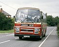 Barton Leyland Leopard Supreme IV 583, PTV 583X.jpg 1,143 × 905; 1.26 MB
-
 Bench mark, The Wheel House, Main Street, Long Whatton - geograph.org.uk - 5847942.jpg 1,280 × 1,280; 663 KB
-

-
 Farmland north of Long Whatton - geograph.org.uk - 3684359.jpg 1,600 × 1,200; 657 KB
-
 Farthings, West End, Long Whatton - geograph.org.uk - 5848343.jpg 1,280 × 960; 469 KB
-
 Former Baptist Chapel, Long Whatton - geograph.org.uk - 5848356.jpg 1,280 × 1,280; 538 KB
-
 Former hosiery workshop and house, Long Whatton - geograph.org.uk - 5845963.jpg 1,280 × 960; 394 KB
-
 Fox Cub Iveco G235 EOA.jpg 2,926 × 2,034; 2.36 MB
-

-
 K6 telephone kiosk, Main Street, Long Whatton - geograph.org.uk - 5845976.jpg 1,095 × 1,280; 381 KB
-
 Keeper's Lodge, Main Street, Long Whatton - geograph.org.uk - 5845969.jpg 960 × 1,280; 293 KB
-
 Keeper's Lodge, Main Street, Long Whatton - geograph.org.uk - 5845973.jpg 1,280 × 960; 434 KB
-
 Long Whatton Brook - geograph.org.uk - 1342934.jpg 480 × 640; 139 KB
-
 Long Whatton milepost - geograph.org.uk - 240283.jpg 480 × 640; 128 KB
-
 Long Whatton Sewage Treatment Works - geograph.org.uk - 5848392.jpg 1,280 × 888; 573 KB
-
 Long Whatton village shop - geograph.org.uk - 5847901.jpg 1,280 × 960; 337 KB
-
 M1 crossing Ashby Road - geograph.org.uk - 240266.jpg 640 × 480; 74 KB
-
 Main Street Long Whatton - geograph.org.uk - 6338601.jpg 2,000 × 1,330; 2.05 MB
-
 Main Street, Long Whatton - geograph.org.uk - 3069118.jpg 640 × 480; 95 KB
-
 Main Street, Long Whatton - geograph.org.uk - 5848361.jpg 1,280 × 960; 329 KB
-
 Makers plate on milepost - geograph.org.uk - 240285.jpg 640 × 448; 98 KB
-
 Manor Farmhouse and outbuildings, Long Whatton - geograph.org.uk - 5847895.jpg 1,280 × 960; 270 KB
-
 Manor farmhouse, Long Whatton, doorway - geograph.org.uk - 5847897.jpg 960 × 1,280; 467 KB
-
 Manor House Farmhouse, West End, Long Whatton - geograph.org.uk - 5848339.jpg 1,280 × 960; 560 KB
-
 Marylea Farm, Long Whatton - geograph.org.uk - 5847871.jpg 960 × 1,280; 480 KB
-
 Medieval earthworks at Long Whatton - geograph.org.uk - 5845959.jpg 1,280 × 883; 361 KB
-
 Medieval earthworks near Long Whatton - geograph.org.uk - 5845957.jpg 1,280 × 960; 426 KB
-
 Milepost in Shepshed Parish - geograph.org.uk - 240154.jpg 480 × 640; 96 KB
-
 Mill house and attached range, Long Whatton - geograph.org.uk - 5847883.jpg 1,280 × 890; 418 KB
-
 Mill Lane, Long Whatton, 50 years ago . . . - geograph.org.uk - 5847247.jpg 1,280 × 872; 301 KB
-
 Motorway bridge at Long Whatton - geograph.org.uk - 559083.jpg 640 × 409; 94 KB
-
 Old Boot House, formerly The Boot Inn - geograph.org.uk - 3750778.jpg 1,200 × 900; 122 KB
-
 Old Boot House, Main Street, Long Whatton - geograph.org.uk - 5847925.jpg 1,280 × 960; 326 KB
-
 Old Boot House, Main Street, Long Whatton - geograph.org.uk - 5848354.jpg 960 × 1,280; 353 KB
-
 River Soar near Whatton House - geograph.org.uk - 720246.jpg 640 × 480; 63 KB
-

-
 The Falcon Inn - geograph.org.uk - 6338602.jpg 2,000 × 1,330; 2 MB
-

-
 The Green, Long Whatton - geograph.org.uk - 3069121.jpg 640 × 480; 73 KB
-
 The Green, Long Whatton - geograph.org.uk - 559961.jpg 640 × 482; 116 KB
-
 The Green, Long Whatton - geograph.org.uk - 5845977.jpg 1,280 × 853; 277 KB
-
 The Lodge, Mill Lane, Long Whatton - geograph.org.uk - 5847879.jpg 960 × 1,280; 446 KB
-
 The M1 Motorway - geograph.org.uk - 559084.jpg 640 × 406; 93 KB
-
 The Royal Oak - geograph.org.uk - 559960.jpg 640 × 542; 133 KB
-
 Whatton Gardens - geograph.org.uk - 482653.jpg 480 × 640; 114 KB
-
 Whatton House - geograph.org.uk - 482649.jpg 640 × 480; 95 KB
-
 Approaching Long Whatton - geograph.org.uk - 559962.jpg 640 × 396; 98 KB
-
 Ashby Road - geograph.org.uk - 240288.jpg 640 × 480; 84 KB
-
 Ashby Road and milepost - geograph.org.uk - 240152.jpg 640 × 480; 60 KB
-
 Drypot Lane - geograph.org.uk - 715515.jpg 640 × 480; 58 KB
-
 Fertiliser Spreading - geograph.org.uk - 386281.jpg 640 × 480; 93 KB
-
 Fields - geograph.org.uk - 240287.jpg 640 × 480; 80 KB
-
 Fields near Windmill Farm - geograph.org.uk - 395677.jpg 640 × 480; 94 KB
-
 Hathern Road near Long Whatton - geograph.org.uk - 559963.jpg 640 × 434; 101 KB
-
 Hedge Laying - geograph.org.uk - 187086.jpg 640 × 480; 110 KB
-

-
 Houses along West End in Long Whatton - geograph.org.uk - 559949.jpg 640 × 459; 108 KB
-
 Kegworth Lane - geograph.org.uk - 294052.jpg 640 × 480; 277 KB
-
 Kegworth Lane - geograph.org.uk - 294056.jpg 640 × 480; 207 KB
-
 Long Whatton Methodist Church - geograph.org.uk - 559957.jpg 640 × 525; 112 KB
-

-
 Looking into square SK4724 - geograph.org.uk - 291493.jpg 640 × 480; 201 KB
-

-
 Main Street, Long Whatton - geograph.org.uk - 559955.jpg 640 × 463; 120 KB
-
 Open land near M1 jn 23a - geograph.org.uk - 168443.jpg 640 × 421; 33 KB
-
 Ornamental pool in Whatton Gardens - geograph.org.uk - 482665.jpg 640 × 480; 100 KB
-
 Piper Wood and fields - geograph.org.uk - 323827.jpg 640 × 480; 52 KB
-

-
 Sheep and Houses - geograph.org.uk - 187087.jpg 640 × 480; 87 KB
-
 Terraced housing along Main Street - geograph.org.uk - 559953.jpg 640 × 496; 110 KB
-
 The Baptist Chapel in Long Whatton - geograph.org.uk - 559952.jpg 640 × 626; 123 KB
-
 The Falcon Inn - geograph.org.uk - 559954.jpg 640 × 584; 123 KB
-
 Timbered building in Long Whatton - geograph.org.uk - 559956.jpg 640 × 452; 129 KB
-
 Top of the Hill - geograph.org.uk - 323829.jpg 640 × 358; 42 KB
-
 Track to the sewage works - geograph.org.uk - 559964.jpg 640 × 463; 126 KB
-
 Uphill view of M1 bridge - geograph.org.uk - 240267.jpg 640 × 480; 80 KB

_p3.082_-_Whatton_House,_Leicestershire.jpg)


