Category:Longnor, Shropshire
Aller à la navigation
Aller à la recherche
village britannique  | |||||
| Téléverser des médias | |||||
| Nature de l’élément | |||||
|---|---|---|---|---|---|
| Lieu | Shropshire, Midlands de l'Ouest, Angleterre | ||||
| Longueur |
| ||||
 | |||||
Sous-catégories
Cette catégorie comprend 3 sous-catégories, dont les 3 ci-dessous.
Média dans la catégorie « Longnor, Shropshire »
Cette catégorie comprend 125 fichiers, dont les 125 ci-dessous.
-
 34027 at Micklewood - geograph.org.uk - 616002.jpg 600 × 400 ; 84 kio
-
 A path through Birch Coppice - geograph.org.uk - 2712078.jpg 979 × 734 ; 404 kio
-
 A Sign Of Work In Progress - geograph.org.uk - 830132.jpg 640 × 425 ; 37 kio
-
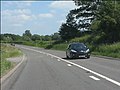
 A49 at Longnor junction - geograph.org.uk - 2958238.jpg 640 × 480 ; 71 kio
-
 A49 at the entrance to Newhouse Farm - geograph.org.uk - 3545348.jpg 640 × 480 ; 29 kio
-
 A49 at the junction for Longnor - geograph.org.uk - 3545355.jpg 640 × 480 ; 35 kio
-
 A49 at the turning for Micklewood Farm - geograph.org.uk - 3545361.jpg 640 × 480 ; 20 kio
-
 A49 east of Micklewood Farm - geograph.org.uk - 3773161.jpg 3 648 × 2 736 ; 1,32 Mio
-
 A49 junction with un-named lane to Longnor - geograph.org.uk - 3773163.jpg 3 555 × 2 664 ; 1,32 Mio
-
 A49 just north of the Longnor junction - geograph.org.uk - 4571281.jpg 1 142 × 857 ; 508 kio
-
 A49 north of the Longnor junction - geograph.org.uk - 3545356.jpg 640 × 480 ; 28 kio
-
 A49 northwards near Newhouse Farm - geograph.org.uk - 4570038.jpg 1 306 × 979 ; 427 kio
-
 A49 passing woodland of Longnor Hall - geograph.org.uk - 5591574.jpg 1 600 × 1 280 ; 840 kio
-
 Across the Valley at Lawley, Shropshire - geograph.org.uk - 632586.jpg 640 × 454 ; 146 kio
-
 Along The Lawley ridge - geograph.org.uk - 2712040.jpg 1 306 × 979 ; 309 kio
-
 Animal pen - geograph.org.uk - 750733.jpg 640 × 480 ; 114 kio
-
 Another claimant to 'The Old Forge' house - geograph.org.uk - 5536377.jpg 2 448 × 1 836 ; 1,24 Mio
-
 Approaching the summit - geograph.org.uk - 5881949.jpg 5 184 × 3 888 ; 4,17 Mio
-
 Autumn on the lane into Lawley - geograph.org.uk - 2712068.jpg 979 × 734 ; 360 kio
-
 Barns and outbuildings at The Old Forge - geograph.org.uk - 5536383.jpg 2 336 × 1 752 ; 1,54 Mio
-
 Blackhurst and The Lawley - geograph.org.uk - 1073354.jpg 640 × 425 ; 87 kio
-
 Blackhurst Farm, Lawley - geograph.org.uk - 1005027.jpg 640 × 480 ; 159 kio
-
 Bridleway below The Lawley - geograph.org.uk - 5881944.jpg 5 184 × 3 888 ; 5,48 Mio
-
 Caer Caradoc from southern end of the Lawley - geograph.org.uk - 4399566.jpg 640 × 360 ; 22 kio
-

-
 Caer Caradoc from the Lawley - geograph.org.uk - 4397194.jpg 640 × 360 ; 16 kio
-
 Cobblers Cottage - geograph.org.uk - 68854.jpg 400 × 300 ; 59 kio
-
 Cold ascent. - geograph.org.uk - 1111095.jpg 640 × 480 ; 47 kio
-
 Coppiced beech in Birch Coppice - geograph.org.uk - 2712096.jpg 734 × 979 ; 382 kio
-
 Cottage below the Lawley - geograph.org.uk - 4399634.jpg 640 × 360 ; 62 kio
-
 Cottages near the church at Longnor - geograph.org.uk - 4780757.jpg 640 × 480 ; 85 kio
-
 Cound Brook, Longnor - geograph.org.uk - 2487030.jpg 553 × 640 ; 361 kio
-
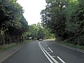
 Country road near Longnor - geograph.org.uk - 6005753.jpg 640 × 480 ; 272 kio
-
 Crossroads east of Longnor - geograph.org.uk - 6089935.jpg 1 600 × 804 ; 519 kio
-
 Descending The Lawley - geograph.org.uk - 5881952.jpg 5 184 × 3 888 ; 4,06 Mio
-
 Early morning at Micklewood Farm - geograph.org.uk - 5279564.jpg 640 × 480 ; 30 kio
-
 Eastwards from The Lawley - geograph.org.uk - 2712052.jpg 1 142 × 857 ; 369 kio
-
 Farm compound at the road junction - geograph.org.uk - 5536363.jpg 1 306 × 979 ; 538 kio
-
 Farmland and Coppice, Lawley, Shropshire - geograph.org.uk - 632587.jpg 640 × 418 ; 141 kio
-
 Farmland near Lawley - geograph.org.uk - 3478263.jpg 1 600 × 1 170 ; 460 kio
-
 Fell gate - geograph.org.uk - 5881941.jpg 5 184 × 3 888 ; 5,06 Mio
-
 Field, Longnor - geograph.org.uk - 5858746.jpg 1 024 × 685 ; 308 kio
-
 Footpath at the edge of Birch Coppice - geograph.org.uk - 2412139.jpg 640 × 480 ; 156 kio
-
 Footpath through the bracken - geograph.org.uk - 5881955.jpg 5 184 × 3 888 ; 4,85 Mio
-
 Ford and farm track to Leasowes - geograph.org.uk - 6090084.jpg 1 600 × 1 274 ; 1,24 Mio
-
 Ford at Longnor - geograph.org.uk - 4019050.jpg 3 872 × 2 592 ; 4,77 Mio
-
 Ford at The Old Forge - geograph.org.uk - 5536367.jpg 979 × 1 306 ; 817 kio
-
 Ford near Green Farm, Longnor - geograph.org.uk - 6090081.jpg 1 600 × 914 ; 707 kio
-
 Ford on a minor road, south of Longnor - geograph.org.uk - 6054194.jpg 4 086 × 3 065 ; 2,56 Mio
-
 Ford, Leasowes - geograph.org.uk - 3863783.jpg 640 × 480 ; 280 kio
-
 Ford, Longnor - geograph.org.uk - 3851423.jpg 640 × 480 ; 285 kio
-
 Frogspawn on a path below the Lawley - geograph.org.uk - 4399579.jpg 640 × 360 ; 80 kio
-
 Frogspawn on a path below the Lawley - geograph.org.uk - 4399620.jpg 640 × 360 ; 88 kio
-
 Frosty valley at Blackhurst - geograph.org.uk - 1073350.jpg 640 × 425 ; 79 kio
-

-
 Gates at northeast entrance to Longnor Hall.jpg 640 × 449 ; 322 kio
-
 Grass fields, Leasowes - geograph.org.uk - 3863787.jpg 640 × 480 ; 219 kio
-
 Green Farm near Longnor - geograph.org.uk - 6090076.jpg 1 600 × 799 ; 545 kio
-
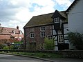
 Half-timbered house, Longnor - geograph.org.uk - 830263.jpg 640 × 414 ; 58 kio
-
 Hedgerow oak, Longnor - geograph.org.uk - 5858744.jpg 1 024 × 685 ; 531 kio
-
 Here's where it starts to get steep - geograph.org.uk - 2710484.jpg 1 142 × 857 ; 351 kio
-
 House, Lawley - geograph.org.uk - 1005502.jpg 640 × 480 ; 140 kio
-
 Junction east of Longnor - geograph.org.uk - 4572149.jpg 1 306 × 979 ; 399 kio
-
 Lane to Lawley Farm - geograph.org.uk - 4572163.jpg 1 044 × 783 ; 441 kio
-
 Lane to Longnor - geograph.org.uk - 5536359.jpg 1 306 × 979 ; 596 kio
-
 Late May and just in leaf - geograph.org.uk - 3476938.jpg 2 394 × 1 857 ; 2,73 Mio
-
 Leasowes ford - geograph.org.uk - 4572167.jpg 1 142 × 857 ; 491 kio
-
 Leaving Longnor - geograph.org.uk - 4571313.jpg 1 142 × 857 ; 363 kio
-
 Local broadband mast - geograph.org.uk - 3480441.jpg 2 164 × 2 544 ; 2,55 Mio
-
 Longnor Bridge - geograph.org.uk - 4572142.jpg 1 142 × 857 ; 549 kio
-
 Longnor Bridge - geograph.org.uk - 830147.jpg 640 × 480 ; 111 kio
-
 Longnor Church - geograph.org.uk - 4780749.jpg 640 × 480 ; 100 kio
-
 Longnor Mill - geograph.org.uk - 750732.jpg 640 × 480 ; 66 kio
-
 Longnor street in winter.jpg 1 728 × 2 304 ; 770 kio
-
 Longnor Village Hall - geograph.org.uk - 4780754.jpg 640 × 480 ; 113 kio
-
 Longnor Village Hall - geograph.org.uk - 830261.jpg 640 × 480 ; 107 kio
-
 Micklewood Farm - geograph.org.uk - 5279597.jpg 640 × 480 ; 31 kio
-
 Micklewood Farm - geograph.org.uk - 5279628.jpg 640 × 480 ; 72 kio
-
 Micklewood Farmhouse and entranceway - geograph.org.uk - 5537065.jpg 1 469 × 1 102 ; 612 kio
-
 Muddy field - geograph.org.uk - 3863790.jpg 640 × 480 ; 293 kio
-
 OS flush bracket - Longnor, Rural Cottages - geograph.org.uk - 4571271.jpg 857 × 1 142 ; 554 kio
-
 Road, Hoar Edge - geograph.org.uk - 5125968.jpg 4 608 × 3 456 ; 2 Mio
-
 Roman Road past Green Farm - geograph.org.uk - 832831.jpg 640 × 480 ; 65 kio
-
 Rural Bus Shelter at Rural Cottages - geograph.org.uk - 4877298.jpg 3 480 × 2 408 ; 1,63 Mio
-
 Short stretch of the Roman road - geograph.org.uk - 4572159.jpg 1 142 × 857 ; 414 kio
-
 Shropshire ford - geograph.org.uk - 830264.jpg 640 × 480 ; 79 kio
-
 Squally summer showers over the Stretton gap - geograph.org.uk - 2972438.jpg 640 × 480 ; 60 kio
-
 The Court House - geograph.org.uk - 2713656.jpg 1 142 × 857 ; 350 kio
-
 The lane out of Longnor - geograph.org.uk - 4571333.jpg 1 306 × 979 ; 567 kio
-
 The lower part of The Lawley's NE ridge - geograph.org.uk - 2712048.jpg 1 306 × 979 ; 291 kio
-
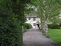 The Moat House - geograph.org.uk - 790175.jpg 640 × 480 ; 107 kio
-
 The NE ridge of The Lawley - geograph.org.uk - 2712028.jpg 979 × 1 306 ; 350 kio
-
 The Old Forge house - geograph.org.uk - 5536365.jpg 2 448 × 1 836 ; 1,62 Mio
-
 The Old School - geograph.org.uk - 4571308.jpg 1 142 × 857 ; 486 kio
-
 Through The Ford - geograph.org.uk - 1071258.jpg 640 × 423 ; 83 kio
-
 Trees in the meadow - geograph.org.uk - 750731.jpg 640 × 480 ; 105 kio
-
 View over Penkridge Hall from the Lawley - geograph.org.uk - 4399549.jpg 640 × 360 ; 51 kio
-
 View to Coppice House from the Lawley - geograph.org.uk - 4396996.jpg 640 × 360 ; 53 kio
-
 View to the Caradoc from the Lawley - geograph.org.uk - 4397167.jpg 640 × 360 ; 29 kio
-

-
 View towards Church Stretton from the Lawley - geograph.org.uk - 4397192.jpg 640 × 360 ; 36 kio
-
 View westwards from the Lawley, Shropshire - geograph.org.uk - 4397177.jpg 640 × 360 ; 32 kio
-
 Well House, below The Lawley - geograph.org.uk - 2713649.jpg 1 142 × 857 ; 366 kio
-
 Where to now^ How about home^ - geograph.org.uk - 750729.jpg 640 × 504 ; 127 kio
-
 Wild flowers beside the path below the Lawley - geograph.org.uk - 4399651.jpg 640 × 360 ; 122 kio
-
 Wooded Road, Lawley - geograph.org.uk - 5125974.jpg 4 608 × 3 456 ; 2,77 Mio
-
 Woodland footpath - geograph.org.uk - 5881958.jpg 5 184 × 3 888 ; 6,57 Mio
-
 Yellow road, Longnor - geograph.org.uk - 5858745.jpg 1 024 × 685 ; 479 kio
-
 Young cattle at Micklewood Farm - geograph.org.uk - 5537084.jpg 1 469 × 1 102 ; 670 kio
-
 Choose your path carefully - geograph.org.uk - 512927.jpg 640 × 480 ; 73 kio
-
 Corner of Fox Covert. - geograph.org.uk - 652637.jpg 640 × 480 ; 116 kio
-
 Cottage next to Frodesley Lane Farm - geograph.org.uk - 627425.jpg 640 × 480 ; 44 kio
-
 Farmhouse, with The Lawley, Shropshire - geograph.org.uk - 632577.jpg 640 × 437 ; 147 kio
-
 Field and Oak Tree near Lawley, Shropshire - geograph.org.uk - 632717.jpg 640 × 472 ; 142 kio
-
 Lane to Condover - geograph.org.uk - 750734.jpg 640 × 480 ; 83 kio
-
 Lane to the east of 'The Lawley' - geograph.org.uk - 667258.jpg 640 × 480 ; 113 kio
-
 Leaving Lawley - geograph.org.uk - 667260.jpg 640 × 480 ; 95 kio
-
 Looking up the Jumps - geograph.org.uk - 399441.jpg 640 × 427 ; 50 kio
-
 Man-made pond next to Fox covert. - geograph.org.uk - 652645.jpg 640 × 480 ; 74 kio
-
 Northern corner of Fox Covert in the rain. - geograph.org.uk - 652648.jpg 640 × 480 ; 71 kio
-
 Oak Trees by Crop Field, Lawley, Shropshire - geograph.org.uk - 632721.jpg 640 × 640 ; 154 kio
-
 Pasture and Woodland, near Lawley, Shropshire - geograph.org.uk - 631424.jpg 640 × 434 ; 149 kio
-
 Pond near Fox Covert. - geograph.org.uk - 652641.jpg 640 × 480 ; 60 kio
-
 The Old Mill at Longnor - geograph.org.uk - 69075.jpg 640 × 480 ; 135 kio
-
 The stream at Longnor - geograph.org.uk - 13945.jpg 640 × 426 ; 155 kio


