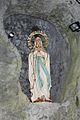
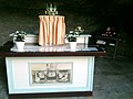
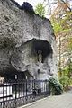
Category:Lourdesgrot, Sint Nicolaasga
Jump to navigation
Jump to search
| Object location | | View all coordinates using: OpenStreetMap |
|---|
cave in the Netherlands  | |||||
| Upload media | |||||
| Instance of | |||||
|---|---|---|---|---|---|
| Dedicated to | |||||
| Location | Sint Nicolaasga, De Fryske Marren, Friesland, Netherlands | ||||
| Heritage designation |
| ||||
 | |||||
|
This is a category about rijksmonument number 514069
|
| Address |
|
Media in category "Lourdesgrot, Sint Nicolaasga"
The following 14 files are in this category, out of 14 total.
-

-
 Lourdesgrot Sint Nicolaasga 01.JPG 576 × 768; 108 KB
-
-
 Sint nicolaas-lourdesgrot-1.JPG 2,048 × 1,536; 847 KB
-
 Sint nicolaas-lourdesgrot-2.JPG 2,048 × 1,536; 757 KB
-

-

-

-

-

-
-

-

-


