Category:Lutherse Kerk (Monnickendam)
Jump to navigation
Jump to search
| Object location | | View all coordinates using: OpenStreetMap |
|---|
church in Monnickendam, Netherlands  | |||||
| Upload media | |||||
| Instance of | |||||
|---|---|---|---|---|---|
| Location | Monnickendam, North Holland, Netherlands | ||||
| Street address |
| ||||
| Located on street | |||||
| Heritage designation |
| ||||
| Inception |
| ||||
 | |||||
|
This is a category about rijksmonument number 30034
|
| Address |
|
Media in category "Lutherse Kerk (Monnickendam)"
The following 7 files are in this category, out of 7 total.
-
 Exterieur - Monnickendam - 20160162 - RCE.jpg 957 × 1,200; 212 KB
-
 Monnickendam 124.JPG 2,448 × 3,264; 2.22 MB
-
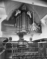
 Preekstoel - Monnickendam - 20160163 - RCE.jpg 968 × 1,200; 221 KB
-
 Voorgevel, Zuideinde - Monnickendam - 20160165 - RCE.jpg 805 × 1,200; 302 KB
-
 Wijnkan - Monnickendam - 20160164 - RCE.jpg 872 × 1,200; 188 KB
-
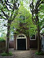
 Zuideinde 38, Monnickendam.JPG 2,592 × 3,888; 4.77 MB
-
 Zuideinde 38, tuin en hek, Monnickendam.JPG 2,592 × 3,888; 4.37 MB


