Category:M-69 (Michigan highway)
Jump to navigation
Jump to search
 | number: | (sixty-nine) |
|---|---|---|
| State highways in Michigan: | 49 · 50 · 52 · 53 · 54 · 55 · 57 · 59 · 60 · 61 · 62 · 63 · 64 · 65 · 66 · 67 · 68 · 69 · 70 · 72 · 73 · 75 · 77 · 78 · 81 · 83 · 85 · 87 · 88 · 89 |
state highway in Michigan, United States   | |||||
| Upload media | |||||
| Instance of | |||||
|---|---|---|---|---|---|
| Location |
| ||||
| Transport network | |||||
| Owned by | |||||
| Maintained by | |||||
| Inception |
| ||||
| Length |
| ||||
| Terminus | |||||
| |||||
English: Media related to M-69 (Michigan highway), a 65.260-mile (105.026 km) state highway in the Upper Peninsula of Michigan, United States.
Subcategories
This category has only the following subcategory.
Media in category "M-69 (Michigan highway)"
The following 9 files are in this category, out of 9 total.
-
 M-69.svg 600 × 600; 4 KB
-
 Michigan 69 map.png 2,205 × 1,239; 82 KB
-
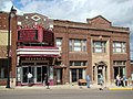 Crystal Theater.jpg 2,048 × 1,536; 1.02 MB
-
 CrystalFallsMichiganM69.jpg 1,814 × 1,154; 753 KB
-
 Finnish and Swedish Mercantile Crystal Falls MI.jpg 2,980 × 1,938; 1.09 MB
-
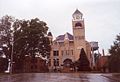 Iron County Court House.jpg 1,093 × 749; 191 KB
-
 Iron County Courthouse.jpg 640 × 480; 83 KB
-
 M-69 1926.svg 600 × 600; 8 KB
-
 M-69 entering Crystal Falls.jpg 640 × 480; 77 KB


