Category:Maarland Noordzijde 6, Brielle
Jump to navigation
Jump to search
| Object location | | View all coordinates using: OpenStreetMap |
|---|
 | |||||
| Upload media | |||||
| Instance of |
| ||||
|---|---|---|---|---|---|
| Location | Brielle, Voorne aan Zee, South Holland, Netherlands | ||||
| Street address |
| ||||
| Located on street | |||||
| Heritage designation |
| ||||
 | |||||
|
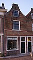
This is a category about rijksmonument number 10707
|
| Address |
|
Media in category "Maarland Noordzijde 6, Brielle"
The following 6 files are in this category, out of 6 total.
-
 Brielle - rijksmonument 10707 - Maarland Noordzijde 6 20111112.jpg 448 × 800; 181 KB
-
 Brielle 009.jpg 2,272 × 1,704; 1.79 MB
-
 Brielle, Netherlands - panoramio (28).jpg 4,896 × 3,264; 5 MB
-
 Exterieur VOORGEVELS - Brielle - 20316254 - RCE.jpg 955 × 1,200; 285 KB
-
 Overzicht - Brielle - 20042968 - RCE.jpg 1,200 × 959; 232 KB
-
 Voorgevels - Brielle - 20042969 - RCE.jpg 959 × 1,200; 257 KB

.jpg)


