Category:Madison County, Idaho
Vai alla navigazione
Vai alla ricerca
Counties of Idaho: Ada · Adams · Bannock · Bear Lake · Benewah · Bingham · Blaine · Boise · Bonner · Bonneville · Boundary · Butte · Camas · Canyon · Caribou · Cassia · Clark · Clearwater · Custer · Elmore · Franklin · Fremont · Gem · Gooding · Idaho · Jefferson · Jerome · Kootenai · Latah · Lemhi · Lewis · Lincoln · Madison · Minidoka · Nez Perce · Oneida · Owyhee · Payette · Power · Shoshone · Teton · Twin Falls · Valley · Washington
contea statunitense dell'Idaho   | |||||
| Carica un file multimediale | |||||
| Istanza di | |||||
|---|---|---|---|---|---|
| Prende il nome da | |||||
| Luogo | Idaho, Stati Uniti d'America | ||||
| Capitale | |||||
| Data di fondazione o creazione |
| ||||
| Popolazione |
| ||||
| Superficie |
| ||||
| Distinto da | |||||
| sito web ufficiale | |||||
 | |||||
English: Media related to Madison County, Idaho, a county in eastern Idaho, United States.
Sottocategorie
Questa categoria contiene le 9 sottocategorie indicate di seguito, su un totale di 9.
File nella categoria "Madison County, Idaho"
Questa categoria contiene 27 file, indicati di seguito, su un totale di 27.
-
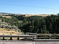 Canyon Creek, Idaho State Highway 33 Northeast of Rexburg, Idaho (1164646569).jpg 1 600 × 1 200; 305 KB
-
 Canyon Creek, Idaho State Highway 33 Northeast of Rexburg, Idaho (1165502366).jpg 1 600 × 1 200; 319 KB
-
 Fort Henry, Idaho Historical Marker 135, Sugar City, Idaho (1164650105).jpg 1 600 × 1 200; 435 KB
-
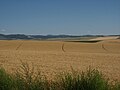
 Idaho State Highway 33 Northeast of Rexburg, Idaho (1164634379).jpg 1 600 × 1 200; 314 KB
-
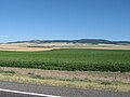
 Idaho State Highway 33 Northeast of Rexburg, Idaho (1164635213).jpg 1 600 × 1 200; 291 KB
-
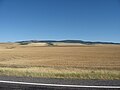
 Idaho State Highway 33 Northeast of Rexburg, Idaho (1164642069).jpg 1 600 × 1 200; 334 KB
-
 Idaho State Highway 33 Northeast of Rexburg, Idaho (1164643341).jpg 1 600 × 1 200; 244 KB
-
 Idaho State Highway 33 Northeast of Rexburg, Idaho (1165490924).jpg 1 600 × 1 200; 274 KB
-
 Idaho State Highway 33 Northeast of Rexburg, Idaho (1165491664).jpg 1 600 × 1 200; 273 KB
-
 Idaho State Highway 33 Northeast of Rexburg, Idaho (1165492374).jpg 1 600 × 1 200; 239 KB
-
 Idaho State Highway 33 Northeast of Rexburg, Idaho (1165493138).jpg 1 600 × 1 200; 313 KB
-
 Idaho State Highway 33 Northeast of Rexburg, Idaho (1165493806).jpg 1 600 × 1 200; 247 KB
-
 Idaho State Highway 33 Northeast of Rexburg, Idaho (1165494556).jpg 1 600 × 1 200; 248 KB
-
 Idaho State Highway 33 Northeast of Rexburg, Idaho (1165495270).jpg 1 600 × 1 200; 247 KB
-
 Idaho State Highway 33 Northeast of Rexburg, Idaho (1165496096).jpg 1 600 × 1 200; 305 KB
-
 Idaho State Highway 33 Northeast of Rexburg, Idaho (1165499416).jpg 1 600 × 1 200; 233 KB
-
 Idaho State Highway 33 Northeast of Rexburg, Idaho (1165500062).jpg 1 600 × 1 200; 213 KB
-
 Idaho State Highway 33 Northeast of Rexburg, Idaho (1165503136).jpg 1 600 × 1 200; 275 KB
-
 Idaho State Highway 33 Northeast of Rexburg, Idaho (1165503762).jpg 1 600 × 1 200; 225 KB
-

-
 North Menan Butte crater.jpeg 3 024 × 4 032; 4,32 MB
-
 Northeast of Rexburg, Idaho (26) (1164632845).jpg 1 600 × 1 200; 199 KB
-
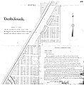 ThorntonTownsite.jpg 3 384 × 3 431; 1,8 MB
-
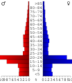 USA Madison County, Idaho age pyramid.svg 520 × 600; 10 KB
-
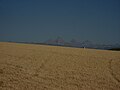
 View of Teton Range, Idaho State Highway 33 Northeast of Rexburg, Idaho (1164645767).jpg 1 600 × 1 200; 190 KB
-
 View of Teton Range, Idaho State Highway 33 Northeast of Rexburg, Idaho (1165497594).jpg 1 600 × 1 200; 219 KB
-
 View of Teton Range, Idaho State Highway 33 Northeast of Rexburg, Idaho (1165498790).jpg 1 600 × 1 200; 189 KB
.jpg)
.jpg)
.jpg)
.jpg)
.jpg)
.jpg)
.jpg)
.jpg)
.jpg)
.jpg)
.jpg)
.jpg)
.jpg)
.jpg)
.jpg)
.jpg)
.jpg)
.jpg)
.jpg)

_(1164632845).jpg)


.jpg)
.jpg)
.jpg)