Category:Maeser, Utah
Jump to navigation
Jump to search
census-designated place in Uintah County, Utah, United States   | |||||
| Upload media | |||||
| Instance of | |||||
|---|---|---|---|---|---|
| Named after | |||||
| Location | Uintah County, Utah | ||||
| Population |
| ||||
| Area |
| ||||
| Elevation above sea level |
| ||||
 | |||||
Media in category "Maeser, Utah"
The following 4 files are in this category, out of 4 total.
-
 Maeser Utah welcome sign.jpeg 2,560 × 1,920; 1.08 MB
-

-
 Uintahcounty ut.png 616 × 1,099; 46 KB
-
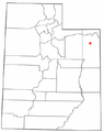 UTMap-doton-Maeser.PNG 238 × 300; 18 KB

