Category:Mansfield District
Zur Navigation springen
Zur Suche springen
district in Nottinghamshire, England   | |||||
| Medium hochladen | |||||
| Ist ein(e) | |||||
|---|---|---|---|---|---|
| Ort | Nottinghamshire, East Midlands, England | ||||
| Hauptstadt | |||||
| Gesetzgebende Körperschaft |
| ||||
| Datum der Gründung, Erstellung, Entstehung, Erbauung |
| ||||
| Einwohnerzahl |
| ||||
| Fläche |
| ||||
| offizielle Website | |||||
 | |||||
Unterkategorien
Es werden 4 von insgesamt 4 Unterkategorien in dieser Kategorie angezeigt:
In Klammern die Anzahl der enthaltenen Kategorien (K), Seiten (S), Dateien (D)
Medien in der Kategorie „Mansfield District“
Folgende 200 Dateien sind in dieser Kategorie, von 1.387 insgesamt.
(vorherige Seite) (nächste Seite)-
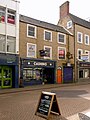
 "Blooming Wonderful" flower shop in Mansfield - geograph.org.uk - 4304609.jpg 3.825 × 5.069; 4,87 MB
-
 "Gala" snack bar in the centre of Mansfield - geograph.org.uk - 4304580.jpg 4.795 × 3.512; 4,22 MB
-
 "The Rosemary Centre", Mansfield - geograph.org.uk - 4304565.jpg 4.414 × 3.685; 3,19 MB
-
 10 ^ 12 Stockwell Gate, Mansfield - geograph.org.uk - 6251646.jpg 952 × 1.280; 306 KB
-
 17 ^ 19 Church Street, Mansfield - geograph.org.uk - 6251572.jpg 1.018 × 1.280; 377 KB
-
 23A Market Place, Mansfield - geograph.org.uk - 6259632.jpg 840 × 1.280; 319 KB
-
 3 Stockwell Gate, Mansfield - geograph.org.uk - 6251650.jpg 959 × 1.280; 347 KB
-
 37 – 39 St John Street, Mansfield - geograph.org.uk - 6256217.jpg 1.280 × 878; 288 KB
-
 37 – 39 St John Street, Mansfield - geograph.org.uk - 6256218.jpg 1.280 × 960; 300 KB
-
 39B – 43 West Gate, Mansfield - geograph.org.uk - 6256186.jpg 1.280 × 963; 397 KB
-
 5 Terrace Road, Mansfield - geograph.org.uk - 6259605.jpg 944 × 1.280; 322 KB
-
 5 ^ 7 Church Street, Mansfield - geograph.org.uk - 6251596.jpg 1.037 × 1.280; 347 KB
-
 5 – 11 Terrace Road, Mansfield - geograph.org.uk - 6259602.jpg 1.280 × 1.041; 395 KB
-
 54 Nottingham Road, Mansfield - geograph.org.uk - 6248544.jpg 1.280 × 935; 342 KB
-
 57 West Gate, Mansfield - geograph.org.uk - 6256205.jpg 1.097 × 1.280; 339 KB
-
 61 ^ 63 West Gate, Mansfield - geograph.org.uk - 6256199.jpg 986 × 1.280; 358 KB
-
 67 ^ 69 West Gate, Mansfield - geograph.org.uk - 6256212.jpg 1.116 × 1.280; 421 KB
-
 69A West Gate, Mansfield - geograph.org.uk - 6256210.jpg 1.067 × 1.280; 352 KB
-
 69A West Gate, Mansfield - geograph.org.uk - 6256214.jpg 1.280 × 895; 282 KB
-
 7 West Gate, Mansfield - geograph.org.uk - 6256766.jpg 1.114 × 1.280; 382 KB
-
 7 ^ 9 Toothill Street, Mansfield - geograph.org.uk - 6259622.jpg 960 × 1.280; 355 KB
-
 72 West Gate, Mansfield - geograph.org.uk - 6256757.jpg 1.280 × 960; 244 KB
-
 72 ^ 74 West Gate, Mansfield - geograph.org.uk - 6256635.jpg 1.280 × 974; 338 KB
-
 76-80 West Gate, Mansfield - detail - geograph.org.uk - 6256641.jpg 1.280 × 960; 389 KB
-
 76-80 West Gate, Mansfield - geograph.org.uk - 6256637.jpg 1.280 × 960; 373 KB
-
 89 ^ 91 West Gate, Mansfield - geograph.org.uk - 6256751.jpg 960 × 1.280; 364 KB
-
 93-97 West Gate, Mansfield - geograph.org.uk - 6256644.jpg 1.280 × 960; 326 KB
-
 A house built upon rock - geograph.org.uk - 2766551.jpg 2.048 × 1.536; 528 KB
-
 A Mansfield Woodhouse train leaving Mansfield - geograph.org.uk - 5447526.jpg 1.024 × 819; 907 KB
-
 A track off Penniment Lane - geograph.org.uk - 3289093.jpg 3.648 × 2.736; 4,06 MB
-
 A W Lymn on Church Hill - geograph.org.uk - 5150095.jpg 1.600 × 1.065; 610 KB
-
 A60 - A617 junction on Mansfield by-pass - geograph.org.uk - 4837852.jpg 4.000 × 2.248; 4,33 MB
-
 A60 Nottingham Road - geograph.org.uk - 3910016.jpg 4.000 × 2.248; 3,86 MB
-
 A60 Nottingham Road in Mansfield - geograph.org.uk - 6602102.jpg 1.024 × 768; 165 KB
-
 A60 towards Warsop, Notts - geograph.org.uk - 4802125.jpg 3.670 × 2.685; 1,55 MB
-
 A60-Leeming Street Junction, Mansfield, Notts. - geograph.org.uk - 4304593.jpg 3.717 × 2.900; 1,86 MB
-
 A60-Terrace Road Junction, Mansfield, Notts. - geograph.org.uk - 4304624.jpg 3.653 × 2.433; 1,87 MB
-
 A617 approaching roundabout - geograph.org.uk - 3892027.jpg 640 × 480; 46 KB
-
 A617 heading east - geograph.org.uk - 3892020.jpg 640 × 480; 45 KB
-
 A617 heading east - geograph.org.uk - 3892038.jpg 640 × 480; 41 KB
-
 A617 passing Ransom Wood - geograph.org.uk - 3519317.jpg 640 × 405; 52 KB
-
 A617 Rainworth bypass - geograph.org.uk - 3975796.jpg 640 × 361; 44 KB
-
 A617 Sherwood Way At A60 junction - geograph.org.uk - 5136245.jpg 640 × 480; 42 KB
-
 A617 towards Newark - geograph.org.uk - 3892046.jpg 640 × 480; 43 KB
-
 A617-A60 junction, looking east - geograph.org.uk - 2761007.jpg 2.048 × 1.536; 609 KB
-

-
 A6191 near Rainworth - geograph.org.uk - 4207166.jpg 640 × 480; 241 KB
-

-
 A6191, Southwell Road West, Mansfield - geograph.org.uk - 4207143.jpg 640 × 480; 259 KB
-

-
 Abandoned orchard - geograph.org.uk - 5613088.jpg 1.024 × 768; 224 KB
-
 Abandoned supermarket trolley, Old Newark Road - geograph.org.uk - 6408377.jpg 1.024 × 768; 321 KB
-
 Abbott Road (A6075) - geograph.org.uk - 4112983.jpg 640 × 480; 72 KB
-
 Abbott Road (A6075) - geograph.org.uk - 4113056.jpg 640 × 480; 97 KB
-
 Abbott Road Playing Fields - geograph.org.uk - 2988372.jpg 2.014 × 1.510; 799 KB
-
 Access to a former spoil heap - geograph.org.uk - 6408579.jpg 1.024 × 768; 195 KB
-
 Access track to ponds near Newlands Farm - geograph.org.uk - 6408145.jpg 1.024 × 768; 261 KB
-
 After Dark - geograph.org.uk - 4024620.jpg 800 × 600; 99 KB
-
 Albans Court, Clipstone Road West - geograph.org.uk - 5154153.jpg 1.600 × 1.065; 481 KB
-
 Albert Street, Mansfield - geograph.org.uk - 5056012.jpg 1.280 × 851; 445 KB
-
 Alcock Avenue, Ravensdale Road, Mansfield - geograph.org.uk - 5155967.jpg 1.600 × 1.065; 569 KB
-
 Apartments on Sutton Road, Mansfield - geograph.org.uk - 3891521.jpg 640 × 480; 57 KB
-
-
 Approaching B6020 roundabout - geograph.org.uk - 3519313.jpg 640 × 356; 40 KB
-
 Approaching Ladybrook Lane, Mansfield - geograph.org.uk - 4304620.jpg 5.038 × 3.607; 3,53 MB
-
 Approaching Mansfield - geograph.org.uk - 3916513.jpg 800 × 533; 89 KB
-
 Arable land north of Skegby - geograph.org.uk - 3546901.jpg 4.608 × 3.072; 5,79 MB
-
 Arms of Mansfield District Council.svg 903 × 905; 12,06 MB
-

-
 Atkin Lane, Mansfield - geograph.org.uk - 3892403.jpg 640 × 480; 101 KB
-
 Atkin Lane, Mansfield - geograph.org.uk - 6573660.jpg 1.024 × 768; 219 KB
-
 Atkin Lane, Mansfield, Notts. - geograph.org.uk - 4341836.jpg 2.943 × 2.490; 1,34 MB
-
 Atkin Lane-High Oakham Drive Junction, Mansfield, Notts. - geograph.org.uk - 4341810.jpg 3.500 × 2.181; 1,35 MB
-
 Attlee Avenue, Forest Town - geograph.org.uk - 6574577.jpg 1.024 × 768; 106 KB
-
 Autocars no longer buying - geograph.org.uk - 5431589.jpg 4.393 × 2.438; 1,44 MB
-
 Autumn colour on Coppice Road - geograph.org.uk - 5562633.jpg 800 × 580; 133 KB
-
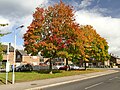 Autumn colour on Garibaldi Drive - geograph.org.uk - 5562635.jpg 800 × 600; 156 KB
-
 Back gate - geograph.org.uk - 5559882.jpg 5.376 × 3.024; 4,06 MB
-
 Bandstand, Berry Hill Park - geograph.org.uk - 2149323.jpg 640 × 427; 74 KB
-
 Bank alongside Eakring Road - geograph.org.uk - 6408589.jpg 1.024 × 768; 381 KB
-
 Bath Lane at Shirburn Avenue, Mansfield - geograph.org.uk - 5156029.jpg 1.600 × 1.065; 510 KB
-
 Bath Lane towards St Peter's Way, Mansfield - geograph.org.uk - 5156103.jpg 1.600 × 1.065; 505 KB
-
 Bath Lane, Mansfield - geograph.org.uk - 5156034.jpg 1.600 × 1.065; 640 KB
-
 Bath Lane-A60 Junction, Mansfield, Notts. - geograph.org.uk - 4304583.jpg 2.919 × 3.167; 2,04 MB
-
 Baxter Hill - geograph.org.uk - 4113102.jpg 640 × 480; 97 KB
-

-
 Beehive Buildings, 1899, Pleasley - geograph.org.uk - 4274600.jpg 1.280 × 925; 223 KB
-
 Beer Shack, Mansfield - geograph.org.uk - 5056023.jpg 851 × 1.280; 253 KB
-
 Bellamy Road, Mansfield, Notts. - geograph.org.uk - 3738168.jpg 3.061 × 1.895; 1,58 MB
-
 Bellamy Road, Mansfield, Notts. - geograph.org.uk - 3738757.jpg 3.657 × 1.908; 1,55 MB
-
 Bellamy Road, Mansfield, Notts. - geograph.org.uk - 4307775.jpg 3.741 × 2.279; 1,75 MB
-
 Bench mark, 15 Church Street, Mansfield - geograph.org.uk - 6251583.jpg 948 × 1.280; 386 KB
-
 Bench mark, 39 St John Street, Mansfield - geograph.org.uk - 6256760.jpg 1.280 × 1.280; 512 KB
-
 Bench mark, churchyard wall, Mansfield - geograph.org.uk - 6249812.jpg 1.280 × 1.051; 490 KB
-
 Bench mark, Mansfield Bus Station - geograph.org.uk - 6248515.jpg 1.280 × 960; 693 KB
-
 Bench mark, Mansfield Viaduct - geograph.org.uk - 6259641.jpg 1.280 × 960; 530 KB
-
 Bench mark, Midworth Street, Mansfield - geograph.org.uk - 6249451.jpg 1.280 × 960; 637 KB
-
 Bench mark, Nottingham Road, Mansfield - geograph.org.uk - 6248543.jpg 1.280 × 960; 551 KB
-
 Bench Mark, Stockwell Gate, Mansfield - geograph.org.uk - 6256165.jpg 960 × 1.280; 372 KB
-
 Bench mark, Wood Street, Mansfield - geograph.org.uk - 6256649.jpg 1.280 × 960; 582 KB
-
 Bend between the roundabouts on A617 - geograph.org.uk - 3519312.jpg 640 × 416; 41 KB
-
 Bend on A617 near Firs Farm - geograph.org.uk - 3519305.jpg 640 × 330; 39 KB
-
 Bernard Road - geograph.org.uk - 4113020.jpg 640 × 480; 75 KB
-
 Berry Hill Hall, Mansfield, Notts. - geograph.org.uk - 4793450.jpg 2.235 × 2.590; 1,58 MB
-
 Berry Hill Lane - geograph.org.uk - 3892409.jpg 640 × 480; 64 KB
-
 Berry Hill Lane Vicinity, Mansfield, Notts. - geograph.org.uk - 5464487.jpg 1.702 × 1.245; 730 KB
-
 Berry Hill Lane, Mansfield, Notts. - geograph.org.uk - 4793409.jpg 3.405 × 2.500; 1,83 MB
-
 Berry Hill Lane, Mansfield, Notts. - geograph.org.uk - 4793430.jpg 3.704 × 3.024; 2,26 MB
-
 Berry Hill Lane, Mansfield, Notts. - geograph.org.uk - 4793477.jpg 3.716 × 2.782; 2,08 MB
-
 Berry Hill Lane, Mansfield, Notts. - geograph.org.uk - 5464633.jpg 1.921 × 1.729; 1,24 MB
-
 Berry Hill Park - geograph.org.uk - 2149324.jpg 640 × 427; 49 KB
-
 Berry Hill Park - geograph.org.uk - 5675015.jpg 4.608 × 3.456; 3,99 MB
-
 Berry Hill Park Athletics Track, Mansfield, Notts. - geograph.org.uk - 5464460.jpg 2.072 × 1.411; 1.008 KB
-
 Berry Hill Park Athletics Track, Mansfield, Notts. - geograph.org.uk - 5464510.jpg 2.709 × 1.711; 1,32 MB
-
 Berry Hill Park Mansfield - geograph.org.uk - 5675004.jpg 4.608 × 3.456; 3,83 MB
-
 Berry Hill Park Mansfield - geograph.org.uk - 5675007.jpg 4.608 × 3.456; 4,15 MB
-
 Berry Hill Park Mansfield - geograph.org.uk - 5675020.jpg 2.885 × 2.163; 1,08 MB
-
 Berry Hill Park, Mansfield, Notts. - geograph.org.uk - 5464375.jpg 2.784 × 1.570; 1,47 MB
-
 Berry Hill Park, Mansfield, Notts. - geograph.org.uk - 5464412.jpg 2.595 × 1.972; 1,7 MB
-
 Berry Hill Park, Mansfield, Notts. - geograph.org.uk - 5464429.jpg 2.397 × 1.691; 1,37 MB
-
 Berry Hill Park, Mansfield, Notts. - geograph.org.uk - 5464533.jpg 2.927 × 1.317; 1,3 MB
-
 Berry Hill Park, Mansfield, Notts. - geograph.org.uk - 5464563.jpg 2.385 × 1.663; 915 KB
-
 Berry Hill Park, Mansfield, Notts. - geograph.org.uk - 5464576.jpg 3.128 × 2.346; 2,57 MB
-
 Between railway and industry - geograph.org.uk - 3916522.jpg 800 × 533; 154 KB
-
 Birch woodland - geograph.org.uk - 6408585.jpg 1.024 × 768; 314 KB
-
 Bird-life on Pleasley Mill Pond - geograph.org.uk - 3288749.jpg 3.648 × 2.736; 4,27 MB
-
 Bistro under the railway arches in Mansfield - geograph.org.uk - 4304597.jpg 3.716 × 5.075; 5,44 MB
-
 Black Scotch Lane - geograph.org.uk - 3892029.jpg 640 × 480; 62 KB
-
 Black Scotch Lane, Mansfield, Notts. - geograph.org.uk - 4307584.jpg 2.534 × 2.176; 1,04 MB
-
 Black Scotch Lane, Mansfield, Notts. - geograph.org.uk - 4307604.jpg 2.461 × 1.848; 984 KB
-
 Black Scotch Lane, Mansfield, Notts. - geograph.org.uk - 4307611.jpg 3.401 × 2.222; 1,51 MB
-
 Black Scotch Lane, Mansfield, Notts. - geograph.org.uk - 4307620.jpg 2.562 × 2.060; 1,19 MB
-
 Black Scotch Lane, Mansfield, Notts. - geograph.org.uk - 4307679.jpg 3.392 × 2.586; 1,74 MB
-
 Black Scotch Lane, Mansfield, Notts. - geograph.org.uk - 5464587.jpg 1.600 × 1.058; 407 KB
-
 Black Scotch Plantation - geograph.org.uk - 5183954.jpg 640 × 427; 195 KB
-
 Black Scotch Plantation Mansfield - geograph.org.uk - 5675010.jpg 4.608 × 3.456; 4,52 MB
-
 Black Scotch Plantation Mansfield - geograph.org.uk - 5675013.jpg 4.608 × 3.456; 4,52 MB
-
 Black Swan, Albert Street, Mansfield - geograph.org.uk - 6248527.jpg 960 × 1.280; 330 KB
-
 Bleak Hill Sidings, Sheepbridge Lane, Mansfield, Notts. - geograph.org.uk - 5605700.jpg 2.352 × 2.352; 1,61 MB
-
 Bleak Hills Area, Mansfield, Notts. - geograph.org.uk - 3514216.jpg 2.963 × 2.157; 1,42 MB
-
 Bleak Hills Area, Mansfield, Notts. - geograph.org.uk - 3514558.jpg 2.913 × 3.657; 1,83 MB
-
 Bleak Hills Lane, Mansfield, Notts. - geograph.org.uk - 3514580.jpg 3.033 × 2.202; 1,23 MB
-
 Bleak Hills Lane, Mansfield, Notts. - geograph.org.uk - 3514634.jpg 3.733 × 2.385; 2,17 MB
-
 Bleak Hills Lane, Mansfield, Notts. - geograph.org.uk - 3514656.jpg 3.243 × 2.412; 1,6 MB
-
 Bleak Hills Lane, Mansfield, Notts. - geograph.org.uk - 4365188.jpg 3.243 × 1.885; 1,47 MB
-
 Boggs Cottages - geograph.org.uk - 3579493.jpg 640 × 480; 78 KB
-
 Botany Avenue, Mansfield - geograph.org.uk - 4778258.jpg 1.024 × 768; 114 KB
-
 Botany Avenue, Mansfield - geograph.org.uk - 5055870.jpg 1.280 × 851; 299 KB
-
 Bottom of Linden Street, Mansfield - geograph.org.uk - 4778245.jpg 1.024 × 768; 142 KB
-
 Bottom of Winkburn Road, Mansfield - geograph.org.uk - 4778251.jpg 1.024 × 768; 148 KB
-
 Boundary stone and forest track near Rainworth - geograph.org.uk - 2696093.jpg 2.048 × 1.536; 932 KB
-
 Boundary stone at Rainworth (close-up) - geograph.org.uk - 2696183.jpg 1.536 × 2.048; 507 KB
-
 Boundary stone at Rainworth - geograph.org.uk - 2696170.jpg 2.048 × 1.536; 895 KB
-
 Boundary stone in forest near Rainworth - geograph.org.uk - 2696069.jpg 1.536 × 2.048; 911 KB
-
 BP Garage on Clipstone Road West - geograph.org.uk - 5152627.jpg 1.600 × 1.065; 572 KB
-
 Bramble Lane Vicinity, Mansfield, Notts. - geograph.org.uk - 4310160.jpg 2.508 × 2.137; 1,2 MB
-
 Briar Lane, Mansfield - geograph.org.uk - 3892424.jpg 640 × 480; 55 KB
-
 Bridge of former railway line - geograph.org.uk - 3288625.jpg 3.648 × 2.736; 4,94 MB
-

-
 Bridge over River Maun - geograph.org.uk - 5559878.jpg 5.376 × 3.024; 3,54 MB
-
 Bridge over the former railway - geograph.org.uk - 5613124.jpg 1.024 × 768; 280 KB
-

-
 Bridge over Toothill Lane, Mansfield - geograph.org.uk - 5764354.jpg 1.024 × 768; 223 KB
-
 Bridle Path Across the Tracks - geograph.org.uk - 2615195.jpg 1.938 × 1.425; 669 KB
-
 Bridle path crossing A617 - geograph.org.uk - 2761116.jpg 2.048 × 1.536; 683 KB
-
 Bridle path towards Strawberry Hill - geograph.org.uk - 3228992.jpg 2.048 × 1.536; 1.013 KB
-
 Bridleway at Oxclose Wood - geograph.org.uk - 5149892.jpg 1.600 × 1.065; 635 KB
-
 Bridleway at Oxclose Wood - geograph.org.uk - 5149894.jpg 1.600 × 1.065; 632 KB
-
 Bridleway at Oxclose Wood - geograph.org.uk - 5149898.jpg 1.600 × 1.065; 650 KB
-
-
 Bridleway off Jubilee Way South, Oak Tree estate - geograph.org.uk - 4159439.jpg 1.024 × 768; 154 KB
-
 Bridleways - geograph.org.uk - 5562638.jpg 800 × 600; 136 KB
-
 Brockenhurst Road, Mansfield - geograph.org.uk - 5431984.jpg 5.376 × 3.024; 2,2 MB
-
 Brunts Buildings, Leeming Street, Mansfield - geograph.org.uk - 6259585.jpg 1.280 × 1.023; 364 KB
-
 Brunts Buildings, Leeming Street, Mansfield - geograph.org.uk - 6259586.jpg 960 × 1.280; 398 KB
-
 Brunts Buildings, Leeming Street, Mansfield - geograph.org.uk - 6259587.jpg 968 × 1.280; 280 KB
-
 Building at Hollins Siding - geograph.org.uk - 5613058.jpg 1.024 × 768; 297 KB
-
 Bungalows on Debdale Lane, Mansfield Woodhouse - geograph.org.uk - 3603317.jpg 3.648 × 2.736; 3,7 MB
-
 Bungalows on Sherwood Hall Road, Mansfield - geograph.org.uk - 5154409.jpg 1.600 × 1.065; 603 KB
-
 Bus passing by on Winthorpe Street - geograph.org.uk - 5427876.jpg 800 × 600; 117 KB
-
 Bus shelter on Redruth Drive - geograph.org.uk - 6408345.jpg 1.024 × 768; 197 KB
-
 Bus Station Vicinity, Mansfield, Notts. - geograph.org.uk - 5258685.jpg 2.480 × 2.011; 1,32 MB
-
 Bus Station, Mansfield, Notts. - geograph.org.uk - 5247597.jpg 2.004 × 2.531; 1.001 KB
-

-
 Bus stop off Park Hall Road, Mansfield Woodhouse - geograph.org.uk - 6573955.jpg 1.024 × 768; 153 KB
-
 Buttermere Court off New Mill Lane - geograph.org.uk - 5150140.jpg 1.600 × 1.065; 760 KB
-
 Calvary Chapel, Forest Town - geograph.org.uk - 5154176.jpg 1.600 × 1.065; 663 KB
-
 Carr Bank Park - geograph.org.uk - 4861609.jpg 6.000 × 4.000; 7,33 MB
-
 Carr Bank Park - geograph.org.uk - 4861610.jpg 5.600 × 3.733; 7,26 MB
-
 Carr Bank Park - geograph.org.uk - 4867112.jpg 6.000 × 4.000; 6,93 MB
-
 Carr Bank Park Bandstand, Mansfield, Notts. - geograph.org.uk - 4304834.jpg 3.072 × 2.780; 1,7 MB
-
 Carr Bank Park Bandstand, Mansfield, Notts. - geograph.org.uk - 4304836.jpg 4.032 × 2.384; 2,14 MB
-
 Carr Bank Park, Mansfield, Notts. - geograph.org.uk - 4304735.jpg 3.891 × 3.023; 2,29 MB
-
 Carr Bank Park, Mansfield, Notts. - geograph.org.uk - 4304750.jpg 3.834 × 2.419; 1,95 MB
-
 Carr Bank Park, Mansfield, Notts. - geograph.org.uk - 4304794.jpg 4.032 × 3.024; 2,64 MB
-
 Carr Bank Park, Mansfield, Notts. - geograph.org.uk - 4304839.jpg 2.366 × 2.573; 1,67 MB
-
 Carr Bank Park, Mansfield, Notts. - geograph.org.uk - 4305478.jpg 3.899 × 2.640; 1,84 MB
-
 Carr Bank Park, Mansfield, Notts. - geograph.org.uk - 4819689.jpg 3.173 × 2.778; 1,44 MB
-
 Carr Bank Park, Mansfield, Notts. - geograph.org.uk - 4819744.jpg 3.674 × 2.224; 1,67 MB
-
 Catholic Church of St Philip Neri, Mansfield - geograph.org.uk - 6256656.jpg 1.280 × 966; 442 KB


_-_geograph.org.uk_-_4112983.jpg)
_-_geograph.org.uk_-_4113056.jpg)


_-_geograph.org.uk_-_2696183.jpg)


