Category:Manton, Rutland
Jump to navigation
Jump to search
village and civil parish in Rutland, UK | |||||
| Upload media | |||||
| Instance of | |||||
|---|---|---|---|---|---|
| Location | Rutland, East Midlands, England | ||||
| Population |
| ||||
| Area |
| ||||
 | |||||
English: Manton is a village in the county of Rutland in the East Midlands of England. It is situated southwest of Rutland Water. (→Manton, Rutland)
Nederlands: Manton is een plaats en civil parish in het bestuurlijke gebied Rutland, in het Engelse graafschap Rutland met 364 inwoners. (→Manton (Rutland))

Media in category "Manton, Rutland"
The following 181 files are in this category, out of 181 total.
-
 A brief glimpse over Rutland Water - geograph.org.uk - 3881042.jpg 1,280 × 960; 287 KB
-
 A field of field beans by a bridleway - geograph.org.uk - 814835.jpg 640 × 480; 114 KB
-
 A hedge lined Wing Road - geograph.org.uk - 3898406.jpg 1,600 × 1,201; 687 KB
-
 A view across the fields nr Manton - geograph.org.uk - 2789667.jpg 640 × 392; 78 KB
-

-

-
 A6003 near Manton - geograph.org.uk - 5163474.jpg 4,000 × 3,000; 934 KB
-
 A6003 north towards Oakham - geograph.org.uk - 3897983.jpg 1,600 × 1,157; 451 KB
-
 A6003 towards Oakham - geograph.org.uk - 5178312.jpg 800 × 570; 133 KB
-
 Agricultural land - geograph.org.uk - 5511591.jpg 640 × 480; 72 KB
-
 Agricultural land - geograph.org.uk - 5511625.jpg 640 × 480; 43 KB
-
 Allotments at Manton - geograph.org.uk - 172140.jpg 640 × 480; 98 KB
-
 Bench mark, Lyndon Road, Manton - geograph.org.uk - 3881088.jpg 1,280 × 960; 416 KB
-
 Bench mark, Manton Cemetery - geograph.org.uk - 3881054.jpg 1,280 × 960; 339 KB
-
 Bench mark, Manton Station approach - geograph.org.uk - 4853174.jpg 960 × 1,280; 333 KB
-
 Bench mark, off Lyndon Road - geograph.org.uk - 4848995.jpg 1,280 × 960; 601 KB
-
 Bridleway from Wing - geograph.org.uk - 4848999.jpg 1,280 × 960; 573 KB
-
 Bridleway leaving the Rutland Water Nature reserve - geograph.org.uk - 5719775.jpg 3,776 × 2,520; 2.71 MB
-
 Broccoli Bottom near Manton - geograph.org.uk - 3898327.jpg 1,600 × 1,065; 430 KB
-
 Bus shelter along Lyndon Road in Manton - geograph.org.uk - 3898007.jpg 1,600 × 1,115; 541 KB
-
 Bus shelter at Manton - geograph.org.uk - 3570377.jpg 1,280 × 856; 249 KB
-
 Caution Runners - geograph.org.uk - 3723557.jpg 1,600 × 1,288; 754 KB
-
 Cemetery gates at Manston - geograph.org.uk - 966147.jpg 640 × 480; 135 KB
-
 Cemetery Lane - geograph.org.uk - 966148.jpg 640 × 390; 96 KB
-
 Cemetery Lane, Manton - geograph.org.uk - 3881048.jpg 1,280 × 960; 522 KB
-
 Church Lane, Manton (geograph 7108985).jpg 1,024 × 768; 301 KB
-
 Church Lane, Manton - geograph.org.uk - 3881073.jpg 1,280 × 960; 280 KB
-
 Church Lane, Manton - geograph.org.uk - 3956772.jpg 1,024 × 768; 197 KB
-
 Church of St Mary, Manton - geograph.org.uk - 5719771.jpg 3,776 × 2,520; 2.67 MB
-
 Churchyard wall, Priory Road, Manton - geograph.org.uk - 4346912.jpg 640 × 480; 135 KB
-
 Crown Well Bridge, Wing Hollow - geograph.org.uk - 4853172.jpg 1,280 × 960; 388 KB
-

-
 Cycleway and footpath along Lyndon Road - geograph.org.uk - 3723507.jpg 1,600 × 1,200; 844 KB
-
 Cycleway by the railway - geograph.org.uk - 4407642.jpg 640 × 387; 89 KB
-
 Cycling east along Lyndon Road - geograph.org.uk - 3723539.jpg 1,600 × 1,088; 727 KB
-
 Cyclists dismount - geograph.org.uk - 966150.jpg 640 × 503; 162 KB
-
 Dead tree from Waderscrape bird hide - geograph.org.uk - 1276600.jpg 640 × 480; 67 KB
-
 Dereliction in a field - geograph.org.uk - 966146.jpg 640 × 470; 117 KB
-
 Driveway to 3 Lyndon Road - geograph.org.uk - 3881091.jpg 1,280 × 960; 410 KB
-
 Driveway to Lambourne House - geograph.org.uk - 3881094.jpg 1,280 × 960; 345 KB
-
 Dustbin day on Lyndon Road Manton - geograph.org.uk - 1277249.jpg 640 × 480; 57 KB
-
 End of the cycle path - geograph.org.uk - 3289636.jpg 4,000 × 2,830; 3.29 MB
-
 Entering Manton - geograph.org.uk - 5709768.jpg 3,776 × 2,520; 2.74 MB
-
 Ewes and lambs next to Wing Road - geograph.org.uk - 3898482.jpg 1,600 × 1,243; 465 KB
-
 Farmland on the edge of Manton - geograph.org.uk - 6090659.jpg 800 × 459; 113 KB
-
 Field of sheep - geograph.org.uk - 5511622.jpg 640 × 480; 47 KB
-
 Fields south of Manton village - geograph.org.uk - 3898420.jpg 1,600 × 1,242; 585 KB
-
 Fields west of Wing Road - geograph.org.uk - 2838085.jpg 640 × 454; 77 KB
-
 Fingerpost at Manton crossroads - geograph.org.uk - 3881083.jpg 1,280 × 960; 508 KB
-

-
 Footpath along Lyndon Road - geograph.org.uk - 3289629.jpg 3,490 × 2,552; 2.76 MB
-

-

-
 Hidden dip - geograph.org.uk - 1301663.jpg 640 × 480; 55 KB
-
 Hill House, Manton and Rutland Water Cycleway - geograph.org.uk - 3881053.jpg 1,280 × 945; 481 KB
-
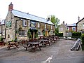
 Horse & Jockey, Manton - geograph.org.uk - 3956779.jpg 1,024 × 768; 149 KB
-
 Horse and Jockey - geograph.org.uk - 966149.jpg 640 × 480; 95 KB
-
 Horse and Jockey pub on Cemetery Lane - geograph.org.uk - 3723485.jpg 1,600 × 1,048; 602 KB
-
 Horse and Jockey, Manton - geograph.org.uk - 3881057.jpg 1,280 × 960; 263 KB
-
 House along Wing Road in Manton - geograph.org.uk - 3898022.jpg 1,600 × 1,112; 750 KB
-
 Houses on St Mary's Road, Manton - geograph.org.uk - 3956765.jpg 1,024 × 768; 192 KB
-
 Ivy House and Vine Cottage, Manton - geograph.org.uk - 3881069.jpg 1,280 × 928; 236 KB
-
 Ivy House, Manton (geograph 7108883).jpg 1,024 × 768; 174 KB
-

-
 Just south of Manton Junction - geograph.org.uk - 4407646.jpg 640 × 426; 77 KB
-
 Lax Hill and Rutland Water - geograph.org.uk - 1011065.jpg 640 × 445; 63 KB
-
 Looking down Stocks Hill, Manton - geograph.org.uk - 3881096.jpg 1,280 × 960; 263 KB
-
 Lyndon Road and cycleway - geograph.org.uk - 1011075.jpg 640 × 526; 110 KB
-
 Lyndon Road entering Manton - geograph.org.uk - 3897996.jpg 1,600 × 1,120; 802 KB
-
 Lyndon Road in Manton - geograph.org.uk - 3723495.jpg 1,600 × 1,068; 649 KB
-
 Lyndon Road, Manton - geograph.org.uk - 3881105.jpg 1,280 × 960; 430 KB
-
 Lyndon Road, Manton - geograph.org.uk - 3956780.jpg 1,024 × 768; 235 KB
-
 Maintenance access gate north of Manton Tunnel - geograph.org.uk - 3956762.jpg 1,024 × 768; 226 KB
-
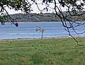 Manton Bay - geograph.org.uk - 1011439.jpg 640 × 485; 99 KB
-
 Manton Bay, Rutland Water - geograph.org.uk - 160667.jpg 640 × 427; 124 KB
-
 Manton Cemetery - geograph.org.uk - 3881056.jpg 1,280 × 960; 603 KB
-
 Manton Crossroads - geograph.org.uk - 3570378.jpg 1,280 × 856; 345 KB
-
 Manton Grange - geograph.org.uk - 4848993.jpg 1,280 × 960; 544 KB
-
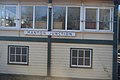
 Manton Junction Signal Box - geograph.org.uk - 1965616.jpg 2,698 × 1,930; 633 KB
-
 Manton Junction Signalbox - geograph.org.uk - 4407632.jpg 640 × 426; 50 KB
-
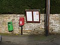 Manton postbox ref LE15 27 - geograph.org.uk - 3881079.jpg 1,280 × 960; 404 KB
-
 Manton Station approach road - geograph.org.uk - 4853177.jpg 1,280 × 960; 306 KB
-
 Manton Station building - geograph.org.uk - 4853179.jpg 1,280 × 960; 374 KB
-
 Manton Telephone Exchange, Rutland - geograph.org.uk - 2257146.jpg 3,072 × 2,304; 1.79 MB
-
 Manton Tunnel - geograph.org.uk - 1011269.jpg 640 × 515; 132 KB
-
 Manton Tunnel - geograph.org.uk - 3881897.jpg 1,280 × 851; 440 KB
-
 Manton up coal train geograph-2769680-by-Ben-Brooksbank.jpg 2,228 × 1,256; 1.18 MB
-
 Manton, Cemetery Lane - geograph.org.uk - 1011152.jpg 640 × 442; 86 KB
-
 Manton, Lyndon Road - geograph.org.uk - 1011083.jpg 640 × 506; 105 KB
-
 Manton, Stocks Hill - geograph.org.uk - 1011085.jpg 640 × 359; 87 KB
-
 Near Wing - geograph.org.uk - 4407654.jpg 640 × 426; 81 KB
-

-
 Oakham Road - geograph.org.uk - 6176872.jpg 3,648 × 2,432; 2.95 MB
-
 Oakham Road A6003 - geograph.org.uk - 6291034.jpg 1,600 × 1,200; 562 KB
-
 Old Hall, Manton - geograph.org.uk - 3393957.jpg 640 × 426; 166 KB
-
 Old road near Manton - geograph.org.uk - 3881045.jpg 1,280 × 960; 254 KB
-
 Osprey and nest in Manton Bay - geograph.org.uk - 3971599.jpg 1,600 × 1,024; 234 KB
-
 Osprey perch in Manton Bay - geograph.org.uk - 3971609.jpg 1,600 × 1,058; 197 KB
-
 Pill box on Lyndon Hill - geograph.org.uk - 1006907.jpg 640 × 464; 91 KB
-
 Priory Road, Manton - geograph.org.uk - 3956773.jpg 1,024 × 768; 191 KB
-
 Railway Bridge - geograph.org.uk - 5511587.jpg 640 × 480; 77 KB
-
 Railway bridge near Manton - geograph.org.uk - 2554846.jpg 640 × 480; 241 KB
-
 Railway bridge over the A6003 - geograph.org.uk - 3017765.jpg 640 × 480; 62 KB
-

-
 River Chater - geograph.org.uk - 3017774.jpg 480 × 640; 126 KB
-
 River Gwash - geograph.org.uk - 317761.jpg 640 × 480; 125 KB
-
 River Gwash comes under the railway - geograph.org.uk - 5935597.jpg 640 × 464; 138 KB
-
 River Gwash meets Rutland Water - geograph.org.uk - 2744440.jpg 2,592 × 1,944; 1.92 MB
-
 Road closed - geograph.org.uk - 2399350.jpg 640 × 427; 123 KB
-
 Road closed - geograph.org.uk - 5935598.jpg 640 × 368; 54 KB
-
 Road towards Manton - geograph.org.uk - 3017770.jpg 640 × 480; 57 KB
-
 Rutland County Council Public Bridleway - geograph.org.uk - 3880679.jpg 1,280 × 851; 201 KB
-
 Rutland Water - geograph.org.uk - 3017761.jpg 2,848 × 2,136; 1.45 MB
-
 Rutland Water - geograph.org.uk - 3886356.jpg 1,280 × 851; 192 KB
-
 Rutland Water - geograph.org.uk - 5511628.jpg 640 × 480; 45 KB
-
 Rutland Water cycle trail - geograph.org.uk - 2399239.jpg 640 × 427; 106 KB
-
 Sheep pasture at Martinsthorpe - geograph.org.uk - 3897931.jpg 1,600 × 1,050; 284 KB
-
 Signpost Manton - geograph.org.uk - 2789658.jpg 640 × 401; 78 KB
-
 Small industrial estate at Manton Junction - geograph.org.uk - 3898390.jpg 1,600 × 1,112; 441 KB
-
 Sounding Bridge - geograph.org.uk - 3566455.jpg 1,280 × 856; 293 KB
-
 Sounding Bridge - geograph.org.uk - 6176875.jpg 3,648 × 2,432; 2.6 MB
-
 Sounding Bridge - geograph.org.uk - 966151.jpg 640 × 407; 82 KB
-
 South end of Stocks Hill, Manton - geograph.org.uk - 3956782.jpg 1,024 × 768; 214 KB
-
 Southview Close - geograph.org.uk - 5511597.jpg 640 × 480; 101 KB
-
 Spitfire over Rutland Water - geograph.org.uk - 3291408.jpg 1,022 × 855; 365 KB
-
 Spring east of Manton - geograph.org.uk - 5719782.jpg 3,776 × 2,520; 3.68 MB
-
 St Mary's Church at Manton - geograph.org.uk - 6090662.jpg 800 × 472; 102 KB
-
 St Mary's Road, Manton - geograph.org.uk - 3881070.jpg 1,280 × 945; 273 KB
-
 Stocks Hill, Manton - geograph.org.uk - 3881933.jpg 1,280 × 851; 391 KB
-
 Telecoms mast entering Manton - geograph.org.uk - 1277248.jpg 640 × 480; 63 KB
-
 The A6003 towards Oakham - geograph.org.uk - 3723468.jpg 1,600 × 1,151; 854 KB
-
 The Chater Valley - geograph.org.uk - 4407650.jpg 640 × 426; 67 KB
-

-
 The Horse & Jockey - geograph.org.uk - 2398735.jpg 640 × 427; 81 KB
-
 The Horse & Jockey, Manton - geograph.org.uk - 3565265.jpg 1,280 × 856; 279 KB
-
 The Horse and Jockey at Manton - geograph.org.uk - 2554840.jpg 640 × 480; 267 KB
-
 The Horse and Jockey, Manton - geograph.org.uk - 5710600.jpg 3,776 × 2,520; 3.39 MB
-
 The Macmillan Way heading west from Manton - geograph.org.uk - 5719730.jpg 3,776 × 2,520; 3.37 MB
-
 The Old Cottage, Manton (geograph 7106171).jpg 1,024 × 768; 149 KB
-

-
 The other line at Manton Junction - geograph.org.uk - 4407635.jpg 640 × 426; 91 KB
-
 The River Gwash flows into Rutland Water - geograph.org.uk - 4205553.jpg 1,537 × 1,047; 264 KB
-
 The River Gwash, near Manton, Rutland - geograph.org.uk - 160675.jpg 640 × 427; 145 KB
-
 The Rutland Water cycle circuit at Sounding Bridge - geograph.org.uk - 5710630.jpg 3,776 × 2,520; 2.68 MB
-

-

-

-
 Thoroughbred Hippo - geograph.org.uk - 2744423.jpg 2,592 × 1,944; 2.23 MB
-
 Three Wells, Manton - geograph.org.uk - 3881112.jpg 1,280 × 960; 358 KB
-
 Towards Wing - geograph.org.uk - 2838086.jpg 640 × 441; 62 KB
-
 Towards Wing Hollow - geograph.org.uk - 2838087.jpg 640 × 480; 91 KB
-
 Track at the Lyndon Nature Reserve - geograph.org.uk - 5178177.jpg 800 × 599; 134 KB
-
 Trees along the bridleway to Manton - geograph.org.uk - 5178203.jpg 800 × 581; 196 KB
-
 Tufted Duck Hide overlooking Manton Bay - geograph.org.uk - 5178095.jpg 800 × 605; 164 KB
-
 Under the railway bridge - geograph.org.uk - 1011284.jpg 556 × 640; 82 KB
-
 View across Manton Bay - geograph.org.uk - 1011366.jpg 640 × 551; 74 KB
-
 View across Manton Bay at Rutland Water - geograph.org.uk - 5571363.jpg 800 × 551; 116 KB
-
 View across the Gwash Valley - geograph.org.uk - 1011158.jpg 640 × 446; 82 KB
-
 View across the western edge of Rutland Water - geograph.org.uk - 3291410.jpg 2,571 × 1,948; 1.51 MB
-
 View east across Manton Bay - geograph.org.uk - 3723461.jpg 1,600 × 1,259; 300 KB
-
 View from Lyndon Road - geograph.org.uk - 2744413.jpg 2,592 × 1,944; 2.08 MB
-
 View from Waderscrape Hide - geograph.org.uk - 2378258.jpg 640 × 450; 68 KB
-
 View north across fields to Rutland Water - geograph.org.uk - 3723518.jpg 1,600 × 1,116; 640 KB
-
 View north across Rutland Water - geograph.org.uk - 3723550.jpg 1,600 × 1,061; 537 KB
-
 View towards Rutland Water - geograph.org.uk - 3723533.jpg 1,600 × 1,033; 596 KB
-
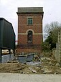
 Water tower near Manton Junction - geograph.org.uk - 3898443.jpg 1,600 × 1,505; 552 KB
-
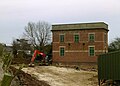 Water tower, Manton - geograph.org.uk - 4853173.jpg 1,280 × 922; 318 KB
-
 Water tower, Manton - geograph.org.uk - 4853175.jpg 960 × 1,280; 319 KB
-
 Western extremity of Rutland Water - geograph.org.uk - 3956759.jpg 1,024 × 768; 110 KB
-
 Wing Road climbing towards the village of Manton - geograph.org.uk - 3898456.jpg 1,600 × 1,453; 451 KB
-
 Wing Road entering Manton village - geograph.org.uk - 3898047.jpg 1,600 × 1,175; 688 KB
-
 Wing Road south of Manton - geograph.org.uk - 3898361.jpg 1,600 × 1,190; 658 KB
-
 Wing Road, Manton - geograph.org.uk - 3881085.jpg 1,280 × 960; 362 KB
-
 Winter morning in Manton - geograph.org.uk - 5211320.jpg 640 × 427; 81 KB
-
 Yew avenue, Manton Cemetery, Cemetery Lane, Manton - geograph.org.uk - 5710610.jpg 3,776 × 2,520; 3.18 MB
-

-
 Bridge over the River Gwash - geograph.org.uk - 317750.jpg 640 × 480; 93 KB
-
 Fields by the River Gwash - geograph.org.uk - 317758.jpg 640 × 480; 123 KB
-
 Garden Nursery - geograph.org.uk - 172146.jpg 640 × 355; 50 KB
-
 Industry at Manton Junction - geograph.org.uk - 172138.jpg 640 × 566; 98 KB
-
 Radio Mast - geograph.org.uk - 172145.jpg 640 × 442; 57 KB


.jpg)


.jpg)


_towards_Uppingham_-_geograph.org.uk_-_3017776.jpg)


.jpg)


