Category:Maps of Lake Tanganyika
Jump to navigation
Jump to search
Wikimedia category | |||||
| Upload media | |||||
| Instance of | |||||
|---|---|---|---|---|---|
| Category combines topics | |||||
| Lake Tanganyika | |||||
lake in Africa   | |||||
| Instance of | |||||
| Part of |
| ||||
| Location |
| ||||
| Width |
| ||||
| Length |
| ||||
| Area |
| ||||
| Elevation above sea level |
| ||||
| Inflows | |||||
| Outflows | |||||
| Drainage basin | |||||
| Basin country | |||||
| Different from | |||||
 | |||||
Subcategories
This category has the following 2 subcategories, out of 2 total.
M
O
- Old maps of Lake Tanganyika (7 F)
Media in category "Maps of Lake Tanganyika"
The following 33 files are in this category, out of 33 total.
-
 Shows Lake Tanganyika in African continent.jpg 768 × 768; 155 KB
-

-

-

-

-

-

-

-

-

-

-

-

-
 Africa (1878) (14589871897).jpg 2,968 × 1,436; 1.09 MB
-
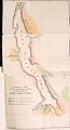
 Congo explorations.jpg 652 × 523; 343 KB
-
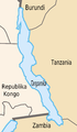
 DRC-Tanzania border.png 811 × 1,111; 282 KB
-
 Grafika-Tanganika12-2.png 2,000 × 3,426; 369 KB
-
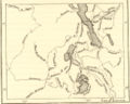
 Karte von Inner-Afrika, Blatt 10 - Unyamwesi.png 9,033 × 7,428; 94.16 MB
-
 Lago Tanganica-bg.JPG 333 × 513; 72 KB
-
 Lago Tanganica-bg2.JPG 333 × 513; 72 KB
-
 Lago Tanganica.JPG 333 × 513; 72 KB
-
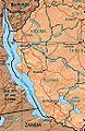
 Lake Tanganyika map.png 728 × 1,373; 493 KB
-
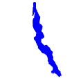 Lake Tanganyika.svg 300 × 300; 11 KB
-
 Lieut. V.L. Cameron's Aufnahme des südlichen Theiles des Tancanjika See's, 1874.png 1,702 × 4,367; 6.53 MB
-

-

-
 Stanley's Lake Tanganyika.jpg 5,312 × 2,988; 4.88 MB
-
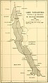
 Tanganjika-See.JPG 1,838 × 4,822; 897 KB
-
 Tanganyika outline.gif 45 × 91; 2 KB
-

-

-
-

.jpg)
.jpg)
.jpg)
.jpg)
.jpg)
.jpg)
.jpg)
.jpg)
.jpg)
.jpg)
.jpg)
.jpg)
_(14589871897).jpg)


_(14587728349).jpg)
_(14587910067).jpg)
_(14596014237).jpg)
_(14782529795).jpg)
.jpg)