Category:Maps of Albania
Przejdź do nawigacji
Przejdź do wyszukiwania
kategoria w projekcie Wikimedia | |||||
| Prześlij plik multimedialny | |||||
| Jest to | |||||
|---|---|---|---|---|---|
| Zagadnienia związane z kategorią | |||||
 | |||||
kategoria w projekcie Wikimedia | |||||
| Prześlij plik multimedialny | |||||
| Jest to | |||||
|---|---|---|---|---|---|
| Zagadnienia związane z kategorią | |||||
 | |||||
Use the appropriate category for maps showing all or a large part of Albania. See subcategories for smaller areas:
| If the map shows | Category to use |
|---|---|
| Albania on a recently created map | Category:Maps of Albania or its subcategories |
| Albania on a map created more than 70 years ago | Category:Old maps of Albania or its subcategories |
| the history of Albania on a recently created map | Category:Maps of the history of Albania or its subcategories |
| the history of Albania on a map created more than 70 years ago | Category:Old maps of the history of Albania or its subcategories |
Podkategorie
Poniżej wyświetlono 32 spośród wszystkich 32 podkategorii tej kategorii.
- Blank maps of Albania (19 plików)
*
+
A
B
- Maps of borders of Albania (4 pliki)
D
F
G
H
L
- Law-related maps of Albania (2 pliki)
M
- Maps of 20th-century Albania (pusta)
P
- Population density maps of Albania (3 pliki)
- Poverty maps of Albania (2 pliki)
R
T
W
Strony w kategorii „Maps of Albania”
Poniżej wyświetlono 2 spośród wszystkich 2 stron tej kategorii.
Pliki w kategorii „Maps of Albania”
Poniżej wyświetlono 78 spośród wszystkich 78 plików w tej kategorii.
-
20161202 DailyMap AlbaniaFloods UCPMresponse.pdf 1754 × 1239; 795 KB
-
20220308 Modules deployed 2021.pdf 1625 × 1125; 961 KB
-
Albaner Border Changes (Plan of Enver Hoxha).jpg 1348 × 1666; 184 KB
-
Albania Counties Colored.svg 184 × 400; 136 KB
-
Albania DNI Solar-resource-map GlobalSolarAtlas World-Bank-Esmap-Solargis.png 1842 × 2605; 1,72 MB
-
Albania GHI Solar-resource-map GlobalSolarAtlas World-Bank-Esmap-Solargis.png 1842 × 2605; 1,6 MB
-
Albania Map (Made With Drones).jpg 710 × 1280; 47 KB
-
Aromanians in Albania.png 284 × 536; 21 KB
-
Bujan.jpg 275 × 404; 10 KB
-
DemoMapForKhirurg.png 655 × 709; 69 KB
-
ECDM 20150202 EEurope Floods.pdf 1625 × 1125; 605 KB
-
ECDM 20150203 EEurope Floods.pdf 1625 × 1125; 711 KB
-
ECDM 20150216 Albania Floods v03.pdf 1625 × 1125; 800 KB
-
ECDM 20150825 Greece RefugeeCrisis.pdf 1625 × 1125; 820 KB
-
ECDM 20150918 WesternBalkansRoute.pdf 1754 × 1239; 1,18 MB
-
ECDM 20161107 EuropeFloodForecast SE.pdf 1625 × 1125; 733 KB
-
ECDM 20161109 BalkanFloodForecast.pdf 1625 × 1125; 721 KB
-
ECDM 20190923 Albania EQ.pdf 1625 × 1125; 639 KB
-
ECDM 20190926 Albania EQ.pdf 1625 × 1125; 730 KB
-
ECDM 20191002 Albania EQ-Response.pdf 1625 × 1125; 656 KB
-
ECDM 20191129 Albania EQ.pdf 1625 × 1125; 1 MB
-
ECDM 20191203 Albania EQ EU-Response.pdf 1625 × 1125; 1020 KB
-
ECDM 20191218 Albania EQ EU-Response.pdf 1625 × 1125; 1013 KB
-
ECDM 20210806 Forestfires SouthernEurope(1).pdf 1625 × 1125; 631 KB
-
ECDM 20240710 WF Albania.pdf 1625 × 1125; 688 KB
-
ECDM 20240731 Wildfires activation Europe.pdf 1625 × 1125; 738 KB
-
ECDM 20240812 WF activations Europe.pdf 1625 × 1125; 710 KB
-
ECDM 20240903 Europe wildfires.pdf 1625 × 1125; 639 KB
-
ECDM 20240910 Europe wildfires.pdf 1625 × 1125; 701 KB
-
ECHO Albania Editable A4 Portrait 2019.pdf 1239 × 1754; 391 KB
-
ECHO Albania Editable A4 Portrait 2019.png 794 × 1123; 797 KB
-
EQC8HhbW4AAZmAP (3).jpg 1080 × 988; 53 KB
-
EUR location ALB.PNG 1600 × 1200; 567 KB
-
Europe map albania.png 1231 × 929; 51 KB
-
Falk Oberdorf UstgVbd ALB.PNG 410 × 600; 41 KB
-
Fancy-political-3d-map-of-lezhe.jpg 423 × 348; 86 KB
-
FLII Albania.png 564 × 887; 317 KB
-
Gji01.png 321 × 341; 62 KB
-
Green Zones.svg 274 × 611; 1,22 MB
-
Harta Hidrografike e Vjosës.jpg 939 × 671; 176 KB
-
Hasi.jpg 2048 × 1360; 861 KB
-
IAN 0945 Heather 1802 Valona.jpg 4591 × 3711; 9,69 MB
-
Kreis-Permet.png 284 × 600; 53 KB
-
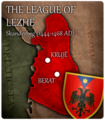
League of Lezha the first unified Albanian state.png 360 × 412; 235 KB
-
Libération de l'Albanie (1918).png 1920 × 1080; 614 KB
-
Map albania.png 8208 × 10 341; 6,99 MB
-
Albanijamapa.PNG 284 × 355; 13 KB
-
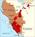
Map of Chameria.png 1412 × 1458; 284 KB
-
Map Of Where The Police Is searching.png 980 × 980; 186 KB
-
Mapa da Albânia (OCHA).svg 254 × 254; 829 KB
-
Mapa Fronteras Albania.png 745 × 676; 112 KB
-
Mapofmirdita.png 3408 × 3988; 758 KB
-
Muzakaj principality.svg 600 × 258; 117 KB
-
Natural resources of Albania.png 1336 × 2521; 396 KB
-
Osmanlı borçlarını ödeyen ülkeler.png 4252 × 3403; 1,02 MB
-
PAT - Albania.gif 800 × 1025; 320 KB
-
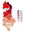
Population density of Albania counties.png 4001 × 6502; 832 KB
-
Pozita gjeografike e fshatit Majac.png 848 × 1200; 208 KB
-
Principality of Albania 1368.png 2349 × 2947; 450 KB
-
Principality of Albania 1370.png 2349 × 2947; 456 KB
-
RefugeeCrisis WesternBalkanRoute DailyMap.pdf 1754 × 1239; 795 KB
-
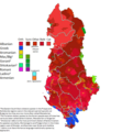
Religious distribution 1927 Albania.png 1576 × 3464; 6,17 MB
-
Religious distribution.png 556 × 1048; 748 KB
-
Sazani map CS.png 689 × 582; 14 KB
-
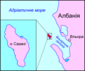
Sazani map PL.png 689 × 582; 14 KB
-
Sazani map RU.png 689 × 582; 23 KB
-
Sazani map UK.png 689 × 582; 15 KB
-
Sistemimi i ri UK.jpg 1284 × 1817; 281 KB
-
Thopia, Arianiti and Gropa (late 14th century).png 3314 × 2408; 2,56 MB
-
Vendndodhja.png 1694 × 1200; 2,14 MB
-
WesternBalkans DailyMap 3092015 v2.pdf 1754 × 1239; 1,22 MB
-
Zonat Teritorjale.jpg 591 × 354; 122 KB
-
Zyra e Regjistrimit të Pasurive të Paluajtshme.svg 355 × 404; 31 KB
-
Адміністрацыйна-тэрытарыяльны падзел Альбаніі.png 178 × 400; 34 KB


