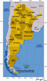
Category:Maps of Argentina
Sari la navigare
Sari la căutare
Țările din America de Sud: Argentina · Bolivia · Brazilia · Chile · Columbia · Ecuador · Guyana · Paraguay · Peru · Surinam · Trinidad și Tobago‡ · Uruguay · Venezuela
Alte teritorii: Aruba · Bonaire · Curaçao · Georgia de Sud și Insulele Sandwich de Sud · Guyana Franceză · Insulele Falkland
‡: parțial situat în America de Sud
Alte teritorii: Aruba · Bonaire · Curaçao · Georgia de Sud și Insulele Sandwich de Sud · Guyana Franceză · Insulele Falkland
‡: parțial situat în America de Sud
Use the appropriate category for maps showing all or a large part of Argentina. See subcategories for smaller areas:
| If the map shows | Category to use |
|---|---|
| Argentina on a recently created map | Category:Maps of Argentina or its subcategories |
| Argentina on a map created more than 70 years ago | Category:Old maps of Argentina or its subcategories |
| the history of Argentina on a recently created map | Category:Maps of the history of Argentina or its subcategories |
| the history of Argentina on a map created more than 70 years ago | Category:Old maps of the history of Argentina or its subcategories |
categorie în cadrul unui proiect Wikimedia | |||||
| Încarcă multimedia | |||||
| Este un/o | |||||
|---|---|---|---|---|---|
| Categoria combină subiectele | |||||
 | |||||
Subcategorii
Această categorie conține următoarele 47 de subcategorii, dintr-un total de 47.
*
B
- Blank maps of Argentina (15 F)
C
D
E
F
G
H
I
L
- Linguistic maps of Argentina (20 F)
M
- Maps of Argentina in logos (11 F)
O
P
R
S
T
- Maps of Tandil (2 F)
- Time zone maps of Argentina (6 F)
W
Pagini din categoria „Maps of Argentina”
Următoarele 2 pagini se află în această categorie, dintr-un total de 2.
Fișiere media din categoria „Maps of Argentina”
Următoarele 160 fișiere se află în această categorie, dintr-un total de 160.
-
 (CORREJIDO) Dep por poblacion.jpg 9.289x16.571; 18,14 MB
-
 28th parallel Argentina.png 520x1.004; 39 KB
-
 35th parallel Argentina.png 520x1.004; 39 KB
-
 42th parallel Argentina.PNG 520x1.004; 36 KB
-
 AlboInterior.jpg 352x599; 57 KB
-
 Argentina (países con embajadas).png 1.425x625; 47 KB
-
 Argentina - panoramio (1).jpg 2.496x3.328; 2,81 MB
-
 Argentina - Situation map - Buenos Aires.png 390x251; 31 KB
-
 Argentina - Situation map - Cuyo.png 390x251; 47 KB
-
 Argentina - Situation map - Mesopotamia y Santa Fe.png 390x251; 51 KB
-
 Argentina - Situation map - Noroeste.png 390x251; 55 KB
-
 Argentina - Situation map - Pampa y NorPatagonia.png 390x251; 43 KB
-
 Argentina disputed w1 countrymap.svg 1.000x1.000; 47 KB
-
 Argentina map eq clear.png 310x451; 27 KB
-
 Argentina map eq.png 310x451; 22 KB
-
 Argentina map eq2.png 310x451; 27 KB
-
 Argentina map eq3.png 310x451; 21 KB
-
 Argentina map eqcleargrey.png 310x451; 12 KB
-
 Argentina Panhandle.svg 17x15; 5 KB
-
 Argentina provinces blank.png 2.000x4.280; 44 KB
-
 Argentina Riu Negre localització mapa.png 1.024x647; 85 KB
-
 Argentinamap3.png 451x808; 26 KB
-
 Argentinian Embassies.PNG 1.425x625; 30 KB
-
 Argentinians with Italian Ancestry by province.png 3.507x5.365; 526 KB
-
 Argentinië lokatie.png 460x533; 11 KB
-
 Argentino kun urboj.png 264x453; 106 KB
-
 ArgmapKaiwálang.JPG 328x712; 44 KB
-
 Arhl.PNG 568x937; 31 KB
-
 Arjentina-Konkani vishwakosh.png 562x752; 84 KB
-
 Bahia blanca y patagonia.jpg 819x619; 94 KB
-
 Bernal.PNG 400x477; 30 KB
-
 Calbuco Volcano Erupts April 23 2015 with gravity waves.jpg 720x480; 163 KB
-
 Carte des provinces de Salta et de Jujuy et d'une partie de la Bolivie.jpg 3.594x2.835; 1,93 MB
-
 Carte papeleras.png 696x397; 437 KB
-
 Centro-norte-argentina.PNG 279x202; 24 KB
-
 Centros de inmigración checa en Argentina.png 566x936; 164 KB
-
 Cerro Fortaleza Formation Location.png 1.931x1.735; 932 KB
-
 Concesion 1.jpg 586x326; 30 KB
-
 Concesion 2.jpg 580x300; 29 KB
-
 Concesion 2019.jpg 629x346; 24 KB
-
 Concesion.jpg 627x303; 26 KB
-
 Concesión y datos.jpg 681x343; 30 KB
-
 Costa atlantica argentina.PNG 363x599; 68 KB
-

-

-
 Departamento Pocito (prov. de San Juan - Argentina).jpg 784x703; 276 KB
-
 DepartamentosLP.jpg 714x598; 46 KB
-
 Distribución de Gleditsia triacanthos.jpg 775x1.280; 61 KB
-
 División política de la Provincia de San Luis -Argentina-.jpg 715x1.001; 164 KB
-
 ECDM 20240422 South America.pdf 2.479x1.754; 965 KB
-
 Edenor en números.jpg 596x327; 25 KB
-
 Equipos Torneo Argentino A 2009-10.PNG 546x920; 34 KB
-
 Eternal brothers, eternos-hermanos (1).png 344x736; 139 KB
-
 ETH-BIB-Karte Córdoba-Rosario-Buenos Aires-Dia 247-Z-00278.tif 3.616x2.878; 29,91 MB
-
 ETH-BIB-Karte, F.C. Transandino, Rio del Plamo (10.-11.I.1934)-Dia 247-Z-00302.tif 2.900x3.552; 29,6 MB
-
 Eva Peron birthplaces map.jpg 1.102x842; 257 KB
-
 Ezpeleta.PNG 400x477; 30 KB
-
 Faltan ellos - Facultad de Ciencias Económicas de la Universidad de Buenos Aires.jpg 3.456x4.608; 5,82 MB
-
 Femicidios-argentina.png 600x697; 163 KB
-
 Flag map of Argentina With Falkland Islands.png 321x665; 32 KB
-
 FLII Argentina.png 532x910; 157 KB
-
 Florida Este - Vicente Lopez Map.png 570x573; 32 KB
-
 Fronterabalcanes.jpg 482x806; 51 KB
-
 Gasoducto comodoro.jpg 443x600; 173 KB
-
 GBIF ocurrencias localizadas en Argentina - septiembre 2016.png 542x1.169; 100 KB
-
 GolfoSanJorge.PNG 702x712; 24 KB
-
 GolfoSanMatias.PNG 723x590; 25 KB
-
 Granbuenosaires4.PNG 305x239; 25 KB
-
 GRANDETIJUCA.jpg 295x243; 57 KB
-
 GRN2.PNG 501x436; 15 KB
-
 Ideología de Francisco de Aguirre.jpg 1.572x1.632; 1,14 MB
-
 Imagen Edea.jpg 666x483; 145 KB
-
 Ingeniero White Argentina.jpg 1.000x1.000; 76 KB
-
 Ingeniero White Necochea Argentina Ussukuma.jpg 1.000x1.000; 79 KB
-
 Junín Eva 003.jpg 909x721; 155 KB
-
 Junín UNNOBA Esquema 05.gif 554x381; 63 KB
-
 Lage San Antonio Oeste.gif 442x769; 13 KB
-
 LAJEADO.jpg 3.508x2.479; 3,4 MB
-
 LECTOS DE ARGENTINA.png 1.052x1.600; 931 KB
-
 Lugares conocidos por D2000 (1).png 352x599; 88 KB
-
 Map of Argentina.gif 996x1.450; 1,01 MB
-
 Map of Cruz del Eje Department, Argentina.png 174x175; 8 KB
-
 Map of Salar de Arizaro.png 689x316; 36 KB
-
 Mapa Argentina accidente Sol 5428.jpg 882x1.500; 639 KB
-

-
 Mapa Argentino según presentación CLPC-ONU - 2009.png 419x589; 440 KB
-
 Mapa CIN.jpg 2.456x3.518; 749 KB
-
 Mapa cuyo.png 568x937; 133 KB
-
 Mapa da Argentina (OCHA).svg 254x254; 568 KB
-
 Mapa da Tríplice Fronteira (Argentina, Brasil e Paraguai).png 2.176x2.172; 273 KB
-

-

-
 Mapa de avistamientos.png 453x715; 58 KB
-
 Mapa De El NEA.jpg 85x68; 3 KB
-
 Mapa de los alertas meteorológicos.png 474x600; 135 KB
-
 Mapa de los conflictos en Argentina de 2013.png 2.000x4.280; 279 KB
-
 Mapa de los conflictos policiales en Argentina de 2013.png 2.000x4.280; 124 KB
-
 Mapa de San José, Provincia de Misiones, Argentina.png 467x396; 203 KB
-
 Mapa de sedes del INTA.jpg 2.825x4.843; 1,1 MB
-
 Mapa delegaciones CECRA.png 609x917; 86 KB
-
 Mapa jorge 2016.jpg 3.369x2.390; 910 KB
-
 Mapa Linha de Ferro 40 Cacequi Saicã.jpg 600x144; 28 KB
-
 Mapa recorrido RoberCamp18.png 762x809; 473 KB
-
 Mapa+dióc 1 ..jpg 1.330x1.128; 293 KB
-
 Mapacomarca.gif 776x712; 74 KB
-
 MapaTorneoRegional2019.png 804x821; 309 KB
-
 MapaUniversidadesArgentinas2010.jpg 1.990x3.253; 765 KB
-
 Matrimonio gay en el Senado de Argentina.jpg 598x1.278; 95 KB
-
 Mesopotamia argentina.png 568x937; 67 KB
-
 Mills3b.gif 600x501; 13 KB
-
-
 Neolicaphrium recens fossil locations.jpg 663x726; 165 KB
-
 Nevadas Argentina 09-07-07.jpg 391x483; 69 KB
-
 Olivo.png 300x388; 63 KB
-
 Olivos - Vicente Lopez Map.png 570x573; 32 KB
-
 Ortotherium distribution map.jpg 800x1.361; 211 KB
-
 Parques-nacionais2.jpg 4.962x7.012; 2,39 MB
-
 PasaporteArgentino Contratapa.jpg 343x500; 45 KB
-
 PAT - Argentina.gif 800x1.035; 175 KB
-
 Physical map of Argentina.png 1.456x2.368; 4,97 MB
-
 Plano de la plaza Jose Ignacio Rucci.jpg 4.000x3.000; 2,47 MB
-
 Porcentaje de votos Argentina 1989.jpg 1.284x2.057; 449 KB
-
 Presencia de ISF en Argentina.jpg 1.944x4.536; 1,59 MB
-
 Presencia ISF.jpg 1.156x2.714; 1,04 MB
-
 Protocolo de aborto no punible por provincia (Argentina).png 1.280x2.740; 251 KB
-
 Argentina - Map - Provinces with names.png 456x776; 37 KB
-
 Provincia del Chubut.svg 1.052x744; 361 KB
-
 Provincias Conocidas por D2000 (1).png 352x599; 85 KB
-
 Provincias donde se encuentra Minicuotas Ribeiro.jpg 569x1.097; 103 KB
-
 Provincias en que actúa la OBTA.png 1.000x1.701; 428 KB
-
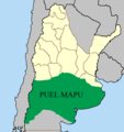
 Puelmapu - Identidades territoriales.jpg 520x1.004; 79 KB
-
 Puelmapu.png 520x1.004; 31 KB
-
 Puelmapu2(2).png 508x541; 12 KB
-
 Puelmapu2(3).png 507x585; 26 KB
-
 Puelmapu2.png 409x508; 11 KB
-
 Referencias Mapa fitogeográfico de la Argentina actualizado a 2018.tif 1.262x2.028; 1,02 MB
-
 Region numero tres de edenor.jpg 579x323; 29 KB
-
 Región 1.jpg 579x321; 27 KB
-
 Región del Bermejo.jpg 1.480x1.712; 319 KB
-
 Región numero dos de edenor.jpg 579x327; 27 KB
-
 Representação d'As Américas e a civilização (1969).png 1.226x2.000; 460 KB
-
 RiodelaPlata.PNG 3.508x2.550; 97 KB
-

-
 Rutas aeréas.png 340x666; 221 KB
-
 Sedes-ucasal.PNG 402x790; 71 KB
-
 Southern Cone(Strict definition).png 541x541; 93 KB
-
 TGS Pipelines.jpg 744x975; 137 KB
-

-
 Trolebuses Argentina.jpg 363x599; 66 KB
-
 Turismo Sanra.gif 358x258; 15 KB
-
 Ubicacion de Bahia Laura.png 2.630x2.364; 93 KB
-
 UBICACION GEOGRAFICA.jpg 1.569x2.065; 264 KB
-
 Ubicacion Río Colorado.png 250x151; 15 KB
-
 Ubicación Cascada Nahiara.png 1.016x728; 1,13 MB
-
 Ubicación Geografica.png 1.354x1.122; 342 KB
-
 Velocidadesprovincias.png 376x640; 144 KB
-
 Viedma location.PNG 143x290; 23 KB
-
 Votos ley de aborto en diputados - Argentina.png 2.000x4.280; 218 KB
-
 Votos ley de aborto en senadores - Argentina.png 2.000x4.280; 133 KB
-
 Yaguareteargentina.PNG 521x1.005; 34 KB
_Dep_por_poblacion.jpg)


.png)
.jpg)


.jpg)


.png)


.png)


.png)


.svg)
.png)
.png)
_(EJEMPLO).png)


.png)


.png)


.png)
.png)


.png)


.png)

_Season_2,_Argentina_map.png)


