Category:Maps of Bonaire
Jump to navigation
Jump to search
Wikimedia category | |||||
| Upload media | |||||
| Instance of | |||||
|---|---|---|---|---|---|
| Category combines topics | |||||
| Bonaire | |||||
island in the Caribbean, part of the Netherlands | |||||
| Instance of |
| ||||
| Part of | |||||
| Location |
| ||||
| Capital | |||||
| Legislative body |
| ||||
| Official language | |||||
| Anthem |
| ||||
| Currency |
| ||||
| Head of state |
| ||||
| Head of government | |||||
| Inception |
| ||||
| Population |
| ||||
| Area |
| ||||
| Elevation above sea level |
| ||||
| Top-level Internet domain | |||||
 | |||||
Subcategories
This category has the following 4 subcategories, out of 4 total.
Media in category "Maps of Bonaire"
The following 20 files are in this category, out of 20 total.
-
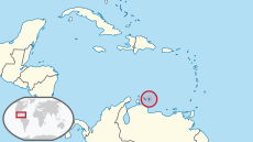
ABC & Venezuela.png 289 × 194; 22 KB
-
ABC Islands location map.svg 2,200 × 1,100; 87 KB
-
Aruba location map.svg 2,200 × 1,100; 94 KB
-
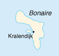
Bonaire.PNG 131 × 124; 9 KB
-
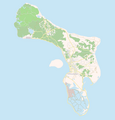
Bonaire2021OSM.png 3,127 × 3,831; 1.72 MB
-
Caribbean maritime boundaries map zh.svg 3,561 × 2,221; 2.87 MB
-
Caribbean maritime boundaries map.svg 3,561 × 2,221; 2.78 MB
-
Caribbean maritime boundaries map mk.svg 3,561 × 2,221; 5.52 MB
-
Mapa das Caraíbas (fronteiras marítimas).svg 3,561 × 2,221; 2.86 MB
-
Mapa del Caribe (límites marinos).svg 5,340 × 3,660; 3.02 MB
-
Mapa del Mar Caribe (límites marinos)-fr.svg 3,587 × 2,221; 1.91 MB
-
Mapa del Mar Caribe (límites marinos).svg 3,587 × 2,221; 1.98 MB
-
Flag map of Bonaire.png 1,440 × 1,710; 164 KB
-
Location map Bonaire.png 739 × 780; 140 KB
-
Netherlands Antilles and Aruba. LOC 2005631608.tif 3,260 × 2,534; 23.63 MB
-
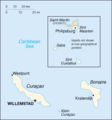
Nt-map.png 351 × 377; 9 KB
-
OSM Bonaire 2.png 1,948 × 2,033; 520 KB
-
OSM Bonaire.png 1,948 × 2,033; 557 KB
-
Washington-Slaagbai Map.jpg 983 × 735; 55 KB
-
Zonegrens benedenw nl.jpg 760 × 839; 65 KB


