Category:Maps of Iran
跳转到导航
跳转到搜索
亚洲国家:阿富汗 · 阿拉伯联合酋长国 · 阿曼 · 阿塞拜疆‡ · 埃及‡ · 巴基斯坦 · 巴林 · 不丹 · 朝鲜民主主义人民共和国 · 大韩民国 · 东帝汶 · 俄罗斯‡ · 菲律宾 · 格鲁吉亚‡ · 哈萨克斯坦‡ · 吉尔吉斯斯坦 · 柬埔寨 · 卡塔尔 · 科威特 · 老挝 · 黎巴嫩 · 马尔代夫 · 马来西亚 · 蒙古国 · 孟加拉国 · 缅甸 · 尼泊尔 · 日本 · 塞浦路斯‡ · 沙特阿拉伯 · 斯里兰卡 · 塔吉克斯坦 · 泰国 · 土耳其‡ · 土库曼斯坦 · 文莱达鲁萨兰国 · 乌兹别克斯坦 · 新加坡 · 叙利亚 · 亚美尼亚‡ · 也门 · 伊拉克 · 伊朗 · 以色列 · 印度 · 印度尼西亚‡ · 约旦 · 越南 · 中华人民共和国
有限承认:巴勒斯坦 · 阿布哈兹‡ · 北塞浦路斯土耳其共和国‡ · 南奥塞梯‡ · 中华民国 – 其他地区:澳门 · 香港 · 阿克罗蒂里和泽凯利亚‡ · 英属印度洋领地
‡:部分位于亚洲
有限承认:巴勒斯坦 · 阿布哈兹‡ · 北塞浦路斯土耳其共和国‡ · 南奥塞梯‡ · 中华民国 – 其他地区:澳门 · 香港 · 阿克罗蒂里和泽凯利亚‡ · 英属印度洋领地
‡:部分位于亚洲
维基媒体项目分类 | |||||
| 上传媒体 | |||||
| 隶属于 | |||||
|---|---|---|---|---|---|
| 分类结合话题 | |||||
| 分类包含 | |||||
 | |||||
分类“Maps of Iran”中的媒体文件
以下199个文件属于本分类,共199个文件。
-
 ((Carte Iran début XX)).jpg 605 × 504;61 KB
-

-
 1ڕۆژھەڵاتی کوردستان.svg 2,051 × 3,311;95 KB
-
 20190711 Iran EU Assistance Breakdown.pdf 1,754 × 1,239;831 KB
-
 20190711 Iran EU Assistance Breakdown.png 1,123 × 794;1.01 MB
-
 Afg mamnu dar iran.png 647 × 585;122 KB
-
 Alamut.png 800 × 686;107 KB
-
 Amsterdam J. Covens et C. Mortier,1720.jpg 1,080 × 914;407 KB
-
 Andimeshki Minjaee.PNG 672 × 600;96 KB
-
 Antarctica, Iran territorial claim.svg 806 × 806;22 KB
-
 Autonomous regions in the Middle East and Asia.jpg 720 × 694;204 KB
-
 Azad medical schools.png 2,000 × 1,785;544 KB
-
 Baghdad Province borders 1960.jpg 498 × 582;51 KB
-
 Baghdad Province borders 1970.jpg 500 × 587;55 KB
-
 Baghdad Province borders 1976.jpg 501 × 519;58 KB
-
 Baghdad Province borders 2013.jpg 512 × 515;66 KB
-
 Balagerive Minjaee.PNG 672 × 600;96 KB
-
 Behdasht iran.png 2,000 × 1,785;532 KB
-
 Caucacus Hotspot 2005 Print.tif 903 × 772;2.03 MB
-
 Caucasus regions map svenska.svg 2,006 × 1,618;271 KB
-
 Central iran.svg 5,051 × 4,665;358 KB
-
 Chalav Government.png 424 × 277;6 KB
-
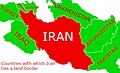 Countries with which Iran has a land border.jpg 462 × 282;94 KB
-
 Dandan pezeshki iran.png 2,000 × 1,785;524 KB
-
 Darusazi iran.png 2,000 × 1,785;517 KB
-
 Dehestane Shahryari.jpg 1,280 × 842;258 KB
-
 Dutch in Iran.png 317 × 251;6 KB
-
 East kurdistan-ڕۆژهەڵاتی کوردستان 2.png 3,264 × 2,985;2.46 MB
-
 East kurdistan-ڕۆژهەڵاتی کوردستان.png 3,264 × 2,576;1.91 MB
-
 East of Iran.svg 5,051 × 4,665;367 KB
-
 ECHO Iran Editable A4 Landscape.pdf 1,754 × 1,239;533 KB
-
 ECHO Iran Editable A4 Landscape.png 1,123 × 794;465 KB
-
 Elam1.png 502 × 400;46 KB
-
 Fezay shari.png 582 × 348;267 KB
-
 FLII Iran.png 1,732 × 704;260 KB
-
 Fouman map 2008.jpg 1,000 × 884;1.11 MB
-
 Freeway 2-IR Map.png 600 × 555;77 KB
-
 Freeway 6-Map-IR.png 895 × 823;28 KB
-
 Ganj dareh.jpg 400 × 574;240 KB
-
 Geographic map of the Lut Desert.png 864 × 592;707 KB
-
 Gharb-Iran.png 895 × 823;39 KB
-
 GSTP Incubation Centers.jpg 950 × 683;174 KB
-
 Hamidieh county locator map (2022).svg 512 × 722;16 KB
-
 Hoz-mahi-map.png 423 × 489;123 KB
-
 Human development index in Iran province.jpg 978 × 989;345 KB
-

-
 Inner-41-42.jpg 4,961 × 3,508;27.02 MB
-
 IR Railways.JPG 476 × 367;33 KB
-
 Iran - DPLA - 048298854ddb9ad159a542273de0853e.jpg 2,554 × 3,278;5.27 MB
-
 Iran - DPLA - 109ffe6f3aad2c4dae820013ca666ef7.jpg 2,404 × 3,132;6.94 MB
-
 Iran - DPLA - 46dd57d46528f5b4acb08e2bf539395a.jpg 2,552 × 3,284;5.37 MB
-
 Iran - DPLA - 5875e6839bf56b8ee59b87c99ae19ae0.jpg 2,554 × 3,276;4.92 MB
-
 Iran - DPLA - 94bc0b8eb7d92c08b549c7949bd4e43d.jpg 2,548 × 3,274;5.24 MB
-
 Iran - DPLA - bd3f8e2046827f8918bd8835e6aa47e2.jpg 2,554 × 3,278;4.93 MB
-
 Iran - DPLA - c34399c943124371cccd157833c7e01f.jpg 11,414 × 10,059;13.3 MB
-
 Iran - DPLA - fd1bf38bd56511ed578aec0b17134cec.jpg 10,259 × 8,797;7.93 MB
-
 Iran Base Map.png 1,108 × 702;516 KB
-
 Iran biotopes.png 1,145 × 1,041;203 KB
-
 Iran compomedical map.png 2,000 × 1,785;519 KB
-
 Iran comprehensive universities.png 2,000 × 1,785;678 KB
-
 Iran Counties (Version 2).svg 1,200 × 1,071;742 KB
-
 Iran disputed w1 countrymap.svg 1,000 × 1,000;27 KB
-
 Iran GRDP بدون نفت.jpg 3,138 × 3,057;1.75 MB
-
 Iran map provinces 1937.PNG 1,146 × 929;36 KB
-
 Iran medical map new.png 1,024 × 914;343 KB
-
 Iran medical map.png 2,000 × 1,785;686 KB
-
 Iran medical map.svg 1,200 × 1,071;521 KB
-
 Iran Medical schools 2.png 2,000 × 1,784;609 KB
-
 Iran Medical schools.png 672 × 600;136 KB
-
 Iran Medical schools.svg 1,200 × 1,071;535 KB
-
 Iran Medical Universities 2.png 672 × 600;57 KB
-
 Iran Medical Universities.png 672 × 600;57 KB
-
 Iran Middle Ages.png 599 × 354;44 KB
-
 Iran new cities.png 1,200 × 1,071;313 KB
-
 Iran Oil and Gas Fields.png 583 × 767;84 KB
-
 Iran oil concession.png 2,916 × 3,125;1.28 MB
-
 Iran old-new provinces.png 1,281 × 878;66 KB
-
 Iran ostanha pers av.png 1,200 × 975;151 KB
-
 Iran Population Density 1395.svg 1,488 × 2,105;5.78 MB
-
 Iran railway (2006) hr.png 1,142 × 1,042;193 KB
-
 Iran railway 2011.png 740 × 600;130 KB
-
 Iran railway map - gis - @RaiLir 1399.jpg 10,622 × 7,540;19.72 MB
-
 Iran railway.png 740 × 616;129 KB
-
 Iran structures map.png 1,200 × 1,071;248 KB
-

-
 Iran-afsharids(1).jpg 3,621 × 3,045;1.8 MB
-
 Iran-map 7.jpg 800 × 806;129 KB
-
 Iran-Map En.jpg 672 × 581;122 KB
-
 Iran-Telephone-Prefix-Map.PNG 1,281 × 878;62 KB
-
 Iran-xerite.png 1,106 × 870;114 KB
-
 Iran1934.PNG 1,146 × 929;41 KB
-

-
 IranMap.svg 512 × 507;164 KB
-
 Iranmapfor faham.jpg 674 × 583;49 KB
-
 IranOMC.png 930 × 788;53 KB
-
 Iranprovincetemplatefootball.png 706 × 427;95 KB
-
 Kermanshah-distance-Map-Iran-With-Water-Bodies.png 894 × 823;54 KB
-
 Khamseh migration map.png 668 × 598;113 KB
-
 Kish fr.jpg 894 × 497;129 KB
-
 Kish-island-Persian-Gulf.jpg 490 × 259;89 KB
-
 Kurdi lakProvinceپاریزگای له ک.png 211 × 228;18 KB
-
 Kürdüstan İyaləti.jpg 1,009 × 827;96 KB
-
 Launch Corridor of the Imam Khomeini Space Center.png 470 × 500;54 KB
-
 Lingusitic Map of Mazandaran.png 931 × 341;33 KB
-
 Location of Abarkuh Cypress.jpg 2,001 × 1,810;1.5 MB
-
 Map iran biotopes simplified-fr.png 1,125 × 1,027;291 KB
-
 Map of Iran in ME.jpg 1,023 × 575;55 KB
-
 Map of Iran in Reza Shah reign.jpg 614 × 528;143 KB
-
 Map of Iran.png 360 × 385;12 KB
-
 Map of Mukriyan.png 551 × 301;37 KB
-
 Map of north of Iran.jpg 909 × 547;83 KB
-
 Map of northern Iran under late Sasanian rule.png 1,789 × 887;1.53 MB
-
 Map of northern Iran under the Sasanians.jpg 1,211 × 623;870 KB
-
 Mapa Iran Bashkardi.gif 1,200 × 1,071;1.29 MB
-
 MapOfIran.png 3,568 × 3,568;9.7 MB
-
 MciNumberingMap.jpg 500 × 438;159 KB
-
 Mihrabanids 1236–Mid-16th century.png 620 × 429;18 KB
-
 Modiriat iran.png 2,000 × 1,785;506 KB
-

-
 Neolithic sites in Iran.jpg 1,162 × 855;105 KB
-
 North of Iran.svg 5,051 × 4,665;366 KB
-
 Olume novin iran.png 2,000 × 1,785;506 KB
-
 Omidieh county locator map (2022).svg 512 × 722;16 KB
-
 Parastari iran.png 2,000 × 1,785;560 KB
-
 Parques nacionales Irán.jpg 1,024 × 849;143 KB
-
 Parts of Iran.png 800 × 714;144 KB
-
 PAT - Iran.gif 920 × 920;305 KB
-
 Persian Empire by Herman Moll.jpg 1,028 × 720;174 KB
-
 Pezeshki iran new.png 1,024 × 913;330 KB
-
 Pezeshki iran new1.png 1,024 × 913;330 KB
-
 Pezeshki iran.png 2,000 × 1,784;533 KB
-
 Picture of Hamadan.png 485 × 318;50 KB
-
 Pirapezeshki iran new.png 1,024 × 914;330 KB
-
 Pirapezeshki iran.png 2,000 × 1,785;533 KB
-
 Production and consumption of electricity in Iran 1399.svg 900 × 800;354 KB
-

-
 Qeshm fr.jpg 894 × 497;128 KB
-
 Qeshm map fr.jpg 669 × 399;100 KB
-
 Qom location map.png 672 × 600;111 KB
-
 RabatDistrict2020.jpg 1,884 × 2,560;1.86 MB
-
 Rojhalat Kurdistan map (Kurdistan of Iran).png 253 × 444;6 KB
-
 Shadagan county locator map (2022).svg 512 × 722;16 KB
-
 Sharq-Iran.png 895 × 823;37 KB
-
 Shatt al arab ar.png 500 × 391;75 KB
-
 Shatt al arab.png 500 × 391;27 KB
-
 Shomal-Iran.png 895 × 823;33 KB
-
 Silakhory Minjaee.PNG 672 × 600;96 KB
-
 Sirri fr.jpg 894 × 497;52 KB
-
 South of Iran.svg 5,051 × 4,665;356 KB
-
 Southeastern Iran - DPLA - 73db256cdb6a240174c35ea73bdba6e6.jpg 5,992 × 6,001;5.06 MB
-
 Soviet invasion of Iran (Threads).png 300 × 263;8 KB
-
 Special governates in iran.png 2,000 × 1,785;662 KB
-
 Strait of Hormuz 2004-es.png 979 × 893;1.5 MB
-
 Strait of Hormuz 2004.png 979 × 893;1.72 MB
-
 Strait of Hormuz AR.jpg 583 × 357;106 KB
-
 Strait of Hormuz-svg-en.svg 1,264 × 1,005;2.06 MB
-
 Strait of Hormuz.jpg 583 × 357;54 KB
-
 Syphilis Iran 2008 (Men).PNG 652 × 600;51 KB
-
 Syphilis Iran 2008 (Women).PNG 652 × 600;52 KB
-
 Syria,iran,iraq,russia.PNG 404 × 273;11 KB
-
 Taghzie iran.png 2,000 × 1,785;507 KB
-
 Tavanbakhshi iran.png 2,000 × 1,785;509 KB
-
 TCBR NDZ.jpg 1,000 × 707;195 KB
-
 TCBR TASA.jpg 1,000 × 707;198 KB
-
 TCBR TBZR.jpg 1,000 × 707;197 KB
-
 TCBR TQCN.jpg 1,000 × 707;197 KB
-
 Teb sonati iran.png 2,000 × 1,785;509 KB
-
 Tenth province of Iran.PNG 1,146 × 929;35 KB
-
 TGSR NDZ.jpg 1,000 × 707;189 KB
-
 The most populated cities of iran.svg 900 × 800;427 KB
-
 The Quarterly journal of the Geological Society of London (13369425644).jpg 3,184 × 1,917;1.25 MB
-
 TQCN TASA.jpg 1,000 × 707;193 KB
-

-
 Tunb fr.jpg 894 × 497;134 KB
-
 Turkmensahrakarta.png 300 × 268;51 KB
-
 Un-iran.png 3,534 × 3,174;3.03 MB
-
 X846.graphic rail now.jpg.pagespeed.ic.eSV H7Pugn.jpg 846 × 754;220 KB
-
 Yeylagh gheshlagh ghashghaee shahli.jpg 1,434 × 1,477;523 KB
-
 Иран на карте Ближнего Востока.png 167 × 156;2 KB
-
 اسامی سپاههای استانی.png 1,092 × 972;245 KB
-
 ایران 1941 تا 1946.png 853 × 747;51 KB
-
 ایران دے صوبے.jpg 4,168 × 3,850;951 KB
-
تاریخ ایران.webm 1分20秒, 1,280 × 720;2.76 MB
-
 جديد ترين نقشه از تقسيمات كشوری ايران.jpg 800 × 709;103 KB
-
 جديد ترين نقشه رسمي ايران.gif 2,000 × 1,785;205 KB
-
 مناطق إيران.png 3,670 × 3,341;1.02 MB
-
 مهم ترين بنادر ايران.gif 801 × 614;36 KB
-
 موقعیت ارغیان از اسپونر.png 1,021 × 495;19 KB
-
 موقعیت جغرافیایی.png 253 × 223;28 KB
-
 موقیعت فنتستیک اتوپیا.png 2,294 × 2,048;754 KB
-
 مکان.png 250 × 223;29 KB
-
 نقشه ایران.jpg 672 × 581;120 KB
-
 نقشه بخش مرکزی شهرستان فومن در استان گیلان.jpg 2,048 × 1,536;670 KB
-
 نقشه جامع شبکه ریلی ایران.jpg 23,673 × 16,654;14.41 MB
-
 نقشه قلعه سلاسل.jpg 3,542 × 2,126;456 KB
-
 نقشه کشور شاهنشاهی ایران در کتاب راهنمای شهر همدان.jpg 2,228 × 2,035;1.06 MB
-
 کدهای مخابراتی ایران 2-01.svg 512 × 457;470 KB
-
 ფერეიდანი.jpg 1,281 × 878;104 KB
-
 盧爾人分布.jpg 892 × 737;190 KB
).jpg)
.jpg)


.svg)


.svg)


_hr.png)


.jpg)


.jpg)


.svg)


.png)
.svg)


.png)


.PNG)
.PNG)


.jpg)


