Category:Maps of Egypt
Jump to navigation
Jump to search
Countries of Africa: Algeria · Angola · Benin · Botswana · Burkina Faso · Burundi · Cameroon · Cape Verde · Central African Republic · Chad · Comoros · Democratic Republic of the Congo · Republic of the Congo · Djibouti · Egypt‡ · Equatorial Guinea · Eritrea · Eswatini · Ethiopia · Gabon · The Gambia · Ghana · Guinea · Guinea-Bissau · Ivory Coast · Kenya · Lesotho · Liberia · Libya · Madagascar · Malawi · Mali · Mauritania · Mauritius · Morocco · Mozambique · Namibia · Niger · Nigeria · Rwanda · São Tomé and Príncipe · Senegal · Seychelles · Sierra Leone · Somalia · South Africa · South Sudan · Sudan · Tanzania · Togo · Tunisia · Uganda · Zambia · Zimbabwe
Limited recognition: Ambazonia · Azawad · Puntland · Sahrawi Arab Democratic Republic · Somaliland – Other areas: Canary Islands · Ceuta · Madeira · Mayotte · Melilla · Réunion · Saint Helena, Ascension and Tristan da Cunha · Scattered Islands in the Indian Ocean · Western Sahara
‡: partly located in Africa
| Category Maps of Egypt on sister projects: | |||||||||
|---|---|---|---|---|---|---|---|---|---|
English: Maps of Egypt — located in North Africa and the Near East.
- See also: Category: Satellite pictures of Egypt.
Wikimedia category | |||||
| Upload media | |||||
| Instance of | |||||
|---|---|---|---|---|---|
| Category combines topics | |||||
 | |||||
Subcategories
This category has the following 41 subcategories, out of 41 total.
*
A
B
- Blank maps of Egypt (16 F)
C
- CIA World Factbook maps of Egypt (21 F)
- Maps of communications in Egypt (10 F)
D
- Demographic maps of Egypt (3 F)
E
F
G
H
L
- Location maps of Egypt (16 F)
M
- Maps el-Bawiti (2 F)
- Maps of Damietta (6 F)
- Ali Pasha Mubarak (2 F)
N
O
P
R
- Maps of regions of Egypt (16 F)
S
T
U
W
Pages in category "Maps of Egypt"
The following 2 pages are in this category, out of 2 total.
Media in category "Maps of Egypt"
The following 109 files are in this category, out of 109 total.
-
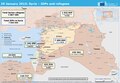
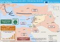
 20150120 Syrian Neighbouring Refugees IDPs Landscape A2.pdf 3,508 × 2,479; 380 KB
-
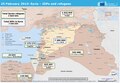
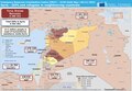
 20150819 Syrian IDPs Refugees Neighbouring Countries Landscape A2.pdf 3,506 × 2,479; 383 KB
-
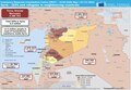
 20150819 Syrian IDPs Refugees Neighbouring Countries Landscape A2.png 2,245 × 1,587; 494 KB
-
 20240418 DM EHRC operations.pdf 1,625 × 1,125; 458 KB
-
 22nd parallel Africa-as.svg 500 × 500; 84 KB
-
 22nd parallel Africa-bn.svg 500 × 500; 84 KB
-
 22nd parallel Africa.svg 500 × 500; 82 KB
-
 Admiralty Chart No 3355 Tolmeta to Salum, Published1960.jpg 16,173 × 11,102; 39.71 MB
-
 Al-FayyumOasis.png 700 × 847; 34 KB
-
 All proposed routes.PNG 13,335 × 9,224; 2.55 MB
-
 Ancient Caravan Routes Egypt Cyrenaica.png 1,077 × 831; 130 KB
-
 Anglo-Egyptian Treaty of 1936.pdf 862 × 1,352, 31 pages; 1.5 MB
-
 Aswani pais.png 600 × 570; 135 KB
-
 Bir Tawil Satmap.png 1,185 × 383; 431 KB
-
 Burger Skica Egipt.png 600 × 614; 61 KB
-
 Cairoeg.jpg 1,024 × 890; 248 KB
-
 CAN 2006 Egypt venues ukr.gif 697 × 585; 24 KB
-
 Canopus Menouthis Heracleion.jpg 375 × 287; 62 KB
-
 Canopus menouthis herakleion-es.jpg 375 × 287; 51 KB
-
 Canopus menouthis herakleion.jpg 375 × 287; 31 KB
-
 Carte-egypte-pyramides1.jpg 1,053 × 1,600; 110 KB
-
 Carte-pyramides-memphis.jpg 1,019 × 1,675; 124 KB
-
 Coptic Egypt Map vector.svg 899 × 844; 261 KB
-
 Coptic Egypt Map.png 8,333 × 8,333; 797 KB
-
 ECDM 20150129 Syria IDPs.pdf 1,625 × 1,125; 304 KB
-
 ECDM 20150229 Syria IDPs.pdf 1,625 × 1,125; 516 KB
-
 ECDM 20150313 Syria IDPs.pdf 1,625 × 1,125; 337 KB
-
 ECDM 20150320 Syria IDPs.pdf 1,625 × 1,125; 424 KB
-
 ECDM 20150331 Syria IDPs.pdf 1,625 × 1,125; 441 KB
-
 ECDM 20150609 Syria IDPs.pdf 1,625 × 1,125; 579 KB
-
 ECDM 20150916 Syria IDP Refugees.pdf 1,625 × 1,125; 494 KB
-
 ECDM 20151008 Syria Refugees.pdf 1,625 × 1,125; 781 KB
-
 ECDM 20151104 Syria IDP Refugees.pdf 1,625 × 1,125; 482 KB
-
 ECDM 20151127 Syria IDP Refugees.pdf 1,625 × 1,125; 374 KB
-
 ECHO Egypt Editable A4 Landscape.png 1,123 × 794; 310 KB
-
 Egyped map.jpg 570 × 552; 76 KB
-
 Egypt Base Map.png 1,109 × 693; 326 KB
-
 Egypt disputed w1 countrymap.svg 1,000 × 1,000; 16 KB
-
 Egypt hdi per governorate .jpg 954 × 808; 78 KB
-
 Egypt HSR 2021.jpg 775 × 720; 70 KB
-
 Egypt HSR spring 2022.svg 512 × 476; 607 KB
-
 Egypt HSR.svg 512 × 476; 444 KB
-
 Egypt location map before 2017.svg 1,055 × 973; 331 KB
-
 Egypt mapa.jpg 596 × 1,353; 155 KB
-
 Egypt markazes.svg 512 × 290; 548 KB
-
 Egypt natural gas fields and select infrastructure (43123546105).png 576 × 288; 57 KB
-
 Egypt regions and boundaries.png 1,289 × 1,521; 55 KB
-
 Egypt-region-map-cities-2.gif 310 × 373; 14 KB
-
 Egypt-region-map-cities-oases.gif 315 × 377; 15 KB
-
 Egypt-region-map-cities-tr.gif 314 × 374; 16 KB
-
 Egypte Monastique couleur.JPG 678 × 982; 123 KB
-
 EgyptianArmedForcesCommands.png 668 × 600; 49 KB
-
 EgyptmapL.png 313 × 385; 19 KB
-
 Eldabaa location.png 600 × 570; 130 KB
-
 ETH-BIB-Egypte (Karte)-Dia 247-11176.tif 3,100 × 3,436; 10.25 MB
-
 Flag of the governorate of suez.png 3,000 × 1,992; 262 KB
-
 FLII Egypt.png 1,472 × 794; 465 KB
-
 Gizeh.PNG 285 × 257; 27 KB
-
 Governorates of Egypt 2011 (Numbered).png 837 × 743; 27 KB
-
 Guiza , Egipto.gif 344 × 367; 33 KB
-
 Hurghada map.png 500 × 461; 54 KB
-
 Itinéraire.jpg 415 × 477; 177 KB
-
 Jebel Musa in the 1869 Ordnance Survey of the Peninsula of Sinai (cropped).jpg 1,331 × 1,091; 351 KB
-
 Kaart Oude Egypte.jpg 336 × 599; 34 KB
-
 Karte Oxyrhynchos.png 399 × 457; 7 KB
-
 Kosseir.png 224 × 296; 28 KB
-
 Lake Nasser location.png 600 × 570; 113 KB
-
 Libysche wueste.png 380 × 543; 30 KB
-
 Lipu tenpo nanpa nasin - nasin telo suli Nile.png 1,176 × 805; 213 KB
-
 Luxor-localitzacio.png 197 × 450; 11 KB
-
 Map of Libya and Egypt (1977).svg 1,151 × 881; 424 KB
-
 Map of project areas.jpg 700 × 635; 62 KB
-
 Miniat Al-Nasr, Dakahliya.svg 410 × 486; 21 KB
-
 MinyaGovernorate.jpg 398 × 393; 83 KB
-
 Nabta-Egypt NL.jpg 1,190 × 1,270; 660 KB
-
 New-state solution.webp 4,722 × 2,180; 225 KB
-
 Official Egypt governorates english.png 882 × 783; 75 KB
-

-
 Oxyrhynchos map.gif 399 × 457; 10 KB
-
 Pelusium Egypt.PNG 242 × 236; 18 KB
-
 Sahara ecoregion.svg 700 × 500; 181 KB
-
 Sallum-Egipto.jpg 300 × 272; 38 KB
-
 Sendion in the map.png 512 × 495; 133 KB
-
 Sharm el Sheikh map-ar.png 1,348 × 1,022; 340 KB
-
 Sinai insurgency map.png 750 × 1,196; 149 KB
-
 Sirbonis.jpg 1,019 × 568; 23 KB
-
 Sirbonis.svg 1,019 × 568; 232 KB
-
 Sumed pipeline-arabic.png 1,088 × 899; 174 KB
-
 Sumed pipeline.png 1,090 × 901; 128 KB
-
 Tabennisi.jpg 171 × 158; 8 KB
-
 Tebtynis location.jpg 367 × 450; 45 KB
-
 The Qattara Depression, Egypt, Matruh Governate.png 3,493 × 2,293; 206 KB
-
 Un-egypt.png 2,992 × 2,211; 1.18 MB
-
 Unterägypten.jpg 697 × 550; 37 KB
-
 LDG en.jpg 1,744 × 1,722; 170 KB
-
 LDG Streufeld.jpg 1,744 × 1,722; 180 KB
-
 AT1317 map.png 761 × 795; 22 KB
-
 Xccxx.jpg 600 × 337; 38 KB
-
 Yam.png 315 × 230; 98 KB
-
 Ägypten-Karte.jpg 834 × 1,487; 144 KB
-
 צינור הנפט סומד.png 1,205 × 941; 123 KB
-
 النطاقات الجغرافية للجيوش والمناطق العسكرية المصرية.png 837 × 743; 22 KB
-
 خريطة توضح مسار ممر التعمير.jpg 3,084 × 3,624; 3.13 MB
-
 خريطة توضح ممر التعمير و الكثبان الرملية في مصر.jpg 3,090 × 3,564; 1.2 MB
-
 خريطة جمهورية مصر العربية.jpg 2,784 × 2,574; 6.78 MB
-
 خريطة محافظات مصر مقسمة حسب الأقاليم.png 837 × 743; 41 KB
-
 مدينة العبور و امتدادها obour and its extension.png 2,401 × 1,364; 297 KB
-
 مشروع المحطة النووية بالضبعة.png 478 × 425; 71 KB
-
 مناطق مصر.png 1,045 × 1,039; 206 KB


.png)


.png)


.jpg)


.svg)


