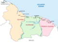
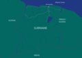
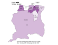
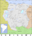
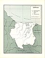
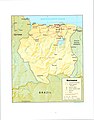
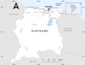
Category:Maps of Suriname
Перейти к навигации
Перейти к поиску

категория в проекте Викимедиа | |||||
| Медиафайл | |||||
| Это частный случай понятия | |||||
|---|---|---|---|---|---|
| Категория объединяет темы | |||||
 | |||||
Подкатегории
В этой категории отображается 20 подкатегорий из имеющихся 20.
Страницы в категории «Maps of Suriname»
Показаны 2 страницы из 2, находящихся в данной категории.
Файлы в категории «Maps of Suriname»
Показано 182 файла из 182, находящихся в данной категории.
-
 20230622 Suriname Basemap Landscape.pdf 1754 × 1239; 1,83 МБ
-
 20230622 Suriname Basemap Landscape.png 3509 × 2482; 9,1 МБ
-
 A20 - Suriname Uitslag Verkiezingen 25 Mei 2020.png 3960 × 3060; 328 КБ
-
 ABOP - Suriname Uitslag Verkiezingen 25 Mei 2020.png 3960 × 3060; 318 КБ
-
 Admiralty Chart No 3940 Trinidad to Natal, Published 1951, Large Corrections 1966.jpg 16 320 × 11 054; 25,28 МБ
-
 Alle districten van Suriname.png 7920 × 6120; 931 КБ
-
 Bedrijventelling Suriname 2016.png 3195 × 2975; 307 КБ
-
 BEP - Suriname Uitslag Verkiezingen 25 Mei 2020.png 3960 × 3060; 316 КБ
-
 Blanco kaart van Suriname met districten.png 8420 × 5950; 1,56 МБ
-
 Blank map of Suriname.png 8420 × 5950; 946 КБ
-
 Block 52 Offshore Map Suriname (Oil and Gas).png 8420 × 5950; 1,22 МБ
-
 Borders of Suriname.png 6120 × 7920; 16,57 МБ
-
 Cheniers NE Suriname.png 1818 × 1031; 2,15 МБ
-
 Colored map south America.png 6120 × 7920; 945 КБ
-
 DA91 - Suriname Uitslag Verkiezingen 25 Mei 2020.png 3960 × 3060; 299 КБ
-
 Detailed Map of Suriname with Capital and Places.png 7920 × 6120; 982 КБ
-
 Detailed places map Suriname.png 6073 × 6120; 1,69 МБ
-
 Disputed Areas Guianas (Venezuela,Guyana,Suriname and French Guiana).png 7870 × 6031; 1,5 МБ
-
 District Brokopondo - Suriname - Location Map.png 7920 × 6120; 904 КБ
-
 District Commewijne - Suriname - Location Map.png 7920 × 6120; 892 КБ
-
 District Coronie - Suriname - Location Map.png 7920 × 6120; 891 КБ
-
 District Marowijne - Suriname - Location Map.png 7920 × 6120; 894 КБ
-
 District Nickerie - Suriname- Location Map.png 7920 × 6120; 891 КБ
-
 District Para - Suriname - Location Map.png 7920 × 6120; 894 КБ
-
 District Saramacca - Suriname - Location Map.png 7920 × 6120; 893 КБ
-
 District Sipaliwini - Suriname - Location Map.png 7920 × 6120; 897 КБ
-
 District Wanica - Suriname - Location Map.png 7920 × 6120; 889 КБ
-
 Districts of Suriname with Capital Cities.svg 1074 × 1252; 203 КБ
-
 DNW - Suriname Uitslag Verkiezingen 25 Mei 2020.png 3960 × 3060; 284 КБ
-
 DOE - Suriname Uitslag Verkiezingen 25 Mei 2020.png 3960 × 3060; 310 КБ
-
 ECDM 20210611 South-America Floods.pdf 1625 × 1125; 525 КБ
-
 ECDM 20240422 South America.pdf 2479 × 1754; 965 КБ
-
 Geografische ligging Suriname.png 4210 × 2975; 950 КБ
-
 Geologische kaart van Suriname.png 2385 × 3339; 1,57 МБ
-
 Grey Map of the Guianas.png 7920 × 6120; 913 КБ
-
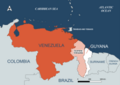
 Guayana Esequiba Disputed Area Venezuela-Guyana.png 8420 × 5950; 1,21 МБ
-
 Guayana Esequiba Guyana–Venezuela territorial dispute.png 8420 × 5950; 1,49 МБ
-
 Guyana Suriname Fr Guiana Location.png 7923 × 5176; 1,01 МБ
-
 Guyana-Suriname basin WITH EEZ AND COORDINATE GRID.png 8415 × 5949; 2,92 МБ
-
 Guyana-Suriname basin with EEZ.png 8415 × 5949; 2,89 МБ
-
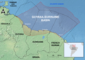
 Guyana-Suriname Basin.png 8415 × 5949; 2,7 МБ
-
 HVB - Suriname Uitslag Verkiezingen 25 Mei 2020.png 3960 × 3060; 329 КБ
-
 Kaart van Nickerie Rivier - Suriname.svg 842 × 1032; 336 КБ
-
 Kaart van Suriname (Wit).png 8419 × 5953; 1,01 МБ
-
 Kaart van Suriname met buurlanden.png 8420 × 5950; 1,21 МБ
-
 Kaart van Suriname met districten.png 8420 × 5950; 1,75 МБ
-
 Kaart van Venezuela Guyana Suriname en Frans-Guyana.png 3960 × 3060; 532 КБ
-
 Karte1801.jpg 1950 × 1443; 425 КБ
-
 Locator Map Albina - Marowijne Suriname.png 7941 × 7941; 1,01 МБ
-
 Locator Map Alkmaar - Commewijne Suriname.png 7940 × 7941; 1,02 МБ
-
 Locator Map Bakkie - Commewijne Suriname.png 7941 × 7940; 1,02 МБ
-
 Locator Map Beekhuizen - Paramaribo Suriname.png 7940 × 7941; 1,12 МБ
-
 Locator Map Bigi Poika - Para Suriname.png 7941 × 7941; 1,14 МБ
-
 Locator Map Blauwgrond - Paramaribo Suriname.png 7941 × 7940; 1,12 МБ
-
 Locator Map Boven Coppename - Sipaliwini Suriname.png 7940 × 7940; 1,36 МБ
-
 Locator Map Boven Saramacca - Sipaliwini Suriname.png 7940 × 7940; 1,36 МБ
-
 Locator Map Boven Suriname - Sipaliwini Suriname.png 7940 × 7940; 1,36 МБ
-
 Locator Map Brokopondo Centrum - Brokopondo Suriname.png 7941 × 7941; 1,11 МБ
-
 Locator Map Brownsweg - Brokopondo Suriname.png 7940 × 7941; 1,11 МБ
-
 Locator Map Calcutta- Saramacca Suriname.png 7941 × 7940; 1,03 МБ
-
 Locator Map Carolina - Para Suriname.png 7940 × 7941; 1,14 МБ
-
 Locator Map Centrum - Paramaribo Suriname.png 7941 × 7941; 1,12 МБ
-
 Locator Map Coeroeni - Sipaliwini Suriname.png 7940 × 7940; 1,36 МБ
-
 Locator Map De Nieuwe Grond - Wanica Suriname.png 7940 × 7941; 1,21 МБ
-
 Locator Map Domburg - Wanica Suriname.png 7941 × 7941; 1,22 МБ
-
 Locator Map Flora - Paramaribo Suriname.png 7941 × 7941; 1,13 МБ
-
 Locator Map Galibi - Marowijne Suriname.png 7940 × 7940; 1,01 МБ
-
 Locator Map Groningen - Saramacca Suriname.png 7940 × 7941; 1,02 МБ
-
 Locator Map Groot Henar - Nickerie Suriname.png 7940 × 7941; 1,11 МБ
-
 Locator Map Houttuin - Wanica Suriname.png 7941 × 7941; 1,21 МБ
-
 Locator Map Jarikaba - Saramacca Suriname.png 7941 × 7941; 1,02 МБ
-
 Locator Map Johanna Maria - Coronie Suriname.png 7940 × 7940; 963 КБ
-
 Locator Map Kabalebo - Sipaliwini Suriname.png 7940 × 7940; 1,36 МБ
-
 Locator Map Kampong Baroe - Saramacca Suriname.png 7941 × 7941; 1,03 МБ
-
 Locator Map Klaaskreek - Brokopondo Suriname.png 7941 × 7940; 1,11 МБ
-
 Locator Map Koewarasan - Wanica Suriname.png 7941 × 7940; 1,22 МБ
-
 Locator Map Kwakoegron - Brokopondo Suriname.png 7941 × 7940; 1,11 МБ
-
 Locator Map Kwatta - Wanica Suriname.png 7940 × 7940; 1,21 МБ
-
 Locator Map Latour - Paramaribo Suriname.png 7941 × 7941; 1,12 МБ
-
 Locator Map Lelydorp - Wanica Suriname.png 7940 × 7941; 1,22 МБ
-
 Locator Map Livorno - Paramaribo Suriname.png 7940 × 7941; 1,12 МБ
-
 Locator Map Margaretha - Commewijne Suriname.png 7940 × 7940; 1,02 МБ
-
 Locator Map Marshallkreek - Brokopondo Suriname.png 7940 × 7940; 1,11 МБ
-
 Locator Map Meerzorg - Commewijne Suriname.png 7941 × 7941; 1,02 МБ
-
 Locator Map Moengo - Marowijne Suriname.png 7941 × 7940; 1,01 МБ
-
 Locator Map Moengotapoe - Marowijne Suriname.png 7940 × 7941; 1,01 МБ
-
 Locator Map Munder - Paramaribo Suriname.png 7941 × 7940; 1,12 МБ
-
 Locator Map Nieuw Amsterdam - Commewijne Suriname.png 7941 × 7941; 1,02 МБ
-
 Locator Map Nieuw Nickerie - Nickerie Suriname.png 7941 × 7940; 1,1 МБ
-
 Locator Map Oostelijke Polders - Nickerie Suriname.png 7941 × 7940; 1,1 МБ
-
 Locator Map Para Noord - Para Suriname.png 7940 × 7940; 1,14 МБ
-
 Locator Map Para Oost - Para Suriname.png 7941 × 7940; 1,14 МБ
-
 Locator Map Para Zuid - Para Suriname.png 7941 × 7940; 1,14 МБ
-
 Locator Map Paramacca - Sipaliwini Suriname.png 7940 × 7940; 1,35 МБ
-
 Locator Map Patamacca - Marowijne Suriname.png 7941 × 7941; 1,01 МБ
-
 Locator Map Pontbuiten - Paramaribo Suriname.png 7941 × 7941; 1,12 МБ
-
 Locator Map Rainville - Paramaribo Suriname.png 7941 × 7940; 1,13 МБ
-
 Locator Map Sarakreek - Brokopondo Suriname.png 7941 × 7941; 1,11 МБ
-
 Locator Map Saramaccapolder - Wanica Suriname.png 7941 × 7940; 1,21 МБ
-
 Locator Map Tamanredjo - Commewijne Suriname.png 7941 × 7940; 1,03 МБ
-
 Locator Map Tammenga - Paramaribo Suriname.png 7941 × 7941; 1,12 МБ
-
 Locator Map Tapanahony - Sipaliwini Suriname.png 7940 × 7940; 1,36 МБ
-
 Locator Map Tijgerkreek - Saramacca Suriname.png 7941 × 7940; 1,02 МБ
-
 Locator Map Totness - Coronie Suriname.png 7941 × 7940; 953 КБ
-
 Locator Map Wageningen - Nickerie Suriname.png 7941 × 7941; 1,1 МБ
-
 Locator Map Wanhatti - Marowijne Suriname.png 7941 × 7940; 1,01 МБ
-
 Locator Map Wayamboweg - Saramacca Suriname.png 7940 × 7940; 1,03 МБ
-
 Locator Map Weg naar Zee - Paramaribo Suriname.png 7940 × 7940; 1,12 МБ
-
 Locator Map Welgelegen - Coronie Suriname.png 7941 × 7940; 957 КБ
-
 Locator Map Welgelegen - Paramaribo Suriname.png 7940 × 7941; 1,12 МБ
-
 Locator Map Westelijke Polders - Nickerie Suriname.png 7940 × 7940; 1,1 МБ
-
 Map of Guianas (Guyana,Suriname,French Guiana).png 8420 × 5950; 649 КБ
-
 Map of Suriname (white).png 8419 × 5953; 1 МБ
-
 Map of Suriname - Protected Areas.png 6120 × 7920; 1,7 МБ
-
 Map of Suriname showing Districts and the capital cities.svg 1448 × 1572; 330 КБ
-
 Map of Suriname, Guyana and French Guiana.png 2381 × 1829; 301 КБ
-
 Map of Suriname.png 8415 × 5950; 1,44 МБ
-
 Map of The Guianas with Capital Cities.png 7920 × 6120; 654 КБ
-
 Map Suriname with border rivers (Dutch).png 5960 × 5563; 1,18 МБ
-
 Mapa de Venezuela, Guyana, Suriname, Guayana Francesa.png 3007 × 1587; 290 КБ
-
 NDP - Suriname Uitslag Verkiezingen 25 Mei 2020.png 3960 × 3060; 335 КБ
-
 NPS - Suriname Uitslag Verkiezingen 25 Mei 2020.png 3960 × 3060; 332 КБ
-
 Overview map Suriname.png 1558 × 1676; 502 КБ
-
 Overzichtskaart Suriname (Nederlands).png 8420 × 5950; 1,15 МБ
-
 PALU - Suriname Uitslag Verkiezingen 25 Mei 2020.png 3960 × 3060; 289 КБ
-
 Pangea political detail.jpg 357 × 290; 55 КБ
-
 PAT - Suriname.gif 860 × 975; 293 КБ
-
 PL - Suriname Uitslag Verkiezingen 25 Mei 2020.png 3960 × 3060; 301 КБ
-
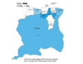 PRO - Suriname Uitslag Verkiezingen 25 Mei 2020.png 3960 × 3060; 317 КБ
-
 Satellite image of Suriname in September 2002.jpg 1855 × 1879; 562 КБ
-
 SDU - Suriname Uitslag Verkiezingen 25 Mei 2020.png 3960 × 3060; 296 КБ
-
 Seasons in Suriname original.png 7834 × 6343; 1,06 МБ
-
 Simple White Map of Suriname.png 8420 × 5950; 946 КБ
-
 South America map with Grid.png 6120 × 7920; 1,34 МБ
-
 SPA - Suriname Uitslag Verkiezingen 25 Mei 2020.png 3960 × 3060; 314 КБ
-
 Spoorlijn Bakhuisgebergte-Apoera v2.jpg 1075 × 772; 56 КБ
-
 Stabroek and Block 58 in Suriname-Guyana Basin Offshore map.png 7920 × 6120; 1,78 МБ
-
 Stadsdistrict Paramaribo - Suriname - Location Map.png 7920 × 6120; 884 КБ
-
 STREI! - Suriname Uitslag Verkiezingen 25 Mei 2020.png 3960 × 3060; 289 КБ
-
 Surinam - DPLA - 1e419c467a4c0ee926b10597b19518eb (page 1).jpg 2418 × 3126; 7,46 МБ
-
 Surinam - DPLA - 1e419c467a4c0ee926b10597b19518eb (page 2).jpg 2416 × 3128; 5,91 МБ
-
 Suriname - DPLA - a32b762db8844459d5ba55b2a7269a69.jpg 2562 × 3278; 5,11 МБ
-
 Suriname - DPLA - aac010efc12671f42d53d7e1593ed65a.jpg 2572 × 3290; 5,74 МБ
-
 Suriname Base Map with Grid.png 7920 × 6120; 1,61 МБ
-
 Suriname Basemap Borders and Border Rivers.png 7920 × 6120; 1,14 МБ
-
 Suriname Beschermde gebieden.png 6120 × 7360; 2,38 МБ
-
 Suriname complete Borders and EEZ.png 6120 × 7920; 1,21 МБ
-
 Suriname Detailed Map.png 6120 × 7920; 4,21 МБ
-
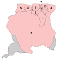 Suriname District Numbers Neutral.svg 595 × 612; 313 КБ
-
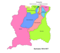 Suriname Districten 1914-1917.png 1584 × 1396; 132 КБ
-
 Suriname Districten 1958-1967.png 1584 × 1396; 115 КБ
-
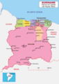
 Suriname Districten vanaf 1 jan 1968.png 1584 × 1396; 117 КБ
-
 Suriname districts and capitals map.png 5950 × 8420; 1,38 МБ
-
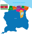
 Suriname Districts.png 6120 × 7920; 8,99 МБ
-
 Suriname Encyclopedia Map - Places.png 6563 × 5950; 2,09 МБ
-
 Suriname Encyclopedia Map Physical Features.png 6563 × 5950; 2,57 МБ
-
 Suriname Gradient Map.png 7920 × 6120; 745 КБ
-
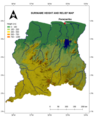 Suriname Height and Relief Map.png 5950 × 7600; 9,55 МБ
-
 Suriname Kustvlakte West en Oostkust.png 6120 × 7357; 2,26 МБ
-
 Suriname Location Map South America.png 8420 × 5950; 1,02 МБ
-
 Suriname Location on South America.png 8420 × 5950; 1,06 МБ
-
 Suriname Location South America.png 7920 × 6120; 1,22 МБ
-
 Suriname Location.png 7920 × 6120; 937 КБ
-
 Suriname Locator Map Neutral.svg 842 × 595; 420 КБ
-
 Suriname Locator South America.png 6120 × 7920; 1,67 МБ
-
 Suriname Main Roads.svg 842 × 595; 1,5 МБ
-
 Suriname Map Green.png 8420 × 5950; 393 КБ
-
 Suriname Map Including Disputed Areas.png 5950 × 6914; 1,41 МБ
-
 Suriname Map of Regions and Provinces.svg 876 × 950; 305 КБ
-
 Suriname map with places with Grid.png 6120 × 7920; 943 КБ
-
 Suriname map with places.png 6120 × 7920; 848 КБ
-
 Suriname Map.png 5950 × 7588; 2,15 МБ
-
 Suriname Offshore blocks 2022-2023.png 4210 × 2975; 476 КБ
-
 Suriname overzichtskaart met buurlanden.png 4209 × 2976; 497 КБ
-
 Suriname PHYSICAL MAP - Hillshade Grey.png 3960 × 3060; 4,86 МБ
-
 Suriname Places Informational Map.png 15 840 × 12 240; 4,94 МБ
-
 Suriname Political Map Corrected.png 6120 × 7920; 2,25 МБ
-
 Suriname Resorts colored by District.png 7920 × 6120; 928 КБ
-
 SVG Map center of Americas with Suriname Disputed Areas.svg 1500 × 1000; 1,74 МБ
-
 VHP - Suriname Uitslag Verkiezingen 25 Mei 2020.png 3960 × 3060; 335 КБ
-
 VVD - Suriname Uitslag Verkiezingen 25 Mei 2020.png 3960 × 3060; 295 КБ
-
 Zona En Reclamación (Guayana Esequiba) on Guiana Shield.svg 480 × 330; 564 КБ


.png)


.png)


.png)


.png)
.png)


.png)


.png)


.jpg)
.jpg)


_on_Guiana_Shield.svg)