Category:Maps of Treptow-Köpenick
Jump to navigation
Jump to search
Subcategories
This category has the following 15 subcategories, out of 15 total.
A
- Maps of Berlin-Adlershof (6 F)
- Maps of Berlin-Altglienicke (5 F)
B
- Maps of Berlin-Bohnsdorf (5 F)
F
G
- Maps of Berlin-Grünau (4 F)
J
- Maps of Berlin-Johannisthal (6 F)
K
- Maps of Berlin-Köpenick (6 F)
M
- Maps of Berlin-Müggelheim (2 F)
N
O
- Maps of Berlin-Oberschöneweide (10 F)
P
- Maps of Berlin-Plänterwald (3 F)
R
- Maps of Berlin-Rahnsdorf (5 F)
S
- Maps of Berlin-Schmöckwitz (5 F)
Media in category "Maps of Treptow-Köpenick"
The following 18 files are in this category, out of 18 total.
-
 Berlin treptow-koepenick.png 800 × 643; 48 KB
-
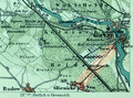 BerlinGlienickerWeg1894.png 840 × 625; 795 KB
-
 Die Köpenicker Waldgebiete.png 2,220 × 1,873; 144 KB
-
 Lage Mueggelsee in Berlin.png 484 × 395; 26 KB
-
 Lage Mueggelsee in Berlin2.png 800 × 642; 47 KB
-
 Lage Niederschoeneweide.png 1,966 × 1,623; 192 KB
-
 Map de-be altglienicke.png 1,134 × 861; 134 KB
-
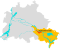
 Map de-be districts trep-koep.png 1,134 × 861; 139 KB
-
 Map de-be gruenau.png 1,134 × 861; 135 KB
-
 Map de-be johannisthal.png 1,134 × 861; 135 KB
-
 Map de-be koepenick.png 1,134 × 861; 138 KB
-
 Map de-be mueggelheim.png 1,134 × 861; 136 KB
-
 Map de-be niederschoeneweide.png 1,134 × 861; 135 KB
-
 Map de-be oberschoeneweide.png 1,134 × 861; 135 KB
-
 Map de-be rahnsdorf.png 1,134 × 861; 137 KB
-
 Map de-be schmoeckwitz.png 1,134 × 861; 136 KB
-
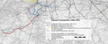 Teltower Kreisbahnen Netzplan.png 5,917 × 2,389; 9.82 MB
-
 Berlin Treptow.png 550 × 463; 7 KB


