Category:Mariakerk, Buitenpost
Jump to navigation
Jump to search
| Object location | | View all coordinates using: OpenStreetMap |
|---|
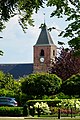
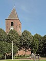
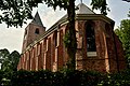
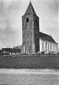
church building in Achtkarspelen, Netherlands  | |||||
| Upload media | |||||
| Instance of | |||||
|---|---|---|---|---|---|
| Dedicated to | |||||
| Location | Buitenpost, Friesland, Netherlands | ||||
| Street address |
| ||||
| Located on street |
| ||||
| Heritage designation |
| ||||
| official website | |||||
 | |||||
Nederlands: Mariakerk - anno 1496
|
This is a category about rijksmonument number 7036
|
| Address |
|
Subcategories
This category has only the following subcategory.
I
Media in category "Mariakerk, Buitenpost"
The following 24 files are in this category, out of 24 total.
-
 20210811 Mariakerk2 Buitenpost.jpg 3,456 × 5,184; 4.03 MB
-
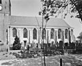
 Buitenpost Friesland.jpg 800 × 533; 321 KB
-
 Buitenpost, de Mariakerk RM7036 foto4 2013-08-25 14.30.JPG 3,304 × 4,405; 10.56 MB
-
 Bûtenpost, Mariatsjerke, gevelstien.jpg 3,279 × 4,917; 8.42 MB
-
 Bûtenpost, Mariatsjerke.jpg 6,000 × 4,000; 11.55 MB
-
 Bûtenpost, Marijetsjerke.jpg 2,604 × 3,013; 4.17 MB
-
 Bûtenpost, protestantske Marijetsjerke.jpg 2,245 × 2,486; 2.84 MB
-
 Exterieur - Buitenpost - 20044792 - RCE.jpg 892 × 1,200; 162 KB
-
 Exterieur - Buitenpost - 20044795 - RCE.jpg 1,200 × 955; 237 KB
-

-
-
 Exterieur vanuit het noord-oosten - Buitenpost - 20044793 - RCE.jpg 1,200 × 830; 156 KB
-
 Exterieur vanuit het zuiden - Buitenpost - 20044794 - RCE.jpg 1,200 × 843; 187 KB
-

-
 Gedeelte zuidgevel, toren + schip - Buitenpost - 20044811 - RCE.jpg 960 × 1,200; 239 KB
-
 Kerk Buitenpost.jpg 972 × 1,296; 442 KB
-
 Kerk Buitenpost2.jpg 972 × 1,296; 409 KB
-
 Mariakerk, Buitenpost.jpg 1,556 × 1,037; 1.02 MB
-
 Mariakerk, Oude Havenstraat 1, Buitenpost.JPG 3,456 × 4,608; 2.91 MB
-
 Noordgevel - Buitenpost - 20044813 - RCE.jpg 971 × 1,200; 313 KB
-
 Toren van de N.H. Kerk.JPG 3,456 × 4,608; 2.3 MB
-
 Zuidgevel - Buitenpost - 20044809 - RCE.jpg 953 × 1,200; 260 KB
-
 Zuidgevel - Buitenpost - 20044810 - RCE.jpg 1,200 × 957; 319 KB
-
 Zuidgevel koor - Buitenpost - 20044812 - RCE.jpg 948 × 1,200; 309 KB


