Category:Market Drayton
Zur Navigation springen
Zur Suche springen
Kleinstadt im Vereinigten Königreich  | |||||
| Medium hochladen | |||||
| Ist ein(e) | |||||
|---|---|---|---|---|---|
| Ort | Shropshire, West Midlands, England | ||||
| Eventuell gleichwertig | Market Drayton (Wikimedia-Dublette, Civil Parish in England) | ||||
| offizielle Website | |||||
 | |||||
Italiano: Market Drayton è un paese di 10.407 abitanti della contea dello Shropshire, in Inghilterra.
Nederlands: Market Drayton is een plaats (marktstad) in het bestuurlijke gebied North Shropshire, in het Engelse graafschap Shropshire. De plaats telt 10.407 inwoners.
Română: Market Drayton este un oraş în comitatul Shropshire, regiunea West Midlands, Anglia. Oraşul se află în districtul North Shropshire.

Unterkategorien
Es werden 6 von insgesamt 6 Unterkategorien in dieser Kategorie angezeigt:
In Klammern die Anzahl der enthaltenen Kategorien (K), Seiten (S), Dateien (D)
Medien in der Kategorie „Market Drayton“
Folgende 200 Dateien sind in dieser Kategorie, von 277 insgesamt.
(vorherige Seite) (nächste Seite)-
 'Maiden' at Market Drayton - geograph.org.uk - 516815.jpg 640 × 428; 91 KB
-
 27 Shropshire Street, Market Drayton.jpg 4.170 × 3.468; 2,62 MB
-
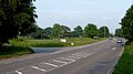
 A53 approaching A529 roundabout - geograph.org.uk - 3532365.jpg 640 × 386; 121 KB
-
 A53 outside Market Drayton - geograph.org.uk - 5422265.jpg 4.032 × 3.024; 3,32 MB
-
 A53, Market Drayton - geograph.org.uk - 6172075.jpg 800 × 600; 119 KB
-
 Adderley Road - geograph.org.uk - 1827029.jpg 640 × 480; 83 KB
-
 Alexandra Road, Market Drayton - geograph.org.uk - 6261921.jpg 800 × 600; 103 KB
-

-
 And why not^ - geograph.org.uk - 2055383.jpg 640 × 480; 130 KB
-

-

-

-
 Aqueduct on the Shropshire Union - geograph.org.uk - 787407.jpg 640 × 480; 306 KB
-
 Autumn on the Shropshire Union Canal - geograph.org.uk - 256088.jpg 640 × 496; 104 KB
-
 Autumn tints in Brownhills Wood - geograph.org.uk - 257647.jpg 604 × 579; 219 KB
-
 Barn conversions at Old Colehurst Manor - geograph.org.uk - 786739.jpg 640 × 480; 249 KB
-
-
 Betton Mill wharf and the former loading bays - geograph.org.uk - 4052551.jpg 1.142 × 857; 275 KB
-
 Betton Road in Market Drayton in Shropshire - geograph.org.uk - 6046024.jpg 1.280 × 960; 1,47 MB
-
 Betton Road in Market Drayton in Shropshire - geograph.org.uk - 6047035.jpg 960 × 1.280; 1,23 MB
-
 Betton Road in Market Drayton, Shropshire - geograph.org.uk - 6042056.jpg 1.280 × 960; 1,96 MB
-
 Bill and Ben are alive and well... - geograph.org.uk - 3202995.jpg 667 × 800; 353 KB
-

-
 Boats at Victoria Bridge - geograph.org.uk - 257631.jpg 640 × 496; 150 KB
-
 Bridge 61 on the Shropshire Union Canal - geograph.org.uk - 2030139.jpg 640 × 480; 407 KB
-
 Bridge No. 62 Shropshire Union Canal - geograph.org.uk - 788702.jpg 640 × 480; 254 KB
-
 Bridge over River Tern - geograph.org.uk - 787437.jpg 640 × 480; 263 KB
-
 Broomhall Lodge - geograph.org.uk - 787403.jpg 640 × 480; 221 KB
-

-
 Businesses on High Street, Market Drayton - geograph.org.uk - 4904228.jpg 1.200 × 799; 414 KB
-
 Butter Market, Market Drayton.jpg 4.896 × 3.672; 2,69 MB
-
 Buttercross, Market Drayton - geograph.org.uk - 5457774.jpg 640 × 480; 65 KB
-
 Buttercross, Market Drayton - geograph.org.uk - 5457778.jpg 640 × 480; 59 KB
-
 Canal Bridge - geograph.org.uk - 1056174.jpg 640 × 425; 367 KB
-
 Canal in Market Drayton, Shropshire - geograph.org.uk - 6040138.jpg 1.440 × 960; 1,5 MB
-
 Canal in Market Drayton, Shropshire - geograph.org.uk - 6040143.jpg 1.440 × 960; 1,56 MB
-
 Canal in Market Drayton, Shropshire - geograph.org.uk - 6040147.jpg 1.280 × 960; 1,15 MB
-
 Canal in Market Drayton, Shropshire - geograph.org.uk - 6040319.jpg 1.440 × 1.080; 1,46 MB
-
 Canal moorings at Market Drayton, Shropshire - geograph.org.uk - 4829069.jpg 1.280 × 905; 753 KB
-
 Canal wharf and basin at Market Drayton, Shropshire - geograph.org.uk - 6040310.jpg 1.440 × 960; 1,13 MB
-
 Canal wharf and basin at Market Drayton, Shropshire - geograph.org.uk - 6040313.jpg 1.440 × 960; 1,03 MB
-
 Canal wharf and basin in Market Drayton, Shropshire - geograph.org.uk - 6040468.jpg 1.440 × 960; 1,24 MB
-
 Canal wharf in Market Drayton, Shropshire - geograph.org.uk - 6040316.jpg 1.440 × 960; 1,11 MB
-

-

-
 Canalside apartments in Market Drayton, Shropshire - geograph.org.uk - 6042030.jpg 1.440 × 960; 1,34 MB
-

-
-
 Canalside housing at Market Drayton, Shropshire - geograph.org.uk - 3202679.jpg 768 × 1.024; 492 KB
-
 Canalside housing at Market Drayton, Shropshire - geograph.org.uk - 3202682.jpg 1.024 × 785; 503 KB
-

-
 Cheshire Cheese Inn, Gingerbread Cafe.JPG 3.840 × 2.880; 2,48 MB
-
 Cheshire Street - geograph.org.uk - 1827030.jpg 640 × 480; 53 KB
-
 Cheshire Street, Market Drayton - geograph.org.uk - 568514.jpg 640 × 480; 82 KB
-

-

-
 Church of St Thomas Aquinas and St Stephen Harding, Market Drayton.jpg 1.200 × 938; 422 KB
-
 Clive and Coffyne, Shropshire St - geograph.org.uk - 1323759.jpg 640 × 480; 72 KB
-
 Close up of cog used to lift lock paddles - geograph.org.uk - 828006.jpg 480 × 640; 110 KB
-
 Coal Brook downstream of Peatswood Lodge - geograph.org.uk - 787393.jpg 640 × 480; 382 KB
-
 Coal Brook upstream of Peatswood Lodge - geograph.org.uk - 787387.jpg 640 × 480; 303 KB
-
 Cotton's House, Market Drayton-geograph-4989331.jpg 640 × 480; 197 KB
-
 Cows by the Shropshire Union Canal - geograph.org.uk - 257627.jpg 640 × 471; 129 KB
-

-
 Drayton Museum, Shropshire St - geograph.org.uk - 1323737.jpg 640 × 480; 73 KB
-
 DraytonViaduct.JPG 1.600 × 1.200; 930 KB
-

-
 Elizabeth II postbox on Shrewsbury Road, Market Drayton - geograph.org.uk - 6262218.jpg 2.919 × 4.589; 2,69 MB
-
 Farmland near Betton - geograph.org.uk - 581963.jpg 640 × 480; 97 KB
-
 Farmland south of Market Drayton - geograph.org.uk - 535926.jpg 640 × 480; 99 KB
-
 Field near Home Farm - geograph.org.uk - 575439.jpg 640 × 480; 135 KB
-
 Fields near Market Drayton - geograph.org.uk - 535872.jpg 640 × 480; 97 KB
-
 Fish farm - geograph.org.uk - 788691.jpg 640 × 480; 351 KB
-
 Footpath to Almington - geograph.org.uk - 788698.jpg 640 × 480; 239 KB
-
 Footpath towards Old Springs Farm - geograph.org.uk - 574740.jpg 640 × 480; 183 KB
-
 Formation swimming in Market Drayton, Shropshire - geograph.org.uk - 6040472.jpg 1.440 × 810; 1,04 MB
-
 Former brewery, Market Drayton.jpg 800 × 602; 421 KB
-

-

-

-
 Gateway to Tunstall Hall - geograph.org.uk - 6172102.jpg 800 × 600; 134 KB
-
 Grazing near Market Drayton - geograph.org.uk - 6261906.jpg 800 × 600; 86 KB
-
 Great Hales Street, Market Drayton - geograph.org.uk - 1866369.jpg 640 × 480; 78 KB
-
 Great Hales Street, Market Drayton - geograph.org.uk - 771244.jpg 640 × 480; 73 KB
-
 Hideout and War Memorial - geograph.org.uk - 5727909.jpg 1.600 × 1.200; 479 KB
-
 High Street - geograph.org.uk - 1829163.jpg 640 × 480; 41 KB
-
 High Street, Market Drayton - geograph.org.uk - 1866304.jpg 640 × 480; 85 KB
-
 High Street, Market Drayton - geograph.org.uk - 2008397.jpg 640 × 480; 86 KB
-
 High Street, Market Drayton - geograph.org.uk - 2488630.jpg 640 × 473; 166 KB
-
 High Street, Market Drayton - geograph.org.uk - 4904193.jpg 1.200 × 799; 326 KB
-

-
 Houses on Alexandra Road, Market Drayton - geograph.org.uk - 6261920.jpg 800 × 600; 114 KB
-

-
 It might have been legal in the 1950s... - geograph.org.uk - 4053886.jpg 857 × 1.142; 460 KB
-
 Joule's Brewery, Market Drayton - geograph.org.uk - 4904233.jpg 1.200 × 799; 257 KB
-
 Lane at Clod Hall - geograph.org.uk - 535865.jpg 640 × 480; 95 KB
-
 Lane to Old Colehurst Manor - geograph.org.uk - 581807.jpg 640 × 480; 134 KB
-
 Langley Dale Stoke on Tern.jpg 4.032 × 3.024; 2,83 MB
-
 Leaving Market Drayton - geograph.org.uk - 5672282.jpg 1.280 × 851; 419 KB
-
 Lodge near Market Drayton - geograph.org.uk - 2157908.jpg 640 × 450; 251 KB
-
 Longslow House - geograph.org.uk - 420287.jpg 640 × 480; 73 KB
-
 Longslow Road - geograph.org.uk - 535992.jpg 640 × 424; 49 KB
-
 Lord's Bridge near Market Drayton in Shropshire - geograph.org.uk - 6051848.jpg 1.280 × 960; 1,12 MB
-
 Maer lane crossing A53 - geograph.org.uk - 3532360.jpg 640 × 401; 94 KB
-
 Market day in Market Drayton - geograph.org.uk - 2008435.jpg 640 × 480; 91 KB
-
 Market Drayton - Shropshire St - geograph.org.uk - 5621956.jpg 5.184 × 2.920; 4,72 MB
-
 Market Drayton - St Mary's Church - geograph.org.uk - 5621957.jpg 5.184 × 2.920; 6,27 MB
-
 Market Drayton - St Mary's Church - geograph.org.uk - 5621958.jpg 5.184 × 2.920; 6 MB
-
 Market Drayton - sunlight through leaves, Queen St - geograph.org.uk - 5621955.jpg 5.184 × 2.920; 6,22 MB
-
 Market Drayton banner.jpg 1.600 × 229; 159 KB
-
 Market Drayton bypass in Shropshire - geograph.org.uk - 6042225.jpg 1.600 × 900; 1,29 MB
-
 Market Drayton fire station - geograph.org.uk - 266806.jpg 640 × 426; 180 KB
-
 Market Drayton Fire Station - geograph.org.uk - 6172071.jpg 800 × 583; 79 KB
-
 Market Drayton marina - geograph.org.uk - 4053876.jpg 1.142 × 857; 358 KB
-
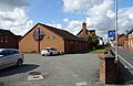
 Market Drayton Methodist Church.jpg 640 × 480; 114 KB
-
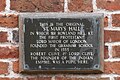 Market Drayton St. Mary's Hall plaque.JPG 1.573 × 1.053; 624 KB
-
 Market Drayton Swimming Bath - geograph.org.uk - 593399.jpg 640 × 480; 88 KB
-
 Market Drayton Swimming Centre - geograph.org.uk - 1829172.jpg 640 × 480; 74 KB
-
 Market Drayton Swimming Centre - geograph.org.uk - 771254.jpg 640 × 480; 82 KB
-
 Market Drayton War Memorial - geograph.org.uk - 5457818.jpg 640 × 480; 52 KB
-

-
 Market Drayton, 15 Cheshire Street - geograph.org.uk - 4988258.jpg 4.896 × 3.672; 2,81 MB
-
 Market Drayton, 19 Cheshire Street - geograph.org.uk - 4988237.jpg 4.568 × 3.426; 2,01 MB
-
 Market Drayton, 53 Shropshire Street - geograph.org.uk - 4989229.jpg 4.896 × 3.672; 2,86 MB
-
 Market Drayton, 63-65 Shropshire Street - geograph.org.uk - 4989344.jpg 4.491 × 3.599; 2,8 MB
-
 Market Drayton, 72a Shropshire Street - geograph.org.uk - 4989500.jpg 4.795 × 3.596; 2,91 MB
-
 Market Drayton, 72a-78 Shropshire Street - geograph.org.uk - 4989481.jpg 4.896 × 3.672; 2,52 MB
-
 Market Drayton, 83 Shropshire Street - geograph.org.uk - 4989546.jpg 4.324 × 3.561; 2,93 MB
-
 Market Drayton, 9 Shropshire Street - geograph.org.uk - 4988401.jpg 3.074 × 4.614; 2,41 MB
-
 Market Drayton, bowling club - geograph.org.uk - 4989562.jpg 4.611 × 3.458; 2,54 MB
-
 Market Drayton, Church Street - geograph.org.uk - 4990589.jpg 4.896 × 3.672; 2,97 MB
-
 Market Drayton, Claremont House - geograph.org.uk - 4989420.jpg 4.039 × 3.404; 2,2 MB
-

-
 Market Drayton, former Railway Hotel - geograph.org.uk - 4988174.jpg 4.896 × 3.672; 2,8 MB
-
 Market Drayton, High Street - geograph.org.uk - 4990686.jpg 4.896 × 3.672; 2,45 MB
-
 Market Drayton, Joule's Brewery - geograph.org.uk - 4990675.jpg 4.896 × 3.672; 2,77 MB
-
 Market Drayton, Kilnbank Road from Shropshire Street - geograph.org.uk - 4989552.jpg 4.460 × 3.299; 3,39 MB
-
 Market Drayton, Lidl and Homebase - geograph.org.uk - 4987477.jpg 4.896 × 3.672; 2,59 MB
-
 Market Drayton, plaque on NatWest Bank - geograph.org.uk - 4988193.jpg 4.896 × 3.672; 5,04 MB
-
 Market Drayton, Poynton House (plaques) - geograph.org.uk - 4989198.jpg 3.672 × 4.896; 3,8 MB
-
 Market Drayton, rear of 63-65 Shropshire Street - geograph.org.uk - 4989557.jpg 4.896 × 3.672; 3,42 MB
-
 Market Drayton, Royal British Legion Club - geograph.org.uk - 4990579.jpg 4.896 × 3.672; 2,94 MB
-
 Market Drayton, Shropshire Union Canal July 1981 Slides297 (10430547955).jpg 1.684 × 1.124; 295 KB
-
 Market Drayton, St Mary's Church car park - geograph.org.uk - 4989564.jpg 4.896 × 3.672; 3,28 MB
-
 Market Drayton, The Old Chapel, 71 Shropshire Street - geograph.org.uk - 4989448.jpg 4.896 × 3.672; 2,94 MB
-
 Market Drayton, vacant premises on Cheshire Street - geograph.org.uk - 4988306.jpg 4.896 × 3.672; 2,56 MB
-
-

-
 Mill pool at Bearstone Mill - geograph.org.uk - 788205.jpg 640 × 480; 267 KB
-

-
 Moorings and housing in Market Drayton, Shropshire - geograph.org.uk - 6042022.jpg 1.600 × 900; 1,29 MB
-
 Moorings in Market Drayton, Shropshire - geograph.org.uk - 6051832.jpg 1.440 × 960; 1,46 MB
-
 Morrison's supermarket, Cheshire Street, Market Drayton - geograph.org.uk - 4746416.jpg 1.600 × 1.064; 250 KB
-
 Mount Lane School - geograph.org.uk - 593411.jpg 480 × 640; 97 KB
-

-

-
-

-

-

-

-
 Newcastle Road Bridge in Market Drayton, Shropshire - geograph.org.uk - 6040146.jpg 1.440 × 960; 1,58 MB
-
 Newport Road (A529) - geograph.org.uk - 6261909.jpg 800 × 600; 150 KB
-
 NFU Mutual, Market Drayton - geograph.org.uk - 6261923.jpg 800 × 600; 80 KB
-
 Old Toll House, Little Drayton - geograph.org.uk - 6114755.jpg 800 × 761; 358 KB
-
 Old Toll House, Stafford Street, Market Drayton - geograph.org.uk - 6114463.jpg 1.800 × 1.200; 378 KB
-

-

-
 Pasture by the Shropshire Union Canal - geograph.org.uk - 257616.jpg 640 × 480; 104 KB
-

-
 Peatswood Lodge - geograph.org.uk - 787401.jpg 640 × 480; 263 KB
-
 PellWall.jpg 1.600 × 1.200; 953 KB
-
 Phoenix Bank, Market Drayton - geograph.org.uk - 1866396.jpg 640 × 480; 94 KB
-

-
 Pill Box on the Shropshire Union - geograph.org.uk - 787327.jpg 640 × 480; 291 KB
-
 Pillbox by the Shropshire Union Canal - geograph.org.uk - 5672278.jpg 1.280 × 851; 496 KB
-
 Pillbox Overlooking the Shropshire Union Canal - geograph.org.uk - 4904353.jpg 1.200 × 799; 425 KB
-
 Plaque to Cheshire Cheese Inn.JPG 3.840 × 2.880; 2,5 MB
-
-

-
 Poynton House, Market Drayton.jpg 4.896 × 3.672; 2,71 MB
-
 Raven House, Market Drayton - geograph.org.uk - 6172067.jpg 800 × 502; 74 KB
-
 Reflections by Brownhills Wood - geograph.org.uk - 257641.jpg 522 × 640; 139 KB
-

-
 River Tern near Market Drayton - geograph.org.uk - 2157920.jpg 496 × 640; 263 KB
-
 River Tern upstream of the fish farm - geograph.org.uk - 788688.jpg 640 × 480; 263 KB
-
 River Tern upstream of the fish farm - geograph.org.uk - 788696.jpg 640 × 480; 277 KB
-
 Roundabout near Market Drayton - geograph.org.uk - 6319327.jpg 3.528 × 2.006; 2,58 MB
-
 Sandy Lane, Market Drayton - geograph.org.uk - 4904083.jpg 1.200 × 799; 516 KB
-
 Sheep at Springs Farm - geograph.org.uk - 582096.jpg 640 × 480; 105 KB
-
 Shops on High Street, Market Drayton - geograph.org.uk - 6263233.jpg 800 × 600; 116 KB
-
 Shrewsbury Road roundabout from A53 - geograph.org.uk - 3532531.jpg 640 × 418; 104 KB
-
 Shrewsbury Road, Market Drayton - geograph.org.uk - 6261919.jpg 800 × 600; 141 KB
-
 Shropshire Street, Market Drayton - geograph.org.uk - 2008445.jpg 640 × 480; 85 KB
-
 Shropshire Street, Market Drayton - geograph.org.uk - 6263244.jpg 800 × 531; 107 KB
-
 Shropshire union canal - geograph.org.uk - 1984.jpg 640 × 481; 31 KB
-
 Shropshire Union Canal - geograph.org.uk - 4904357.jpg 1.200 × 799; 383 KB
-
 Shropshire Union Canal - geograph.org.uk - 4904361.jpg 1.200 × 799; 356 KB
-

-


_-_geograph.org.uk_-_4989198.jpg)


.jpg)


_-_geograph.org.uk_-_6261909.jpg)


